Ghirza (Gerisa): A Roman Frontier City in Libya

Site at a Glance
- Rating
- 4.7
- Popularity
- Very Low
- Country
- Libya
- Primary era
- Classical
- Eras represented
- Classical
- Civilizations
- Roman
- Site type
- City
On this page10 sections
History
Ghirza, also called Gerisa, is an ancient Roman city in Libya, built in the pre-desert region of Tripolitania near the confluence of Wadi Ghirza and Wadi Zemzem. Located about 250 kilometres southeast of the coast and south of Leptis Magna, it began as a settlement during the first century AD and developed extensively during the late second century and the late Roman period.
Settlement and frontier development
Numismatic evidence places the beginning of settlement in the first century AD. Ghirza’s main expansion followed the reorganization of the Limes Tripolitanus around AD 200 under Emperor Septimius Severus, who ruled from AD 193 to 211 and came from nearby Leptis Magna. The Limes Tripolitanus was the fortified southern frontier of the Roman province of Tripolitania, combining forts, watchtowers, roads, settlements, and agricultural installations to regulate movement and protect the desert margins.
The frontier system had already expanded under Hadrian and was strengthened particularly during the tenure of Quintus Anicius Faustus, governor of the province and legate of Legio III Augusta from AD 197 to 201. Ghirza became one of the fortified settlements that helped control this frontier. Its position also encouraged movement between the desert and the coastal region, while commercial routes linked the settlement with areas toward sub-Saharan Africa.
The population was predominantly composed of indigenous Libyan tribespeople who had adopted sedentary life. Inscriptions show that local inhabitants took Roman names, used the Roman language, and followed Roman customs. Former soldiers, mostly local Berbers but also including some legionaries from Italy, were settled in the region. Roman merchants had also established themselves there during the late Augustan period.
Agriculture, society, and religious life
Ghirza prospered through the development of arid land and the control of seasonal floods. Farmers cultivated cereals, figs, grapes, olives, pulses, almonds, and dates, and they may also have grown melons. Dams and cisterns in Wadi Ghirza supported this agricultural economy by regulating flash floods and storing water.
Six fortified farms, known as centenaria, formed part of the settlement. A centenarium was a fortified Roman-period agricultural estate associated with the frontier system. These installations combined farming with defense and show how local production was integrated into the organization of the southern Roman frontier.
The two cemeteries have been associated with two leading aristocratic families or clans. Their contrasting funerary designs and decoration suggest competition among prosperous local elites. The monuments express a cultural identity that combined indigenous traditions with Roman and Punic influences. Local aristocratic names also adopted Roman forms, reinforcing the connection between local society and the Roman political and cultural world.
A temple stood at the edge of the settlement, although its deity is unknown. It may have been dedicated to Gurzil, a Libyan deity or semi-divine figure whose name has also been proposed as a possible origin for the ancient name of Ghirza. Bowls, fragments of statues, and altars indicate active religious practice in the temple and in the mausolea.
Late Roman decline and later occupation
Ghirza declined gradually after the late Roman period. The Limes Tripolitanus was partly abandoned under Diocletian, and local soldier-farmers known as limitanei took on responsibility for regional defense. These frontier troops were often recruited locally and combined military duties with settlement and agricultural work. The frontier remained effective into the Byzantine period, and Emperor Justinian reorganized it in AD 533.
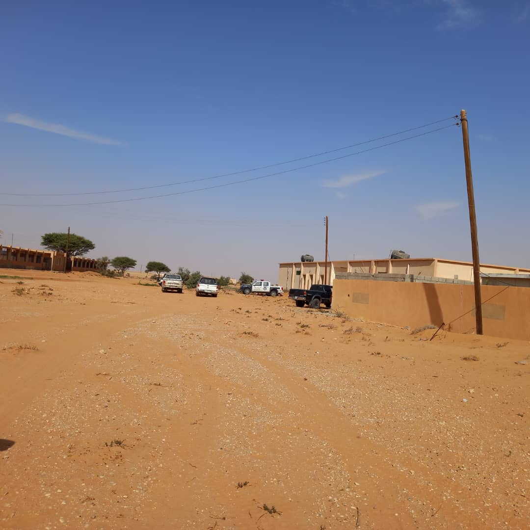
The settlement was abandoned in the early Middle Ages or after the Islamic conquest of the region. By the tenth century, it had been forgotten and covered by sand. The surrounding area was later repopulated, and a small modern settlement developed near the excavated ruins. Evidence from a former temple converted into a dwelling, including coins and pottery, indicates occupation during the Islamic period in the tenth or eleventh century.
Ghirza was added to the UNESCO World Heritage Tentative List in 2020 under criteria (ii) and (iii). The Libyan Department of Antiquities administers the site, which is protected under Libyan law. An adjoining national museum and local archaeological office support its care and interpretation. Wind erosion has damaged some parts, but the principal components remain recognizable. The settlement is listed as Gh127 in the UNESCO Libyan Valleys Archaeological Survey.
Remains
Ghirza extends approximately 500 metres from northeast to southwest and 300 metres in the other direction. Its remains form a cluster of about forty structures, ranging from single-room buildings to large fortified installations. The settlement includes six fortified farms, a temple, water-management works, and two cemeteries. Most surviving structures, including the funerary monuments, date from the late third and fourth centuries.
Frontier farms and water management
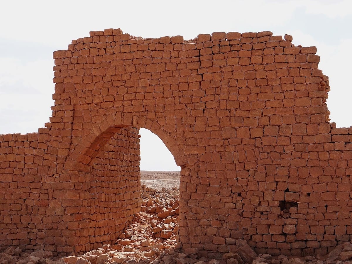
The fortified agricultural estates known as centenaria are among the main components of the settlement. Building 34 measures about 45 by 45 metres, while Building 31 measures approximately 47 by 47 metres. Their substantial scale reflects the combined agricultural and defensive functions of the frontier community.
Dams and cisterns remain visible in Wadi Ghirza. These structures regulated sudden floods and helped sustain cultivation in the arid environment. Together with the fortified farms, they show how the settlement’s built landscape connected defense, water control, and agricultural production.
Funerary monuments
Northern Necropolis
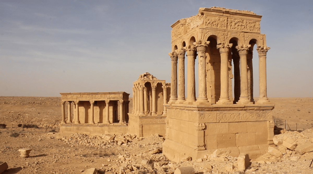
The Northern Necropolis lies about 500 metres west of the town center and contains the remains of seven temple-shaped tombs. These mausolea are substantial funerary monuments containing or commemorating burials. They were generally built from ashlar masonry, using regularly cut blocks of locally quarried limestone. Their common design consists of a colonnaded, temple-like arcade surrounding a masonry burial room, with the burial chamber placed beneath the podium.
Northern Tomb A has two burial chambers on a high podium. Columns with composite capitals surround the monument, and a Doric entablature completes its architectural arrangement. A Latin inscription between two eagles on the facade names Marchius Nasif and Marchia Mathlich. Their sons, Marchius Nimira and Fydel, dedicated the tomb, which dates to the beginning of the fourth century. Reliefs on the podium show two female busts, two farmers with an ox, and a lion attacking another animal.
Northern Tomb B has a burial chamber enclosed by columns with Corinthian capitals. Monolithic stone arches surmount the columns instead of architraves. Marchius Metusan built the tomb during the first quarter of the fourth century for his parents, Flavia Thesylgum and Marchius Fydel. A relief above the false door depicts a tribal leader in a chariot receiving gifts, while other scenes show hunting.
Northern Tomb C resembles Tomb B and was built by Marchius Nimmire and Maccurasan for their parents, Marchius Chullam and Varnychsin. It probably dates to the second quarter of the fourth century. Reliefs on the west side portray a harp player, a man carrying an amphora, and a man feeding dromedaries. The south side includes a man watering fields, mules, palm trees, and hunting scenes.
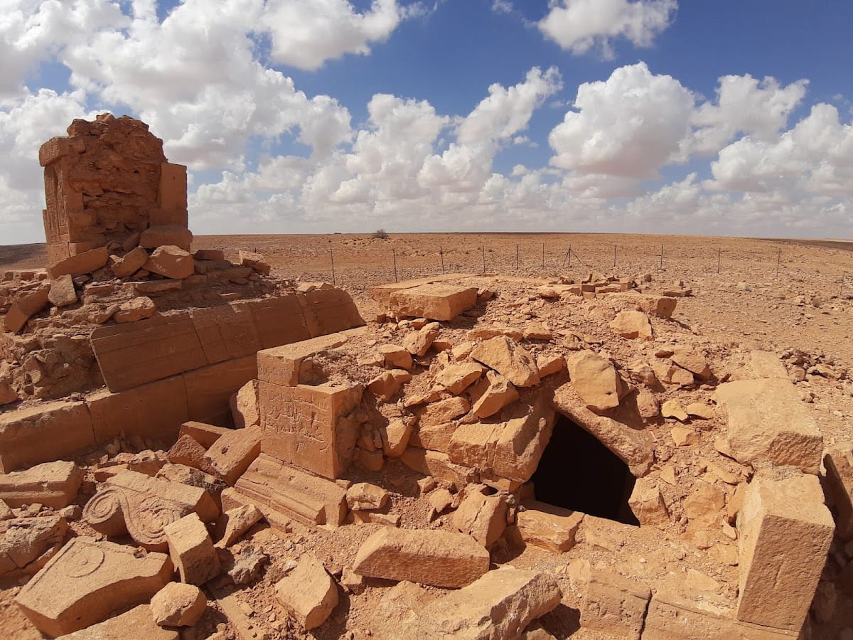
Tombs D through G are less well preserved. Their surviving reliefs suggest dates in the fifth century. Across the northern monuments, classical architectural features appear alongside local scenes of hunting and agricultural work, creating a distinctive funerary style.
Southern Necropolis
The Southern Necropolis lies approximately 2 kilometres west of the town center. Its mausolea have obelisk-shaped, three-storey forms influenced by Phoenician and Punic traditions. Their corner pilasters echo classical architectural orders, while the monuments retain the ashlar construction and burial-room arrangement used elsewhere in the cemeteries.
The southern monuments contain indigenous-style reliefs and no surviving inscriptions. Southern Tomb A and the second storey of Tomb NN are the best-preserved examples. The second storey of Tomb NN was reconstructed from another mausoleum. The Southern Necropolis is traditionally associated with a second leading clan, distinct from the group linked with the northern cemetery.
The decoration of the southern monuments includes portrait busts and portrait sculptures, along with agricultural cycles and produce, hunting on foot and from camels, grapes, fish, ostrich hunts, and other scenes. Portrait imagery is frequent in this cemetery, while inscriptions are more prominent in the Northern Necropolis. The contrast between the two groups reflects different funerary choices within the local elite.
Temple and archaeological collections
The temple at the settlement’s edge survives as part of the archaeological complex. Bowls, fragmentary statues, and altars point to ritual activity there and in the mausolea. The structure was later converted into a dwelling, and coins and pottery from the building indicate Islamic-period use during the tenth or eleventh century.
Many reliefs from the cemeteries are preserved in museums at Leptis Magna and Tripoli. Other reliefs and architectural fragments are held in the Tripoli museum complex, while numerous movable objects are kept in the museum adjoining the site. The Libyan Department of Antiquities relocated one mausoleum for display at the Saraya al-Hamra museum complex. A large quantity of antiquities and carved funerary monuments was also removed to Istanbul in the late nineteenth century.