Ptolemais Archaeological Park: Ancient Greek, Roman, and Byzantine City in Libya


Site at a Glance
- Rating
- 4.3
- Popularity
- Low
- Country
- Libya
- Primary era
- Classical
- External website
- Open
- Eras represented
- Iron Age, Classical, Medieval
- Civilizations
- Ancient Greek, Byzantine, Ptolemaic, Roman
- Site type
- City
On this page20 sections
History
Ptolemais Archaeological Park in Libya preserves the remains of Ptolemais, a city built through Greek and later Roman and Byzantine phases in ancient Cyrenaica. Founded as a major Ptolemaic city by at least the mid-third century BC, it became one of the five principal cities of the Cyrenaican Pentapolis and developed as a strategic port, administrative center, and seat of Christian authority.
Greek settlement and Ptolemaic foundation
The site began as a small Greek settlement in the late seventh century BC. It served as the port of Barca, a settlement located about 24 kilometres inland. By at least the middle of the third century BC, a new city had replaced the earlier settlement under the patronage of the Ptolemaic dynasty, the Greek ruling house that governed Egypt from 305 to 30 BC. The foundation was probably associated with Ptolemy III Euergetes.
The Ptolemies developed Ptolemais as a dynastic expression of territorial control and as a port supporting naval power in the eastern Mediterranean. The city probably housed the Ptolemaic governor of the region. Its early prosperity is also reflected in an invitation to participate in the Panhellenic Games at Delphi in the late third century BC. Ptolemais stood alongside Cyrene, Apollonia, Taucheira, and Berenice, or Euesperides, in the group known as the Cyrenaican Pentapolis.
Roman administration and regional prominence
Ptolemais became a Roman possession in 96 BC and was incorporated into the province of Crete and Cyrenaica. It flourished during the early Roman period and remained a major regional center in Late Antiquity. When the emperor Diocletian reorganized the Roman provincial system between AD 284 and 305, Ptolemais became the capital of Libya Superior, also called Libya Pentapolis.
The city gained further importance after a severe earthquake damaged Cyrene in AD 262, after which Ptolemais surpassed its former rival. A later earthquake in AD 365 affected the cities of the Pentapolis, but Ptolemais survived in relatively good condition. Its position as a regional capital and its extensive urban development reflect the continuing interaction of Greek, Egyptian, Roman, and Libyan traditions.
Christian institutions and Late Antiquity
Ptolemais became the seat of an influential Christian bishopric, a territory and institution governed by a bishop. Arius, the Christian theologian whose teachings about the nature of Christ gave their name to Arianism, lived in the city. Ptolemais was also associated with Secundus, a bishop who supported Arius, attended the First Council of Nicaea in AD 325, rejected its decree, and was deposed by the bishop of Alexandria before later regaining power. His Arian successor, Stephanus, was deposed around AD 360.
Basilides may have served as bishop around AD 260, while Saint Theodore was remembered as an early bishop martyred during anti-Christian persecutions. Synesius held the office from about AD 407 to 413 and was succeeded by his brother Evoptius, who attended the Council of Ephesus in AD 431. Georgius of Ptolemais signed the acts of the Second Council of Constantinople in AD 553. Gabriel, recorded in the sixth century, is the last known bishop of the ancient see.
Ptolemais was destroyed by Libyans in AD 411 and remained the capital of Cyrenaica until AD 428. The city was rebuilt during the reign of Justinian I, but it did not regain its former importance. Its decline was gradual and its final circumstances are uncertain. The ancient bishopric is no longer residential, although the Catholic Church continues to list it as a titular see, preserving the name of the former bishopric without treating it as a functioning diocese.
Later occupation and archaeological investigation
Occupation continued at Ptolemais from the late tenth to the early thirteenth centuries. Arab writers described the place as an anchorage and trading post in accounts dating from the ninth, twelfth, and fourteenth centuries. European explorers described the ruins as abandoned in the eighteenth and nineteenth centuries.
During the Italian occupation in the early twentieth century, a colonial town was built beside the ancient harbor. Italian fortifications and small forts were also constructed in the surrounding area, and several of these structures remain near the ancient city. Systematic archaeological excavation began in the twentieth century with Italian teams and continued through American and British missions.
Since 2000, a Polish mission has used remote sensing and geophysical surveying to create a new plan of Ptolemais and its surroundings. Since 2001, the Institute of Archaeology of the University of Warsaw has excavated domestic areas, including the quarters around the Palazzo delle Colonne and a project focused on an entire urban block. These investigations have examined changing living conditions from the Hellenistic period to the arrival of Arab rule in the mid-seventh century AD. Conservation has also treated excavated mosaics, wall paintings, coins, and sculptures for possible display in the local museum.
Ptolemais was placed on Libya’s UNESCO Tentative List in 2020 under criteria relating to cultural exchange, historical testimony, and architectural or urban value. The Department of Antiquities administers the site under Antiquities Law No. 3. The proposed property includes the ancient city and outlying monuments, while neighboring privately owned land has been affected by land clearing and road construction.
Remains
The ancient city occupies a narrow coastal zone about 110 kilometres east of Benghazi, approximately two kilometres wide between the Mediterranean and the lower spurs of the Jebel el-Akhdar, or Green Mountain. Wadi Ziwanah lies to the east and Wadi Khambis to the west. Defensive walls enclosed more than 200 hectares, and the city followed a rectangular grid with major streets running north to south. Its large urban blocks, known as insulae, measured about 100 by 500 Ptolemaic feet, or approximately 36.5 by 182.5 metres.
Streets and urban plan
The main east-west avenue, called the Street of the Monuments, ended at a portico and later received a triumphal arch dedicated to Constantine the Great in AD 311 or 312. The regular street grid and large blocks preserve the principles of Hellenistic urban planning, while the avenue and arch demonstrate the city’s later Roman development.
Public buildings and entertainment spaces
Theaters and odeon
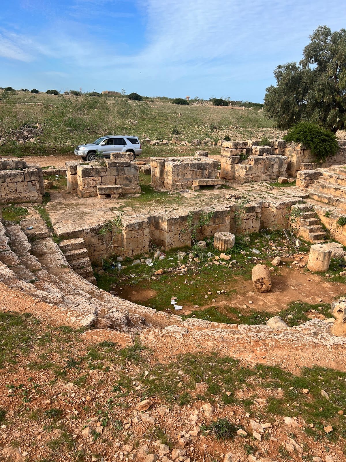
Ptolemais contained three theaters, an amphitheater, and a hippodrome. The smallest theater, an odeon, was converted during the fourth or fifth century AD for water spectacles. This alteration reflects the continued adaptation of public buildings during Late Antiquity.
Elite houses and domestic quarters
Palazzo delle Colonne
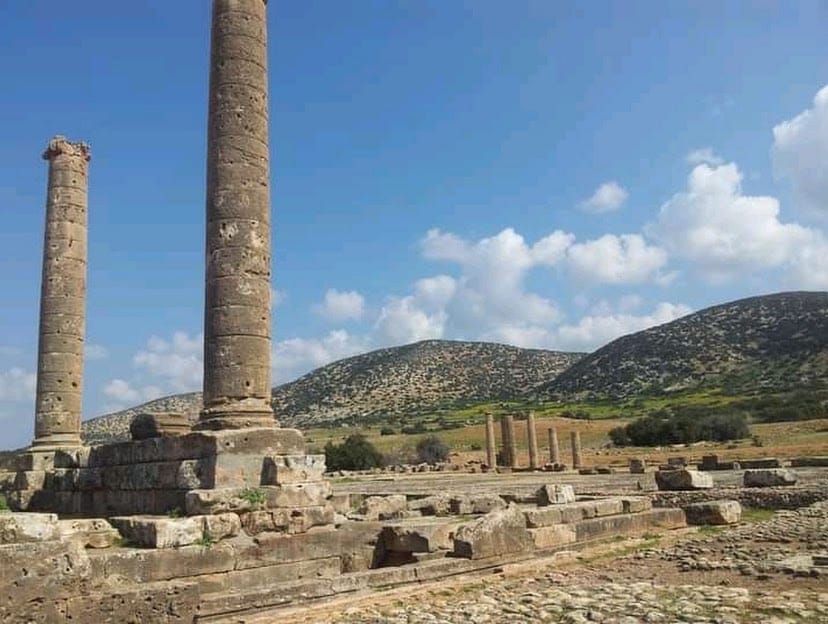
The Palazzo delle Colonne was a large Hellenistic mansion near the agora, probably constructed in the second or first century BC. It is associated with the residence of the city governor from the late Hellenistic period through the Roman and Byzantine periods and functioned as an elite urban house. Its central area was arranged around an open courtyard surrounded by two rows of columns, 28 in all. A large pool was added later, while dining rooms and living quarters contained mosaics, marble wall revetments, and painted decoration.
The mansion also included a roofed northern court supported by a vaulted, partly subterranean gallery, a western wing probably used by women, and a private bath suite. The bath contained a cold room, a warm room, and a hot room, known in Roman terminology as a frigidarium, tepidarium, and caldarium. Street-front commercial or workshop units occupied part of the building, while a separate eastern area may have housed guards or minor officials. The architecture and decoration show Alexandrian influence, and numerous Egyptian statues were found within the house.
Villa of the Four Seasons and House of the Triapsidal Hall
Several insulae contain large courtyard houses that originated in the Hellenistic period and were refurbished or enlarged during the Late Roman period. The Villa of the Four Seasons had richly decorated frescoes and mosaic floors. The House of the Triapsidal Hall contained later Roman audience and reception spaces, showing how domestic architecture changed as elite households adapted their interiors.
Villa of Leukaktios
Near the Palazzo delle Colonne, Polish excavations uncovered a well-preserved villa dating to the third century AD. Its residential section centered on a four-column courtyard, with dining rooms decorated by geometric and figural mosaics. One mosaic shows the sleeping Ariadne with Dionysus and his followers, while two others bear the name Leukaktios, identified as the villa’s owner.
Colorful frescoes on the villa walls imitated marble revetment and incorporated geometric designs and paintings of different bird species. South of the residential area, a domestic complex surrounding a small atrium provided living and storage space. Large containers for agricultural products and several house cisterns were found there, along with coarse pottery fragments and marble statues inside the cisterns.
Earthquakes, particularly those in the mid-third century and AD 365, affected the villa’s successive phases. A hoard of second- and third-century AD coins was found in connection with the third-century earthquake. After the villa declined in the fourth century, the surrounding insula continued in use and probably acquired pottery and metalworking workshops between the fourth and sixth centuries. A separate luxurious house in the northern part of the block contained a large room with a colorful sixth-century mosaic.
Water systems and harbor
Aqueduct and reservoirs
Private baths served some houses, while several public baths belonged to the Roman and Byzantine city. A Roman aqueduct, probably dating to the reign of Hadrian, carried water from a spring more than eight kilometres away. Outside the city, the aqueduct and a road crossed Wadi Ziwanah on a bridge.
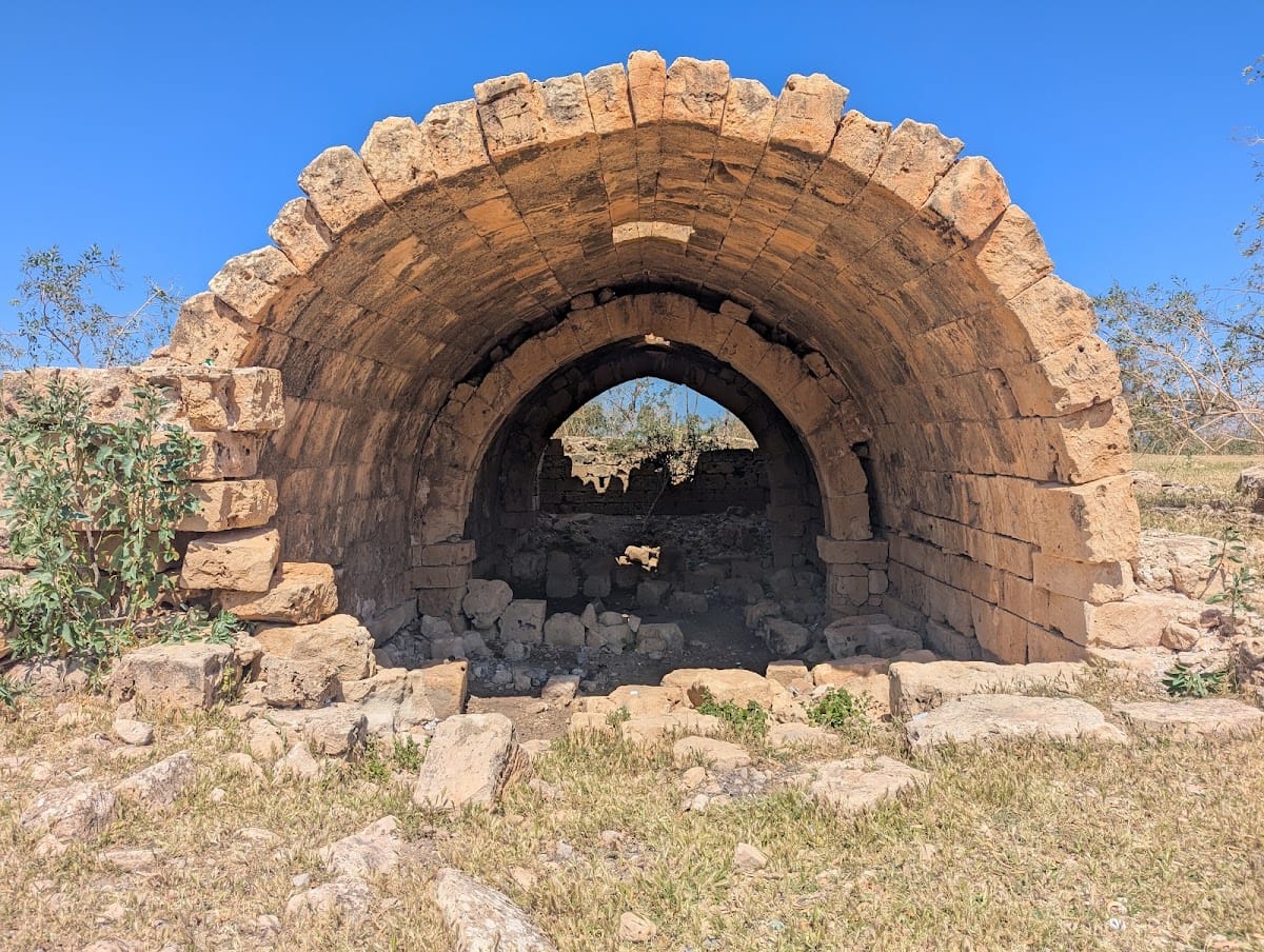
Water was stored in two large open reservoirs in the eastern part of Ptolemais and in seventeen vaulted cisterns beneath the Roman Square of the Cisterns. Together, the cisterns had a stated capacity of 7,000 kilolitres. A porticoed space stood above them, and the underground chambers were later used as a refuge capable of sheltering approximately 200 to 300 people.
Harbor and lighthouse
The harbor lay on the eastern side of the city and aligned with the principal avenue. An ancient lighthouse stood on a promontory near the harbor, beneath the present lighthouse. A 2009 survey identified a submerged pier and a shipwreck, adding evidence for the harbor’s maritime setting.
Tombs and commemorative monuments
Qasr Faraoun
A conspicuous Hellenistic tower-like mausoleum known as Qasr Faraoun, or the Royal Tomb, stood more than 15 metres high. It has been proposed as a monument intended for Ptolemy VIII Physcon Euergetes II, who ruled Cyrenaica from 163 to 145 BC, but that attribution remains uncertain.
Quarry tombs
Chamber tombs cut into quarries east and west of the city produced tombstones and numerous inscriptions. Their inscriptions reflect the diverse communities of Ptolemais, including Libyan, Greek, Roman, Jewish, and Christian populations.
Inscriptions, coins, and archaeological finds
Excavations have yielded mosaics, sculptures, reliefs, sarcophagi, inscriptions, coins, ceramics, architectural elements, and small objects. Among the inscriptions are imperial edicts, including Diocletian’s Edict on Maximum Prices of AD 301, an attempt to regulate the prices of goods and services across the Roman Empire. More than 1,000 coins recovered by the Polish mission have contributed to the study of Cyrenaican coinage in the Hellenistic and Roman periods, including the practice of halving bronze coins during the late first century BC and the first half of the first century AD.
In 2006, the Polish mission found a Roman coin hoard in rooms beside a street. The rooms formed an industrial complex associated with the Villa with a View. The hoard contained 568 coins in place, including 553 sestertii and 15 silver coins, with another 18 bronze coins from neighboring rooms. It was conserved in 2007, and more than 1,200 synthetic casts of its obverses and reverses were produced for study. Many finds from Ptolemais are displayed in the museum near the site entrance.