Citadel of Erbil: An Ancient Fortified Settlement in Iraq


Site at a Glance
- Rating
- 4.4
- Popularity
- High
- Country
- Iraq
- Primary era
- Modern
- External website
- Open
- Eras represented
- Iron Age, Medieval, Early Modern, Modern
- Civilizations
- Assyrian, Ottoman
- Site type
- Military
- Remains
- Citadel
On this page25 sections
History
The Citadel of Erbil is an ancient fortified settlement mound in Iraq and the historic centre of Erbil. Occupation began by the fifth millennium BC and may have started earlier, while the visible settlement developed through successive periods of Mesopotamian, Iranian, Islamic, and Ottoman history. The mound has traditionally been described as one of the oldest continuously occupied settlements in the world, although this remains a qualified interpretation rather than an established absolute claim.
Early Mesopotamian Settlement
Pottery associated with the Neolithic period has been suggested, but clearer evidence comes from the Chalcolithic period. Erbil first appears in written records around 2300 BC in the archives of Ebla, where it may be named Irbilum. The city was largely under Sumerian control from about 3000 BC until the rise of the Akkadian Empire. Around 2200 BC, it was captured by Erridupizir, king of Gutium.
During the Third Dynasty of Ur, the city was known as Urbilum. King Shulgi destroyed it in his forty-third regnal year, after which his successor Amar-Sin incorporated it into the Ur III state. In the eighteenth century BC, Erbil was listed among the cities conquered during the campaigns of Shamshi-Adad I and Dadusha. Shamshi-Adad established garrisons there, giving the settlement a continuing military importance.
Assyrian Religious and Political Centre
Erbil was incorporated into Assyria during the second millennium BC and became a starting point for military campaigns toward the east. In the Neo-Assyrian period, the major Assyrian state centred in northern Mesopotamia during the early first millennium BC, the city was also an important religious centre. It participated in the revolt associated with the succession of Shalmaneser III and was known as Arbi-Ilu, a name interpreted as “Four Gods.”
The local form of worship of Ishtar, a major Mesopotamian goddess associated with fertility, war, and political power, held particular importance at Erbil. Her sanctuary was repaired or maintained by Shalmaneser I, Esarhaddon, and Ashurbanipal. Inscriptions of Ashurbanipal describe dreams associated with Ishtar of Erbil, and he probably held court there and received foreign envoys.
After the fall of the Assyrian Empire, Erbil came under Median control and was later incorporated into the Achaemenid Empire. Alexander the Great’s victory at the Battle of Gaugamela in 331 BC, fought near Erbil, brought the city into his empire. It subsequently formed part of the Hellenistic Seleucid Empire under the names Arabella or Arbela. Rome and Parthia later contested control of the city.
Christian and Early Islamic Erbil
From the first century AD, Erbil became an important Christian centre. During the Sassanian period, when the Iranian imperial dynasty ruled much of the region before the Islamic conquests, the city was the seat of a governor. Christians were persecuted there in 340, and the governor was martyred in 358 after converting to Christianity. Around 521, a Nestorian school founded by the School of Nisibis was established at Erbil, while the city also contained a Zoroastrian fire temple.
Muslims conquered Erbil in the seventh century. The city remained an important Christian centre until the ninth century, when its bishop transferred his seat to Mosul. Its religious history therefore continued across several political changes, with Christian institutions existing alongside the religious traditions of the Sassanian period and the later Islamic city.
Begteginid Rule and the Mongol Conquests
In the mid-tenth century, Erbil came under the rule of the Hadhabani Kurds. The Seljuks took the city in 1063. From the first half of the twelfth century until 1233, Erbil was the seat of the Begteginids, a Turcoman ruling dynasty that rose under Zengi, the atabeg of Mosul.
In 1183, the ruler Zain ad-Din Yusuf transferred his allegiance to the Ayyubid Sultanate. After his death in 1190, his elder brother Muzaffar al-Din Gökböri, formerly governor of Edessa, became governor of Erbil. Gökböri developed a lower town around the citadel and founded hospitals and madrasahs, institutions for religious and scholarly education. When he died without an heir in 1233, control passed to the Abbasid caliph al-Mustansir after a siege.
The Mongols attacked Erbil in 1237, plundered the lower town, and withdrew before an approaching caliphal army. After capturing Baghdad in 1258, they returned and took the citadel following a six-month siege. Hülegü appointed a Christian governor, and Jacobite Christians subsequently entered the town and were permitted to build a church.
Persecution of Christians, Jews, and Buddhists increased in the Ilkhanate during the late thirteenth century. During the reign of Öljeitü, Christians sought refuge in the citadel, but Ilkhanate troops captured it on 1 July 1310. The defenders and the Kurdish inhabitants of the lower town were massacred.
Ottoman-Era Political Changes
After the Battle of Chaldiran in 1514, Erbil came under the Soran Emirate, a semi-independent Kurdish polity under Ottoman authority. The Baban Emirate took the city in the eighteenth century, but the Soran ruler Mir Muhammad Pasha of Rawanduz retook it in 1822. Ottoman forces reasserted control in 1851, and Erbil remained part of the Mosul Vilayet until the First World War.
Nader Shah attacked Erbil in 1732 and again in 1743. The second siege lasted two months, and artillery bombardment destroyed much of the citadel’s former perimeter wall. Around the end of the Ottoman period and before the First World War, Erbil had approximately 3,200 inhabitants and included a substantial Jewish minority. After the defeat of the Ottoman Empire and its Kurdish allies in the First World War, the town was transferred to British control.
Twentieth-Century Transformation and Conservation
Erbil’s urban structure and social composition changed substantially during the twentieth century. A 15-metre steel water tank installed in 1924 supplied purified water but contributed to foundation damage through seepage. Wealthier residents increasingly moved into larger houses with gardens outside the citadel. In 1960, more than 60 houses, a mosque, and a school were demolished to create a straight north-south road between the southern and northern gates. Reconstruction work at the southern gate followed in 1979.
In 2007, the Kurdistan Regional Government established the High Commission for Erbil Citadel Revitalization to preserve and restore the site with UNESCO assistance. Approximately 840 remaining families were relocated with financial compensation, while one family was permitted to remain so that continuous occupation would not be interrupted. The government planned to return 50 families after renovation.
Surveys carried out in 2006 and 2007 by the University of West Bohemia and Salahaddin University combined geodetic measurements, satellite imagery, aerial photography, and other photography into a map and digital three-dimensional model. Geophysical investigations sought buried architecture, and archaeological work examined the western slope and included a small test trench in the eastern part of the citadel.
A Neo-Assyrian chamber tomb found at the foot of the mound during construction work in the late 2000s was investigated by the local Antiquities Service and the German Archaeological Institute. Later work revealed additional architecture probably dating to the Neo-Assyrian period and further burials. In 2012, the Higher Committee for the Maintenance and Rehabilitation of the Citadel selected seven excavation areas. Four excavation seasons between 2013 and 2015, directed by Abdullah Khorshid Qadir with foreign advisers including John McKinnes of the University of Cambridge, exposed a previously unseen section of the citadel wall in area E.
Iraq submitted the citadel to the UNESCO Tentative List in January 2010, and restoration began in June of that year. UNESCO inscribed the Citadel of Erbil as a World Heritage Site under criterion (iv) on 21 June 2014. This criterion concerns an outstanding example of a building, architectural ensemble, or landscape illustrating a significant stage in human history. In 2017, UNESCO indicated that slow restoration progress could put the inscription at risk. The revitalization authority also advocated a protected zone extending 300 to 400 metres around the citadel, with building heights restricted to about 10 metres.
Remains
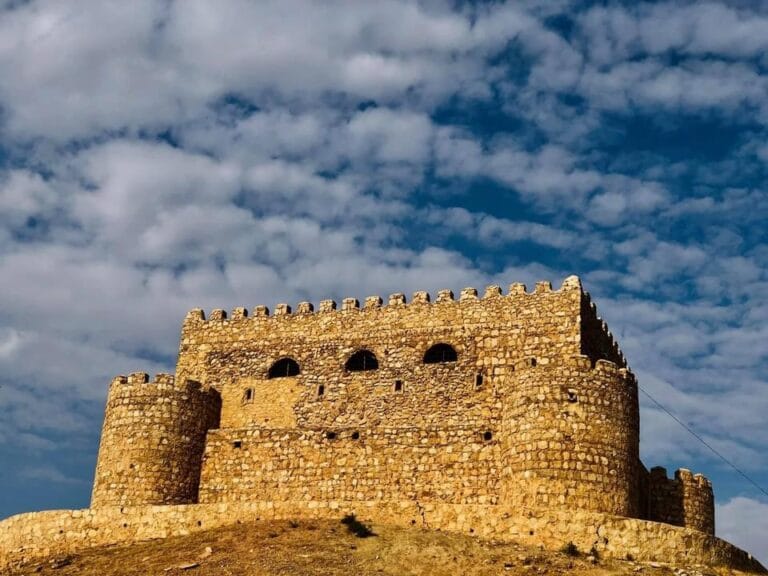
The Citadel of Erbil occupies a large tell, a settlement mound formed by accumulated remains from successive human occupations, in the centre of the modern city. The roughly oval mound rises about 25 to 32 metres above the surrounding plain and covers approximately 102,000 square metres. Its summit measures about 430 by 340 metres, its slopes descend at an angle of roughly 45 degrees, and natural soil has been reached about 36 metres below the present surface. This deep archaeological sequence lies beneath the visible buildings and the yellow-grey outer ring of traditional houses.
Settlement Mound and Residential Fabric
Outer Ring and Districts
Approximately 100 traditional houses encircle the mound. Their adjoining façades create the appearance of a perimeter wall, although they do not form a continuous fortification wall. Many façades were strengthened with buttresses because they stand on or near the steep slope. When the citadel was occupied as a residential settlement, it was divided from east to west into the Serai, Takya, and Topkhana districts. Prominent families lived in the Serai, the Takya contained dervish residences and religious lodges, and craftsmen and farmers lived in the Topkhana.
About 30 large, palace-like houses stood mostly near the outer edge. The oldest securely dated surviving house bears an inscription indicating a date of 1893. Houses in the southeast are older, while many on the northern perimeter date from the 1930s and 1940s. A 1920 inventory divided the citadel into 506 house plots. In 1984, 4,466 people lived in 375 houses, while the 1995 census recorded about 1,600 inhabitants in 247 houses.
Courtyard Houses and Streets
Traditional houses were generally arranged around courtyards. Raised arcades overlooked these open spaces, and the houses had flat roofs. Entrances followed a bent approach that prevented a direct view from the doorway into the courtyard. Before the north-south thoroughfare was built, internal streets radiated from the southern gate like the branches of a tree. They were approximately 1 to 2.5 metres wide, with major alleys reaching 300 metres in length and cul-de-sacs generally measuring 30 to 50 metres.
Fortifications and Entrances
The citadel was fortified during the Atabeg period, when a deep moat added to its defensive strength. Historical references mention eastern and western gates as well as a northern gate facing Ainkawa. Guards closed the gates at night with large wooden doors and shut them during attacks. Three ramps lie on the northern, eastern, and southern slopes and lead to entrances in the outer ring of houses. The southern approach may originally have been the only ramp, leading through a large arched gateway into a small open court from which four principal alleys diverged.
Southern Gate
The southern gate was the oldest of the principal entrances. It was rebuilt or repaired at least once, including work in 1860. Fears that the structure might collapse led to its demolition in 1960, and a modern replacement was erected in 1979. A large arched gateway was reconstructed in 2015.
Northern and Eastern Gates
The northern gate was formerly associated with the name Amka. It was closed at an uncertain date, and a new northern entrance opened by Ahmad Effendi, the governor of Erbil, in 1926 or 1927. This entrance became known as the Ahmadi Gate, although its precise relationship to the earlier gate remains uncertain.
The eastern gate, known as the Harem Gate, was used by women. A route descending near the house of Birbal Agha was later considered a late Ottoman opening, but it may have followed the line of an eastern gate that existed at least nine centuries earlier or before the Islamic period. The three entrances now identified are the large southern gate, the northern Ahmadi Gate, and the eastern gate.
Western Gate
The western gate lay between houses in the Topkhana district and was closed in the distant past. A later house occupied the space between the former entrance and the edge of the citadel. After that house and its western wall collapsed, the edge wall was rebuilt without recognition of the earlier gate.
Religious and Public Buildings
Mosques and Religious Lodges
In the early twentieth century, the citadel contained three mosques, two schools, two religious lodges, and a hammam, or public bath organized around heated bathing and changing spaces. A synagogue remained until 1957. The Mulla Afandi Mosque, the principal Friday mosque, was rebuilt on the site of an earlier nineteenth-century mosque and may have been founded on an earlier mosque dating to 1720. The Sheikhani Mosque, also known as the Mulla Ibrahim Dogramachi Mosque, was built in 1920.
The Takya district contained religious lodges associated with Sheikh Sharif and Haji Mulla Khidr al-Talafari. Both belonged to the Qadiriyya lodge tradition, whose rituals were practiced on Mondays and Fridays. Graves and shrines within the citadel include those associated with Sheikh Ibrahim al-Kilani, Imam Abd al-Qadir, Habib al-Najjar, Sufi Qoja or the Chilla-khana, Sheikh Abd al-Qadir, and a burial in the basement of the Abd al-Razzaq Agha al-Uzairi guest house. These burials are generally associated with prominent Sufis buried in or near their lodges.
Citadel Hammam
The citadel hammam stands east of the citadel and west of the main mosque. It is an Ottoman-period public bath built in 1775 by Qassim Agha Abdullah. The bath remained in service until the 1970s and was renovated in 1979, when many original architectural details were lost.
The building has an irregular rectangular plan divided into two principal sections. The northern section contains a rectangular changing and resting hall with three bathing basins, eight small rectangular windows, eight pointed blind arches, and a relatively high hemispherical dome pierced by small openings. Branches connect this area to other parts of the bath, and the main entrance lies on the south. The southern section contains an octagonal reception hall with an octagonal basin. Additions by the Rashad al-Mufti family altered the building’s form after renovation.
Guest Houses
Private guest houses, or diwankhanas, served wealthy and noble families as places for social and cultural gatherings and hospitality. Recorded examples include the guest houses of Yaqub Agha, Rashid Agha, Ali Pasha al-Dogramachi, Abdullah Pasha al-Naqib, and Muhammad Karim Agha.
Archaeological Evidence
Neo-Assyrian Tomb and Later Burials
The Neo-Assyrian chamber tomb at the foot of the mound had been looted in antiquity but still contained pottery dating to the eighth or seventh centuries BC. Additional graves belonged to later centuries, and nearby architecture probably dates to the Neo-Assyrian period. The tomb and the later burials add evidence for activity around the mound as well as on its summit.
Pottery and Tobacco Pipes
Excavations recovered decorated Ottoman clay tobacco pipes used during the nineteenth and twentieth centuries and into the early twentieth century. Pottery fragments from different periods included storage-jar bases, jar necks, and decorated handles bearing incised or thumb-impressed ornament. Other finds date to the late Abbasid and early Ilkhanid period, particularly the thirteenth and fourteenth centuries.
One fragment has closely spaced small floral decoration comparable to a style known from the caliphal palaces of Samarra. Another fragment, found within a wall core, carries rare multi-panel decoration with geometric fields that recall Nuzi ornament. A copper coin attributed to Sultan Muzaffar al-Din, the Atabeg ruler of northern Iraq during the late Abbasid period, bears a lion, the Atabeg emblem, on one face and the sultan’s name on the other.
Cultural Institutions and Commercial Setting
Museums and Craft Collections
The Kurdish Textile Museum opened in a renovated mansion in 2004. A Kurdish clothing museum opened in 2015, displaying models in traditional garments from different parts of Kurdistan based on designs documented in old and rare books, especially garments of the nineteenth and twentieth centuries.
The citadel contains or has contained museums and cultural institutions devoted to Kurdish textiles, clothing, stones and gems, the citadel itself, music, Turkmen heritage, and the interpretation of the site. Other collections include an exhibition of miniature Kurdish costumes, a handmade-carpet exhibition or centre, and an antique collection. The handmade-carpet centre opened in 2014 to preserve and revive Kurdish weaving. Its wool and silk carpets vary in size, colour, and pattern, including depictions of political and cultural figures, and production is associated with centres in Harir, Rawanduz, Koy Sanjaq, Baharka, and Khasnazan.
Qasariyah Market
Below the southern base, the covered bazaar known as the Qasariyah retains a labyrinthine arrangement of narrow alleys sheltered by corrugated-iron latticework. Its trades include jewellery, shoemaking, carpentry, metalwork, butchery, honey and dairy products, traditional textiles, and the Kurdish craft of making white Klash shoes. The market forms part of the commercial landscape around the citadel, while the present structures below the mound include modern redevelopment.
The surviving fabric of the citadel has been affected by demolition, altered circulation, water damage, relocation of residents, and restoration. Conservation work has focused on preserving historic houses, recovering buried architecture, and reconstructing or stabilizing damaged features.