Roxburgh Castle: A Medieval Royal Fortress in Scotland

Site at a Glance
- Rating
- 4.3
- Popularity
- Very Low
- Country
- United Kingdom
- Primary era
- Medieval
- Eras represented
- Medieval
- Civilizations
- English
- Site type
- Military
- Remains
- Castle
On this page13 sections
History
Roxburgh Castle is a medieval royal castle in the United Kingdom, associated with the former town of Roxburgh near Kelso. Tradition attributes its foundation to David I, king of Scotland from 1124 to 1153, and the castle is first recorded around 1128, when a church dedicated to Saint John was mentioned within its domain. The early fortress was probably built mainly of timber. It stood beside an important border settlement that later became a royal burgh, a town granted special commercial and administrative privileges by the Scottish crown.
A contested royal fortress
Roxburgh’s position made it an important stronghold during the repeated conflicts between the Scottish and English crowns. After William I of Scotland was captured at Alnwick in 1174, the castle was surrendered to England. It subsequently changed hands between the English and Scots several times, reflecting the instability of the border region.
Edward I of England held the castle during his campaigns against Scotland. From 1306 to 1310, he imprisoned Mary Bruce, the sister of Robert the Bruce, in a cage suspended outside the castle. Her confinement formed part of the English response to the Scottish royal family during the First Scottish War of Independence.
Recapture and destruction in 1314
On 19 February 1314, Sir James Douglas recaptured Roxburgh in a night escalade, an assault in which attackers climb defensive walls with ladders. His men wore dark cloaks and were reportedly mistaken for cattle as they approached. They reached the walls using ladders made from rope and boards, allowing the Scottish force to take the castle by surprise.
Robert the Bruce then ordered Edward Bruce, Earl of Carrick, to demolish the fortress. The order was intended to prevent the English from using Roxburgh to control the surrounding territory. This destruction formed an important stage in the castle’s medieval history, although the site continued to be contested and repaired in later decades.
English occupation and renewed Scottish attacks
Edward III of England captured Roxburgh in 1334. Alexander Ramsay and his Scottish forces retook it on 30 March 1342 through another daring night assault, but the English recovered the castle after the Battle of Neville’s Cross in October 1346.
A repair report prepared in 1416 for Henry V of England referred to Neville Tower and Stokhouse Tower. Neither tower has left identifiable remains. The report also described shortages of ammunition and food, indicating the difficulties faced by the garrison. A Scottish siege in 1417 required repairs to the castle, but the English defenders held the structure despite its poor condition.
By the 1380s Roxburgh was equipped with cannon. During a planned Scottish siege in August 1436, James I of Scotland assembled a large army and brought substantial artillery operated by German crews under Johannes Paule, the king’s master of engines. Alexander of Islay, Earl of Ross, led about 3,000 Highlanders and Islesmen, while Lowland forces included contingents associated with Archibald, Earl of Douglas, and William, Earl of Angus.
James abandoned the siege after his queen warned him of a conspiracy against him and he learned that northern English forces had arrived under the Archbishop of York, the Bishop of Durham, and the Earls of Northumberland. His army dispersed and left the German equipment behind. The episode shows the scale of the preparations required to challenge the English-held fortress, even though the attack itself did not take place.
Capture, demolition, and later fortification
The Scots besieged Roxburgh again in 1460. During the siege, a metal fragment from the explosion of one of James II of Scotland’s bombards killed the king. Scottish troops nevertheless stormed and captured the castle. James II’s queen, Mary of Guelders, then ordered its complete demolition. Roxburgh was not rebuilt as a medieval castle, and the associated town was also destroyed during the Scottish capture.
The site was briefly fortified again during the War of the Rough Wooing, the mid-sixteenth-century conflict linked to Henry VIII’s attempts to force a marriage alliance between the English and Scottish royal houses. In 1545, an English garrison commanded by Ralph Bulmer constructed a rectangular fort on the former castle site at the direction of the Earl of Hertford. In 1547, Hertford commissioned the surveyor William Ridgeway and the master carpenter John Revell to undertake further work, including the construction of a brewhouse. Bulmer also proposed a blacksmith’s forge and a southern bulwark giving access to drinking water.
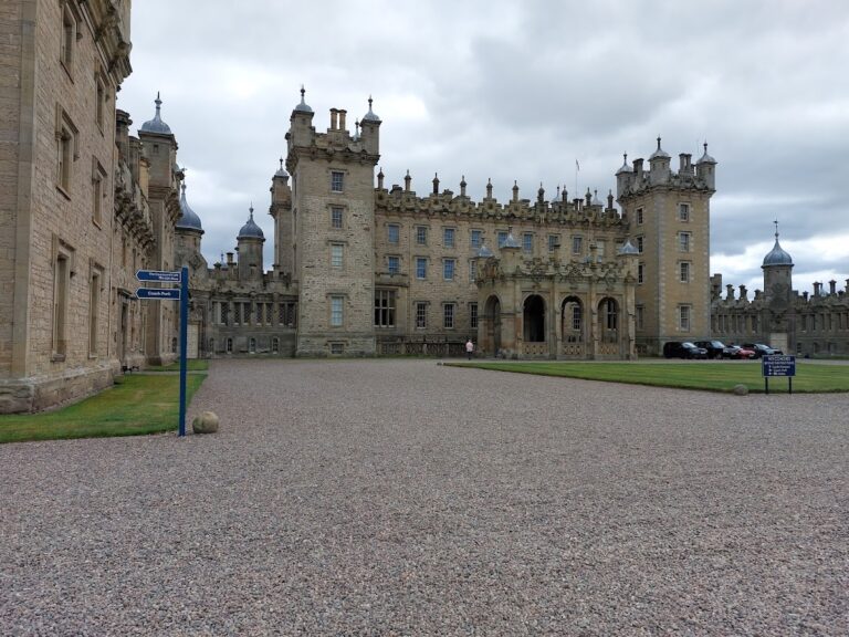
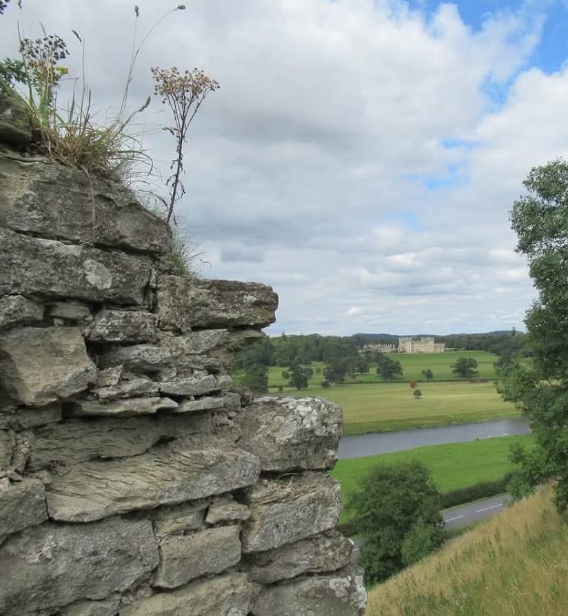
The sixteenth-century fort was dismantled in 1550 under the Treaty of Boulogne, which ended the conflict between England and Scotland. Roxburgh was not subsequently refortified. The Ker family had acquired the surrounding estate from James IV of Scotland in 1488 and later became the Dukes of Roxburghe. Floors Castle, their residence, stands across the Tweed, and the castle ruins now lie within its grounds. Roxburgh has been a protected monument in the United Kingdom since 14 February 1955. Its capture in 1314 also helped inspire James Hogg’s The Three Perils of Man.
Remains
Setting and surviving medieval fabric
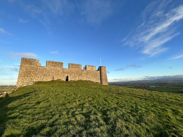
The ruins occupy a raised mound between the rivers Tweed and Teviot, overlooking their junction. The site lies on the southern bank of the Tweed, opposite Floors Castle and across the river from Kelso. The two rivers meet to the east, giving the castle a position enclosed by waterways on two sides.
Only small fragments of the medieval stone walls survive, particularly on the southern side, while weathered wall fragments remain beside the Teviot. The surviving remains are dispersed across the large mound. Nettles heavily overgrow the ruins, and dozens of trees grow among the surviving masonry.
Walls and entrances
Tweed defensive wall
Because the castle stood between two rivers, its approaches on both sides required defensive walls. Along the Tweed are the low remains of a protective wall almost two metres thick. It was constructed in 1378 and originally stood about nine metres high. Its surviving height gives little sense of the full scale of the medieval barrier, but its position records the castle’s river-facing defenses.
Western gatehouse
The gatehouse stood on the western side, where it was approached from the bank of the Teviot. It was restored around 1420, and its two poternes survive. A poterne is a small secondary entrance through a fortification, usually more concealed than the principal gateway. These openings are among the identifiable elements of the western entrance complex.
Principal tower and sixteenth-century fort
Douglas Tower and Bell Mount
The principal tower, or donjon, was formerly known as Douglas Tower. A donjon was the main fortified tower of a castle and often combined strong defensive and residential functions. Nothing of Douglas Tower remained by the sixteenth century. It probably occupied the position later covered by a bastion called Bell Mount, which formed the highest point of the site.
The 1545 fort
A plan made in 1547 shows the later rectangular fort with a courtyard and a ditch on both its western and eastern sides. The western side included a water well and a barbican called Base Court. A barbican was an outer defensive work protecting an entrance or approach. The plan also records a brewhouse and a residential building called Captain’s Lodgings.
The fort built in 1545 occupied the same general site as the medieval castle. Further work followed in 1547, but the fort was later demolished after the Treaty of Boulogne. No substantial remains of this later fort are described as surviving, leaving the mound and scattered medieval fragments as the principal physical evidence of Roxburgh’s long defensive history.