Piltene Castle: Residence of the Bishops of Courland in Latvia


Site at a Glance
- Rating
- 4.5
- Popularity
- Very Low
- Country
- Latvia
- Primary era
- Medieval
- Eras represented
- Medieval, Early Modern
- Civilizations
- Crusader
- Site type
- Military
- Remains
- Castle
On this page16 sections
History
Piltene Castle is a medieval fortress in Piltene, Latvia, developed as the principal residence and administrative center of the Bishops of Courland in western Latvia. Its construction probably began in the late thirteenth century after the episcopal center moved from Memel and Amboten, and the castle served as the capital of the bishopric until the sixteenth century. It later became chiefly a district administrative center.
The Bishopric of Courland and the First Castle
The Bishopric of Courland was established around 1234 as a medieval ecclesiastical territory whose bishops exercised both religious and territorial authority. Control of Courland was repeatedly disputed. Curonian uprisings led the Teutonic Order, a German military-religious institution governing neighboring territories, to reconquer the region between 1242 and 1247. The bishops did not secure lasting control until after the 1260s. In the division of Courland in 1253, the Order received the left bank of the Venta, while the bishopric received the right bank, including Piltene.
A tradition attributes an earlier small castle at Piltene to the Danish king Valdemar II in 1220. The later episcopal residence, however, developed after the transfer of the bishopric’s center from Memel and Amboten. Amboten passed to the Teutonic Order in 1290, after which building work at Piltene probably began. Some accounts place this construction in 1295. Bishop Edmund von Werth established the cathedral chapter at Piltene in 1290, and Bishop Burchard was residing there between 1300 and 1311, indicating that the first construction phase had been completed or was substantially advanced.
The castle first appears in a document dated 3 December 1309. At that time, a civil conflict had forced the Bishop of Courland to renounce his lands and castles for life and leave the country. The fortress was later drawn directly into regional warfare. Lithuanians and their allies from Riga besieged it in 1329 or 1330 with siege engines but failed to capture it, although the settlement outside the castle was burned. In 1336 the Teutonic Order captured Piltene after the entire defending garrison had been killed in combat.
Episcopal Capital and Town
During the late fourteenth century, the settlement beside the castle received town rights based on Riga law. Contemporary documents repeatedly mention its town council and burgomaster. Seventeen episcopal bailiffs are known at Piltene between 1424 and 1583, reflecting the castle’s continuing role as an administrative seat.
The castle also served as a setting for the bishopric’s historical representation. A testimony from 1431 described portraits of all the bishops who had held office, painted with their names and years of service on the walls of the great hall. The related chronicle, the Libellus gestorum, included a foundation story involving the Danish king Abel and a first bishop named Ernemordus. Later historians considered this narrative a deliberate fabrication designed to enhance the prestige of the bishopric.
The Sixteenth-Century Political Crisis
In 1521 the Bishopric of Courland became an officially separate member of the Holy Roman Empire, and its bishop became a prince of the Empire. In 1557 Bishop Johann von Münchhausen reconfirmed Piltene’s town rights and its function as the seat of civil and criminal courts. These arrangements were soon disrupted by the Livonian War, the sixteenth-century conflict that destabilized Livonia’s medieval political order and transferred Piltene from episcopal rule into Danish and then Polish-Lithuanian control.
In 1559 Münchhausen sold the bishopric to King Frederick II of Denmark, who transferred it to his brother, Duke Magnus of Holstein. Magnus used Piltene as his principal residence from at least 1560 to 1564 and returned there in 1578 after his attempt to establish a Livonian kingdom had failed. King Stephen Bathory then sanctioned Magnus’s submission to the Polish camp and guaranteed his safety and property.
Forces based at Piltene took part in Polish military operations in 1579 and 1580, including incursions into the former Bishopric of Tartu. Magnus’s daughter Jevdokia was baptized at Piltene in 1581. Magnus died at the castle on 18 March 1583, after spending his final years in poverty and debt, and was initially buried there.
Destruction and Abandonment
Magnus’s death left a power vacuum and triggered a succession conflict. Polish troops entered the Piltene bishopric on 24 May 1583, while the castle remained in the hands of the bishopric’s faction. On 29 July, a Danish force of 60 cavalrymen, 80 infantrymen, and three guns attacked a Polish camp about 40 kilometres away but was defeated. The Poles subsequently partially blew up the castle buildings, apparently to prevent a feared Danish landing and to render the fortress unusable. The large round tower was probably among the structures damaged or destroyed.
The Treaty of Kronenberg in 1585 transferred Denmark’s rights to Piltene to the Polish-Lithuanian Commonwealth for 30,000 thalers. An inventory made that year found the castle considerably plundered. The Piltene district received autonomy within the Commonwealth in 1617, but Hasenpoth became its administrative center. In 1621 the castle was described as partly collapsed and closed, and by 1659 it was recorded as devastated and abandoned.
Duke Magnus’s remains were transferred from Piltene to Denmark in 1662. Around 1710, a flood caused the Venta to cut a new channel across the river bend. The castle was left about 1.5 kilometres from the navigable river, ending its direct water access and damaging local trade. The last inhabited part of the castle was abandoned around 1750. Eighteenth-century conflicts involving Polish, Swedish, and Russian forces further contributed to the collapse of local settlement and economic activity.
Later Reuse and Archaeology
A Lutheran church was built beside the castle area around 1808 and enlarged in 1856. Its builders may have reused stone dismantled from the ruins. Around the turn of the twentieth century, the castle grounds contained a farmstead with timber-framed and other buildings. Excavations led by Ēvalds Mugurēvičs in 1976 and 1977 exposed and examined foundations and moats and uncovered remains of a bridge crossing the moat.
Remains
Piltene Castle occupied a low rise on the right bank of the Venta beside a former river bend and in marshy terrain. The river at the site lay approximately 20 centimetres above sea level, while the bank beside the castle rose about 5 metres. The fortress was a convent-house castle, meaning that its residential, administrative, religious, and service rooms were arranged around an enclosed courtyard. A large outer bailey extended around the east and south sides of the main castle, while the west side faced the river. Piltene was the largest fortress in northern Courland.
Main Castle
The original main castle formed a small enclosed complex with a ground plan of approximately 40 by 50 metres, also described as about 45 by 40 metres. It later developed into a three-winged, largely enclosed complex with a freer internal arrangement than a typical Teutonic convent house. A stone cloister was added along three sides of the courtyard, with the connecting passage omitted on the north. During the first half of the sixteenth century, carved dolomite frames embellished the courtyard windows and cloister.
Church and Eastern Wing
The eastern wing contained the castle church and a four-bay room. On its first floor were four vaulted chambers and a chapel with a choir and sacristy at the northern end. The chapel contained an altar panel showing the Three Magi, a pulpit, three brass chandeliers, an organ, seating along both sides, and a large crucifix with three figures. Two chapel windows and three choir windows, two of them glazed, are also described.
Residential and Administrative Wings
The northern wing held the bishop’s offices, bedroom, and great hall. The hall had four large nine-part windows decorated with coats of arms, along with a large stove, serving counter, and three long tables with benches. These furnishings indicate that it probably served as a refectory, or communal dining hall. A small vaulted central chamber stood beside it. The northern east wing contained three storerooms for grain and other supplies, while a treasury or accounting office stood near the gate.
The bishop’s divided bedchamber occupied the northern end of the western wing. Nearby were a heated vaulted room with a table and benches, two windows toward the Venta and one toward the courtyard, and a small Mirror Chamber with six windows. A long hall contained painted portraits of former bishops, benches, a tiled stove, and five windows facing the river and courtyard. The western wing also included a vaulted room, a kitchen, pantries, and a vaulted cellar.
Service Rooms and Upper Storeys
The ground floor contained a vaulted hall, a small vaulted cellar, and a large vault with five additional cellar rooms in the south wing. The north wing held a brewery and bakery. On the second floor were an abandoned chamber, a smoke chamber, and two further vaulted rooms supported by pillars. A timber grain store above the great hall was connected to the first floor by a spiral staircase, while additional chambers stood above the Mirror Chamber and portrait hall. The castle had three storeys, but its roofs were already in poor condition around 1585, making the upper-storey arrangement incomplete.
The south side was not fully built up, leaving a wall and gate opening onto the main courtyard. Two iron-bolted, iron-clad gates at the eastern end of the south wing secured access from the outer bailey. Foundations, low wall remnants, and parts of both round towers survive, while most other foundation walls remain buried.
Outer Bailey and Entrances
The outer bailey measured approximately 110 by 130 metres. Its buildings included square towers near the southern gate and in the southeast corner, a timber-framed building against the northern part of the east curtain wall, a four-room building between the southeast and gate towers, and a stable between the gate tower and the southwest corner. The entrance approached from the south over two drawbridges, each operated by two iron chains, and passed through two old iron-clad gates. A gatekeeper’s house stood beside the outer gate, with a well opposite the south wall of the main castle. The 1585 inventory also mentioned a decayed stable beside the gate.
The square gate-defense tower contained three chambers placed one above another and two bells in its upper storey. A probably similar tower stood in the southeast corner of the bailey. Both towers were positioned inside the curtain-wall line and probably dated from the fourteenth century.
River-Side Buildings and Towers
A separate wing extended from the southwest corner of the outer bailey toward the southwest corner of the main castle. Its ground floor contained washing rooms, while the upper levels held timber chambers and other rooms. One room had 20 windows, another had 16 windows decorated with coats of arms, and a large communal room occupied part of the building. The complex may have served as an inn or guesthouse.
A two-storey timber building attached to the west curtain wall contained a long bathhouse on the ground floor. Its upper Wooden Chamber had 20 four-part windows facing the river, a fireplace, and benches. The Wooden Room faced the outer-bailey courtyard and had 16 coat-of-arms windows and a large tiled stove. One of these rooms probably functioned as a banqueting hall.
Eastern Artillery Tower
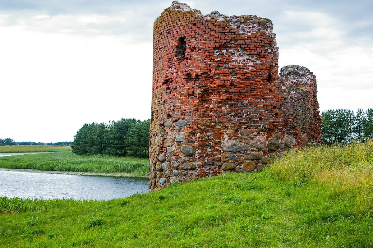
A large round artillery tower, probably built around 1500, reinforced the eastern curtain wall on the landward side. It measured about 14.2 metres across and had walls approximately 3 metres thick. Fieldstone and limestone formed its masonry. The lower section survives and carries traces of violent destruction, probably associated with the partial demolition of the castle in 1583.
Southwestern Flanking Tower
A smaller round tower stood at the southwestern corner beside the river. Probably dating from the fourteenth or fifteenth century, it controlled river traffic and watched a small harbor. Known as the Devil’s Tower and also as the Shame Tower, or Schmachturm, it was traditionally said to have contained a prison cell in its deep basement.
The tower’s lower section was built of fieldstone, with brickwork rising above it for approximately 4.6 metres. The surviving eastern portion retains impressions of the 4-metre-high curtain wall and traces of a wall-walk, a defensive passage along the wall top. Descriptions place the surviving section at approximately 6 metres high in one account and up to 11 metres in another. The western half fell into the Venta during a flood.
Moat and Surviving Landscape
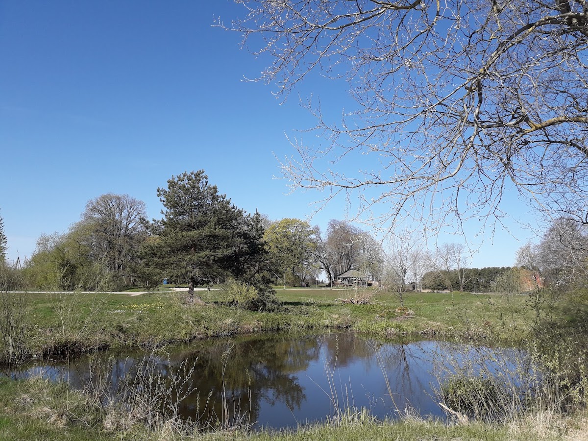
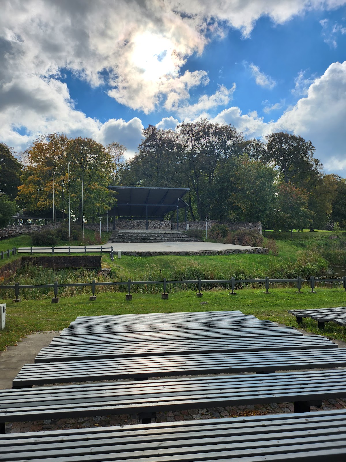
The castle was surrounded by a moat originally connected with the Venta. Along the east and south sides, it measured about 3 metres deep and between 5 and 30 metres wide. The southern section and former river bend remain as a marshy water feature containing two small ponds and a water-filled or groundwater-fed former channel. North of the castle, the river and moat enclosed a triangular tract protected by a rampart and resembling a bastion, a projecting defensive work.
The surviving archaeological landscape therefore consists of the castle foundations, low wall fragments, parts of both round towers, and part of the southern moat, together with the former river and marsh channels. The Lutheran Piltene parish church stands approximately 100 metres east of the castle area.