Great Wall of Gorgan: A Sasanian Frontier Defense in Iran
Site at a Glance
- Popularity
- Very High
- Country
- Iran
- Primary era
- Medieval
- Eras represented
- Classical, Medieval
- Civilizations
- Sassanid
- Site type
- Military
- Remains
- Wall
On this page9 sections
History
The Great Wall of Gorgan is a Sasanian frontier defense in Iran, built in the late fifth or sixth century AD under the Sasanians, an Iranian dynasty whose empire lasted from the third to the seventh century. It crossed a strategic bottleneck between the Caspian Sea and the mountains of northeastern Iran, forming the eastern part of the Caspian Gates, passages between the Caspian region and the Iranian interior. The area was ancient Hyrcania, around the southeastern Caspian. The wall is generally understood as protection against threats from the north, possibly the White Huns, also called the Hephthalites, a Central Asian power that fought the Sasanians. Other interpretations point to additional regional military threats and the area’s economic geography.
Dating and construction traditions
Radiocarbon testing of charcoal from kilns along the wall and optically stimulated luminescence, a method dating when mineral grains were last exposed to light, support a Sasanian date for the surviving structure. Archaeologist M. Y. Kiani had proposed in 1971 that a Parthian barrier, from the Iranian empire that preceded the Sasanians, was later rebuilt and repaired under Sasanian rule. If Alexander the Great encountered a barrier in this area, it would have been an earlier structure, rather than the surviving wall.
Traditions differ over which ruler began or completed the work. One credits Yazdegerd I with starting construction and Khosrow I with finishing it; others assign the project to Khosrow alone, with construction said to have taken about 90 years. Another proposal links the wall to Peroz, or another Sasanian ruler, during or around the conflicts with the Hephthalites. Peroz spent periods in Gorgan between 459 and 484, and this interpretation connects the wall’s purpose with protecting the fertile Gorgan Plain.
Military use and later traditions
At least one fortress on the wall remained in military use for a century or more after its construction, with soldiers stationed there, before it was abandoned. The need to send troops to wars with the Byzantine Empire or to resist the Arab invasions may have contributed to its abandonment.
Later traditions attributed the wall to a ruler of the Dabuyid dynasty, a local ruling house in Tabaristan south of the Caspian, and also credit a ruler of Tabaristan with repairing it. A medieval tradition describes its capture by a Turkic king. Muslim accounts connected the wall with Alexander the Great, the Macedonian king whose eastern conquests inspired later stories about it. Its traditional names include Alexander’s Wall, Alexander’s Barrier, Anushirvân’s Barrier, Firuz’s Barrier, Red Wall, and Red Snake, a reference to the color of its bricks. It is officially called the Gorgan Defense Wall.
Archaeological study and protection
American archaeologist and pilot Erich Schmidt photographed the wall from the air in 1936 and 1937, and his images helped guide later archaeological work. A survey in 1999, undertaken amid development pressure including construction of the Golestan Dam, located remains where the wall met a drainage canal. Concrete blocks were later used to mark the archaeological boundary. Investigations in 2005 sampled the kilns to help establish the wall’s date. The wall is registered on Iran’s national heritage list.
Remains
The wall ran northeast from the Caspian coast, between the Atrak River and Bandar Torkaman, past Gonbad-e Kavus and toward the Pishkamar Mountains. Its precise termini remain uncertain, but the surviving descriptions place it across the landscape as a long brick-built barrier, accompanied by a water-carrying ditch and a chain of forts.
Course and construction of the wall
Proposed limits include the mouth of the Gorgan River, a village, the Golidagh Mountains, and Mount Aliabad-e Katul. A medieval geographer also questioned whether a proposed continuation from Dargaz to Sarakhs belonged to this wall or was a separate structure. Estimates of the wall’s length range from about 195 to 200 km, although a 1971 estimate placed it at about 175 km. Its estimated height is 6 to 8 m, and its width is given as 6 to 10 m.
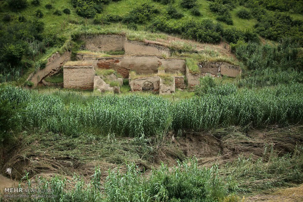
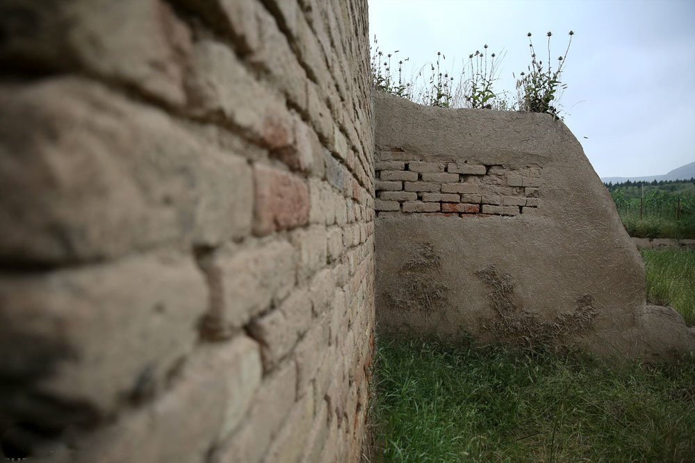
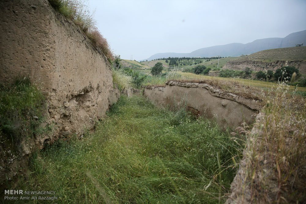
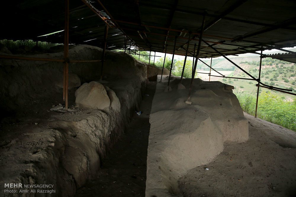
Builders used mudbrick, fired brick, gypsum, and mortar. They made the fired bricks from local loess, a fine wind-deposited soil, in kilns along the route. A common brick measured about 40 by 40 by 10 cm, and some bricks were set vertically between horizontal courses. Tens of millions of bricks went into the construction, with kilns and brickmaking workshops found along or near the wall. The surviving stretches are small, generally buried beneath the soil, and in substantial disrepair. An exposed section in a village north of Kalaleh consists of large bricks.
Associated defenses and military facilities
Ditch and watercourse
The wall lay slightly north of a local river. A ditch about 5 m wide ran alongside it and carried water along most of the route.
Fortresses and barrack blocks
More than 30 fortresses stood along the wall, generally 10 to 50 km apart, and 40 have been identified. They varied in size and shape, covering about 5 to 20 hectares; most were square and built with brickwork of the same type and period as the wall. Three military towers are also reported. Estimates based on the forts and barrack blocks place the possible garrison at between 15,000 and 36,000 soldiers, with one estimate suggesting a capacity of about 30,000.