Calder Abbey: A Cistercian Monastery in Cumbria
Site at a Glance
- Popularity
- Medium
- Country
- United Kingdom
- Primary era
- Medieval
- Eras represented
- Medieval, Modern
- Civilizations
- British, English
- Site type
- Religious
- Remains
- Monastery
On this page12 sections
History
Calder Abbey is a medieval monastery ruin at Calderbridge in Cumbria, United Kingdom, founded in 1135 by twelve Savigniac monks from Furness. Ranulf de Gernon, a Norman nobleman and second Earl of Chester, granted the site to the monks on 10 January 1134. Their first community, led by Abbot Gerold, received a house, a mill, and two saltworks at Whitehaven. Pope Innocent II confirmed the saltworks, while Ranulf’s successors and other donors added further support.
Foundation and displacement
In 1138, amid unrest following the death of King Henry I of England, Scottish forces raided the abbey. William FitzDuncan, a Scottish noble and military commander acting for King David I, led the attack. The monks fled to Furness, but a dispute over Gerold’s position as abbot prevented them from remaining there. After moving between sites, they settled at Byland.
Gerold later disputed whether Calder should belong to Byland’s monastic lineage or remain affiliated with Furness. A compromise resolved the issue. After Gerold sought release from Furness’s authority, the monks were freed from its jurisdiction in 1142. A second community from Furness, led by Abbot Hardred, then re-established Calder with FitzDuncan’s protection.
Cistercian house and church
Calder began as a Savigniac monastery under Furness. In 1148, the Savigniac order joined the Cistercians, a monastic order that absorbed its houses, and Calder became Cistercian. It was affiliated with the Cistercian lineage associated with Clairvaux Abbey, dedicated to St Mary, and within the Diocese of York, the church district overseen by the bishop of York.
The first monks lived in a wooden monastery. The abbey church was consecrated in 1175, and a stone church stood by about 1180. In the early thirteenth century, the abbey underwent extensive rebuilding in the English Gothic style, with support from Thomas de Multon, lord of Egremont.
Raids, revenues, and dissolution
Calder remained modest in wealth. Its annual revenues were £32 in 1291 and had fallen to £5 by 1314, amid poor harvests and Scottish raids. Further raids affected the abbey in 1216 and 1332. In 1381 the community consisted of four monks and three lay brothers, non-ordained members of the religious community who commonly undertook manual work. The abbey’s net income was £50 in 1535.
A visitation in 1535 found eight monks seeking release from their vows or facing accusations of serious disciplinary failings. In 1536, during King Henry VIII’s dissolution of England’s monasteries, the last abbot, Richard Ponsonby, surrendered Calder with nine monks, and the community was expelled. At the dissolution the monastery possessed a belt claimed to have belonged to the Virgin Mary.
Reuse and later investigation
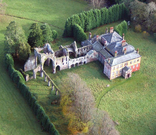
Henry VIII granted the abbey to Thomas Leigh, who removed the roofs and sold their metal and the furnishings. The church became a ruin, and other buildings supplied stone for nearby houses. A painting made by Matthias Read around 1730 shows the church largely ruined, with gables still standing over the south transept and the west end of the nave. The Senhouse family, owners in the late eighteenth century, extensively altered the manor. Mary Senhouse, who married Thomas Irwin in 1840, arranged for its north wing to be rebuilt and a riverside walk to be laid out. In the late nineteenth century, occupant Thomas Rymer restored parts of the ruins.
Excavations began in 1881, concentrating mainly on the choir and south transept. On 10 April 1915, the ruins received Grade I designation, England’s highest listed-building category. Further work examined the infirmary in 1947 and, in 1985–86, earthworks east of the abbey that had formed an ancient fishpond. In 1934, a Mass among the ruins marked the abbey’s eight-hundredth anniversary. A large congregation attended, led by Thomas Wulstan Pearson, the Roman Catholic Bishop of Lancaster.
Remains
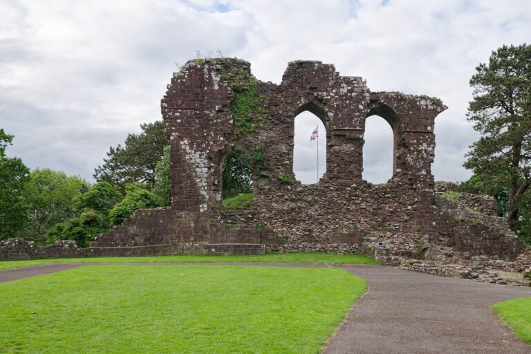
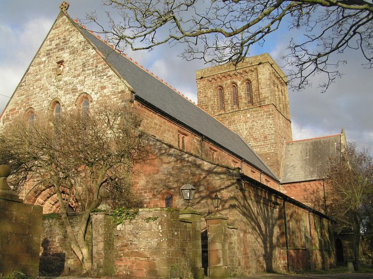
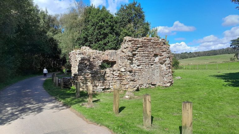
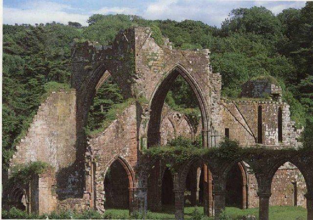
The abbey’s precinct covered about 30 acres, a little over 12 hectares, with the church in its northern part and the cloister to the south. The stone church preserves Norman and later Gothic work. The site also includes surviving monastic ranges, underground foundations, and a fourteenth-century gatehouse forming part of the western boundary.
Abbey church
The church measured about 45 metres long and 25 metres across its transepts, the crosswise arms of the building. Its plan had an aisleless presbytery, the area around the high altar, with a flat east end and two side chapels on each side. Each transept had two chapels along its eastern side, while the nave had aisles and five sections. A tower stood over the crossing, where the nave and transepts met, an arrangement that departed from the usual Cistercian plan.
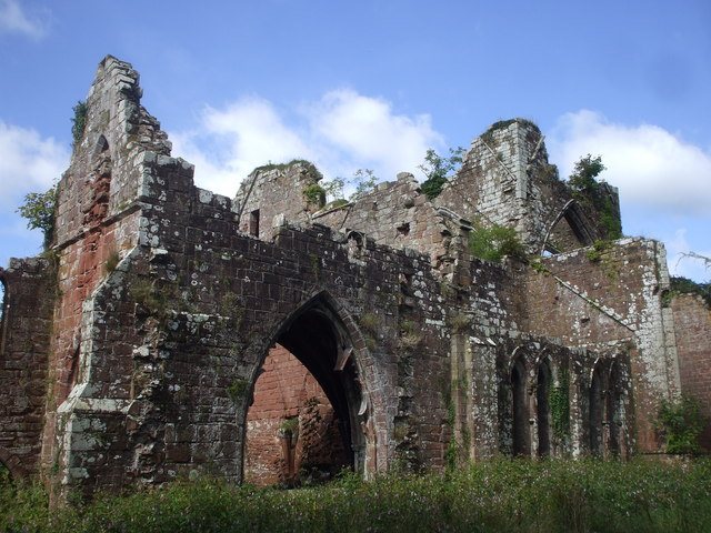
The west entrance preserves a Norman feature from the earlier church, and parts of the transepts date to about 1175–80. The north nave arcade, a row of arches, survives to about four metres high. Four arches that supported the crossing tower remain, as does much of the south transept. The north transept and presbytery are more fragmentary, with some remains incorporated into later reinforcing supports for the tower.
The nave columns alternate between four-lobed and eight-sided shapes. Their capitals carry restrained stylized leaf decoration, reflecting the Cistercian preference associated with Bernard of Clairvaux. A higher tier of arches survives at the crossing than in the nave. Traces also remain of a stair from the monks’ dormitory to the transept and a separate stair leading to the tower.
Cloister ranges
Eastern range and chapter house
The eastern range held the chapter house, where the monks met, and a monks’ room, with the dormitory above. The chapter house projected beyond the range and was rebuilt in the later thirteenth century. Part of its vault survives, along with a large east window; one of the three windows on that side retains fragments of glazing with geometric interlace. A vestibule to the west had a central entrance between two arches. The northern arch led to a large book cupboard, with the night stair above it. A passage south of the chapter house led toward the cemetery, and a day room where monks worked probably stood farther along the range. Much of the dormitory’s upper walls survives, with regularly spaced narrow, pointed windows.
Southern and western ranges
The southern range contained a warming room, refectory, and kitchens. After the Dissolution, the transept was used as a stable and the south side of the cloister was adapted for domestic use. Parts of the south and east ranges now form part of Calder Abbey House, a largely early-nineteenth-century private residence, making the south range difficult to interpret. Foundations beneath the ground mark other cloister buildings; the western range housed the lay brothers.
Cemetery and service buildings
The monks’ cemetery lay just beyond the church’s east end. Southeast of the cloister, the infirmary had an L-shaped plan; its foundations suggest that it was probably built of wood. The precinct also included a corn-drying kiln, a mill, and a dovecote.
Monk’s Bridge
Calder’s monks built Monk’s Bridge, also called Matty Benn’s Bridge, on Cold Fell. It crosses the River Calder just upstream from the river’s meeting with Friar Gill. The bridge remains in use and is Cumbria’s oldest packhorse bridge, a bridge built for pack animals.