Wittenburg Monastery: An Augustinian House on a Former Castle Site
Site at a Glance
- Popularity
- Medium
- Country
- Germany
- Primary era
- Medieval
- Eras represented
- Medieval, Modern
- Civilizations
- German, Holy Roman Empire
- Site type
- Religious
- Remains
- Monastery
On this page11 sections
History
The castle before the monastery
Wittenburg Monastery is a former Augustinian canons’ monastery on Klosterberg in Lower Saxony, Germany, established on a hill previously occupied by a medieval castle. Its history connects a strategically placed stronghold with a religious community that later became an administrative centre and agricultural estate.
The castle’s origins are uncertain, although an eleventh-century foundation is often proposed. One account instead links it to the Billunger, a Saxon ruling family said to have taken the site from the Immedinger and Riedag during Frankish campaigns of 772–804. This account places the castle’s construction around 805. The Billunger withdrew around 1000, leaving the settlement and castle abandoned. Its chapel was dedicated to St Willehad, the first bishop of Bremen, a dedication that may point to an earlier foundation.
The hill gave the castle a strategic position overlooking a north–south route, now followed by the B 3, and the west–east Hellweg, now followed by the B 1. The routes crossed five kilometres southeast of the castle. The castle appears only once in the historical record: a document made around 1200 recalled an earlier donation to the Hildesheim cathedral chapter, the body of clergy associated with the cathedral. The donor was a Duchess Adelheid, but the document did not date the gift. She may have been either a daughter of Albert the Bear, who died before 1162, or the wife of Bernhard II, Duke of Saxony, who died in 1059. The Ascanians inherited from the Billunger after 1106, a succession that supports a Billung connection to Wittenburg. The castle had lost importance by the time Poppenburg was built; Poppenburg is first mentioned in 1251.
Several explanations have been offered for the name Wittenburg. One interprets it as meaning “white castle,” after the white shell limestone of the Finie hills. Another traces it through the forms Witegowo, Witegeburg, and Witteburg to a Billung name. A third, attributed to Georg Wulbrand Bock von Wülfingen, understands the original name as “widow’s castle,” connecting it with a period when the site served as a residence for widows of that family.
Hermits and the Augustinian monastery
By the thirteenth century, the abandoned castle site belonged to the Hildesheim cathedral chapter. Hermits settled there in 1297. From 1316, Bishop Heinrich II of Hildesheim granted the community privileges in recognition of its good reputation. In 1328, Bishop Otto II made its six members canons regular, clergy who lived communally according to the Rule of Augustine. This established an Augustinian canons’ monastery.
Agriculture formed the basis of the monastery’s economy, and its landholdings expanded. In 1330, it acquired four hides of land at Quickborn, an abandoned village near Elze. A hide was a traditional unit for measuring or assessing land, though its size varied by place and period. After the monastery suffered raids and a fire, Bishop Gerhard of Hildesheim granted it the tithe from Osede, another abandoned settlement near Elze, in 1387. That year, the number of canons increased from six to eight. The dukes of Brunswick, Bernhard I in 1389 and Heinrich I in 1415, promised protection, while the Bock von Wülfingen family made several endowments.
Around 1423, Wittenburg joined the Windesheim Congregation, a late-medieval reform movement of canons regular, as its twenty-ninth house. The monastery prospered toward the end of the fifteenth century. Its church was completed in 1497 under Prior Stephan von Möllenbeck, the community’s senior officer.
Confessional change and secular use
In 1543, the canons adopted the Protestant faith, in keeping with the expectations of Duchess Elisabeth of Brandenburg. Economic decline was apparent by 1552. A ducal steward took charge of the monastery’s finances in 1553, but his mismanagement led the canons to leave. In 1564, Duke Erich II pledged the monastery to a private individual. Only the prior and one canon remained, and the church was closed.
Duke Julius secularized the monastery in 1580, transferring it to secular administration, and made it the seat of the Wittenburg administrative office within the larger Calenberg bailiwick, an administrative district. From 1590, the church’s eastern choir, the area used for clergy and worship, served the local congregation. The western part was put to agricultural use as a sheepfold and barn. The eastern section continues to serve as the parish church.
Estate, church restoration, and preservation
After the monastery’s dissolution, its land was leased as an estate. Under King George III, who also ruled Hanover, Wittenburg developed as a model farm and became the seat of the Calenberg Agricultural Society in 1795. By then, half the land had been parcelled out. The division of the remainder in 1908 brought the estate’s operations to an end.
In 1884, architect Conrad Wilhelm Hase remodelled the church’s eastern choir in the Neo-Gothic style. The western section was repaired after German Emperor Wilhelm II visited in 1889. Under the Loccum Treaty, a 1955 agreement concerning relations between Lower Saxony and Protestant churches, the monastery church was transferred back to the local congregation. For a time, Sunday services were held in the attached sacristy while the eastern section was used only on special feast days; services now take place again in the eastern choir. The western section served for storage until 2003, after which it was cleared for cultural events.
An association founded in 2000 took up the church’s preservation, and the complex developed into a religious and cultural centre for the region. In 2011, the association acquired and cleared the overgrown garden south of the church. A foundation acquired the whole hill in 2012 and entrusted it to the association, which manages the land through sheep grazing. The church complex is protected as a monument.
Remains
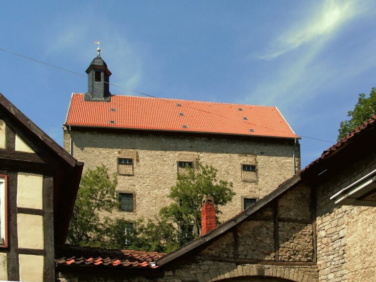
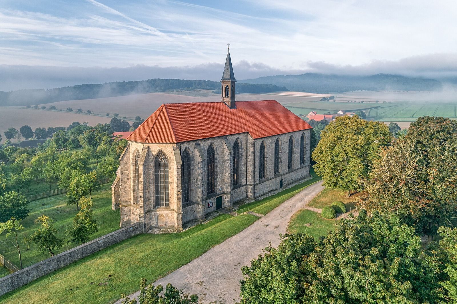
The monastery occupies Klosterberg, a terraced, levelled spur at the southern end of the Finie ridge in the Hildesheim district of Lower Saxony. The ridge is a small, wooded line of hills northwest of Elze and east of Osterwald. The surviving complex includes a large Gothic church, parts of the former enclosure, and the ruins of a utility building. The former castle and later monastery occupied a triangular, levelled area on the steep-sided hill.
Hilltop enclosure
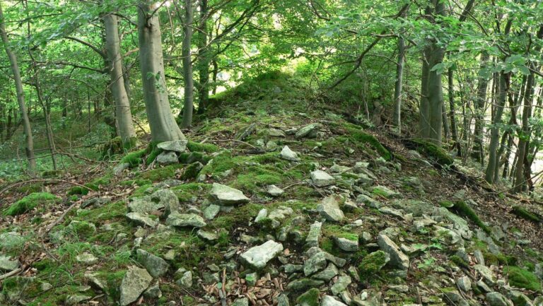
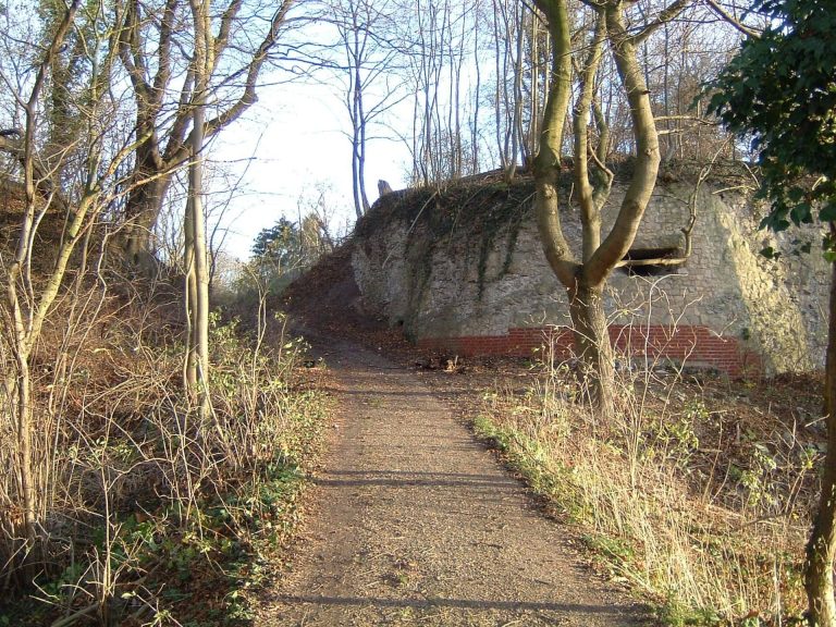
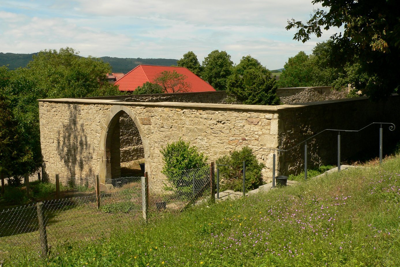
The levelled area measures up to 135 by 100 metres. Short stretches of a ring-section rampart, an earthwork forming part of a fortified enclosure, remain along the site. The rampart is up to eight metres wide and one metre high; its ditch is of equal width and one metre deep. Sections of the monastery wall around the edge of the spur may follow the castle’s defensive line. A projecting section of wall in the southeast may mark an earlier gate.
Church and monastic buildings
The church
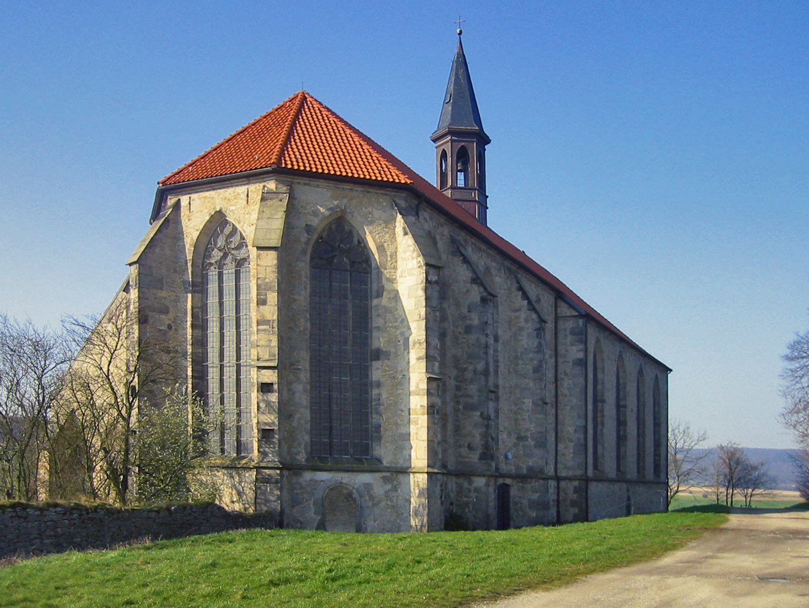
The church is a 44-metre-long, single-nave building, meaning it has one main longitudinal space without side aisles. It was built in 1497–98 in Late Gothic style, a later phase of medieval Gothic architecture, using rubble stonework covered with plaster. The eastern part is slightly older than the western part. A rood screen, a partition separating the choir from the rest of the church, divides the interior near its midpoint. The eastern section contains the choir stalls, some dating to the fifteenth century. The east was intended for the monks, while the west was used by lay brothers, community members who carried out manual work rather than serving as ordained clergy.
The two sections also differ in their supports: the eastern walls have exterior buttresses, projecting structures that strengthen a wall, while supports in the western section are set inside. Pointed-arch Gothic windows light the church. A hexagonal roof turret, a small tower rising from a roof, holds a bell in place of a ground-based church tower. The keystone above the western entrance bears the date 1497 in Roman numerals, MCCCCXCVII. Interior and exterior lighting was installed in 2010 in collaboration with the University of Applied Sciences and Arts.
Former convent range and service buildings
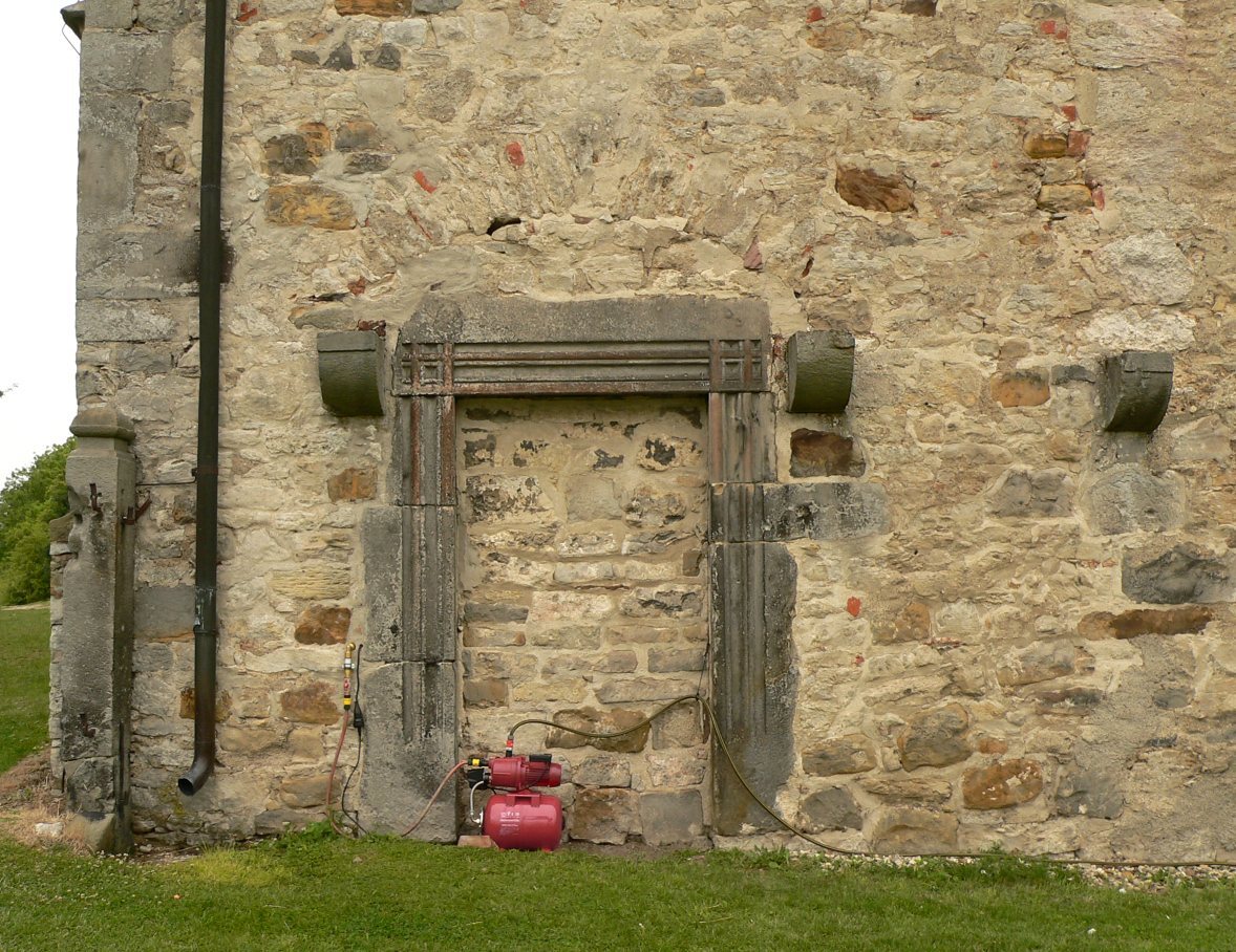
On the church’s south side, projecting support stones and blocked doorways indicate the position of the former two-storey monastic range attached to the building. A cloister, a covered walkway usually arranged around a courtyard, is thought to have occupied this area. It may have been reached from the nave through a doorway that is now blocked. A sacristy, a room for preparing worship and storing liturgical objects, is attached to the eastern part of the church. The complex also includes the ruins of a Gothic utility building. The church’s divided plan has parallels at the monasteries of Frenswegen, Dalheim, and Niederwerth.
Garden and grounds
The former monastery garden lies south of the church on ground used in turn for the castle, monastery, administrative buildings, and estate. It is now meadowland with an orchard. The monastery wall partly encloses the grounds and survives in poor condition. From the garden, the land falls toward views south over the Leine valley and east toward the Hildesheim region.