Knife River Indian Villages National Historic Site: Preserving Hidatsa Village Remains
Site at a Glance
- Popularity
- Medium
- Country
- United States
- Primary era
- Early Modern
- Eras represented
- Early Modern
- Civilizations
- Unclassified
- Site type
- City
On this page10 sections
History
Knife River Indian Villages National Historic Site preserves the historic and archaeological remains of Hidatsa communities in Stanton, North Dakota, United States. Three villages occupied the area: Awatixa Xi’e, also called the lower Hidatsa village, Awatixa, and Big Hidatsa. Awatixa Xi’e is believed to have been the oldest, established around 1525; Big Hidatsa was established around 1600.
Villages, farming, and exchange
The villages became a center of farming and trade. Their residents helped move goods through networks extending from Minnesota across the Great Plains to the Gulf Coast and Pacific Northwest. They exchanged furs, firearms, and metals such as copper. Hidatsa and Mandan people also traded corn and other crops. Women managed extensive gardens of corn, beans, squash, and sunflowers, while residents also hunted bison.
Sacagawea, a Shoshone woman who had been taken captive, lived in one of the villages. She later accompanied the Lewis and Clark Expedition, a U.S. exploration of western North America, with her son, serving as an interpreter and guide. Some Indigenous groups the party met regarded it as non-threatening because it included a woman and child, unlike a war party.
Smallpox and relocation
Smallpox outbreaks beginning in 1837 brought severe losses. The outbreaks caused an overall population decline of 50 percent; Mandan mortality from 1837 to 1840 reached 90 percent. In the 1837–38 outbreak, only 31 of 1,600 Mandan villagers survived. People continued to visit trading posts despite warnings, helping spread the disease. Neighboring groups who raided abandoned villages also carried infection away on blankets, horses, and household tools.
Around 1845, survivors from the Mandan, Hidatsa, and Arikara communities moved north and developed Like-a-Fishhook village.
The site was established in 1974 to preserve the historic and archaeological remains of the Hidatsa communities. On October 26 that year, it was designated a National Historic Site and added to the National Register of Historic Places, the federal list of properties recognized for their historical importance. The National Park Service administers the site.
Remains
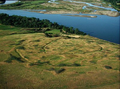
The 1,758-acre site lies at the confluence of the Knife and Missouri Rivers. It extends along both sides of the Knife River and includes a forested peninsula that follows the river. Its remains include village sites and earthlodge traces within a landscape of prairie, woodland, wetlands, and sandbars.
Village remains and dwellings
Village layout
Visible traces include large circular depressions marking earthlodges, cache pits used for storage, and travois trails, routes made by frames dragged to carry goods. Collapsed lodge walls and roofs form an outer circular rim around each depression. Villages were often placed on narrow dunes for defense, with a river protecting two sides and a palisade, a defensive barrier of upright stakes, guarding the third.
Earthlodges
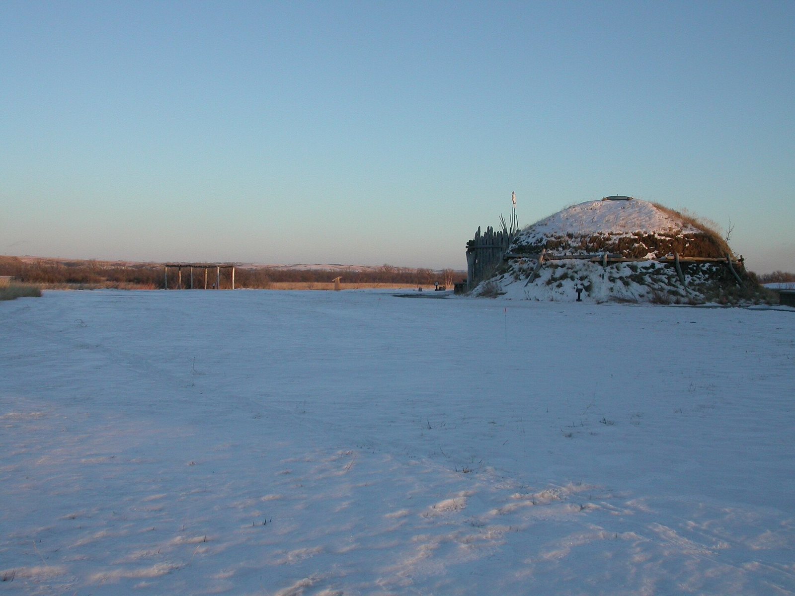
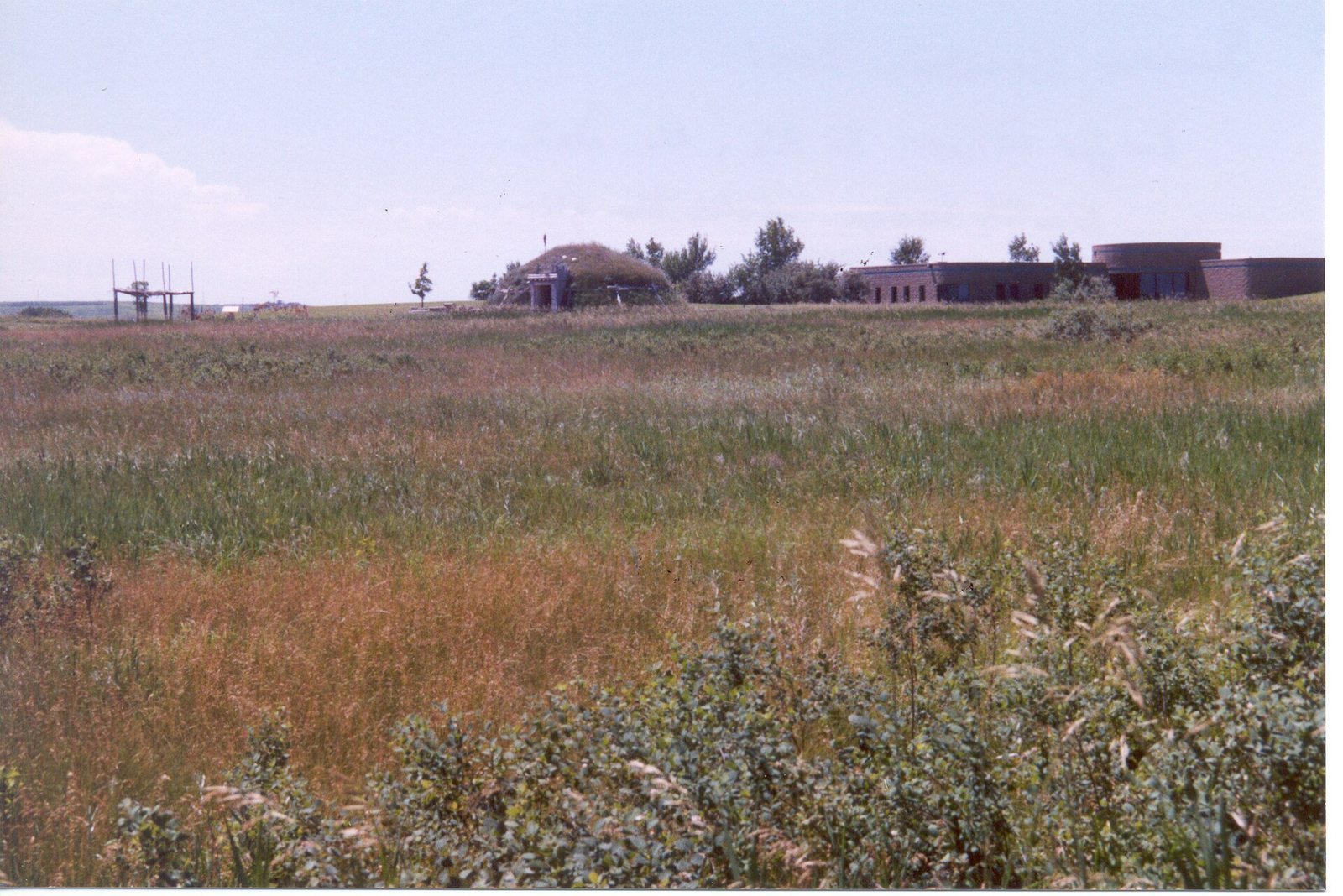
Earthlodges were built at ground level with a wooden framework covered by willows and dried grass, then by about four inches of earth. They could reach 40 feet across and 14 feet high. A dwelling could shelter 10 to 30 people, and some housed as many as two families. Daily sweeping gradually left the floor below the surrounding ground. A central fireplace and an opening in the roof allowed smoke to escape; the most valued horses were kept overnight in a corral by the entrance. A reconstructed Hidatsa earthlodge is also present at the site.
River and upland landscape
Prairie and woodland
During Indigenous occupation, the uplands were mostly treeless mixed prairie, while people cleared fertile river-bottom forests for gardens. Green ash, cottonwood, American elm, and box elder grew in the bottomlands, along with sandbar willow, red-osier dogwood, and buffalo berry. Today, the site includes native short-grass prairie, exotic grassland, 450 acres of hardwood forest, village sites, wetlands, and sandbars. Some forest areas have changed little. Prairie plants include wheatgrass, needlegrass, grama grass, and big bluestem, as well as forbs, herbaceous plants other than grasses. Chokecherry, wild plum, buffaloberry, and Juneberry provide food for wildlife. In 1974, the surrounding landscape was altered to resemble its appearance during Indigenous occupation. Exotic plants became established after Indigenous and Euro-American forest clearing, mostly by accident and sometimes deliberately. Park inventories and monitoring of plant and animal species guide efforts to control invasive plants.
River habitats
The Knife and Missouri Rivers within the site support more than two dozen species of aquatic mollusks.