Kargaly: A Copper-Mining and Metallurgical District in Russia
Site at a Glance
- Popularity
- High
- Country
- Russia
- Primary era
- Bronze Age
- Eras represented
- Bronze Age, Early Modern, Modern
- Civilizations
- Russian
- Site type
- Economic
- Remains
- Mine
On this page12 sections
History
Kargaly is an extensive copper-mining and metallurgical district in Russia’s southern Urals, in the Orenburg region. Copper extraction began there in the fourth millennium BCE, and mining and metalworking later reached an ancient peak during the Late Bronze Age, when the Srubnaya community worked its richest deposits.
Early extraction and the Bronze Age
The earliest mining began in the second half, or near the end, of the fourth millennium BCE. It is associated with the Yamno-Poltavka archaeological community, a grouping linked to pastoral populations of the southern Urals and neighboring regions. Mining paused for several centuries, roughly from 2500 to 1900 BCE.
Work resumed on a much larger scale during the Late Bronze Age, broadly between the eighteenth and fourteenth centuries BCE. The Srubnaya community, another archaeological grouping associated with pastoral populations, exploited Kargaly’s richest deposits. Early metalworking belonged to the Circumpontic tradition, associated with the region around the Black Sea; later activity was part of a broader Eurasian tradition.
At Gorny, mining was joined by ore processing, smelting, casting, mould-making and tool forging. The settlement stood on a hilltop exposed to seasonal extremes and lacked a water supply. These difficult conditions have been interpreted in connection with the community’s sacred beliefs. Ritual practices were intertwined with work and daily life. Large-scale animal slaughter has been linked to mining and metalworking, and livestock may also have been exchanged for ore or metal.
Mining and metalworking stopped again during the last third of the second millennium BCE, for reasons that remain unknown. An interval of about three millennia followed before extraction resumed.
Mining under Russian industrialists
In the 1740s, Russian industrialist I. B. Tverdyshov reopened the district and quickly expanded mining around Bronze Age workings. Russian merchants and manufacturers acquired extensive land, including Kargaly, from the Bashkirs, an Indigenous people of the southern Urals.
Kargaly became an important copper source for Russia. By the mid-eighteenth century, its ore supplied between one-fifth and one-quarter of the copper smelted at works in the Russian Empire. Before the Crimean War of 1853-1856, copper from the district was also exported to England and France. Horse carts carried ore north to metallurgical works between about 180 and 500 kilometres away. Mining continued through the nineteenth century and had effectively ended by the turn of the twentieth.
Total copper production is estimated at about 200,000 to 250,000 tonnes, with as much as half possibly dating to the Bronze Age. Separate estimates place Bronze Age output between 55,000 and 120,000 tonnes, while production during the later mining period reached at least 126,000 tonnes.
Archaeological study and protection
Orenburg local historian P. I. Rychkov described Kargaly in 1762, shortly after mining restarted. Archaeological fieldwork began in 1989 under the leadership of Evgenij Chernykh, a Moscow archaeologist and historian of metallurgy. Later expeditions identified settlements, cemeteries and mining remains, and excavations continued until 2003. By then, only about 0.2 percent of the district’s extensive workings, settlements and cemeteries had been investigated. The Institute of the Steppe of the Ural Branch of the Russian Academy of Sciences monitors the area’s cultural and natural heritage. A 1995 presidential decree recognized the copper mines as a federal cultural-heritage site, and some parts of the mining field also have natural-heritage status.
Remains
Kargaly’s remains extend across an approximately oval ore field about 50 kilometres long and 10 kilometres wide. Copper mineralization covers roughly 500 square kilometres, with richer concentrations occupying about 140 square kilometres in 11 major and 11 smaller clusters. Mining followed irregular ore deposits within sandstone and slate, leaving a landscape of shafts, underground passages, open workings, collapsed ground and waste heaps.
Ore-bearing landscape
Malachite and azurite are the main copper minerals in the district; primary and secondary copper sulfides are uncommon. The deposits lie chiefly in sandstone and slate, and some copper-bearing layers contain fossil remains of Permian-period trees. Ore formed in uneven pockets and short, discontinuous veins, from surface exposures down to depths of 80 to 90 metres. Individual pockets range from a few centimetres to more than 10 metres in length.
Mines and spoil landscape
Shafts and underground passages
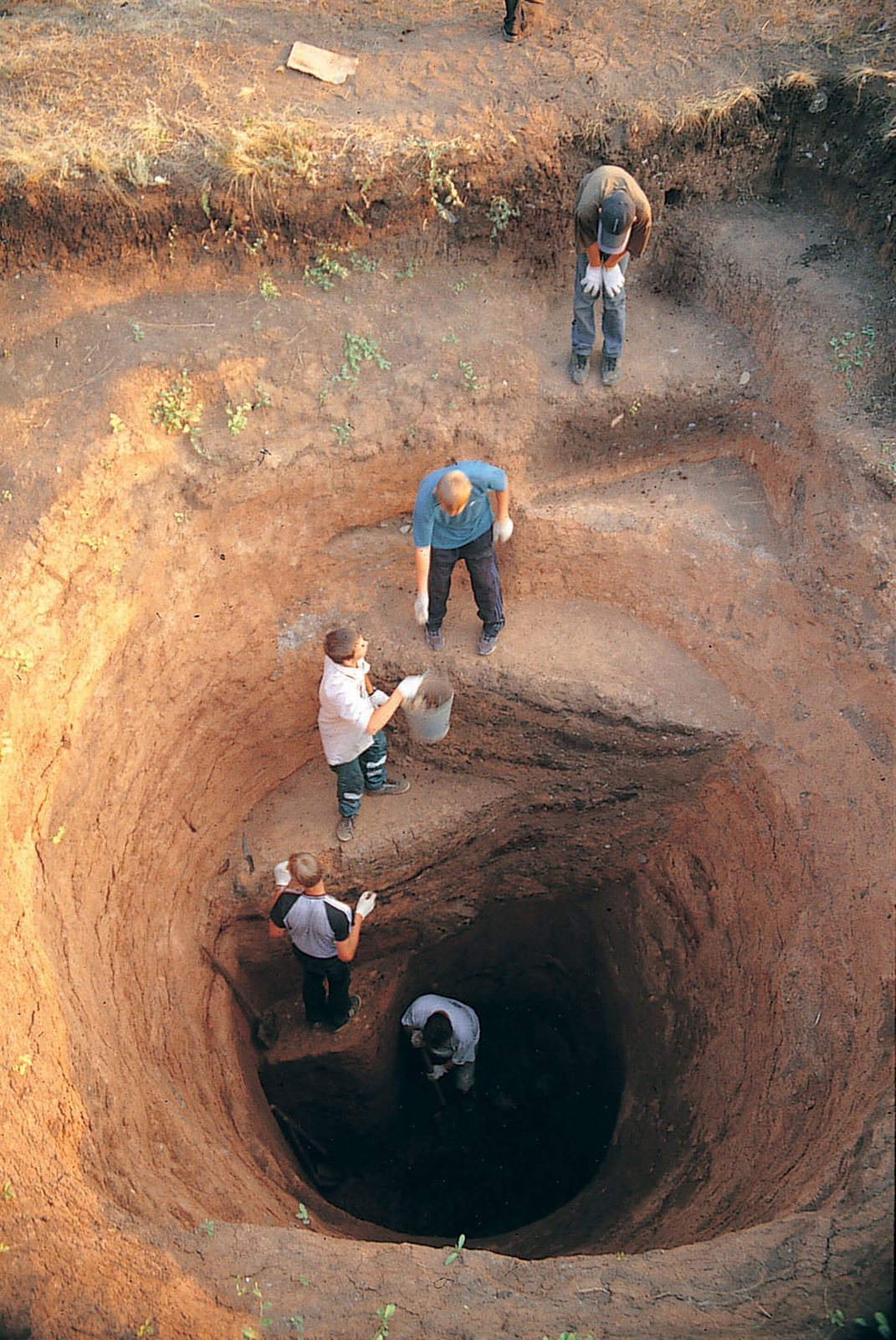
Vertical and sloping shafts pass through sandstone and slate beneath clay-rich soil. They gave miners access to ore, helped ventilate the workings and served to bring rock and minerals to the surface. Many shafts have since filled with fallen rock and debris, while later mining dumps destroyed others. Bronze Age workings reached depths of about 40 to 42 metres; shafts from the eighteenth and nineteenth centuries extended to 80 to 90 metres.
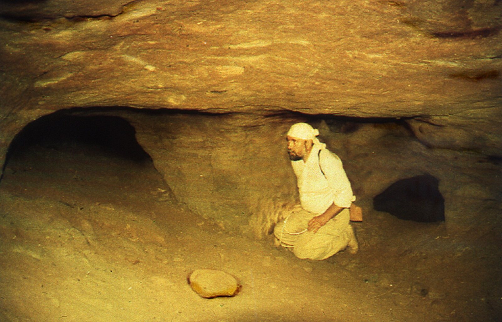
Horizontal or gently sloping galleries are the most widespread underground remains. Their dimensions and winding courses varied with the deposits. Some widened into chambers with ceilings as high as 20 metres, linked to other passages; others ended without continuing farther. Trial pits were also dug through the surface loam in the search for copper. The total length of underground passages was probably several hundred kilometres.
Surface traces and waste
As many as 35,000 surface traces of mining have been identified, including shafts, horizontal entrances and open-cast workings. Collapses formed where the roofs of underground workings gave way. These depressions range from 2 to 70 metres across and from 1 to 30 metres deep.
Waste heaps occur near mine and gallery entrances. Some run for hundreds of metres along ravine sides, and a few extend for a kilometre or more. Heaps from different periods overlap, sometimes covering earlier shafts. Bronze Age spoil typically includes crushed ore-bearing rock and rich fragments of malachite and azurite. Eighteenth- and nineteenth-century heaps are generally larger but poorer in copper minerals, reflecting deeper workings. Later miners sometimes incorporated older shafts and galleries into new workings, or filled them completely. The total excavated waste is estimated at 100 to 120 million cubic metres, equivalent to as much as 250 million tonnes.
Settlements and burial grounds
Gorny settlement
Gorny occupies a promontory hill among extensive mine workings. Its earlier occupation included small pit dwellings; later, larger complexes brought together living quarters, smelting areas and yards for processing ore. Excavations across about 1,000 square metres yielded more than 120,000 pottery fragments and around 4,000 copper finds, including object fragments, casting splashes and droplets. The finds also included nearly 200 fragments of, or complete, stone casting moulds and almost 1,500 stone hammers and mallets, alongside other tools.
More than 2.5 million bones from domestic animals were recovered at Gorny, most interpreted as sacrificial remains. Some were deposited in large pits, with selected bones, especially lower jaws and ribs, placed in deliberate groupings. Numerous oracle bones, animal bones used in divination or other ritual practices, were also found. Masculine and feminine symbols were made before trenches for casting-yard foundations and pits for large central hearths were constructed.
Burial grounds
Kargaly contains more than twenty Late Bronze Age settlements and several burial-mound cemeteries with burials from the Early and Late Bronze Age. Some cemetery remains also date to the Sarmatian period, associated with ancient Iranian-speaking peoples of the Eurasian steppe. At the Pershin cemetery, a youth’s grave near the centre of the mining field contained a casting mould for an axe with a handle socket and a flat copper axe. Radiocarbon dating places the burial at about 2900 to 2700 BCE.