Altıntepe: Urartian Fortress and Ancient Settlement in Turkey
Site at a Glance
- Popularity
- Medium
- Country
- Turkey
- Primary era
- Iron Age
- Eras represented
- Iron Age, Classical, Medieval
- Civilizations
- Achaemenid, Byzantine, Urartian
- Site type
- Military
- Remains
- Fort
On this page27 sections
History
Altıntepe is an archaeological settlement and Urartian fortress in Turkey, occupied from the Early Bronze Age through the Middle Ages. During the Iron Age kingdom of Urartu, centered in the Armenian highlands, it was the kingdom’s westernmost settlement, on the frontier with Phrygia, an ancient kingdom in Anatolia. The temple complex was probably built in the second half of the eighth century BCE. The scale of the palace suggests that the fortress served a local administrative role.
Urartian frontier and funerary practice
Urartian expansion under King Sarduri II, who reigned from about 760 to 730 BCE, reached at least as far as Altıntepe’s frontier. The site’s slopes also served as a setting for funerary worship. Liquid offerings accompanied rites for the dead, and some grave goods may have been used in ceremonies before burial. This combination of libations and funerary practice is the only known example of its kind in the Urartian evidence.
Urartian decline and uncertain later occupation
Urartian state power collapsed in the kingdom’s heartland in the early sixth century BCE. Altıntepe’s inhabitants left around this time, taking some portable goods. Whether Urartians continued to live at the site, or a later community settled there during the Achaemenid expansion, remains uncertain. The Achaemenids were the dynasty that ruled the Persian Empire in the first millennium BCE. Archaeologist Geoffrey D. Summers assigned Altıntepe’s Phase II building layer to the Achaemenid period, and placed Triangle Ware pottery from nearby Saztepe in the post-Urartian Achaemenid period.
Byzantine and medieval settlement
A church built in the sixth century CE shows that Altıntepe was settled in the early Byzantine period. The Byzantine Empire was the eastern continuation of the Roman Empire. Settlement layers on the hill extend into the Late Middle Ages, when a cemetery was established over the church.
Discovery and archaeological work
Altıntepe came to archaeological attention in 1938. Its discovery has been linked either to workers building the Erzincan–Erzurum railway or to local people who opened and looted a chamber tomb; the railway does not cross the hill. Some objects were sold to the archaeological museum in Ankara. Turkish newspapers publicized the finds in April 1938, and archaeologist Hans Henning von der Osten published a report after visiting the site in 1939.
Looting continued in later years. In 1956, road workers broke into the northeastern of the three tombs and left some grave goods behind. Tahsin Özgüç of Ankara University directed the first scientific excavations from 1959 to 1968, investigating the fortress, temple complex and residential areas. The excavated ground was left exposed; it later became overgrown and remained vulnerable to looting.
A second excavation campaign began in 2003 under Mehmet Karaosmanoğlu of Ankara University and uncovered the church on the hill’s eastern side. In 2006 and 2007, researchers also surveyed an area within about five kilometres of the fortress to investigate its economic connections with nearby settlements and temporary livestock camps. Mountains bounded the survey area to the north and the Karasu River to the south.
Remains
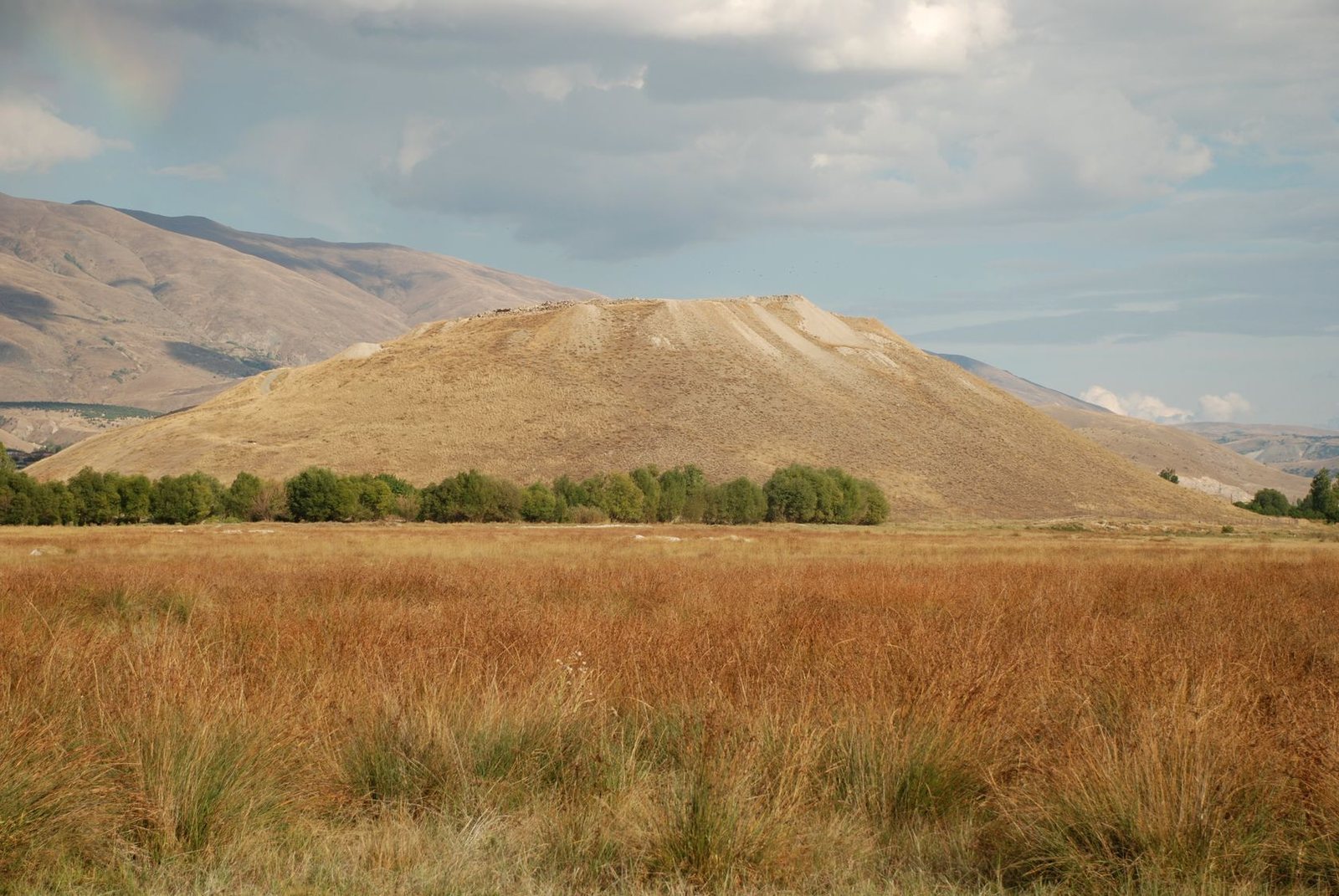
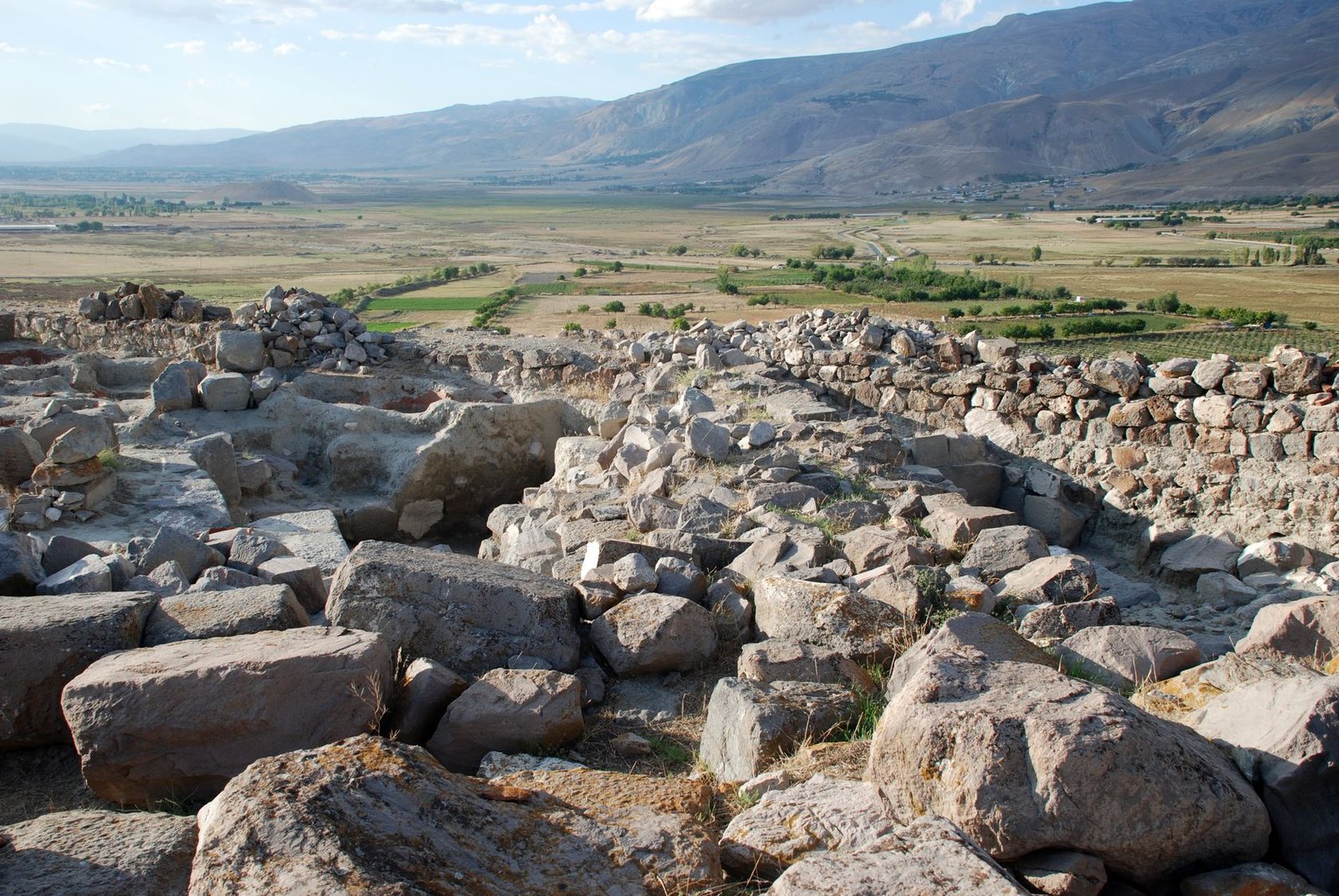
The Urartian fortress occupied the summit of a volcanic, flat-topped conical hill. Its enclosure contained a large palace in the southern central area and a temple complex to the northwest; three chamber tombs lay outside the wall on the southern slope. Rough stone foundations and defensive walls supported buildings that also used mud brick. The remains are in ruins.
Hill and surrounding landscape
The hill, plain and wetlands
In Üzümlü District, Erzincan Province, about 20 kilometres east of Erzincan, the hill rises roughly 60 metres above the plain. Its summit is 1,215 metres above sea level, and its base is about 500 metres across. The hill stands at the northern edge of a broad plain crossed northwestward by the Karasu, a headstream of the Euphrates. Wet meadows, small streams, irrigation channels and marshes lie to the west. The marshland has shrunk as channels were built; in antiquity, it was probably used as an animal enclosure and as a gathering place for wild birds. Fields, gardens and tree rows to the east, and sandy river deposits and flooding to the south, shape the surrounding landscape.
Nearby archaeological sites
Saztepe, about two kilometres west, is a mound roughly 40 metres high with Iron Age remains, especially from the Late Iron Age. Küpesik Höyük, about 500 metres west, is a settlement mound measuring about 140 by 200 metres, now obscured by soft sandy-gravel deposits. Deep pits dug by looters expose cultural layers to a depth of about six metres. Küçük Höyük lies to the north, within a stream.
Summit enclosure and central buildings
Defensive enclosure and terrace
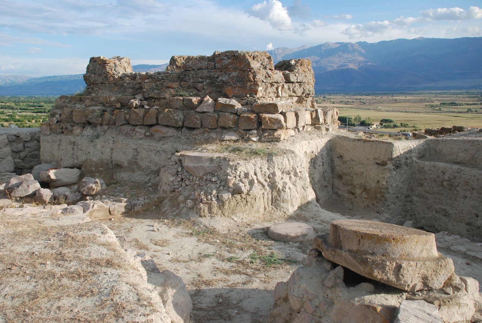
A perimeter wall enclosed the summit, with projecting rectangular towers and gates leading toward the palace. Its rough stone blocks slope slightly inward. The wall cuts across building plans on the north and east sides, suggesting it was added late in the Urartian period as military conditions worsened. Its tower shape and entrances facing inward have also prompted a possible Hellenistic dating. In 2007, a probe at the fortress’s northwestern edge exposed massive stonework beneath a deep layer of medieval debris. The masonry was interpreted as a terrace.
Palace and storage rooms
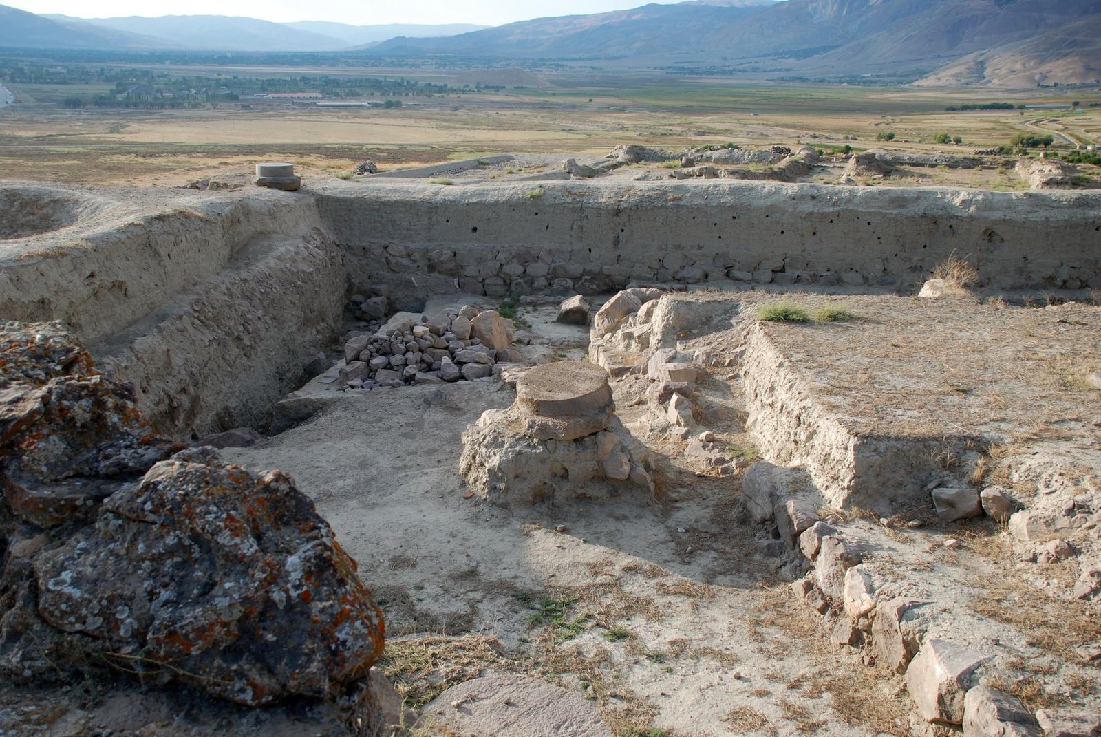
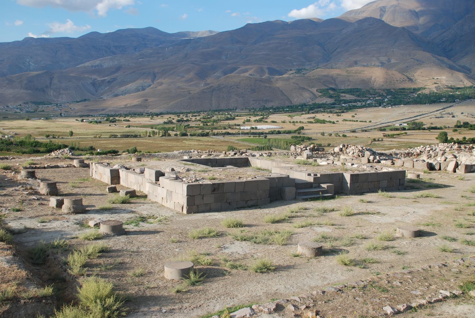
The palace belonged to the second architectural layer. It stood on higher ground, aligned southwest to northeast, and joined the temple precinct at an acute angle. Its great hall measured 44 by 25 metres internally. Six columns, arranged in two rows of three, supported a flat timber roof. The surviving column bases are about 1.5 metres in diameter, suggesting the columns may have been made of clay rather than wood. Mud-brick outer walls at least three metres thick rested on large, rough stone blocks. The hall’s entrance was at its northeastern corner.
Three storage rooms adjoined the hall’s northwestern long side. One held eleven large storage jars set into the floor in three rows; another contained sixty, arranged in rows of ten. Two spacious rooms stored grain, barley, beans, oil and wine. Hieroglyphic marks on the jars indicated their capacities. Three smaller rooms lay to the southeast, where a later wall, possibly Hellenistic, cut through one of them.
Palace wall paintings
The hall walls had a thin clay-based plaster coating, painted after it had dried. These paintings, dated to the first half of the seventh century BCE, probably covered the walls to an average height of about 2.35 metres. Lower decorative bands showed pomegranates and rosettes. Central panels featured winged sphinxes, seated bulls, geometric patterns, palm-leaf motifs and spirits gathered around a tree of life. One sequence, about 60 centimetres high, showed a lion stalking a stag beneath a tree with a blue trunk and red leaves, followed by the lion eating the stag. Similar wall-painting fragments are known from Teišebai URU and Erebuni, in present-day Armenia.
Temple courtyard
The temple complex occupied much of the summit northwest of the palace. Its courtyard and adjoining rooms formed a square about 27 metres on each side. A roofed colonnade ran around the rectangular courtyard, with twenty wooden columns resting on stone bases. The surviving bases indicate that the columns were less than 43 centimetres thick. Reeds lay between the roof beams, beneath a covering of rammed earth.
Tower temple and adjoining rooms
The square tower temple stood set back along the courtyard’s long axis, with its entrance facing southeast. It measured about 14 metres across externally, and its walls were about 4.75 metres thick. Two rows of carefully dressed, tightly fitted stone facing survive in the lower walls. Projections at the corners belonged to the upper structure. Two steps led to the entrance, and holes in stones on either side may have held spears. A pedestal for a cult statue stood against the rear wall of the inner chamber; vases and spearheads found nearby were offerings.
The courtyard entrance was probably first centered in the southeastern wall, opposite the temple façade. It became unusable after the adjoining palace was built. A low rectangular stone altar stood in this area, and many ivory pieces were found between it and the southeastern wall. Three rooms adjoined the southwestern enclosure wall. The central room was twice the size of the others and may have provided access to the courtyard after the palace was built. A separate two-room building west of the courtyard may have been a priest’s residence or a treasury.
Tombs and funerary sanctuary
Open-air sanctuary
A level platform with a clay floor lay on the slope beside the tombs. Dated to the same period as Tomb 1, it has been interpreted as an open-air sanctuary connected with funerary rites. Four uninscribed upright stones stood along its rear edge, with an upright basin for ritual liquid offerings in front of them. A stone altar and the sanctuary’s relationship to the nearby tombs further connect the area with worship for the dead.
Tomb 1
Tomb 1 had a passage about two metres high, aligned northwest to southeast, leading to three chambers in sequence. Rectangular niches were cut into the chamber walls. Its roof was formed by stone courses that projected inward, then covered by about 40 centimetres of large rubble and a layer of rammed earth mixed with smaller stones.
Among the tomb’s finds was a bronze cauldron 51 centimetres high and 72 centimetres in diameter. Four bull heads decorated its rim, and it stood on a tripod with feet shaped like bull hooves. It resembles a cauldron from the roughly contemporary tomb of Phrygian king Midas at Gordion. Other objects included mixing vessels, quivers, furniture fittings and bronze tripod candelabra.
Tomb 2
Tomb 2 was built later than Tomb 1 and blocked a path that had led to it. A passage approached from the southeast and entered one rectangular chamber, whose three walls each had two rows of niches. Indentations in the niche floors suggest that urns containing cremated remains were set there. A fitted stone slab and a second, rougher stone closed the entrance. Fragments of a silver belt decorated with geometric patterns came from this tomb.
Tomb 3
Tomb 3 stood a few metres west of Tomb 2 and contained three chambers, the third slightly southwest of the other two. The two rear chambers had stone sarcophagi. The vestibule was entered from the northeast. A large cauldron there held an elaborate bronze belt, horse figures and harness, chariot parts, and two bronze discs. One disc carries an engraved winged deity with a smaller winged horse below it.
A man was buried in the sarcophagus in the second chamber without clothing, with gold and silver buttons and an iron shield beside him. The third chamber held a woman’s remains in elaborate clothing, accompanied by gold and gemstone jewelry. A wooden table and bench furnished the chamber.
Inscriptions and other finds
Inscriptions
Altıntepe has yielded inscriptions in cuneiform and the only known Urartian inscriptions in Luwian hieroglyphs, a writing system of the ancient Near East. Two Luwian-hieroglyphic inscriptions incised on bronzes from the tombs help date them to the reign of Argišti II, who ruled from 714 to 680 BCE. A separate belt plate with a cuneiform inscription is attributed to the eighth or seventh century BCE. It identifies its owner as a contemporary of Argišti I and shows winged centaurs resembling the bowless bird-men depicted at Anipemza.
Palace objects and grave goods
Ivory pieces found near the palace’s southeastern portico belonged to a throne. They include a seated lion and a deer beside a tree. Shields, numerous helmets, and arrowheads and bow points were also found in the area. Other excavated objects include bronze and iron spearheads dedicated to Haldi, a principal Urartian deity, as well as symbols, staffs, maces, bowls and carved wooden objects.
Jewelry from men’s and women’s graves includes gold and silver buttons and ornaments made from carnelian, jasper, agate, faience, amber, steatite and rock crystal. Altıntepe, together with Değirmentepe, has the richest recorded selection of gemstones in eastern Anatolia.
Church and Byzantine buildings
Basilica foundations
The church stood on a natural terrace halfway up the hill’s eastern side. Its rectangular foundations measured 19.6 by 11.3 metres externally and were about one metre thick. The building had three aisles, with a central nave flanked by side aisles, and three columns in each row supported its roof. A semicircular recess for the sanctuary was set within the straight, northeast-facing east wall. Side rooms flanked the sanctuary.
Mosaics and wall images
The largely preserved floor mosaic has geometric and floral patterns, animals, and a depiction of the ancient wetland landscape. Images of Christian saints were formed from colored stones and glass fragments on the walls. A corrugated roof and wire-mesh walls protect the mosaic.
Other Byzantine remains
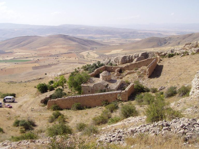
Foundations of additional Byzantine buildings survive east of the defensive wall. A chapel with a semicircular recess projecting from its east wall once partly overlaid the northern half of the palace.