Ruins of Loropéni: A Medieval Fortified Settlement in Burkina Faso
Site at a Glance
- Popularity
- Medium
- Country
- Burkina Faso
- Primary era
- Medieval
- Eras represented
- Medieval
- Civilizations
- Unclassified
- Site type
- Military
- Remains
- Fortified Town
On this page10 sections
History
The Ruins of Loropéni are a medieval fortified settlement at Niratoma in southern Burkina Faso, near the borders with Ghana and Côte d’Ivoire. Its construction date and builders remain disputed, while the settlement’s prosperity reached its height between the 14th and 17th centuries. Interpretations connect its occupation with the Lohron and Kulango peoples, as well as with the Kaan, also known as the Gan.
Origins and proposed functions
One proposed sequence places a Kulango settlement at the site before the construction of a square enclosure attributed to Kaan builders. That attribution is contested. A revised chronology suggests instead that Kaan people occupied and later left fortifications made by others. Possible Lohron involvement is also conjectural, leaving the builders’ identity unsettled.
The settlement’s original purpose is likewise uncertain. Proposals include a ruler’s residence, a place where enslaved people were held, or a fortified community connected with the regional gold trade. The suggestion that gold was stored behind the walls rests on circumstantial evidence. Loropéni has also been linked to trade routes serving places such as Mopti, Djenné, and Timbuktu.
Traditions of Kaan occupation
Local tradition relates that Kaan people fled raids by the Ashanti, a powerful kingdom in what is now Ghana, and moved northwest around the mid-17th century. They are said to have established a capital at Obiré and displaced the Kulango. Another tradition connects the ruins with Tokpa Farma, remembered as the ninth Kaan ruler, who intended to transfer the capital from Obiré, about eight kilometres away. In this account, the outer walls came first, followed by internal divisions and other buildings. The plan was abandoned after Tokpa Farma died prematurely. The Kaan name Kpõkayãga, meaning “abandoned fortress,” is associated with this unrealized move.
Gold commerce and abandonment
Loropéni’s gold-related prosperity coincided with wider changes in West African commerce. In 1324, Mansa Musa, ruler of the Mali Empire, a major West African state, made a pilgrimage to Mecca and distributed gold. That distribution prompted a ten-year fall in gold prices in Cairo, Mecca, and Medina. Trans-Saharan trade, commerce crossing the Sahara between West Africa and markets to the north, later weakened as the Mali and Songhai empires declined. Trade increasingly shifted toward the coast, where gold was more readily available from Ashanti territories. Loropéni was abandoned in the early 19th century.
Archaeology and heritage
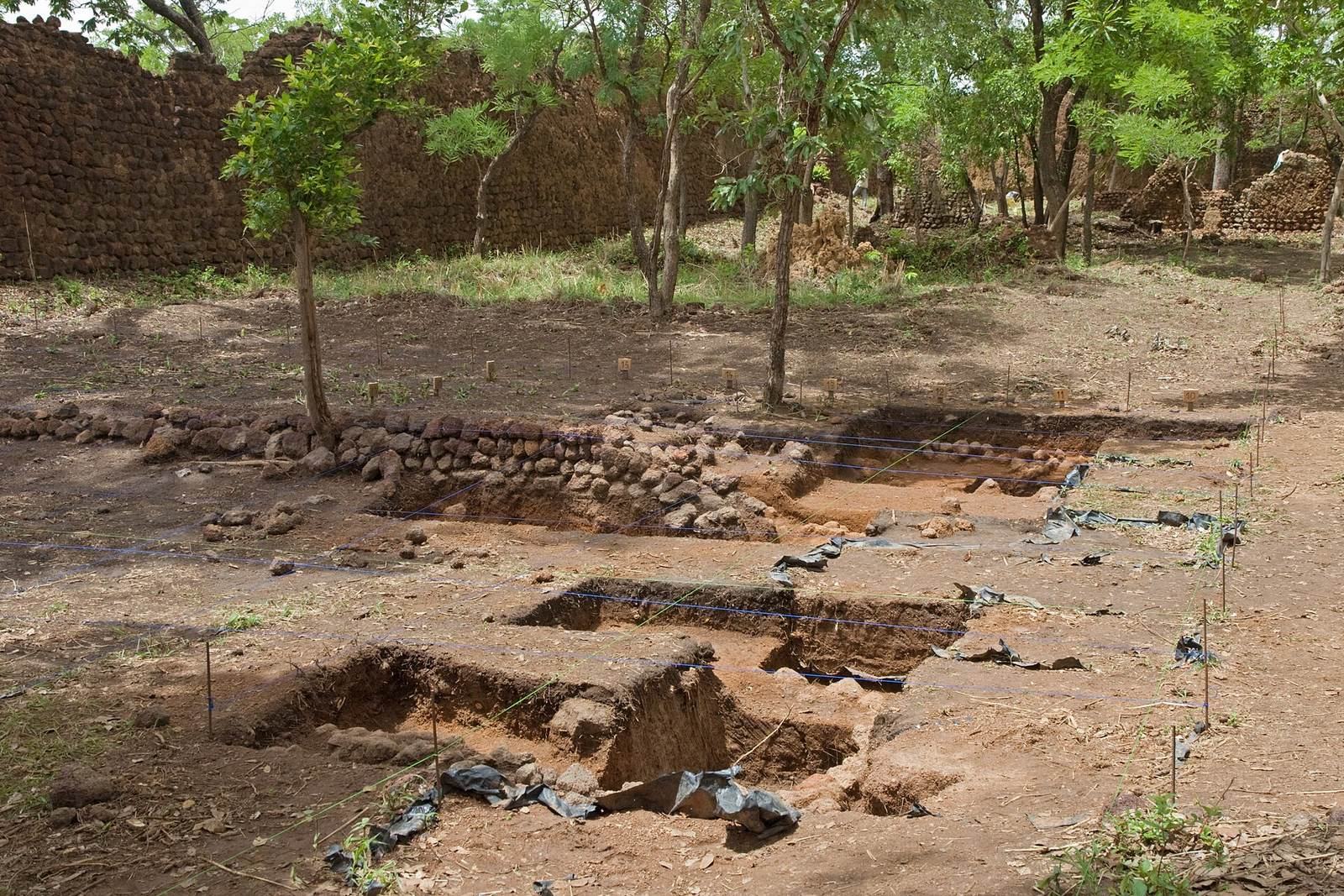
Excavations continue in the search for evidence that could clarify who built the fortifications. A management committee was established to support care of the ruins and their contribution to sustainable local development. In 2009, UNESCO, the United Nations Educational, Scientific and Cultural Organization, added Loropéni to its World Heritage List. It became Burkina Faso’s first site on the list, under criterion (iii), which recognizes a place as testimony to a cultural tradition or civilization.
Remains
The site is arranged around a square stone enclosure, with internal walls dividing the settlement into several areas. The surviving buildings and walls form a fortified complex, whose remains extend into a surrounding landscape of forest and agricultural land. Loropéni is described as West Africa’s best-preserved example of a fortified settlement and the best preserved among ten fortifications in the area.
Enclosure and surrounding area
Perimeter walls
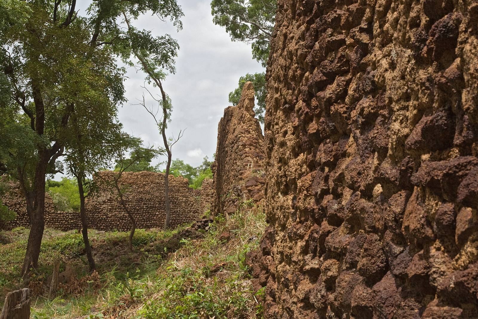
About 80 percent of the original enclosure walls survive, reaching up to six metres high. They measure roughly 1.4 metres thick at the base and 30 centimetres near the top. Rounded and oval stones are held together with sandy mortar, mud, and other materials. Stones mixed with gravel form the lower portions of the inner and outer faces, while gravel makes up the upper sections. Some areas include clay mixed with mortar, and ceramic fragments occur within the mortar in places. Small traces of a surface coating may indicate an earlier plaster finish.
The walls appear to have followed straight lines, though their present irregularities are thought likely to reflect tree growth and later land use. At the junctions, the walls curve into rounded or semicircular forms.
Interior divisions and buildings
Two parallel lines of internal walls connect with the enclosure and divide its interior into several zones. Fragments of these partitions survive. Within the zones are remains of about 20 buildings with rounded corners. Some structures rise to three metres, while others are preserved at foundation level.
Groups of enclosed spaces are also present within the walls. Each is bounded by three walls that form part of buildings.
Surrounding remains and landscape
The protected area covers 11,130 square metres, and the surrounding buffer zone extends across about 278 hectares of forest and farmland. Groups of circular and square building remains occur in this wider area, alongside grindstones and traces of ironworking and stone shaping. Dense trees and shrubs now cover parts of the landscape. The ruins are also affected by increasingly variable rainfall and cycles of extreme temperature.