Peel Castle: A Norse Royal Residence and Fortress on the Isle of Man
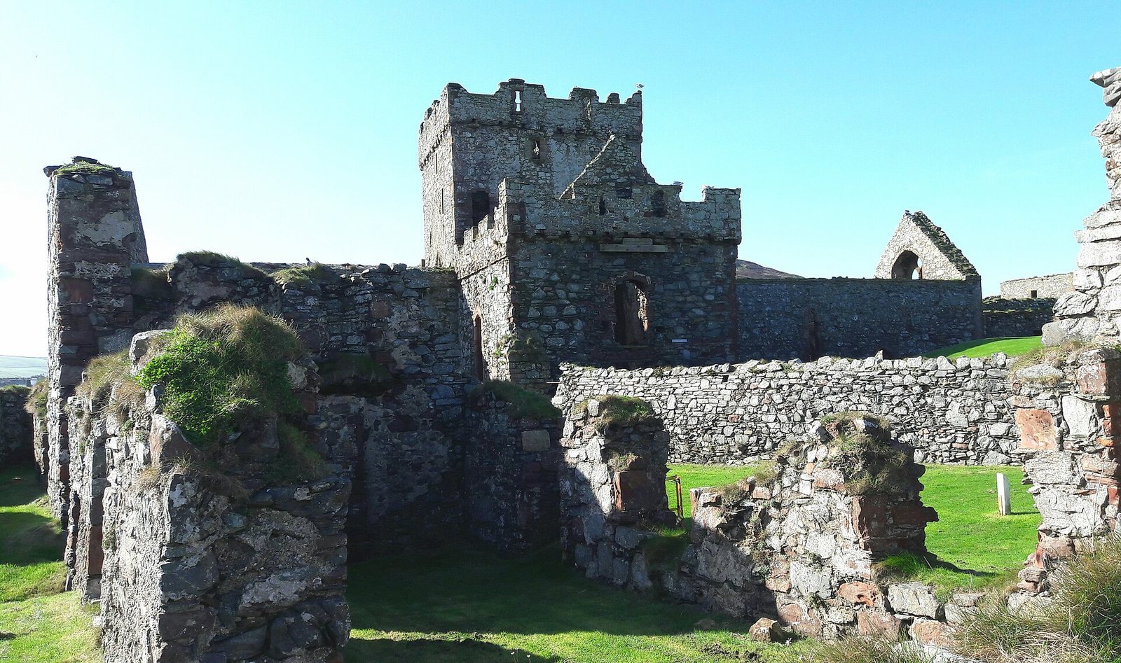
Site at a Glance
- Country
- Isle of Man
- Primary era
- Medieval
- Eras represented
- Medieval, Early Modern, Modern
- Civilizations
- British, English, Norse, Norwegian
- Site type
- Military
- Remains
- Castle
On this page17 sections
History
Peel Castle stands on St Patrick’s Isle, just outside Peel harbour on the Isle of Man. Norse forces built its first fortifications around 1100, probably under Magnus Barefoot, king of Norway. The island later served as a royal residence and centre of government, while a cathedral and successive defences shaped its history.
Early settlement and Norse rule
People lived on St Patrick’s Isle from the Stone Age, and an early Christian community with a monastery was established there in the fifth century. The first Norse fortifications came much later, probably after Magnus Barefoot and his men campaigned with the Welsh against the Normans on Anglesey. The stronghold offered them a secure residence. The name Peel may derive from a word meaning “stakes,” perhaps reflecting its early timber defences.
The kings of Man used the island as their home and seat of government until the middle of the thirteenth century. Godred II Olavsson died there in 1187, and Olav II Godredsson in 1237. The timber buildings proved vulnerable to attack, prompting their gradual replacement with stone. Events in 1224 and 1228 exposed the insecurity of Man’s southern coast and the danger posed by attackers using the harbour at what is now Castletown.
The cathedral and changing control
The Diocese of Sodor and Man, a Christian district governed by a bishop, was founded in 1154 under the authority of the Archdiocese of Nidaros in Norway. Its cathedral was built within the castle. Construction may have begun in connection with Bishop Reginald I’s appointment around 1154. A later phase may have started under Bishop Reginald II, who held office from 1217 to 1226, and finished under Bishop Simon, bishop from 1226 to 1248. The Chronicle of the Kings of Mann and the Isles credits Simon with building the cathedral.
Around 1257, Magnus Olavsson probably gave St Patrick’s Isle to the Church and moved the royal residence and centre of power to the south of the island. He died at Castle Rushen in 1265. The Church continued to use St Patrick’s Isle, but later royal control restricted its access to the cathedral.
During the Anglo-Scottish conflict over Man, control of the island shifted between 1290 and 1333, increasing the castle’s military importance. After 1333, the kings of Man strengthened its defences and resisted leaving the island under Church control. In 1363, the bishop appealed directly to the pope for permission to resume services in the cathedral.
Medieval rebuilding and artillery
In 1392, William le Scrope, 1st Earl of Wiltshire, who governed Man for Richard II of England, received permission to build a castle at Patrickholm, near and belonging to the Church of Sodor. He also arranged repairs to the cathedral. The pope granted indulgences, which offered remission from temporal punishment for sin under specified conditions, to people who worked on the repairs.
After James II of Scotland attacked Man in 1456, the castle’s outer wall was strengthened or replaced. During the sixteenth century, parts of the defences were adapted for guns, in response in part to the wars waged by Henry VIII of England against Scotland.
Elizabethan defences and military decline
In the 1590s, Spain planned to use Man as a base for galleys and smaller warships. An arsenal, a building for storing weapons and ammunition, was probably erected south of the church after 1593. When Ferdinando Stanley, 5th Earl of Derby and Lord of Mann, died in 1594, Elizabeth I took direct control of the island and ordered its defences strengthened. By 1595, £460 had been spent on weapons and ammunition.
A private warship attacked Peel harbour in 1692 but withdrew after the castle’s guns fired on it. The castle had 18 guns in 1694 and 15 in 1713, including three heavy guns. After the French fleet’s defeat in 1692, the danger from pirates and privateers, privately owned vessels authorized to attack enemy shipping, declined. From 1714, the island’s defences were generally allowed to decay. The castle still had a limited military role during the American Revolution, when American privateers were a concern.
A causeway linked the island to Man in the 1750s. In 1765, an act of the British Parliament authorized the purchase of Man’s feudal rights, the powers and revenues attached to a lordship, from the Duke of Atholl. The duke dismissed the castle’s soldiers and took its best guns to his Scottish seat; the British government did not replace them.
Ruins and later use
The cathedral had declined since the seventeenth century and was described as ruinous in 1662. Repairs were attempted around the consecration of a new bishop in 1755. By 1775, the castle’s buildings were roofless apart from part of the cathedral’s eastern arm. A storm removed the remaining cathedral roof in 1824, after which the ruin was considered beyond restoration.
New fortifications were built in 1860, but the artillery battery was decommissioned in 1870, ending around eight centuries of military use on St Patrick’s Isle. A limited military presence returned during both world wars. In 1877, architect and surveyor Robert Anderson recommended repairs to the cathedral ruins, but his proposals were not carried out. In 1980, the parish of German was formally transferred to the newer Cathedral Church of St German in Peel under an Act of Tynwald, the Isle of Man’s parliament.
Peel Castle has been proposed as a possible location for Avalon, the legendary island associated with King Arthur. Manx folklore also links the castle with Moddey Dhoo, a ghostly black dog. The story appears in Walter Scott’s novel Peveril of the Peak.
Remains
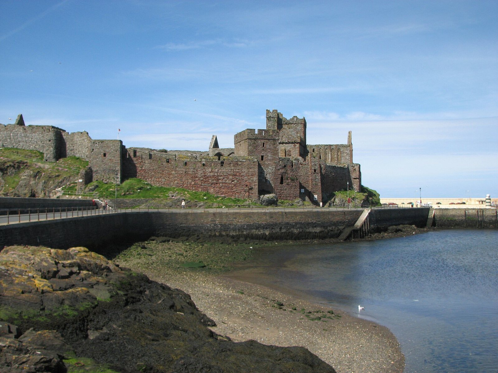
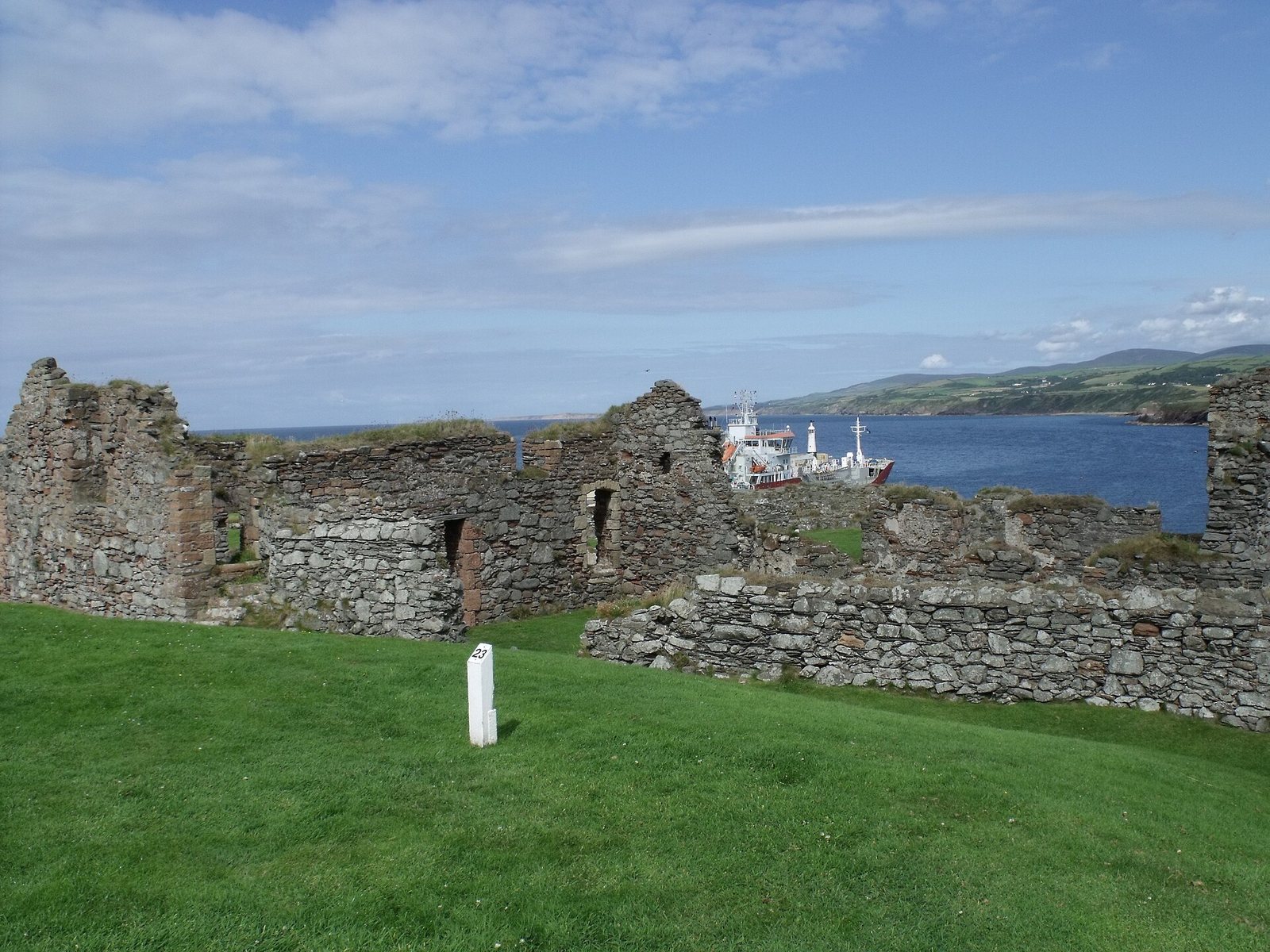
The roughly triangular St Patrick’s Isle lies where the River Neb reaches the sea, just outside Peel harbour. It measures about 326 metres across and 205 metres long, rising to 25.45 metres near its western end. Steep, uneven cliffs border the south and northwest sides; a road terrace built in the nineteenth century runs along the east. A paved causeway now joins the island to the mainland. The castle’s defences cover nearly the whole island. Most buildings inside the walls are ruins, while much of the outer wall still stands, built chiefly of local red sandstone.
Early settlement and Norse fort
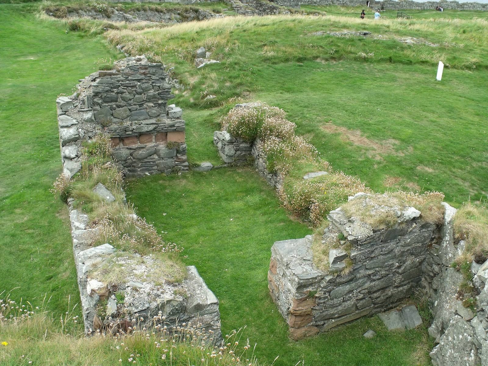
The early monastery is thought to have occupied the island’s southern part, between a chapel near the centre and the later fortification. Small buildings included monks’ cells and a dining hall, and may also have included a guesthouse, school, and scriptorium, a room for writing and copying texts. They were made from wattle and mortar and had thatched roofs. The church was first built of heavy timber before being replaced in stone. Excavated postholes indicate the scale and layout of the Norse timber fortifications, with the island’s natural perimeter likely contributing to their defence.
Churches and cathedral
St Patrick’s Church
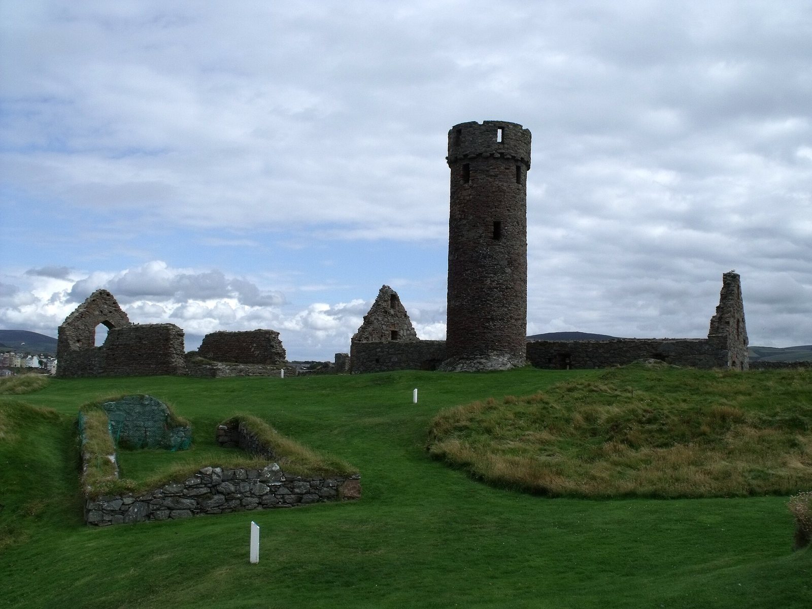
St Patrick’s Church, an Irish-style building, was constructed between about 950 and 1050. Its interior measures 8.4 by 5.5 metres, and its walls are made from roughly dressed local red sandstone. After an apparent disaster, it was rebuilt on its original foundations in the twelfth century with features of Norman construction. It was probably rebuilt again in the fifteenth century, when a new eastern wall included a large window and a doorway was added at the western end of the north wall. A seventeenth-century illustration shows the church with a roof and a bell turret on its western gable. By 1774 it was roofless and in disrepair.
Round tower
A round tower stands outside the church’s western wall. Probably part of the monastery, it dates to between about 950 and 1050 and is built of red sandstone. The tower rises 10.7 metres and has four rectangular openings near its top; battlements were added later. It served as a bell tower and a refuge in dangerous times. A seventeenth-century illustration suggests that it once had a conical wooden roof, which has since disappeared.
Cathedral and underground chamber
The cathedral ruins occupy the northern part of the island within the castle walls. The building had a cross-shaped plan, with a short main western section and an eastern arm of the same width. Stone and rubble mixed with red sandstone formed its walls. In a later phase, the eastern arm was replaced. Its upper part held a large free-standing stone altar, with Bishop Simon’s tomb just to its north. An underground chamber about three metres below floor level contained relics associated with St German, a local, possibly legendary Christian saint.
A pointed, tunnel-shaped stone ceiling covers the underground chamber beneath the cathedral’s altar area. The chamber measures about 10 by 5 metres and reaches about 3 metres in height at its western end, sloping down toward its eastern entrance. During repairs in the late fourteenth century, the southern side aisles were rebuilt with a window at each end, and the central tower was raised. Bishop Rutter’s tomb, dating to his burial in 1661, lies in the crosswise part of the cathedral. A cemetery now occupies the former main western section, and the cathedral roof is entirely gone.
Cemetery and finds
Excavations on St Patrick’s Isle in 1982–1987 uncovered an extensive cemetery. One grave, dating to the tenth century, belonged to a Norse woman known as the Pagan Lady. It contained an amber Norse necklace, now displayed at the Manx Museum in Douglas. A cache of silver coins dating to about 1030 was also found.
Castle defences and buildings
Gatehouse
The gatehouse stands at the entrance to the defences, at the island’s most vulnerable point. It is probably the castle permitted in 1392 and is built of small, finely cut red sandstone blocks. At low tide, people could reach it by wading across what was then the River Neb. Its second storey had a wooden floor and served as the commandant’s headquarters in the seventeenth century; battlements protected soldiers on the roof. Most of the building survives and still forms the entrance to the defences and cathedral ruins.
Outer walls and artillery
Most of the outer walls and towers were built primarily of local red sandstone, particularly in the early fourteenth century. After the attack of 1456, the outer wall was strengthened or replaced with massive slate slabs. Sixteenth-century gun positions ran from the tower at the island’s western corner along the northern wall to the northeastern tower. The main battery had eight or nine guns loaded through the muzzle; the gatehouse held a mortar and two smaller guns. In the nineteenth century, two artillery positions stood on a circular base on the northern side, opposite the present lifeboat house.
Residential and service buildings
The castle’s remains include the Lord’s Apartments, built in the late fifteenth century. Of three long buildings identified in the island’s southern part, two date to the sixteenth century and served as a dining hall and an arsenal. The arsenal stood south of the church and was probably built after 1593.