Bhismaknagar Ruins: A Fortified Chutia City in India
Site at a Glance
- Country
- India
- Primary era
- Medieval
- Eras represented
- Medieval
- Civilizations
- Unclassified
- Site type
- City
On this page12 sections
History
The Bhismaknagar ruins are the remains of a fortified Chutia city in India, traditionally said to have been built in the eighth century and later rebuilt under Chutia ruler Ratnadhwajpal, also known as Gaurinarayan. The surviving ruins are generally dated from the eleventh to fifteenth centuries, during the period when the Chutias ruled the Sadiya region from the eleventh to sixteenth centuries.
Chutia rule and the capital region
The Chutias, a Tibeto-Burman people, made the site a stronghold within Sadhayapura, also called Svadhayapuri, the political center and capital region of their kingdom. Copper inscriptions connect the region with the name Sadhayapura and its rulers with the title Sadhayapur-ishwar, meaning “lord of Sadhayapura.”
An inscribed brick bearing the name of Chutia king Lakshminarayana links the site to the early fifteenth century. Comparison of its letter forms with dated writing supports the interpretation that the area served as his capital, although another interpretation proposes that Lakshminarayana may instead have repaired the site.
Doi-Tang and Chutia-Ahom conflict
The ruins are identified with Doi-Tang, also rendered as Tangiri, a fortified hill city described in the Buranjis, historical chronicles of the Ahom and Assam region. The chronicles name three fortified cities in the capital region: Doi-Tang, Bar Nagar, also called Che-lung, and Chandanagiri, also called Doi-Chandan. They associate Doi-Tang with the Kundil River and Chandanagiri with the Dibang River. The fortifications may have belonged to a chain of forts built at the foot of the hills by Gaurinarayan after he consolidated his kingdom, alongside large ponds and temples.
Doi-Tang served as a base for Chutia minister Kasitora, also known as Kai-tora. In 1524, Ahom commander Chao-Seng-Kung-Rin, also rendered Kang-Sheng, attacked him, beheaded him, and delivered his head to Ahom king Suhungmung at Bar Nagar. The Ahoms were a ruling power in Assam. Chutias at Doi-Tang rebelled in 1529, but the uprising was suppressed. The settlement was abandoned during the sixteenth century.
Changing identification and archaeological work
The name Bhismaknagar became attached to the present ruins through a complicated history of identification. In notices from 1845 and 1848, T. Raulet and S. F. Hayne called this site Shishupal Nagar, while applying Bhismaknagar, or Bishnuk Nugger, to a different archaeological site near the Dibang-Dikrong hills. Later confusion between the sites appears to have transferred the Bhismaknagar name to the present ruins. Publications recorded that name in 1883 and 1928.
Proposed explanations for the name include the popularity in Sadiya of Sankardev’s sixteenth-century poem Rukmiṇiharaṇa, about Rukmini and Krishna. In its story, Rukmini is the daughter of King Bhismaka. Another proposal derives the name from a Sanskritized form of Bhirmukka, a legendary Chutia king. In 1883, Captain John Mitchell noted that the Mishmi people of the eastern Himalayas called hills north of the site Tengri-thaya. In the Mishmi language, thaya means “hill,” a connection that has been used to suggest the hill was once called Tangiri.
Raulet and Hayne recorded early descriptions of the ruins, and L. W. Shakespeare noted further remains during an Assam Rifles expedition in 1919 and 1920. Archaeological researchers uncovered the site in the 1970s. Excavation has remained limited, with preliminary work by the Arunachal Pradesh government adding to knowledge of its physical layout.
Remains
The fortified city covered about 2,500 acres, and its area is also described as roughly 10 square kilometres. It measured approximately 4.5 kilometres long and 2.5 kilometres wide. Fired brick was the principal building material, used alongside stone and earth. The Mishmi Hills formed a natural barrier along the northern side, while defenses enclosed the eastern, western, and southern sides.
Defensive boundaries
Hill defenses and earthworks
Early descriptions distinguish two defensive circuits on high ground below the foothills. One included a wall made from hard red earth brought from elsewhere, with a platform about 20 yards wide at its base. The steep hillside beyond was described as rising 10 to 30 feet. Shakespeare also noted a raised earthen rampart with a ditch in front; scattered bricks suggest that brick defenses had stood on the rampart.
Walls and gateways
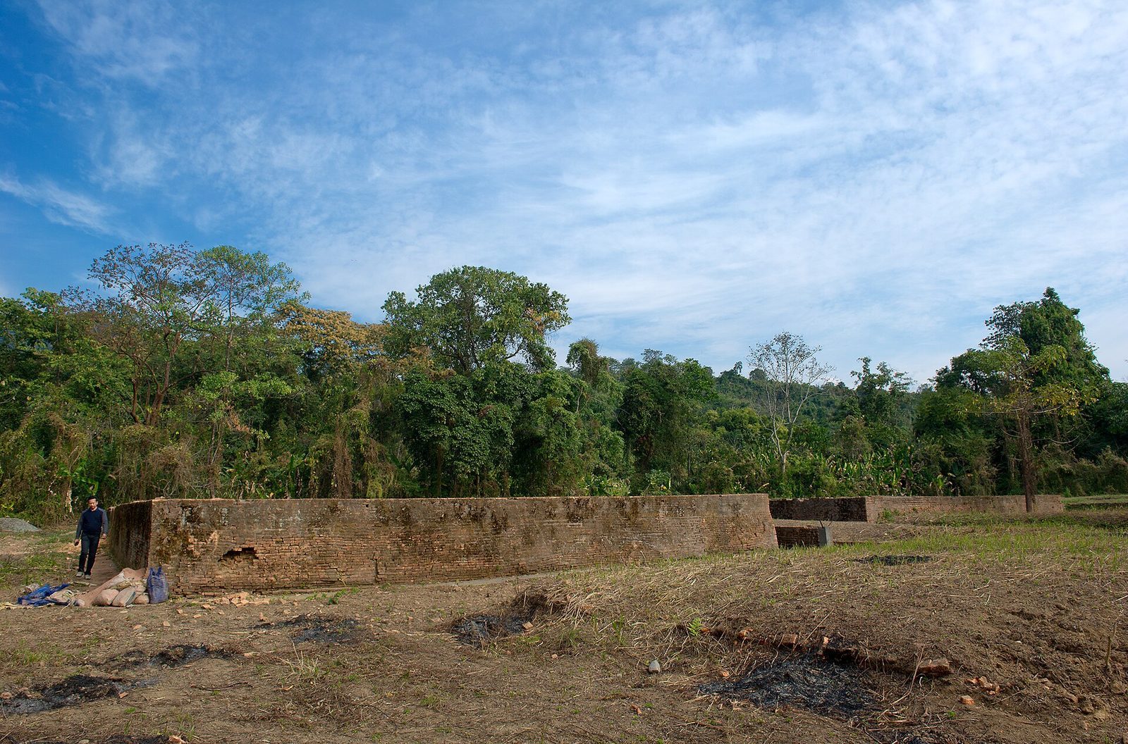
Walls on the eastern, western, and southern sides were about 4.5 metres high and 6 metres wide, built from granite and brick in six to nine layers. Brick formed the main entrance and adjoining defensive sections. Eastern and western gateways survive, and preliminary excavation identified two gates. The enclosure also contains brick platforms, including one identified as a temple platform.
Interior structures and finds
Tanks and building remains
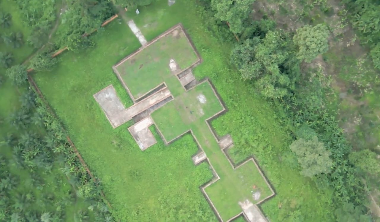
Preliminary excavation identified three tanks. Shakespeare described traces of tanks within the enclosure, then filled with mud and covered by dense forest. Other interior remains include numerous brick structures, stone platforms, and the foundations of a large building. Some foundation walls stood 3 to 5 feet high. The bricks were large, thick, and nearly square. Raulet proposed that residential houses may have been built of stone.
Central complex
A central complex covered about 1,860 square metres and comprised three halls, six entrances, and two additional rooms. A stone wall about 2 metres high was also recorded within the complex, as was a separate structure inside the defensive walls.
Archaeological finds
Finds from the ruins include pottery, a perforated clay pot, terracotta figurines and plaques, decorative tiles, and bricks.