San Fernando Fortress of Omoa: A Spanish Coastal Defense in Honduras
Site at a Glance
- Country
- Honduras
- Primary era
- Early Modern
- Eras represented
- Early Modern, Modern
- Civilizations
- Spanish
- Site type
- Military
- Remains
- Fort
On this page11 sections
History
Omoa before the fortress
San Fernando Fortress of Omoa is an eighteenth-century Spanish coastal fortification in Omoa, Honduras, built to defend the Caribbean coast and silver shipments from raiders. Omoa was an Indigenous settlement by 1536, when Spanish conquistador Pedro de Alvarado assigned it to the colonial landholder Luis del Puerto. By the late sixteenth century, the settlement had been depopulated. Its Indigenous inhabitants were dispersed and compelled to provide labor under the repartimiento, a colonial system of forced labor or tribute. Spanish authorities had also established a small fort near the bay as part of their regional defenses.
In 1609, Omoa came under the Captaincy General of Guatemala, the Spanish colonial government responsible for military and administrative affairs in Central America. After British attacks on Portobelo and San Lorenzo in 1739, Spain strengthened its defenses in the Americas. Omoa was re-established as a port town in 1752. The town and planned fortress were meant to secure the coast and silver shipments against pirates and other sea raiders operating near the Tinto and Walis rivers. Omoa replaced the Port of Golfo Dulce as a defensible Spanish stronghold and became an important port for exporting silver.
Construction and Spanish defense
King Ferdinand VI of Spain authorized the fortress in 1759. Spanish military engineer Luis Díez Navarro was assigned to the project, with fellow engineer Antonio de Murga also involved. Indigenous people and enslaved Africans carried out the construction, which was completed in 1775.
The Omoa defenses faced pirate attacks on three occasions. French buccaneer François l’Olonnais, a Caribbean privateer or pirate, led one raid and seized valuables. Another attack failed.
British forces captured the fortress in November 1779. Spanish forces under Matías de Gálvez, the region’s senior military and administrative governor, retook it on January 5, 1781. Gálvez’s campaign also drove British forces from the San Juan River and Lake Cocibolca. He returned to Guatemala in 1782.
Political change and military use
After Honduras became independent from Spain in 1821, the fortress was captured by the First Mexican Empire, the monarchy established after Mexico’s independence. In 1823, it passed to the Federal Republic of Central America, a federation formed after the empire’s collapse. When Honduras left the federation in 1838, the fortress came under the Honduran government and was used as a prison.
In November 1832, colonels Ramón Guzmán and Vicente Domínguez invaded Omoa with 200 Black men and 300 Guatemalans. Their forces took the fortress and used it as an operations center, while also capturing Trujillo and Comayagua. Honduran forces led by General Francisco Ferrera retook the captured places, and Ferrera ordered the rebels executed.
From 1840, the fortress served as the base of operations for Juan José Morales, commander general of the Honduran armed forces. Morales, a native of Omoa, was a trusted associate of President Francisco Ferrera. During the Guatemala-Honduras war in August 1853, Guatemalan troops under Colonel José Víctor Zavala seized the fortress. President José Trinidad Cabañas ordered Honduran troops to recover it.
Prison closure and preservation
On October 3, 1870, President José María Medina ordered the prison closed on humanitarian grounds because its rooms were insanitary. Honduran and foreign prisoners had died there during wartime. In 1873, the imprisonment of several British subjects caused a diplomatic dispute. The British frigate Niobe bombarded the fortress on August 19 and 20.
After the prison closed, the building remained empty for a long period. On May 11, 1959, it was declared a National Historic Center and is also recognized as a national monument. It appears on UNESCO’s World Heritage Tentative List, which contains sites a country is considering for possible nomination to the World Heritage List. The fortress now houses a public museum managed by the Honduran Institute of Anthropology and History.
Remains
Fortress layout and features
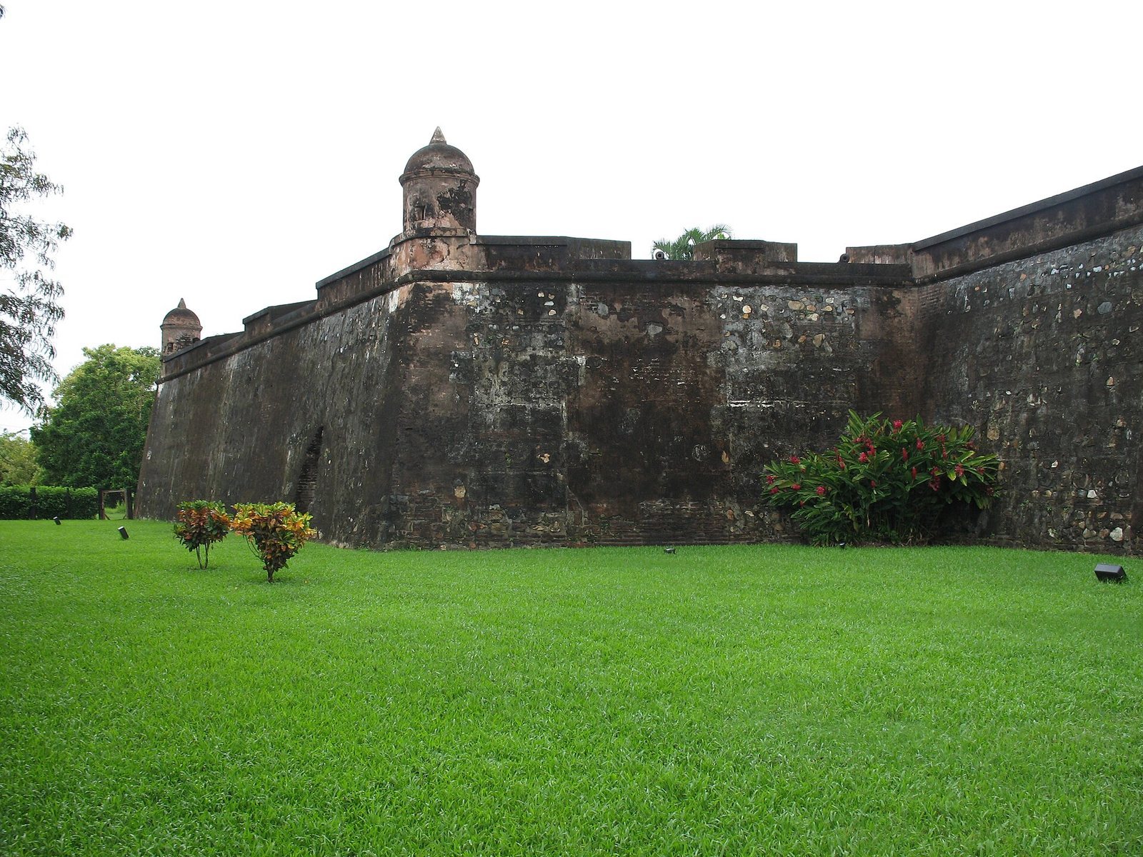
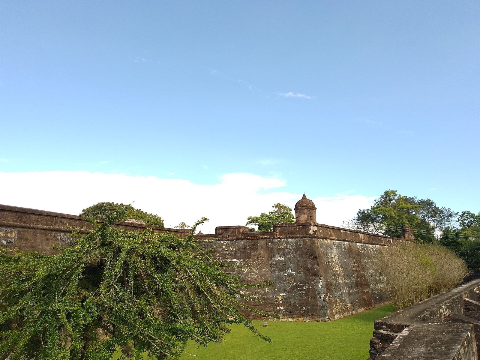
The fortress covers about 4,400 square metres. It is the largest fortress in Central America and the second largest in the Americas. Its walls follow a semicircular, bow-and-arrow-like plan and were built from brick, river stone, and coral. A plan drawn by Díez Navarro in 1768 depicts the fortress foundations and the port.
Walls and shoreline
The walls have rounded faces intended to reduce the force of sea waves. When the fortress was built, it stood only a few metres from the sea. The shoreline has since gained more beach, leaving a wider stretch of ground between the building and the water.
Rooms and stores
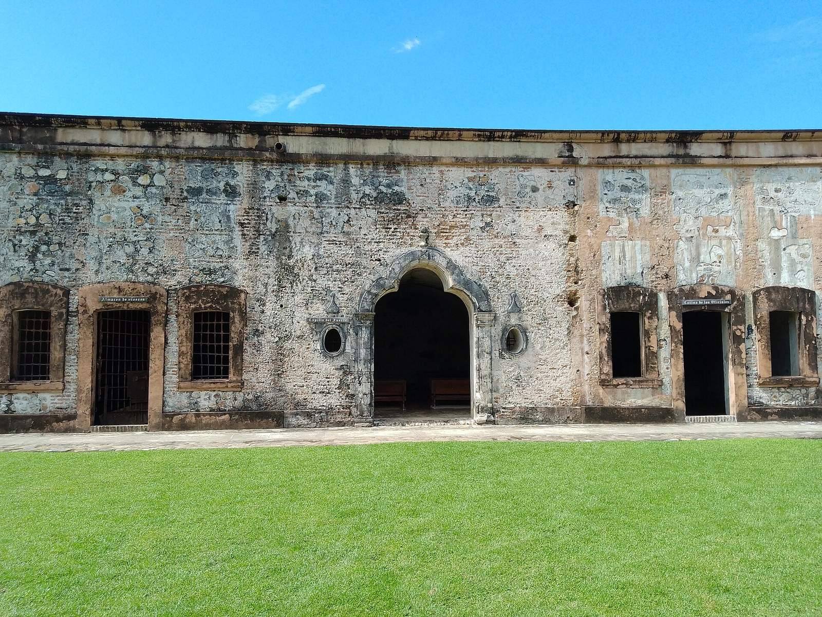
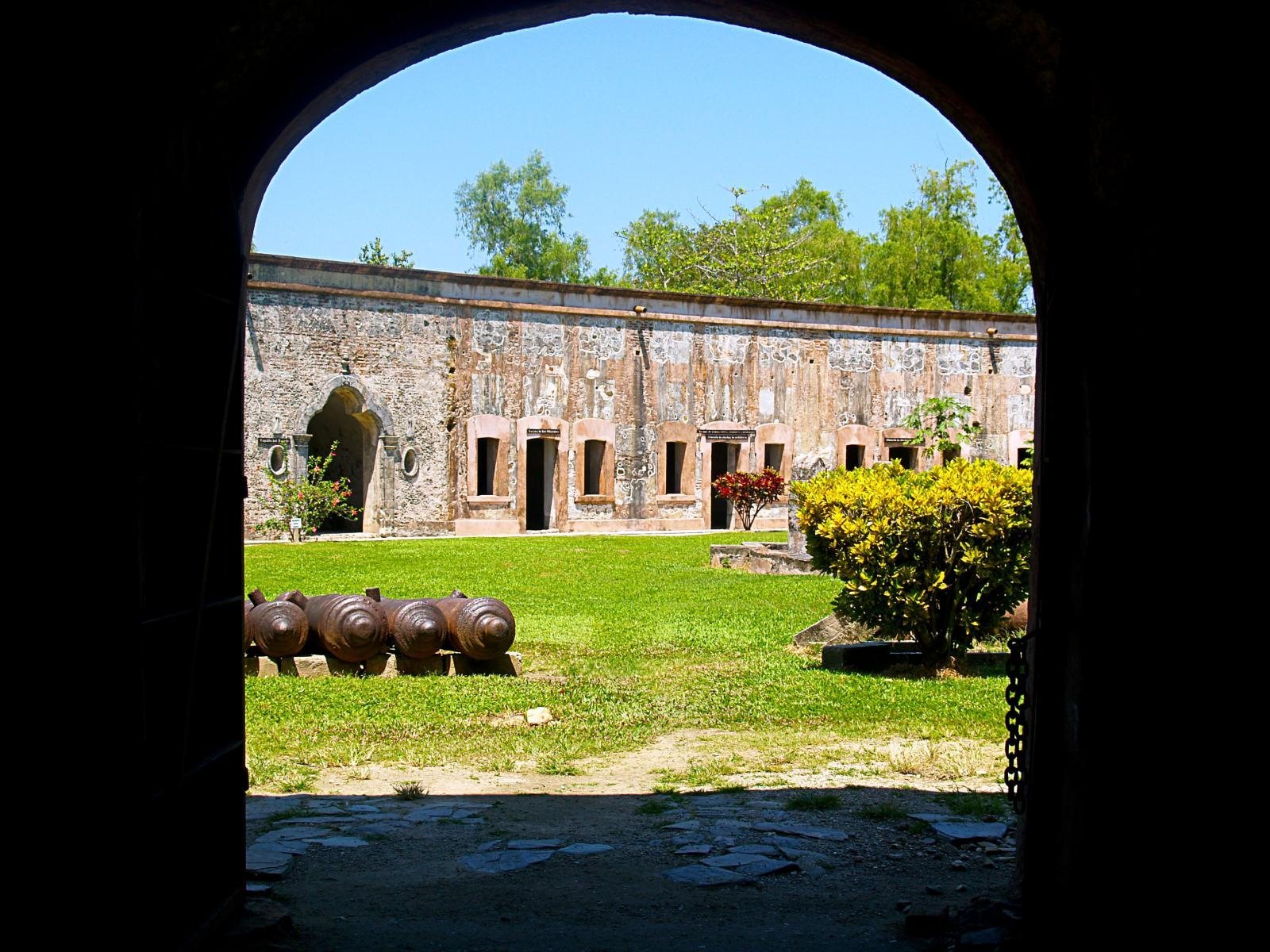
The complex contains 31 large rooms with arched ceilings. Their uses included a chapel, kitchens, administrative offices, a secure gunpowder store, a provisions store, and an armory. Some of the rooms have very thick bars.
Terrace and defenses
Cannons were placed on the terrace. The upper-level guardhouses have ornate Baroque designs, an early modern architectural style, and the fortress also includes watchtowers. One armory retains its original arrangement and contains a large stock of cannonballs.
Grounds and museum
A cemetery lies outside the fortress. The surrounding area once included dwellings that were dismantled for their building materials. Museum facilities stand beside the fortress, with exhibits that include historical material about the site, a model, armor, and period weapons.