Fort McClary: A Coastal Defense Fort in Maine
Site at a Glance
- Country
- United States
- Primary era
- Modern
- Eras represented
- Modern
- Civilizations
- Unclassified
- Site type
- Military
- Remains
- Fort
On this page12 sections
History
Fort McClary is a coastal fortification at Kittery Point, Maine, at the mouth of the Piscataqua River in the United States. The present federal fort was established in 1808 as part of the Second System, one of the successive U.S. programs for building coastal defenses. It helped protect Portsmouth harbor and the Portsmouth Naval Shipyard as part of a seven-fort network that also included Fort Constitution, Fort Sullivan, and Fort Foster in Maine, and Fort Washington, Fort Stark, and Fort Dearborn in New Hampshire.
Colonial defenses and the Revolution
Coastal defenses here began in 1689, when shipbuilder and merchant William Pepperrell acquired the property and built an earthwork, an earthen defensive position, beside his home. First called Battery Pasture, it later became known as Fort Pepperrell or Pepperrell’s Garrison. Before its construction, the village relied on Fort William and Mary at New Castle for defense.
In 1715, the Province of Massachusetts Bay approved a permanent six-gun fortification at the river mouth, and construction followed in 1720. The fort also served as a customs post, collecting duties from Massachusetts residents to fund its upkeep. It may also have been intended to resist taxes that New Hampshire’s governor sought to impose on people from other colonies.
During the American Revolution, Patriot forces confiscated the Pepperrell property because the family remained loyal to Britain. In 1776, the fort received ammunition for its nine- and twelve-pounder guns. New Hampshire militia manned the defenses until the fort was abandoned in 1779.
Federal fort and border tensions
The colonial fortification passed to the United States in 1803 and became known as Fort William. In 1808, Massachusetts transferred about 0.75 hectares for a new federal fort, officially named Fort McClary. It was named for Major Andrew McClary, a New Hampshire militia officer killed in 1775 at the Battle of Bunker Hill, an early major engagement of the American Revolution.
The fort was used during the War of 1812 but saw no action. In 1846, the federal government acquired about 10 hectares of adjoining land, and the fort was deactivated until the Civil War. Expansion during the 1840s probably reflected tensions with Great Britain over the Maine–New Brunswick border. The dispute, known as the Aroostook War, was bloodless; the 1842 Webster–Ashburton Treaty settled it and established parts of the boundary between the United States and British North America. A blockhouse was built on the hilltop in 1844, near the former upper battery, after earlier buildings there were cleared.
Civil War and unfinished expansion
During the Civil War, the Maine Coast Guard and Kittery Artillery Company manned the fort, followed by the Maine State Guard. Four Parrott guns arrived from the Portsmouth Navy Yard, and a militia company was soon replaced by regular troops. The fort saw little action. Hannibal Hamlin, who later served as U.S. vice president from 1861 to 1865, enlisted as a private in Company A of the Maine State Guard and worked as a cook at the fort for three months in 1864. Later references, including a fort plaque, have incorrectly associated him with the Maine Coast Guard.
A major rebuilding under the Third System, a U.S. program for coastal fortifications, began in 1863 but remained incomplete. Masonry forts were considered vulnerable to rifled cannon, artillery with grooves inside their barrels. Federal funding for masonry fortifications ended in 1867, and work at Fort McClary stopped by 1868.
Changing defenses and state stewardship
By 1901, Fort McClary had been superseded by Fort Foster and new batteries at Fort Constitution, built under the Endicott Program, a later U.S. effort to modernize coastal defenses with new harbor batteries. The fort had largely fallen into disrepair by the 1910s and was decommissioned in 1918. During the First World War, its blockhouse served as an observation post supporting harbor defenses at Fort Foster and Fort Constitution.
In 1924, Maine acquired most of the property from the federal government, apart from about 0.75 hectares containing the old fort buildings. The grounds were managed as a park, first by Kittery and then by the state from 1937; Maine received the remaining land in 1961. During the Second World War, civilian defense forces used parts of the fort, and the blockhouse served as a lookout from 1942 to 1945. Fort McClary entered the National Register of Historic Places in 1969. The blockhouse and other structures were renovated in 1987, and the blockhouse now houses a museum.
Remains
Site layout and lower battery
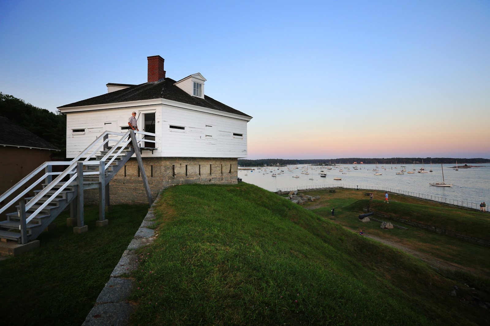
The fort stands at the mouth of the Piscataqua River, opposite Fort Constitution. Its layout centers on Central Hill, where a curving granite lower battery, a position for artillery, extends around the hill. The former upper battery stood near the present blockhouse. The lower battery held about nine guns and included a shot furnace, which heated solid cannon shot before firing.
Blockhouse and rifle houses
The blockhouse
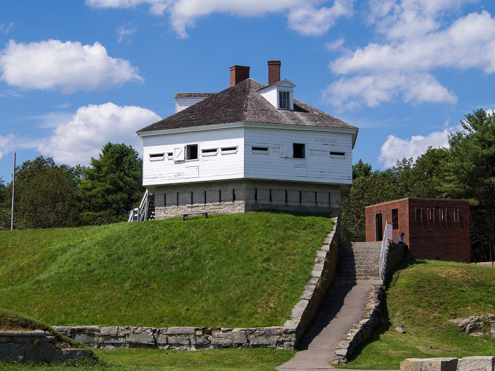
The hexagonal blockhouse has three levels built from different materials. Its ground floor is fieldstone and served as a powder magazine, a storage chamber for gunpowder. The first floor is granite, while the upper floor, made of logs, provided quarters for officers. It was the last blockhouse built at a fort in Maine and probably among the last built at a U.S. coastal fort.
Rifle houses
Two brick rifle houses flanked the blockhouse, providing defensive fire along its sides. One was demolished for safety in 1928.
Unfinished Third System works
The planned five-sided fort called for one or two tiers of guns around its perimeter, with two-tier granite casemates, enclosed positions for artillery. Its design also included a southern caponier, a protected structure for flanking fire, and a northern bastion, a projecting part of a fortification, intended to protect a spring. The completed works included one casemate level, seawalls on the two seaward sides, and a landward gun bastion with a granite magazine for ammunition and powder. A small caponier with openings for rifle fire defended the seawall. Large granite blocks intended for the unfinished sections remain scattered across the grounds.
Later gun positions
In the 1870s, the lower battery was reshaped as an earthwork with three temporary wooden platforms for 10-inch Parrott rifles, rifled artillery pieces. In the 1890s, nine 15-inch Rodman guns, large smoothbore cannon, and seven carriages were stored at the fort; three guns were mounted during the Spanish–American War in 1898. The other Rodman guns and carriages, together with two remaining Parrott guns, stayed in storage until 1905. The fort’s guns were scrapped in 1910.