El Fuerte de Samaipata: A Pre-Columbian Ceremonial and Administrative Center
Site at a Glance
- Country
- Bolivia
- Primary era
- Classical
- Eras represented
- Classical, Medieval, Early Modern
- Civilizations
- Inca, Spanish
- Site type
- Religious
- Remains
- Sanctuary
On this page15 sections
History
Chané occupation and ritual use
El Fuerte de Samaipata is a pre-Columbian archaeological site in the eastern foothills of the Bolivian Andes, in Santa Cruz Department. Chané, an Indigenous people of Arawak origin, occupied it as a ritual and residential center around AD 300, during the Mojocoyas archaeological period (AD 200–800). Work on the great carved rock is associated with this phase, although the beginnings of the site’s earliest built structures are uncertain. The surviving carved and built features also reflect Inca and Spanish activity.
Chané use of the rock has been interpreted as ceremonial and as a way to observe the sky and mark time and seasonal change. Water may have been used to reflect the sky, while observations of the moon were connected to beliefs centered on a lunar deity. The moon was also associated with women’s physiological cycles.
Inca expansion and eastern frontier
Contact between Chané and Inca communities is placed around 1410. Inca expansion into the region probably began late in the reign of Túpac Yupanqui, an emperor of the 15th century. A 17th-century narrative by Diego Felipe de Alcaya says that Guacane, a relative of the emperor, led an Inca force to Samaipata. He persuaded the local leader Grigotá and 50,000 people under his authority to accept Inca rule, then established his capital at the site, about 1,900 metres above sea level.
Inca Samaipata served ceremonial, religious, administrative, and residential purposes. It may have been a provincial capital and a post on the empire’s eastern frontier, a boundary it has also been interpreted as marking. Inca expeditions used the center while searching for resources, including minerals near Saipurú. Associated outlying defenses included La Fortaleza, about 50 kilometres to the east. Guanacopampa was also said to guard a mine at Saipurú or Caypurum.
Inca building took place in the late 15th and early 16th centuries. A plaza and residences were constructed, some over earlier Chané structures, and some plaza walls date to the end of the 15th or beginning of the 16th century. A large building was left incomplete, and Inca construction appears to have been interrupted. Excavations have also pointed to several occupations before the Inca phase, with some evidence suggesting communities of Amazonian origin. Samaipata has been interpreted as an Inca control point linked to local silver mines; the center and mines may have been attacked and looted shortly before the Spanish conquest.
Guaraní resistance and Spanish occupation
Guaraní groups, called Chiriguano in Spanish historical usage and also known as Ava Guaraní, resisted Inca expansion and occupied the region into the Spanish colonial period. Alcaya’s account says that Guacane and Grigotá were killed during the conflict and that Inca counterattacks failed to dislodge the Guaraní. It also recounts the enslavement of Chané people and of Inca noblewomen who had not escaped. The Incas negotiated for the women’s release in exchange for withdrawing from the eastern cordillera. The conflict’s date is uncertain, and Indigenous artifacts and ceramics at Samaipata reflect Guaraní-period occupation.
Spanish military use of the site may have begun in the 1570s. A Spanish settlement was established during the 1610s, while Guaraní attacks remained a threat. The Spanish moved to a nearby valley and founded the town of Samaipata in 1618; their presence at the archaeological site had ended by 1630. They built in an Arab-Andalusian style and cut into the rock while searching for precious minerals, but whether they found any is unknown. The name El Fuerte, meaning The Fort, reflects an early emphasis on the Inca military presence, although the site also served religious, ceremonial, and residential functions.
Exploration, research, and protection
The naturalist Tadeo Haenke visited in 1795 and made the earliest known sketch of the rock carvings. During his travels in Bolivia from 1830 to 1832, Alcide d’Orbigny made a plan of the structures and noted what he understood to be an Inca settlement south of the rock. He interpreted the carved rock as an installation for washing gold, an idea later rejected. In 1908, the Swedish explorer Erland Nordenskiöld described the rock and photographed its condition. Leo Pucher, a Bolivian-Austrian scholar, visited in the 1930s and 1940s, made a plan, and in 1945 proposed that the hill had been a pre-Inca temple associated with animist and totemic beliefs. Hermann Trimborn’s visits in 1955 and 1960 led to a detailed description and simplified plan, accompanied by a topographic survey by his assistant H. Müller-Beck.
Archaeologist Carlos Ponce Sanginés helped establish an archaeological research center at Samaipata in 1974. From 1992 to 1996, a research project directed by archaeologist Albert Meyers mapped the rock and architectural groups, investigated the site’s chronology and functions, and excavated areas beside the rock to the south and east. Bolivia had declared the archaeological area a national monument in 1951. In 1997, about 260 hectares around the site were donated to the state and designated by municipal ordinance as an eco-archaeological park. UNESCO added El Fuerte de Samaipata to its World Heritage List in 1998, recognizing exchanges expressed through architecture and monumental art, and its evidence for pre-Hispanic religious traditions. The municipal research center oversees investigation, conservation, restoration, and the study and presentation of archaeological materials.
Remains
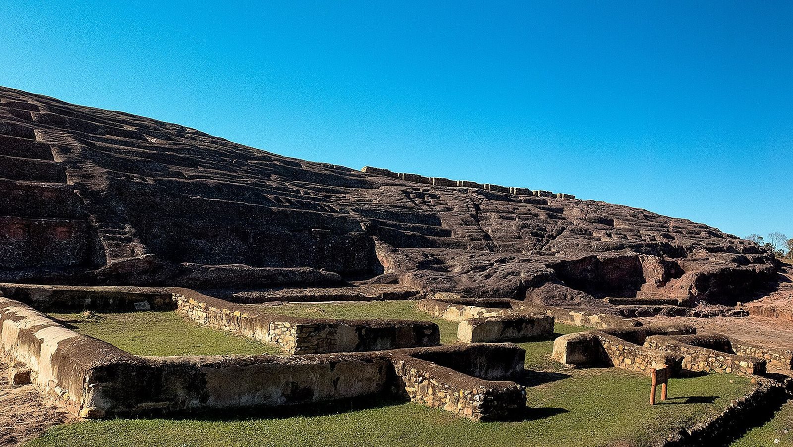
The archaeological area covers about 20 hectares and is divided into a northern ceremonial sector and a southern administrative and residential sector. The ceremonial area, about 220 by 60 metres, centers on a massive carved rock formation. The southern sector occupies three artificial platforms. Together, the rock carvings, Inca buildings, and colonial remains preserve evidence of the site’s successive uses.
The ceremonial rock
Carved surfaces and water channels
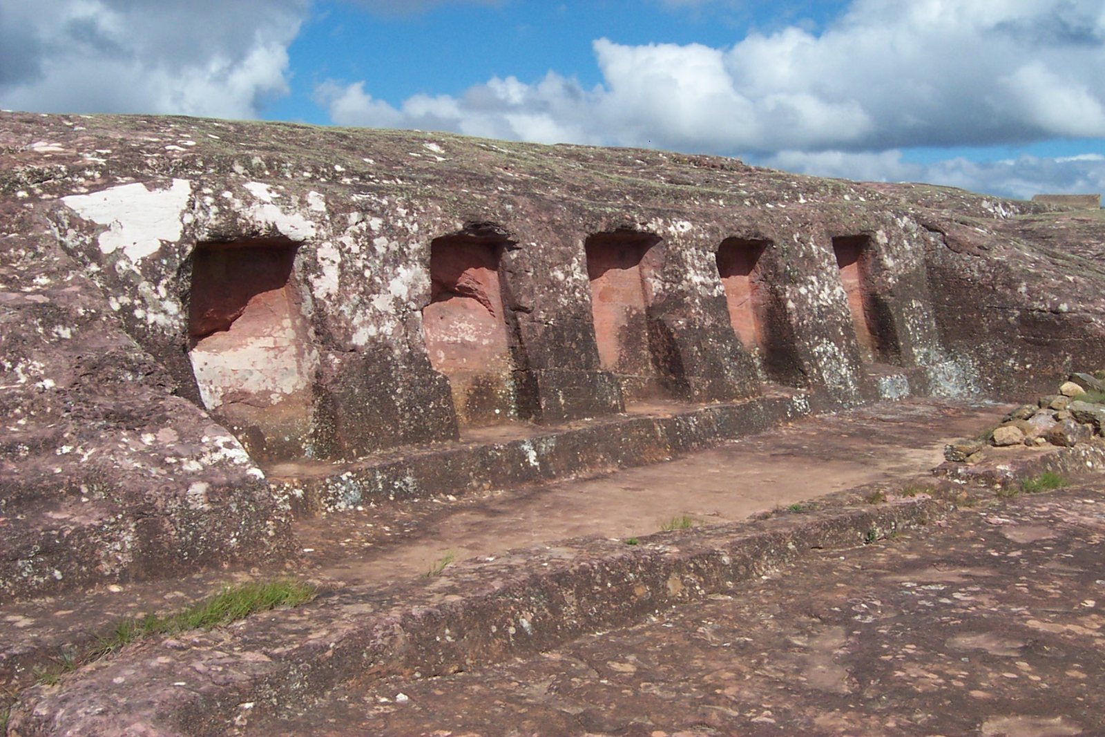
Carvings attributed to pre-Inca and Inca activity cover the rock, including animal and geometric figures, carved walls and niches, and long channels. A complex arrangement of channels, basins, and drains crosses its surfaces. These features may have supported rituals and the use of water to reflect the sky. An Inca-period stone wall runs across carvings on the rock, a relationship that supports a pre-Inca date for the carvings it crosses.
Niches and the Choir of the Priests
At the rock’s highest point, a deeply cut circular area called the Choir of the Priests has 18 niches in its walls, which may have served as seats. At the base are 21 rectangular niches, interpreted as possible priestly dwellings or places to store ceremonial objects. Further niches and alcoves are distributed around the ruins.
Animal figures and the southern face
Long paired channels and smaller zigzag cuts form a pattern known as the Serpent’s Spine or the Rattle. On the western part of the rock, two felines sit on a circular base. They are the site’s only identified carvings in raised relief. Several circular carvings measure about one metre across, and some are badly worn. Farther east, a feature has been interpreted as a feline’s head. At least five temples or sanctuaries once occupied the southern face, where wall niches remain among their surviving traces.
Administrative and residential sector
Plaza and gathering hall
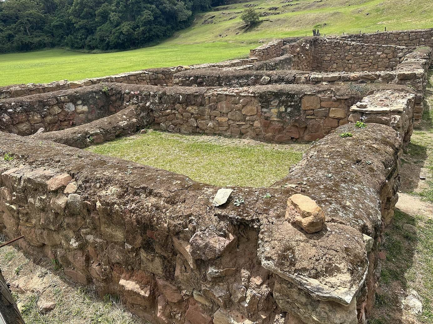
The sector’s most prominent feature is a trapezoidal plaza, about 100 metres on each side. A kallanka, a large rectangular Inca building for public gatherings and accommodation, borders the plaza on the south. Measuring about 70 by 16 metres, it was used for feasts and for lodging visitors and soldiers. It is the second-largest kallanka in Bolivia. Its drainage canal and thatched roof were left unfinished.
House of selected women
An acllahuasi, an institution for selected women known as aclla, also stands in the southern sector. These women were chosen to weave textiles, marry Inca nobles, take part in ceremonies, and sometimes be sacrificed in religious rites.
Colonial remains
The Colonial House stands on an artificial platform at the foot of the rock, in an area called the Plaza of the Three Cultures. Excavations there revealed Inca and pre-Inca structures alongside colonial remains. Built in an Arab-Andalusian style, the house has an open central courtyard; its lower stone walls survive.
Archaeological finds and preservation
The archaeological research center holds bowls, vessels, and plates decorated with human figures and attributed to pre-Hispanic cultures. Some are dated to around 200 BC. The site also has sculptures assembled from individual pieces of stone. The rock carvings remain visible, though some are worn. Water erosion and damage caused by walking on the carvings have prompted protective measures, including a cordon around the inner rock area.