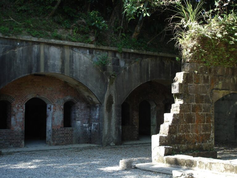
Hobe Fort: A Qing Coastal Defense Fort in Taiwan
Site at a Glance
- Country
- Taiwan
- Primary era
- Modern
- Eras represented
- Modern
- Civilizations
- Qing
- Site type
- Military
- Remains
- Fort
On this page15 sections
History
Hobe Fort is a coastal fort in Tamsui, Taiwan, begun in 1886 in a Western-style program to defend the Tamsui River estuary. Built under the Qing dynasty, China’s last imperial dynasty, it became associated with the title “Key to the North Gate.”
Building a coastal defense
The Sino-French War, fought between Qing China and France in 1884–1885, sharpened concern about Taiwan’s coastal defenses. French forces attacked Keelung and Tamsui in 1884. Qing commander Sun Kaihua led the defense of Tamsui, where the French were repelled, although they captured Keelung. An unfinished battery at Tamsui was hastily equipped with three guns during the fighting, but was not ready to serve its intended purpose.
Construction of Hobe Fort began in 1886 under Governor Liu Mingchuan, with German lieutenant Max E. Hecht supervising the Western-style fortifications. The main structure was completed by 1888. The guns were installed in May 1890, when the remaining construction work was also finished. The plan called for four guns: one 12-inch, one 10-inch, and two 8-inch weapons. During the First Sino-Japanese War, the 1894–1895 conflict between Qing China and Japan, the two 8-inch Armstrong guns were replaced by two 21-centimeter Krupp guns. The fort’s guns faced the river mouth, but the fort did not take part in combat.
Japanese attack and military reuse
On June 9, 1895, Japanese warships under Admiral Togo Heihachiro fired more than ten rounds at the fort. Its garrison had fled, and Tamsui fell that day. Later, a fire accidentally started by people who had entered the fort caused part of its passageways to collapse.
During Japanese rule in Taiwan, the fort was repurposed. Four guns were removed in 1917, and the site became an artillery training ground. The eastern drill ground was turned into a golf course in 1918, and a wireless receiving station was built north of the fort in 1928. By 1931, the central building was in poor condition because of inadequate maintenance. The Tamsui Youth Association cleared weeds and installed benches, while proposals were made to link the fort, nearby naval land, and the golf course as a recreation area. During the Pacific War, the Japanese dismantled the fort’s heavy guns for scrap.
Postwar preservation
After Taiwan came under Chinese Nationalist administration, troops were stationed at the fort. In 1985, the Ministry of the Interior designated it a second-grade historic site; it is now classified as a national monument. A comprehensive restoration plan followed in 1991, with its first phase completed in 1996 and a second in 2007. The county government later incorporated the golf course’s sixth and seventh fairways into Hobe Fort Park, an area of about eight hectares. The New Taipei City Tamsui Historical Museum, established in 2005, took the park into its management system. In 2011, the fort’s official name was standardized using an older written form of the character for “cannon.”
Remains
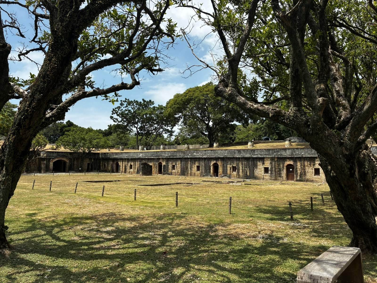
The fort covers 26,711 square metres on relatively high ground. Its rectangular plan is arranged around an open central space, with trees and defensive banks of piled earth screening the fort. From the outer defenses inward, the arrangement includes a rampart, a ditch, the entrance, an inner protective wall, gun positions, covered structures, passageways, and the central square.
Defensive layout
Outer ramparts and earthworks
The outer earthwork rampart was about 6.5 metres high, with a top approximately 10.97 metres wide. The surrounding ditch measured about 9.14 metres across at its base. Two protected earthworks extended from the fort’s sides, one descending toward the hillside and the other toward the riverbank. Another followed the ridge northwest for about three-quarters of a mile. These works included covered passages and sloping protective faces, and their arrangement allowed rifle fire along their length.
Inner parapet and gun positions
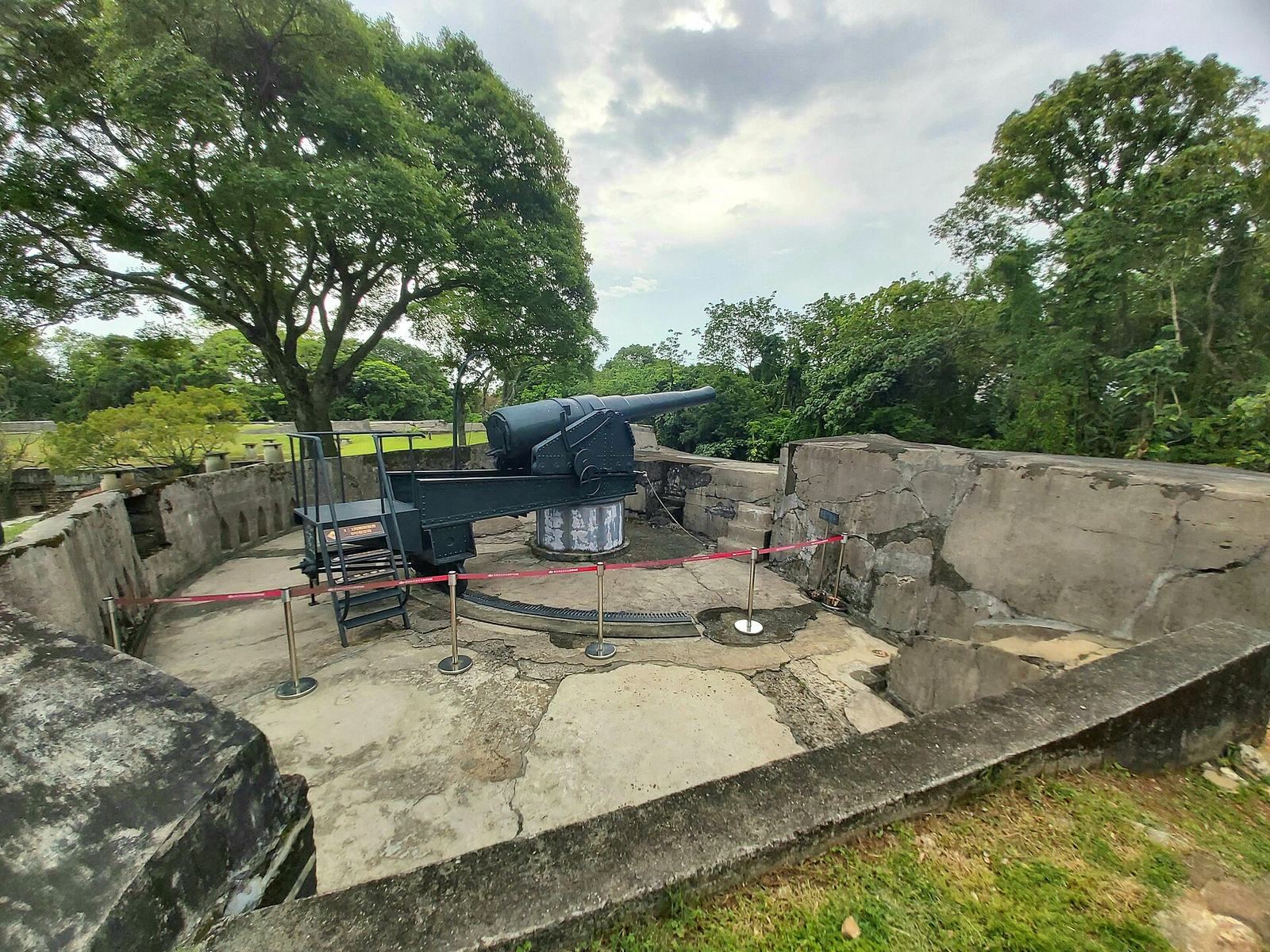
The main walls were built of stone and thick concrete. The inner parapet, a protective wall, reaches a maximum thickness of 4.2 metres and a height of seven metres. Recesses in it held reserve shells. Four gun positions had circular platforms that allowed the weapons to turn through a full circle, with firing arcs covering the Tamsui River estuary. Beside the muzzles, the parapet curves inward to clear the guns’ paths of fire, while nearby recesses provided shell storage. Replica guns are displayed at the fort. In 2019, approval was granted to recreate a full-scale 8-inch Armstrong breech-loading gun, loaded from the rear of its barrel, at the northwest position.
Entrance and central structures
Southeastern entrance
The main entrance is an arched gate on the southeastern side. Liu Mingchuan’s inscription on its lintel gives the words “Key to the North Gate,” a date corresponding to 1886, and his signature.
Command building
The central command building had a traditional hard-gable roof, with a front hall, a main building, and side wings. Its foundations used stone, brick, and mortar made from lime and earth; the central passage retains a firm mortar floor. The building’s surviving fabric consists of floor foundations and a remnant stone wall, and the area is now an open courtyard.
Barracks
The barracks could accommodate about 500 people. Their upper surfaces were covered with soft earth intended to absorb the impact of incoming shells, and ventilation holes pierced the covering. Circular wooden shelters stood above the guns.
Passages and ammunition storage
Passageways
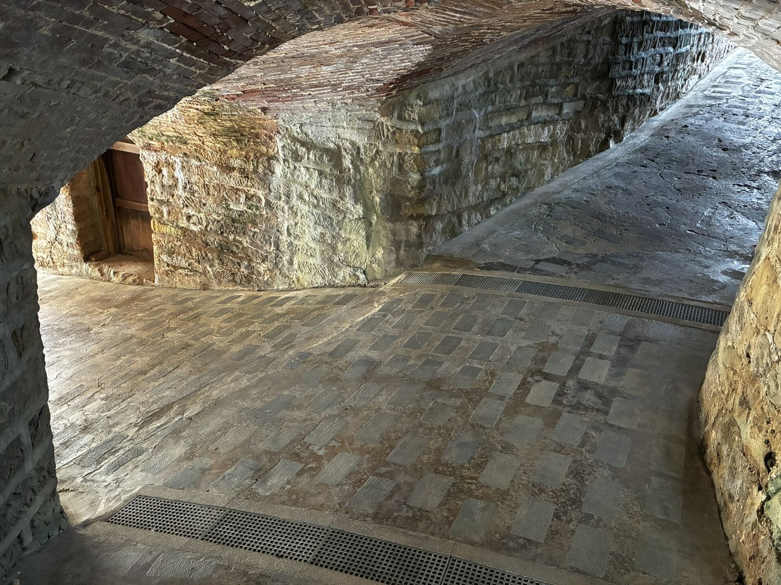
A connected system of semicircular tunnels runs inside the parapet. The passages served as sleeping quarters, storage, an ammunition depot, and everyday living space. Their bases are chiefly stone, including types named for Qili’an and Guanyinshan in Taiwan, while red-brick arches form the vaulted roofs. Small openings through the arches connect the tunnels to the outdoors for ventilation.
Rows of small openings along the inner sides have an uncertain purpose; they may have supported scaffolding during construction. The arches use small bricks shaped like swallow tails, with soot-like marks on their sides. Some parapet sections altered during Nationalist military use may have been rebuilt in reinforced concrete rather than the original brick and stone. A kitchen and bathhouse built on the northeastern side during the military occupation were later removed.
Ammunition depot
The separate ammunition depot is a semicircular structure with an arched ceiling. An interior wall divides the passage from the protected ammunition space. One doorway was for people, while a larger opening allowed shells to be moved. A Y-shaped ramp split into two branches leading to different gun positions.