Nuzi: An Ancient Mesopotamian City in Iraq
Site at a Glance
- Popularity
- High
- Country
- Iraq
- Primary era
- Bronze Age
- Eras represented
- Stone Age, Bronze Age, Classical
- Civilizations
- Akkadian, Sassanid
- Site type
- City
On this page19 sections
History
Nuzi was an ancient city at Yorghan Tepe, southwest of modern Kirkuk in Iraq. Its best-documented phase belongs to the Late Bronze Age, an archaeological period of the second millennium BCE, especially the fifteenth and fourteenth centuries BCE. The city stood in northern Mesopotamia near the Tigris.
Prehistoric occupation
People occupied the site from prehistoric times. Evidence of the Halaf culture, a prehistoric Mesopotamian society, dates to around the middle of the sixth millennium BCE. Northern Ubaid activity followed in the fifth millennium BCE, then Uruk-period activity in the second half of the fourth millennium BCE. Pottery and other finds place occupation in the Early Dynastic period during the third millennium BCE.
Gasur and early Mesopotamian rule
Before it was called Nuzi, the city was known as Gasur. It was probably founded under the Akkadian Empire, a Mesopotamian state of the late third millennium BCE, and became subject to it. More than 200 tablets from this phase describe an estate managed by an official named Zuzu. The records include land allotments made in exchange for dues, as well as distributions of food rations. Gasur traded with Assur, Sabum, Susa, and the city of Akkad, and may also have had commercial links with Ebla.
An inscription attributed to Ititi, an early ruler of the Assyrian city of Assur, describes the capture and plundering of Gasur, probably in the early decades of the twenty-second century BCE. Later occupation took place during the Ur III, Isin-Larsa, Old Babylonian, and Old Assyrian periods, but was less extensive than in the best-documented phases. Tablets from some of these periods point to continuing connections with Assur.
Hurrian Nuzi and its administration
By the middle of the second millennium BCE, Hurrians, a people of northern Mesopotamia and neighboring regions, controlled the city, which was then called Nuzi. It formed part of the kingdom of Arrapha, centered in the Kirkuk region. Arrapha was a vassal of Mitanni, a Hurrian-led kingdom, by at least the second half of the fifteenth century BCE. Nuzi was a small provincial center in a region with a predominantly Hurrian population.
A governor based at the palace administered the city and its province. The king’s main residence was in Arrapha’s capital, but a royal court also operated at Nuzi, where a queen and secondary wives were present. The governor’s deputy, called a sukkallu and often translated as vizier, worked alongside a district chief and a mayor. These officials and district judges shared judicial responsibilities. Free subjects owed ilku, a service obligation that could include military duty or labor for the state.
Archives and household life
About 5,000 tablets have been excavated at Nuzi. Most date from the late fifteenth to the first half of the fourteenth century BCE, in the decades before the city’s destruction. Written in cuneiform, a system of writing made with wedge-shaped marks, they are mainly in Akkadian, in a second-millennium form influenced by Hurrian. The scribes spoke Hurrian as their first language, a fact reflected in Hurrian words and patterns of speech within the texts. Few tablets include date formulas, so officials’ names and other internal clues help place them in sequence.
The records include palace and private documents on labor, rations, weapons, loans, marriage, inheritance, pledges, wills, and correspondence. Some groups of tablets belong to individual households. A substantial archive belonged to Shilwa-Teshub, a son of Arrapha’s king. Another, containing about 1,000 tablets, came from the household of Tehip-Tilla, a major landowner probably related to the royal family through marriage. Most of the tablets are now held by the Oriental Institute in Chicago, the Harvard Semitic Museum, and the Iraq Museum in Baghdad.
The documents reveal a society with different legal and economic positions. An elite of chariot drivers also owned large estates, although its members were not all military personnel. Other groups included people liable for state service, residents dependent on the palace, people whose status is less clearly defined, and enslaved people. Records also describe family arrangements and the management of household succession. Marriage contracts allowed a husband to initiate divorce, but required him to return the bride’s dowry to her family. If his first wife could not have children, he might take a secondary wife to bear them, though she held a lower position. A father without a son could make his daughter his principal heir, helping preserve the family line and ancestral worship.
Adoption was common and could accompany transfers of land. In one arrangement, a seller adopted a buyer as a son and passed property to him as an inheritance share, while the buyer gave the seller a gift. Tehip-Tilla entered into such agreements about a hundred times. Whether these documents disguised ordinary land sales or used adoption language to formalize transfers remains disputed. The transactions formed part of a wider concentration of land among wealthy owners. Sellers could remain as cultivators, still responsible for taxes and service duties, while surrendering part of the harvest to the new owner.
Land, trade, and civic disputes
Barley cultivation was central to the regional economy. Fields depended on irrigation or rainfall, while gardens, orchards, and livestock added to agricultural production. Canal supervisors regulated water use. Rural land included village fields, large state and elite estates organized around fortified centers called towers, and steppe used for grazing. Irrigated fields may have produced seven to ten measures of grain for each measure of seed.
Wealthy landowners lent grain and sometimes metal, often at interest rates near 50 percent. A loan could be secured against a person’s labor or a plot of land. Merchants traveled to obtain goods unavailable locally, mainly for the palace but also for private buyers. Private ventures could be funded by loans or partnerships that divided the profits. The archives also preserve an investigation of Mayor Kussi-harpe and his associates. The accusations included bribery, misuse of public labor and grain, taking palace timber for a private door, extortion, theft, and rape. The accused denied charges, and the outcome is unknown.
Destruction and later occupation
Nuzi’s main occupation ended in a major destruction, generally dated to around 1340 BCE. Assyrian power was displacing Mitanni by the middle of the fourteenth century BCE. Relations with Arrapha had included trade and diplomacy before turning hostile, and tablets refer to a conflict near Tursha. Nuzi was apparently destroyed in the Assyrian campaign that also brought Arrapha under Assyrian rule. The site was then abandoned.
Occupation later returned on a limited scale. Surface traces point to activity under the Parthians, one of the Iranian dynasties that ruled much of the Near East. In later antiquity, a small number of houses and a cemetery occupied the site. Several excavated graves contained objects from the early Sasanian period, including a coin issued during the reign of the third-century ruler Shapur I.
Excavation and interpretation
Tablets from the Kirkuk region began appearing on the antiquities market in the late nineteenth and early twentieth centuries. Some came from the larger city, where a landslide had exposed them, but most originated at Yorghan Tepe. After Gertrude Bell drew attention to tablets appearing in Baghdad, archaeological work began at the site in 1925. Edward Chiera led the first excavations and returned in 1927–28; Robert Pfeiffer directed work in 1928–29, followed by Richard Francis Strong Starr from 1929 to 1931. Further excavation took place in 1934, 1937, and 1939.
Excavations identified about 15 occupation levels, including 12 major layers and their subdivisions. Separate numbering systems were used for deep soundings, the temple area, and parts of the mound to the northwest and southeast, and their correlations remain debated. Most work focused on the Late Bronze Age occupation, while investigations of earlier periods were limited. In 1948, Max Mallowan drew attention to the pottery type later known as Nuzi ware.
Remains
The mound and town plan
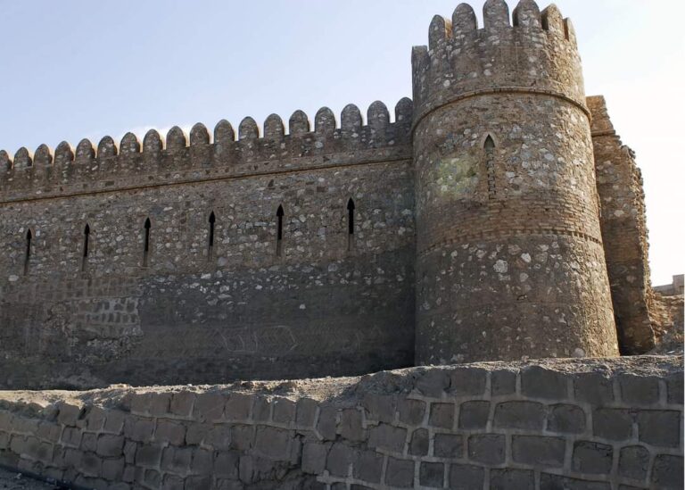
The central mound is roughly square, about 200 metres on each side. In the Late Bronze Age it held the palace and temples and probably formed an enclosed upper city, or acropolis; the surrounding settlement is interpreted as a lower town. A city wall protected the main mound, although only a small stretch has been excavated. Deep wadis appear to mark gates on its northeast, southwest, and southeast sides. A well-drained road ran between the northeast and southwest gates, passing between the central palace and temple area; another road led from the southeast gate to join it. Two large residential complexes stood on low rises north or northeast of the mound. They probably belonged to an outer town thought to have had its own wall, which modern agriculture has destroyed.
The palace
The palace occupied the middle of the main mound, and excavations exposed about 120 metres of its length. Its north entrance led through a vestibule into a large courtyard fitted with benches. Rooms south of this court appear to have served as offices and storage. On the west side, a long room with a hearth opened into the palace’s largest courtyard, which was bordered by reception rooms. Two long rooms on the west probably formed an audience area; their entrance had two pillars that may have supported a pillared porch. Smaller rooms, especially in the western part, served as apartments. The building may have had an upper storey with the principal apartments. Its floors combined brick and stone, and the palace included an elaborate drainage system, painted walls, kitchens, and storerooms.
The temple complex
The religious complex developed from one shrine into two sanctuaries. Both retained their general arrangement during the Late Bronze Age, with courtyards and inner rooms reached by turning from the entrance.
Northern sanctuary
A courtyard accessible from the street led to the northern sanctuary’s inner room, which was entered from the northeast; the area for the cult image lay at the south. Glazed ceramic pegs shaped as animals, including sheep, boars, and lions, decorated the walls. The lion imagery and finds of female figurines have led to an association with Ishtar, the Mesopotamian goddess of love and war, known to the Hurrians as Shaushga.
Southeastern sanctuary
The second sanctuary lay southeast of the first. Its courtyard opened west into an inner room, with smaller rooms to the south. It is attributed to Teshub, a principal Hurrian storm god, although the finds supporting this identification are limited.
Residential buildings
Excavated houses included block-shaped buildings with rooms of similar size and tripartite houses arranged around a central room. Houses built around central courtyards were uncommon. Larger homes had more spacious rooms and a clearer division between reception areas and private quarters. The residence associated with Shilwa-Teshub resembled a small palace and contained wall paintings. The area around the two large residential complexes has not been extensively excavated.
Early occupation finds
Uruk-period remains include mudbrick construction, spouted vessels, bevel-rimmed bowls, a small copper animal figurine, and drilled marble stamp and cylinder seals. Early Dynastic pottery came from a pit, paved areas, and graves. Finds from the Akkadian period include stone figurines, a copper axe and daggers, a shell seal mounted on a copper pin, and five cylinder seals. One small Akkadian-period tablet, about 6 by 6.5 centimetres, depicts a river or canal and two mountain ranges. Its purpose is uncertain: it may show landholdings or a route. It names Maskan-dur-ebla and marks irrigated gardens belonging to Azala below the Rahium River.
Pottery and glazed materials
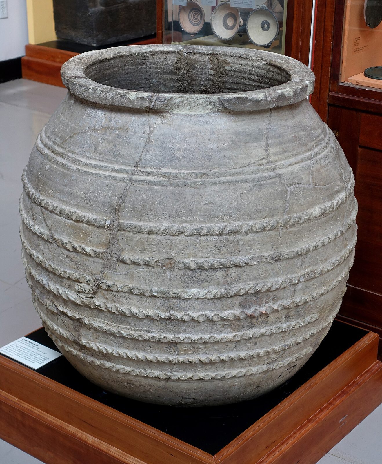
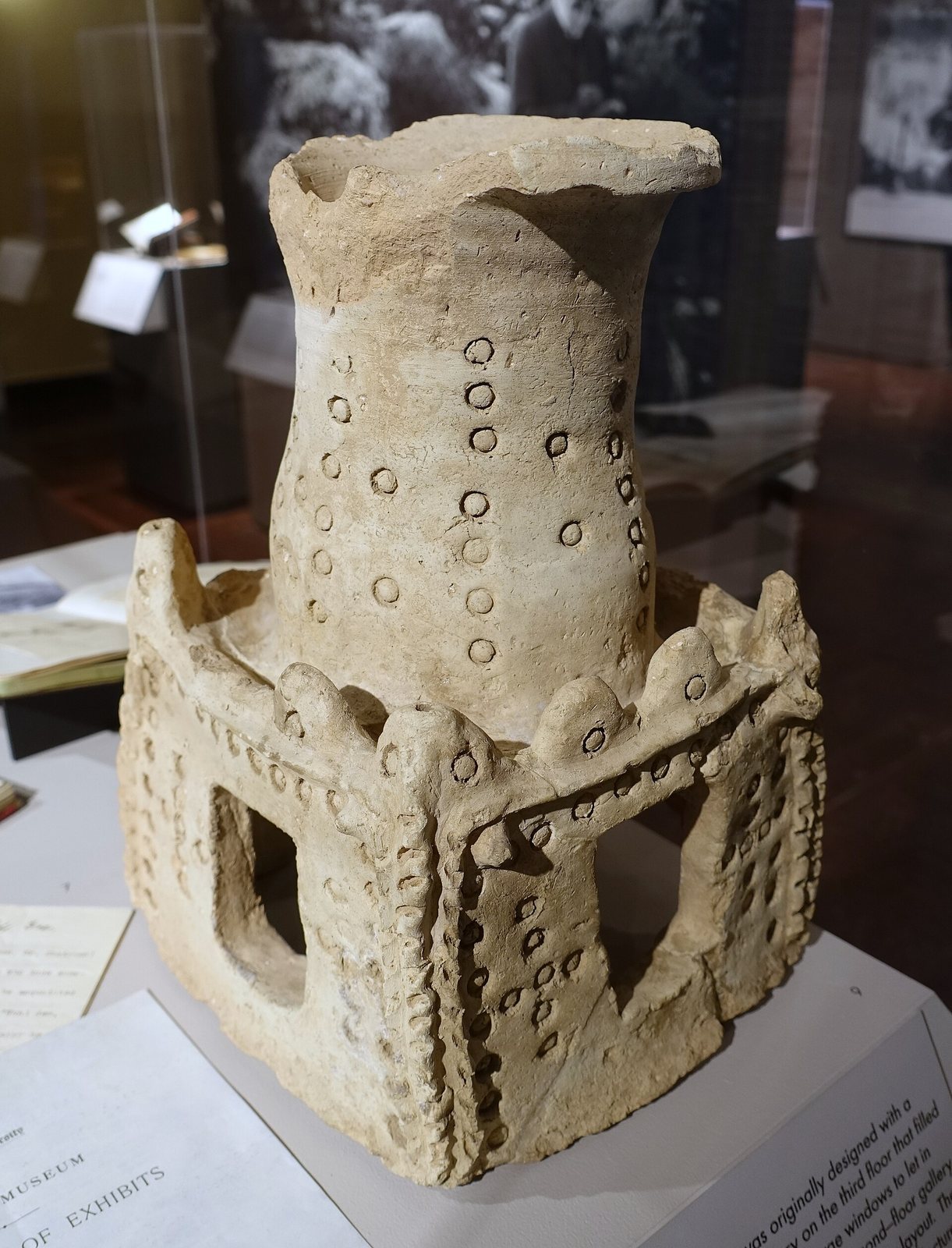
Nuzi ware is distinguished by white-painted designs over a dark surface. Its decoration ranges from triangles and bands to rosettes, curling forms, and floral patterns. The pottery type was later identified at sites across Upper Mesopotamia. Other finds connected with the development of glazed and glass-like materials include glazed bricks, frit, a material used in glassmaking, and faience, a glazed material rich in glass. Excavations also recovered metal weapons, terracotta figurines, and models or representations of buildings.
Objects from the temple area
Bronze finds from the temple area included a three-dimensional statue, nine sickles, two sun-discs, two crescents, six pins, a bell, two bracelets, and hundreds of small beads. One sickle carries an inscription. Each sun-disc is about 12 centimetres across, with a central depression surrounded by raised dots and a six-pointed star.
Later graves
Several graves from the site’s later occupation contained objects from the early Sasanian period. One was a coin from the reign of Shapur I.