Shabwa: Capital of the Ancient Kingdom of Hadramaut
Site at a Glance
- Popularity
- High
- Country
- Yemen
- Primary era
- Iron Age
- Eras represented
- Bronze Age, Iron Age, Classical
- Civilizations
- Unclassified
- Site type
- City
On this page16 sections
History
Shabwa is an ancient city in Shabwah, Yemen, that served as the capital and an administrative and religious center of Hadramaut, an ancient South Arabian kingdom. Its earliest known occupation dates to 1410–1200 BC, before the incense-caravan trade is attested in the region.
Early settlement and incense trade
Human activity in the wider region reaches further back. Flint tools and hearths from plateaus and nearby valleys indicate earlier occupation; two hearths have been dated to 4,800 ± 400 and 5,330 ± 70 years before present. Hunter groups lived in the region around 4000 BC, and small amounts of obsidian point to connections with neighboring areas.
Inscriptions and pottery trace the growth of the city and its defenses. The oldest known inscription, probably from around the eighth century BC, refers to a ruler using stone from a quarry to build his house. Other texts describe houses and defensive walls, with many accounts of wall construction or repair dating from the sixth to the second centuries BC. Inscriptions also name wealthy residents, including Rafa’an son of Shafsy, some of whom were merchants or major landowners.
By around the seventh century BC, inscriptions indicate a Sabaean presence in the region. Some early dedications invoke Almaqah, a major god of the Sabaean kingdom of Saba, and may reflect a period of Sabaean dominance in Hadramaut. Shabwa later developed into a major storehouse and trading center for aromatic resins. At the western edge of the Hadramaut valley, it connected routes across the Ramlat as-Sab’atayn toward Ma’rib, Saba’s capital, the Jawf valley, Najran, Hegra, and Petra. Hadrami merchants also traded in the eastern Mediterranean, especially at Alexandria and Gaza.
Classical writers described Shabwa, using names such as Sabata, Sabota, and Sabautha, as a royal center associated with temples and incense. Strabo, drawing on the Greek geographer Eratosthenes, identified Sabata as the Hadramite capital. Pliny the Elder wrote that Sabota had sixty temples within its walls, while the first-century AD Periplus of the Erythraean Sea, an account of maritime routes and trade, described Sabautha as an inland royal residence and incense depot.
Pliny also described royal and religious rules governing the incense trade. He said that camel-borne incense entered through a designated gate, where priests took a measured share for the god Sabis, identified by Roman writers with Hadramaut’s principal god, Siyân. The share helped pay public expenses. Exports then passed through the territory of the Gebbanites, whose king also received tribute.
Royal Hadramaut and regional power
Hadramaut reached a high point during the first three centuries AD, when its political and commercial connections extended west toward Qataban, another South Arabian kingdom, and east toward Sumhurân on the Indian Ocean coast. The kingdom also controlled fortified points guarding access to the port of Qanî, maintained a fleet, conquered Socotra, and increasingly relied on maritime routes. At Shabwa, the main flourishing phase is placed between the sixth century BC and the second century AD.
Water management was central to the city’s agricultural economy. At the beginning of the third century AD, King Ili’azz Yalut built an inscribed water-control gate at the head of a new canal. The city also had religious and royal connections beyond its walls. At the sanctuary of al-Uqla, about ten kilometres west of Shabwa, Hadrami rulers were enthroned. Ili’azz Yalut’s investiture around AD 217–218 was attended by people identified as Indians, Chaldeans, an ancient people associated with Babylonia, and Palmyrenians, inhabitants of Palmyra in Syria.
Inscriptions from Shabwa include about ninety texts in South Arabian languages. Fragmentary dedications name deities including Dhāt-Himyâm and Hawbas; another inscription refers to a sanctuary of Dhāt-Zahran. Numerous bronze tablets name Siyân and record offerings associated with pilgrimages and ritual banquets. The exact location of Siyân’s sanctuary in the city has not been established.
Capture and decline
A long inscription from Ma’rib recounts a Sabaean attack on Shabwa around AD 225–230. A force led by Fari’ Ahsan acted on the orders of the Sabaean king Sha’r Awtar. The inscription describes attackers entering a royal palace courtyard, where defenders held them for thirteen days. After Sha’r Awtar arrived with relief forces, the Sabaeans took and looted the palace, set it on fire, and captured the Hadrami king, Ili’azz Yalut. The palace in the inscription is called Shaqar, but its identification with Shabwa’s excavated palace remains uncertain.
Shabwa remained inhabited after the Sabaean capture, and evidence of occupation continues into the fifth century. Himyarite control followed the Sabaean period; the Himyarites were a later South Arabian power. Fourth-century inscriptions refer to a garrison in the city and invoke Rahman, a divine name used in Himyarite texts, indicating religious change or a decline in polytheistic worship.
From the fifth century, maintaining irrigated fields required major work on raised water intakes and channels, while fields needed to be cleared and worked again. These demands accompanied the city’s decline. During periods of prosperity, the al-Burayk tribe governed Shabwa and helped protect sacred places in southern Arabia. At the city’s commercial peak, it had about 4,000 families. As the spice trade contracted, more members of the tribe lived in tents and relied on camels. In the ninth century, the historian al-Hasan al-Hamdânî wrote that Shabwa’s inhabitants had moved to Shibâm, though he still described Shabwa as a fortified point in Hadramaut.
Archaeological investigation and later occupation
H. St. John Philby made an early full description of Shabwa, recording inscriptions and studying texts at al-Uqla. During British rule, Major Hamilton received permission to excavate part of a city monument. It was first interpreted as a tomb, contributing to the mistaken idea that Shabwa was a vast necropolis. In 1942, archaeologist Leonard Woolley argued instead that the structure had a strong stone base and several upper storeys, comparable to Hadramaut’s tower houses.
After years when independence wars and border conflicts made access difficult, the People’s Democratic Republic of Yemen proposed archaeological work with France in 1972. A French mission began excavating in December 1974; Jean-François Breton took over its direction in 1978. Work continued intermittently until 2002. Excavations in the southeast, including around building 41, revealed fourteen successive layers, dated from the sixteenth century BC to the fourth century AD. In 2002, the mission fenced some of the major monuments, transferred archaeological material to the museum at Ataq, and began cataloguing it.
Three villages later occupied parts of the ruins. Residents began leaving around 1990, moving in some cases to Saudi Arabia and in others to homes on the plain. Salt extraction at Shabwa continued, with salt carried by truck to nearby areas.
Remains
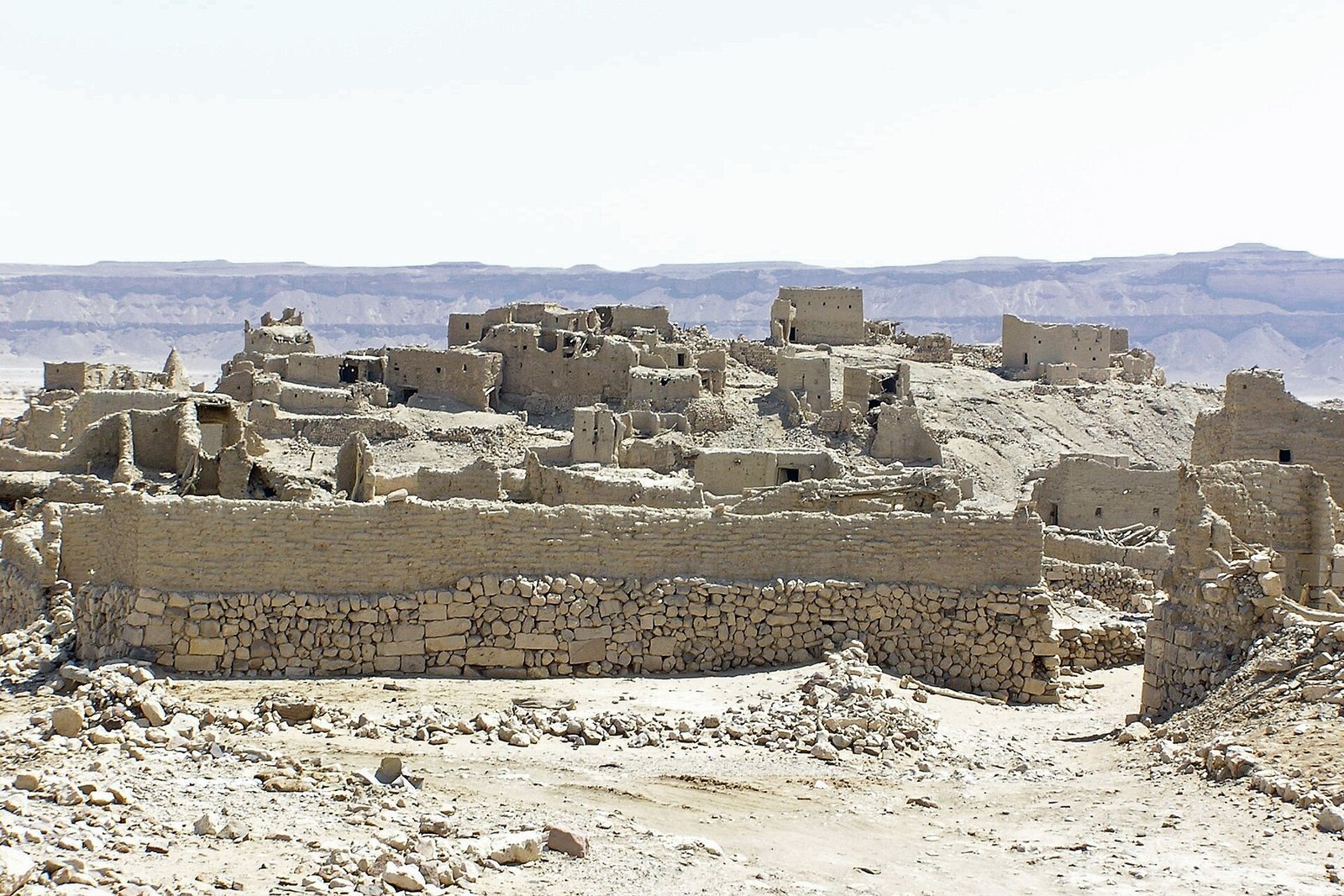
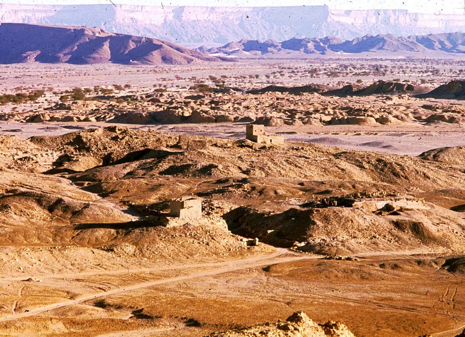
Shabwa’s remains occupy a highland landscape of hills and low ground, organized around an outer city and an inner city, with citadels, houses, temples, and irrigation channels. The site lies at an average elevation of about 700 metres at the western end of the Hadramaut plateau. Its hills form a broad triangle, roughly 900 metres along a side and 550 metres at the base. The rocky al-‘Aqab ridge bounds it to the north; high ground rises to 747 metres in the west, and the Qarât al-Firân heights enclose it to the north and northeast. Al-Hajar hill, at 720 metres, lies to the east.
A natural raised spur beside al-Hajar divides Wadi ‘Irmâ, a seasonal valley, into the eastern Wadi Mihbâd and western Wadi Mish’ar. The latter bends through a low sandy area before crossing the al-‘Aqab ridge and watering fields to the northwest. Below 700 metres, the central depression of al-Sabkha contains underground and open salt mines.
Defenses and water management
Walls, gates, and citadels
Reconstructions place the outer city at least one kilometre from north to south and about 900 metres across at its widest. The inner city lay in the southern part of the settlement, measuring about 500 metres from southwest to northeast and up to 365 metres from northwest to southeast. Its central area covered about 0.15 square kilometres.
The defensive system extended about 4,200 metres and made use of the surrounding hills and lower ground. A continuous wall of packed pebbles followed the western, northern, and eastern hills, with regular changes in its line. Another continuous wall protected the city’s low western side, where towers were joined by curtain walls, defensive walls running between towers. This line connected eastward to the citadel on al-Hajar. The system had ten gates, six in the inner wall and four in the outer lines. Along the northern wall, which was about 450 metres long, monumental gate 3 and secondary gate 2 controlled entrances. Gate 3 opened from the al-Sabkha depression toward the city’s main northwest-to-southeast axis.
The citadel on al-Hajar is associated with a long wall and is now partly obscured by the village of al-Hajar. A second citadel stood in the southeastern part of the outer city. Buildings of mud brick have also been excavated outside the defenses.
Irrigation channels
The irrigation works diverted spring and summer floods with stone deflectors and thresholds placed upstream in Wadi ‘Irmâ. Main canals ran on both sides of the city, while distributors at intervals carried water to fields several kilometres upstream. The irrigated oasis eventually covered about 1,500 hectares. Flood sediment raised the fields; one approximate estimate puts the rate at 0.7 centimetres a year, or 0.7 metres per century.
Nearby quarries supplied different kinds of building stone, and one bears an inscription dating to around the seventh century BC. Iron was mined at al-Harash, and salt came from numerous local mines. Acacia and jujube forests nearby provided timber for the upper parts of buildings.
Houses and palace
Early buildings and tower houses
Excavations on the southern slope of the al-‘Aqab ridge exposed early city buildings made of interlocked mud-brick walls. They include a dwelling room showing domestic use and an open area for storing mud bricks. Buildings in this sector generally followed a southeast-to-northwest alignment.
Many of Shabwa’s large houses had stone foundations two to four metres high, typically measuring ten to twelve metres on each side. Walls crossing at right angles formed internal cells filled with earth, mud brick, or other material. Timber frames and mud-brick infill continued the structure above the stone base. Stair traces indicate at least one upper storey, and perhaps as many as three in the royal palace. About 200 later houses remain visible at the surface. These residences of wealthy families had defensive features, including height, mostly closed ground floors, few windows, and upper terraces.
A main road crossed the inner city, though excavations have exposed only a few intersections and the full street arrangement is not known. The outer city also contained houses built of mud brick.
Royal palace
The royal palace stood near the northwestern gate and the northern defensive line, opposite gate 3. Its complex comprised buildings A and B around a courtyard, with annex C to the northwest. The whole area measured about 46.5 metres east to west by 61.4 metres north to south, covering roughly 2,855 square metres. Building A, south of the courtyard, measured up to 22.9 by 19.8 metres; building B, to the north, measured 32.5 by 38.5 metres and formed a U-shaped enclosure around the courtyard. Annex C measured 11.9 by 5 metres.
The courtyard occupied a broad artificial terrace about five metres above the main street and opened outward through at least two narrow passages between A and B. Building A used finely dressed stone blocks, many with carefully tooled faces and polished grooves along their edges. Building B initially enclosed a central courtyard with a rectangular structure at its center, and was later raised by an additional storey. Painted panels between timber framing at ground level showed people and animals. A gallery ran around its three upper wings; openings facing the courtyard had central stone dividers, or mullions, and decorated capitals.
An elaborate entrance on the eastern side combined a staircase with rows of benches, forming an approach and reception space. Nearby blocks and slabs supported bronze statues and fittings. Excavations recovered fragments of bronze figures, including riders and archers, as well as animals such as lions, horses, and griffins. Other finds include an ivory hand and an ivory casket dated to the fourth or fifth century AD, probably made locally from imported ivory. Mosaic, painted, and colored glass point to imports from the eastern Mediterranean, especially Egypt. Pottery included Roman fine tableware, other high-quality wares, and storage jars from the eastern Mediterranean, the Aegean, and North Africa.
Coins found in the palace area are often too corroded by salt to identify. Some bear the name Shaqar; others name both Siyân and Shaqar and show a bull in profile. Nearly 200 timber beams were found in successive layers of fire dating to the first centuries AD.
Temples and later monuments
City temple
A temple identified as building 114 stood in the southwestern part of the outer city. A substantial but poorly preserved temple complex also occupied the southern edge of Shabwa.
Al-Uqla sanctuary
About ten kilometres west of Shabwa, the sanctuary at al-Uqla consists of a natural rock outcrop topped by a rectangular basin. Around one hundred inscriptions cut into its sides chiefly name people who accompanied their ruler and describe ritual hunts connected with royal investitures.
Tomb and mosque
A tomb and small mosque associated with a sheikh, a traditional community or tribal leader, of the al-Burayk tribe stand at Shabwa.