Arikamedu: An Ancient Port and Bead-Making Settlement in India
Site at a Glance
- Rating
- 3.7
- Popularity
- Medium
- Country
- India
- Primary era
- Classical
- External website
- Open
- Eras represented
- Classical, Medieval
- Civilizations
- Unclassified
- Site type
- City
On this page17 sections
History
Arikamedu is an archaeological site at Ariyankuppam in Puducherry, India, on the bank of the Ariyankuppam River. Its occupation extended from the second century BCE to the seventh or eighth century CE, with evidence suggesting that settlement continued into more recent times. The site is associated with the ancient port of Podouke, an emporium described in the Periplus of the Erythraean Sea, an ancient Greek mariners’ guide to ports and trade routes, and in Ptolemy’s Geographia. Arikamedu and neighbouring Virampattinam are understood to have formed this port complex.
Port traditions and early identification
The port was also connected with Virai, which Sangam literature describes as a harbour associated with salt pans during the period of the Velir, chiefly ruling lineages known from early Tamil tradition. The name Arikamedu is an archaeological name derived from a Tamil expression meaning “Mound of Arakan.” The site has also been associated with Viraiyapattinam or Virampattinam, meaning “Port of Virai.” Podouke has been interpreted both as a Roman form of the Tamil Potikai, meaning “meeting place,” and as a name connected with the local Poduvar clan.
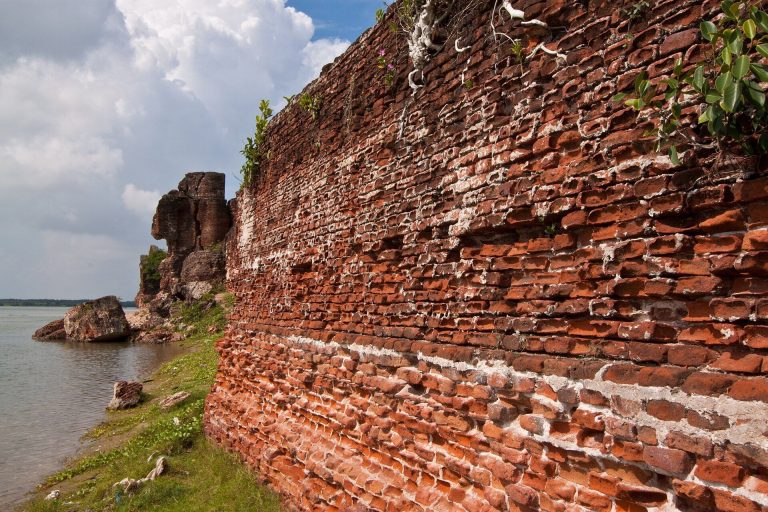
The earliest recorded reference dates to 1734, when an Indo-French colonial consul reported that villagers were removing old bricks at Virampattinam. In 1765, Le Gentil saw villagers collecting large bricks exposed along the riverbank. They attributed the remains to an old fort associated with King Vira-Raguen.
Discovery of the international trading site
In 1937, the French Indologist Jouveau Dubreuil acquired gemstone antiquities from local children and collected objects visible on the surface. An intaglio, a carved design cut into a gemstone, depicted a man whom he identified as Augustus Caesar, the first Roman emperor. Dubreuil therefore connected the finds with the Roman Empire and described Arikamedu to the local governor as “a true Roman city.”
Unsystematic excavations followed in the early 1940s. The French colonial public-works service, the Service des Travaux Publics, worked at the site, while Father Fancheux and Raymond Surleau also excavated and sent antiquities to Indian museums and to the École française d’Extrême-Orient in Hanoi.
Systematic excavation began in 1945 under Sir R.E.M. Wheeler, Director General of the Archaeological Survey of India. Wheeler recognized pottery from Arikamedu in the Madras Museum as Italian terra sigillata, also called Arretine ware, a fine stamped ceramic made especially at Arezzo. Indian archaeologists took part in the excavations and received training there, and Wheeler published his findings in 1946.
Wheeler interpreted Arikamedu as a Greek or Yavana trading station. In this context, Yavana was an ancient Indian term for peoples associated with the Greek-speaking and wider western world. He linked the settlement with Rome, placed its establishment in the reign of Augustus Caesar, and proposed that it operated for roughly two centuries, from the late first century BCE to about 200 CE. He associated its commerce with gems, pearls, spices, silk, and other goods brought by merchants from India’s western coast, Ceylon, Colchoi or Colchi, and the Ganges region.
Revised chronology and interpretation
Jean-Marie Casal investigated Arikamedu from 1947 to 1950. His main contribution was the identification of nearby megalithic burials, graves marked by large stones. These stones were locally called Pandukal, meaning “old stones,” and led Casal to associate the site with an early megalithic period.
Later work questioned the limits of Wheeler’s chronology. Chinese celadon attributed to the Song-Yuan period, which covered the Chinese Song and Yuan dynasties from the tenth to the fourteenth centuries, and Chola coins dating to about the eleventh century were found during Wheeler’s work. They were treated at the time as intrusive material or debris left by brick robbers. Chinese blue-and-white ware was also recovered.
During the early 1980s, Vimala Begley studied Arikamedu’s ceramics, developed a preliminary sequence of occupation, examined its beads, and arranged a chronological display of finds in the Pondicherry Museum. Excavations directed by Begley and K.V. Raman, in collaboration with the University of Pennsylvania and the University of Madras, took place from 1989 to 1992. Steven Sidebotham of the University of Delaware supervised trench excavation. Six working seasons produced a revised sequence of six major occupation periods.
Begley’s research placed settlement between the second century BCE and the seventh or eighth century CE and indicated that trade with Rome continued much longer than Wheeler had proposed. Begley and Raman also inferred continuous occupation from at least the second or third century BCE into much more recent times. Their interpretation treated Arikamedu’s Roman commercial connection as an inference rather than proof that the settlement was specifically founded by Romans. The site’s extensive glass and stone beads, identified as Indo-Pacific beads manufactured at Arikamedu, provided an important connection between local production and the settlement’s long occupation.
The Archaeological Survey of India has controlled the site since 1982. In October 2004, an international conference organized by the Government of Puducherry and Italy’s Ministry of Foreign Affairs decided to pursue joint investigation for conservation. Puducherry later proposed Arikamedu for UNESCO World Heritage status, while the Archaeological Survey of India proposed it within the “Silk Road Sites in India” cultural-heritage category.
Remains
Arikamedu covers about 34.57 acres, or 13.99 hectares, beside the Ariyankuppam River, also called the Virampattinam River. For much of the year the river functions as a lagoon and forms the northern outlet of the Gingee River before it reaches the Bay of Bengal. The site occupies a bend in the river that protected sea-going vessels anchoring there. The excavated mound is divided into northern and southern sectors according to occupation and elevation, with the northern sector nearer the coast and the southern sector farther inland.
Northern sector
Communal feeding area
Ceramics and cooking vessels from the northern sector indicate communal feeding for sailors and merchants who camped at the port. During the later part of the second century BCE, wine stored in amphorae, large transport vessels commonly used for wine and oil, was the principal imported commodity from western regions.
Enclosures and drainage
Two walled enclosures contained ponds and drainage systems. These installations may represent dyeing operations in which vats were used to colour muslin for export. Buildings in the northern sector indicate urbanization and the presence of Indian and non-Indian communities, although their dates could not be established because the excavations did not reach sufficient depth.
Southern sector
Brick storehouse
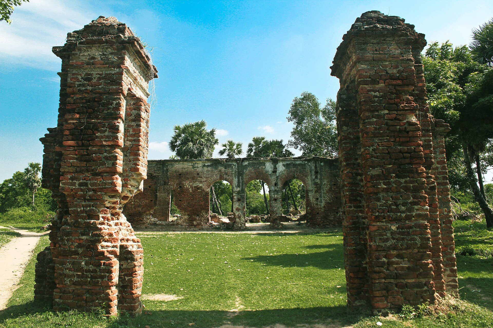
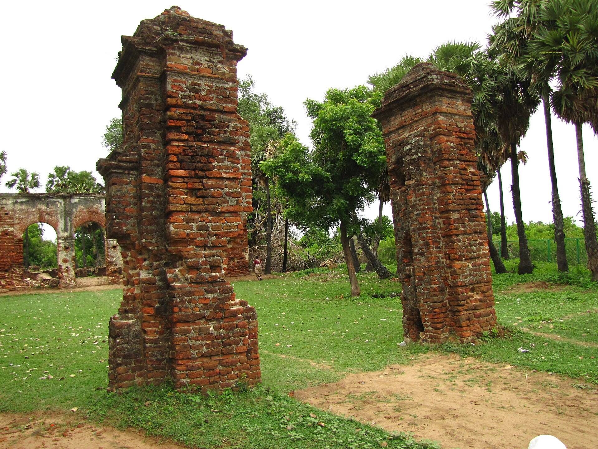
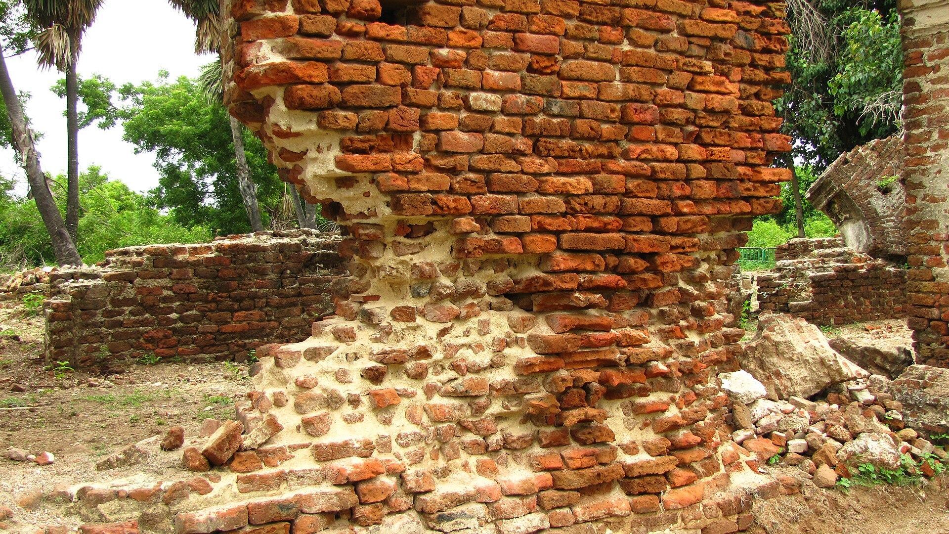
A 45-metre-long oblong brick structure stood in the southern sector. It had lime-mortar plaster and an internal dividing wall and was used as a storehouse. Excavations also revealed that the site’s brick buildings and wells were constructed on weak sandy foundations. Their workmanship was poor, the woodwork was of low quality, and the houses lacked waterproofing.
Trade goods and local production
Imported pottery and containers
Arikamedu produced local and Mediterranean pottery, including amphorae and Arretine ware from the first century BCE. The Arretine pottery went out of use by about 50 CE. Pink amphora jars with two handles and a yellow clay coating occurred in every excavated layer and were used to store wine or oil. Rouletted Ware, pottery decorated with repeated impressions made by a roulette tool, was classified in one scientific study as “Arikamedu Type 1.” Wheeler considered it Mediterranean rather than Indian in origin. Another sherd, classified as “Arikamedu Type 10,” has been examined for its style and distribution across the site.
Beads and small objects
Numerous glass and stone beads were recovered from the site. Begley identified them as Indo-Pacific beads, small glass beads associated with exchange networks linking South and Southeast Asia and the western Indian Ocean, and concluded that they were manufactured at Arikamedu. Other finds included shell beads, gemstones, gold, terracotta objects, iron nails, a copper percussion beater, a fragment of a Roman lamp shade, an engraved emblem of Augustus, an ivory handle, and a wooden toy boat. Amphorae containing wine residues, Roman-related beads and gems, and a Roman stamp further indicate connections with Mediterranean and Roman trade, without proving that Arikamedu was a Roman foundation.
Religious and artistic objects
Sculpture and figurines
A second-century CE statue depicts a girl holding a bird. The excavated area also produced a figurine associated with Mahavira, the principal historical teacher of Jainism and the twenty-fourth Tirthankara, a Jain spiritual teacher believed to show the path to liberation. Several Hindu religious images were found as well, including a rare statue of Brahma.
Brahma image
The Brahma statue shows the deity seated on a lotus in a form compared with the Hindu creation narrative in which Brahma emerges from Vishnu’s navel. A hole at the centre of the lotus allowed the image to be mounted on a peg representing the stalk rising from Vishnu’s navel.
Earlier ceramic and burial traditions
Red and black ceramics occur in layers that predate the trading centre and continue into later contexts. They are associated with megalithic burial traditions and with Pandukal, the stone markers used for such graves. These materials provide evidence for activity at Arikamedu before the period represented by its international trading connections.