Gingee Fort: A Historic Hill Citadel in India

Site at a Glance
- Rating
- 4.6
- Popularity
- Medium
- Country
- India
- Primary era
- Medieval
- Eras represented
- Medieval, Early Modern
- Civilizations
- Chola, French, Maratha
- Site type
- Military
- Remains
- Fort
On this page15 sections
History
Gingee Fort is a large fortified complex in India at Gingee, Tamil Nadu, whose earliest development is associated with a small Chola fort of the ninth century. The hill fortress grew through successive phases under the Cholas, Kadava rulers, the Vijayanagara Empire, the Gingee Nayaks, the Marathas, the Mughals, the Carnatic Nawabs, the French, and the British. Its many historical names include Senji, Chenji, Chanchi, Jinji, Senchi, Badshabad, Chandry, Chindy, Nusratgadh, Chingee, and Chengey.
Early Fortification and Vijayanagara Rule
The beginnings of the fort are dated in different traditions to the Kon dynasty around 1190 or to Ananda Kon around 1200. At Melacerri, about 4.8 kilometres away and known as Old Gingee, fortification remains are dated to approximately 1200. The earliest recorded reference to the hill fort comes from an inscription issued in the tenth year of the reign of Vikrama Chola, an early twelfth-century Chola ruler. It describes a Kadava feudatory as the lord of Senjiyar and refers to its strongly fortified fort.
The Kadava rulers altered the earlier fort in the twelfth century. The Vijayanagara rulers developed it further in the fourteenth century and made it a citadel, a strongly defended central fortress, protecting the settlement of Gingee. During the early sixteenth century, the Vijayanagara emperors appointed the Gingee Nayaks as governors. After Vijayanagara was defeated at the Battle of Talikota, the Nayaks became independent rulers. The fortifications were substantially strengthened or rebuilt during the fifteenth and sixteenth centuries, although the precise dating of individual works remains uncertain. Gingee served as the Nayaks’ headquarters in northern Tamil Nadu.
Bijapur, Maratha, and Mughal Control
Bijapur and Golconda forces invaded the Carnatic, and Bijapur captured Gingee in the mid-seventeenth century. Under Bijapur rule, the fort was known as Badshabad and remained under the authority of Bijapur governors for nearly three decades.
Shivaji, the founder and principal early ruler of the Maratha Empire, captured Gingee in July 1677 during his southern campaign. He brought the fortress into Maratha territory and ordered its mud walls to be replaced with granite. Shivaji regarded Gingee as the most impregnable fortress in India. During the Mughal campaign against the Marathas, the fort became a temporary seat of the Maratha Empire.
After Shivaji’s successor Sambhaji was killed, Rajaram I escaped to Gingee and continued the Maratha resistance from there. Mughal generals Zulfiqar Khan, Asad Khan, and Kam Baksh besieged the fortress in 1691. Santaji Ghorpade successfully defended it, but the Mughals captured Gingee in 1698 after a seven-year siege. Rajaram escaped before the fall of the fort. In the Mughal period, it was renamed Nusratgadh in honour of Zulfiqar Khan Nusrat Jung.
Rajput and Carnatic Nawab Rule
In 1700, the Mughal emperor Aurangzeb granted Gingee to the Rajput commander Raja Swarup Singh Bundela as an imperial reward. Swarup Singh held the fort with substantial autonomy as a mansabdar, a ranked military and administrative official in the Mughal system. After his death in 1714, his son Tej Singh, also known as Raja Desingh, came into conflict with Saadatullah Khan I, the Nawab of Arcot. A Nawab was a provincial governor or ruler under the Mughal political order and its successor states. Tej Singh was defeated and killed in the ensuing battle, after which Gingee passed under the authority of the Carnatic Nawabs.
Tej Singh’s rebellion and death made Gingee the setting for a powerful Tamil historical and legendary tradition. Poems, ballads, and street plays associated him with the fort, while his friendship with the general Mehboob Khan became part of the same tradition. The Marathas used the names Chandry and Chindy for Gingee, while later French and British usage produced the forms Gingee, Jinji, Chingee, and Chengey.
French, British, and Mysorean Occupation
During the Second Carnatic War, a conflict for control of southern India involving European powers and their regional allies, French forces captured Gingee in 1750. They strengthened the garrison with artillery and ammunition, and sculptural elements were transferred from the fort to Pondicherry during the occupation. The British captured Gingee in 1761 as French power in India declined. French control of the Carnatic ended soon afterward with the loss of Pondicherry in 1762.
Hyder Ali of Mysore briefly captured Gingee in 1780 during the Anglo-Mysore conflict. The British recovered the fortress after the defeat of Mysore and retained it as a military station until the nineteenth century. Following the Anglo-Mysore wars, Gingee saw no further major military action and gradually deteriorated.
Archaeological Administration and Heritage Status
Gingee was declared a National Monument in 1921 and placed under archaeological administration. The Archaeological Survey of India maintains the complex, established a museum at the entrance, and has carried out preservation and restoration work. In 2025, Gingee Fort was inscribed within the UNESCO World Heritage property Maratha Military Landscapes of India. The property recognises a group of forts associated with the formation and expansion of the Maratha Empire under criteria concerning architectural and technological achievement and historical associations.
Remains
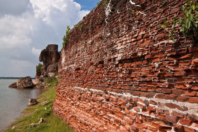
Gingee Fort occupies elevated terrain rising approximately 240 metres above its surroundings. Its principal defensive system consists of three hill citadels, Rajagiri to the west, Krishnagiri to the north, and Chakkiliya Durg to the southeast. Chandrayan Durg, also called Chandragiri or St. George’s Mountain, forms an additional smaller fortified hill connected to Rajagiri by a low rocky ridge. Walls approximately 13 kilometres long enclose about 11 square kilometres in a broad triangular layout. Granite and lime mortar form the main construction materials, while natural cliffs, ravines, rock outcrops, and steep slopes reinforce the masonry. A moat about 24 metres wide added another defensive line.
Lower Fort and Water Management
The lower areas between the citadels contained residences, public halls, temples, mosques, shrines, pavilions, granaries, prisons, stables, magazines, and water installations. Arcot Gate and Pondicherry Gate served as the principal lower-fort entrances, with Pondicherry Gate probably improved during the French occupation. The complex’s water system includes two freshwater sources on the hilltops and three reservoirs below them. Earthenware pipes carried water from a nearby reservoir to the Kalyana Mahal. Anaikulam, Chettikulam, and Chakrakulam are among the tanks and reservoirs, while Aanaikulam is also a sacred pond within the fortifications.
Rajagiri Citadel
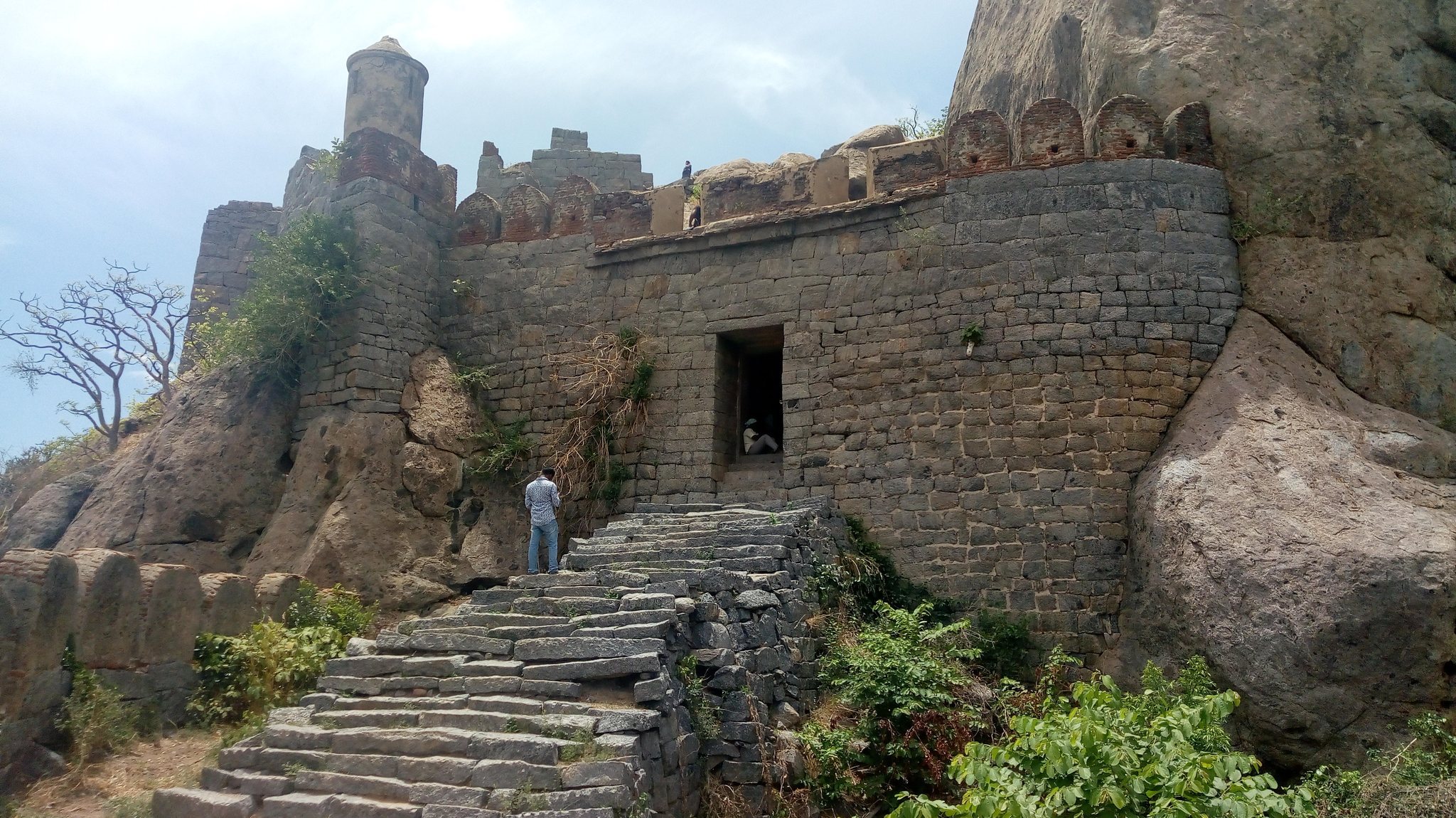
Rajagiri, also called Kamalagiri or Anandagiri, is the principal hill citadel. Its summit is separated from the surrounding terrain by a natural chasm approximately 9 to 10 metres wide and 18 to 20 metres deep. Entry formerly crossed the chasm by a small wooden drawbridge and continued through seven gates. Walls, gateways, and embrasures, openings in defensive walls for artillery or weapons, follow the rock shelves and steep edges. Rajagiri was historically regarded as the most impregnable part of the fortress.
Kalyana Mahal and Inner Enclosure
The Kalyana Mahal, meaning Marriage Hall, is a seven-storeyed structure within the Rajagiri complex. It has a pyramidal shikhara, or crowning summit, and two internal stairways. The inner Rajagiri fort also contains royal stables, a ruined royal palace, Anaikulam tank, granaries, a magazine, and the shrine of Venugopalaswami. An Indo-Islamic-style treasury and a grain storehouse form part of the surviving fortified complex.
Temples, Mosque, and Upper Defences
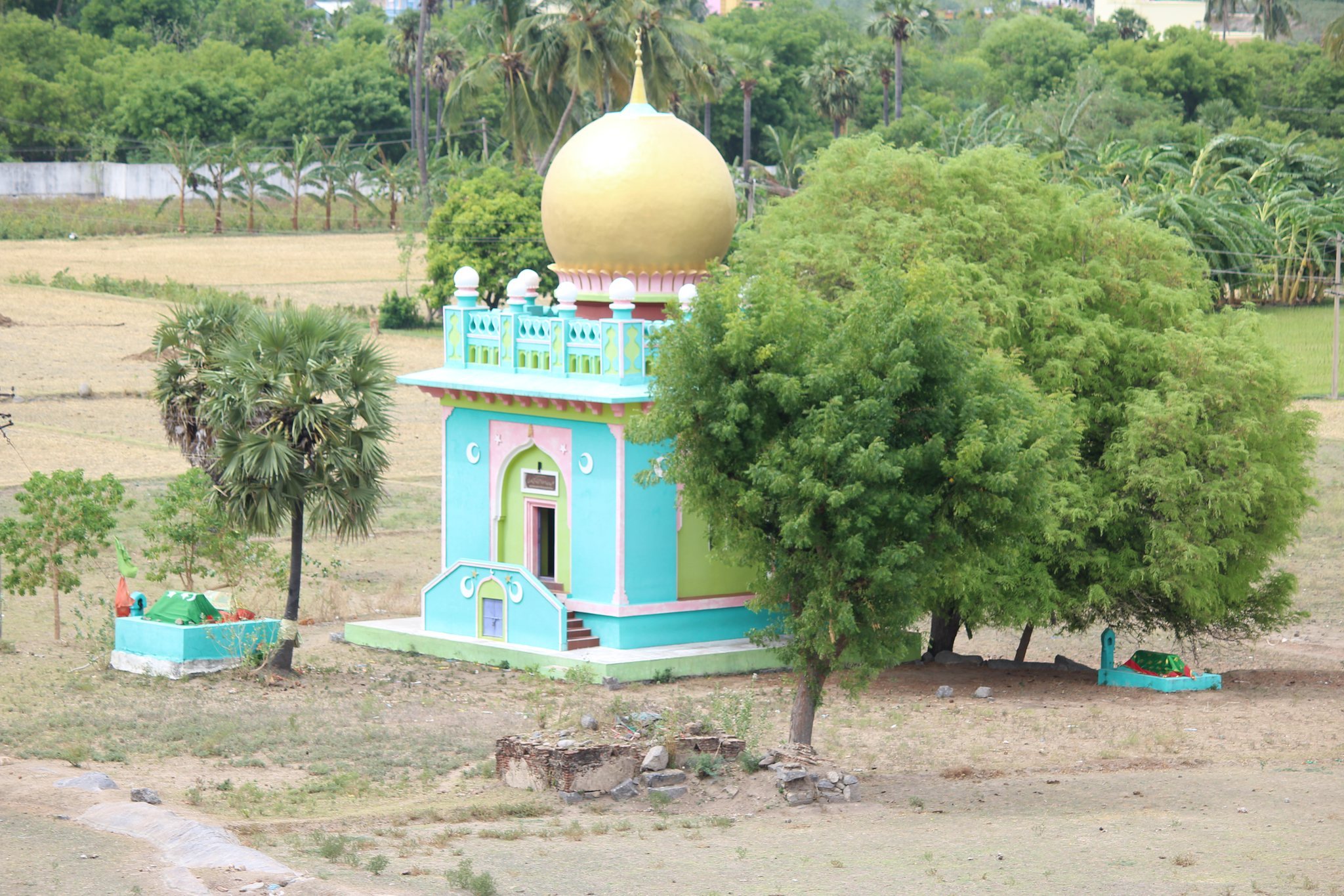
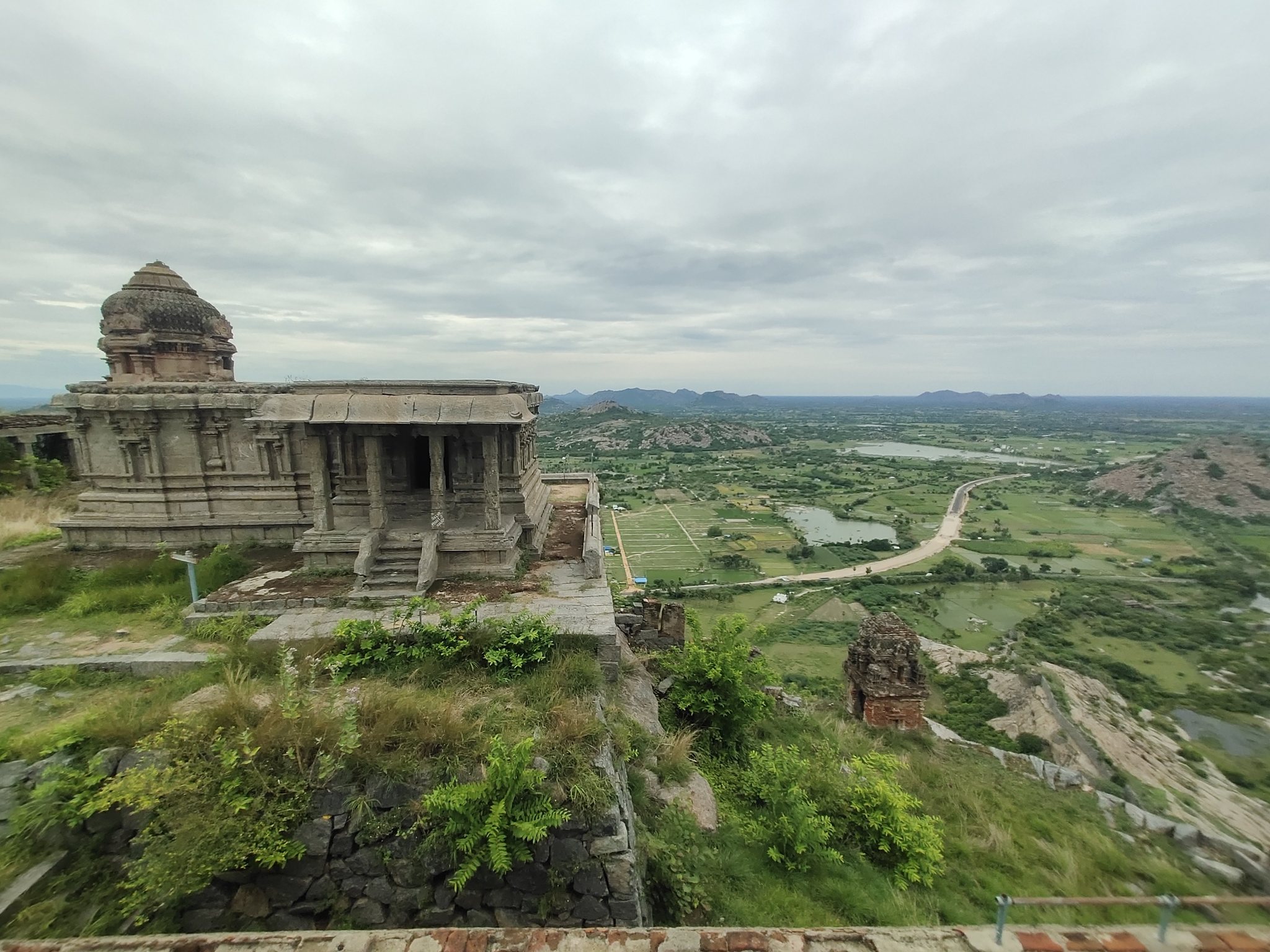
Religious buildings on Rajagiri include the Kamalakanni Amman Temple, Ranganathar Temple, Venugopalaswami Temple, Venkataramanaswami Temple, and Pattabhi Ramaswami Temple. Sadatulla Khan’s Mosque and other shrines occupy the hill as well. The upper area includes a bell or clock tower, a watchtower, a cannon, a royal battery, and the drawbridge. A mural survives behind the Kamalakanni Amman Temple.
Lower Rajagiri Features
The lower Rajagiri enclosure includes Arcot Gate, Pondicherry Gate, the prison above Pondicherry Gate, the royal battery, Chettikulam, Chakrakulam, and a platform associated with the death of Raja Desingh. A large stone image of Hanuman stands within the enclosure. The prisoners’ well is associated with the reported execution of condemned prisoners, who were thrown into it and left to die of starvation.
Krishnagiri Citadel
Krishnagiri is the second major hill citadel. It is smaller and lower than Rajagiri and lies north of the road toward Tiruvannamalai. A flight of granite steps leads to the summit, where later-period buildings stand. The hill is also called English Mountain, possibly because British residents occupied its fort for a period. Damage caused by a cyclone in 1913 was followed by partial repairs, and the Archaeological Survey of India preserves the citadel.
Chandrayan Durg and Chakkiliya Durg
Chandrayan Durg, or Chandragiri, is linked to Rajagiri by a low rocky ridge and is also known as St. George’s Mountain. Later-period buildings are associated with it, while its slopes contain thorny shrubs and fallen stones from the fortification. Its military and strategic importance was lower than that of Rajagiri and Krishnagiri.
Chakkiliya Durg, also called Chamar Tikri, is the third principal fortification. The reason for its name is uncertain, although it may have been associated with Chamar warriors. Thorny vegetation and stones from the fortification cover much of the hill. The complex also includes a smaller fourth fortified hill, but its identification as Chandrayan Durg or Chakkiliya Durg is uncertain.
Museum and Movable Remains
The Archaeological Survey of India museum at the fort entrance displays sculptures associated with the different periods and ruling dynasties of Gingee. Guns and stone cannonballs remain scattered throughout the complex, alongside sculptural fragments connected with its successive historical phases. Temples dedicated to Hindu deities, mosques, shrines, sacred ponds, and water tanks together preserve the religious and practical features of the fortified settlement.