Ruins of Gedi: A Medieval Swahili Coastal Settlement
Site at a Glance
- Rating
- 4.5
- Popularity
- Medium
- Country
- Kenya
- Primary era
- Medieval
- External website
- Open
- Eras represented
- Medieval, Early Modern
- Civilizations
- Swahili
- Site type
- City
On this page16 sections
History
The Ruins of Gedi are the remains of a medieval Swahili settlement near Gede in coastal Kenya, within Arabuko-Sokoke Forest. The town was built by an African coastal community whose culture combined local traditions with Islam and Indian Ocean exchange. Its earliest known occupation dates to the eleventh or early twelfth century, and Gedi grew into one of the important settlements of the Swahili coast.
Foundation and early growth
Gedi developed after coastal trade had intensified from the sixth century onward. A grave marker dated by radiocarbon to AD 1041–1278 provides the earliest evidence for occupation and indicates that the first settlement probably arose during the eleventh or early twelfth century. Trade appears to have been an important reason for the town’s foundation and expansion.
The settlement formed part of the chain of Swahili towns that extended from southern Somalia to the Zambezi River. It probably supported about 2,500 inhabitants at its peak. Its coastal position and imported goods connect it with exchange networks reaching the Near East, Arabia, China, India, and Indochina. Goods traded along the Swahili coast included gold, ivory, enslaved people, ebony, mangrove poles, copper, copal gum, frankincense, myrrh, and rock crystal.
Before the outer wall was built in the fifteenth century, the settlement developed mainly in the northern part of the modern site. From the eleventh to the fourteenth centuries it expanded northward, westward, and southward. During the fifteenth century, settlement shifted toward the area around the Great Mosque. Smaller communities established near Gedi between the fourteenth and sixteenth centuries probably supplied the town with agricultural produce. These included sites at Mida Creek, Kiburugeni, Watamu, Shaka, and Kilepwa. A concentration of house sites identified at Chafisi near Mida Creek has been proposed as a possible outport, or subsidiary landing and trading place, but that interpretation remains hypothetical.
Islamic community and prosperity
The inhabitants adopted Islam during the twelfth century. Three mosques built in succession in the northern part of the settlement, between the twelfth and fourteenth centuries, reflect this development. The form of Gedi’s mosques has also led to an archaeological interpretation of local affiliation with, or influence from, Ibadism, a distinct branch of Islam. This interpretation is based especially on the buildings’ plans and their treatment of mosque architecture.
Gedi’s population and prosperity reached a peak during the fifteenth and sixteenth centuries. The town probably had a mixed economy based on livestock, farming, horticulture, fishing, craft production, and trade. Local activities included pottery making, metalworking, masonry, spinning, weaving, and possibly salt production. Crops included millet, African rice, cocoyam, coconuts, bananas, citrus fruits, pomegranates, figs, sugar cane, cotton, and vegetables. Cattle were probably the principal livestock, alongside sheep, goats, and chickens.
Imported ceramics, glass beads, and two Chinese coins show that Gedi participated in long-distance exchange. Cowrie shells were found in house storerooms in greater abundance than struck coins and may have served as the town’s principal currency. Beads may also have been used in exchange. These material links, together with the town’s urban organization and Islamic buildings, place Gedi within the wider history of African coastal communities rather than treating its coral-stone architecture as evidence of an Arab or foreign settlement.
Abandonment and local traditions
Gedi was abandoned by the middle of the seventeenth century. Portuguese efforts to monopolize Indian Ocean trade and their armed intervention are considered major factors in the decline. Other possible contributors include falling water levels, a Wazimba raid along the coast in 1589, and Oromo migrations and raids from Somalia. The relative importance of these pressures remains unsettled, and the abandonment appears to have resulted from several circumstances rather than one clearly identified event.
Local Giriama communities, one of the Mijikenda peoples of the Kenyan coast, have long known the ruins and maintain a community around them. They regard Gedi as a sacred and spiritual place. Local traditions describe ancestral or evil spirits inhabiting the ruins and hold that the spirits of former priests protect the site and curse those who damage it.
Rediscovery, excavation, and protection
Sir John Kirk, the British resident of Zanzibar, visited Gedi in 1884, after which colonial officials began recording the ruins. The site attracted wider attention after its rediscovery in the 1920s. Gedi became a historic monument in 1927 and a protected monument in 1929, following the removal of Chinese porcelain inlays by looters. Restoration of structures threatened with collapse began in 1939.
Excavation began in 1948 under James Kirkman and continued until 1958, with intermittent work during the 1960s through the 1980s. Kirkman excavated the palace, mosques, houses, and parts of the town centre while clearing and repairing walls. The Great Mosque was excavated in 1954 and the palace in 1963. Further vegetation clearance and repair work took place from 1948 to 1959 after Gedi and the surrounding forest were declared a national park.
Research intensified from the 1990s. A topographical survey in 2001 mapped the distribution of neighbourhoods, while investigations examined the mud-and-thatch areas between the walls and the development of the town before the fifteenth century. Research in 2002–2003 also examined coral houses associated with social elites. Administration passed to the National Museums of Kenya in 1969, and the site is managed by its Department of Coastal Archaeology. A museum completed in 2000 contains a permanent exhibition on Swahili culture.
The historic town and archaeological site was inscribed on the UNESCO World Heritage List on 29 July 2024. Its World Heritage value rests on the combined evidence of Swahili civilization, cultural exchange, urban planning, architecture, archaeological deposits, and continuing cultural associations. Spatial documentation completed in 2010 provided the basis for a three-dimensional model of the site.
Remains
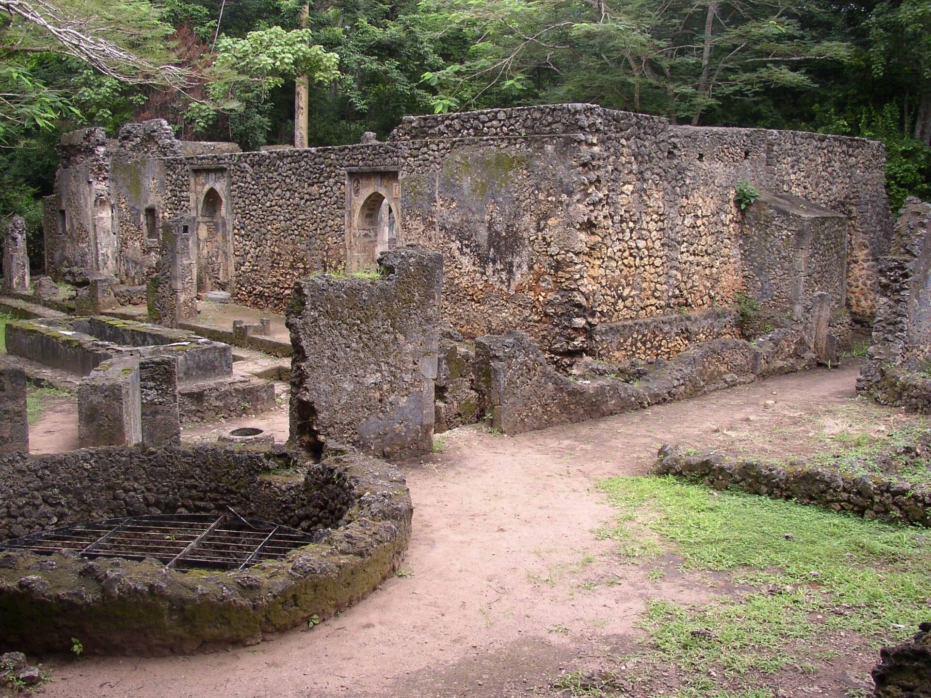
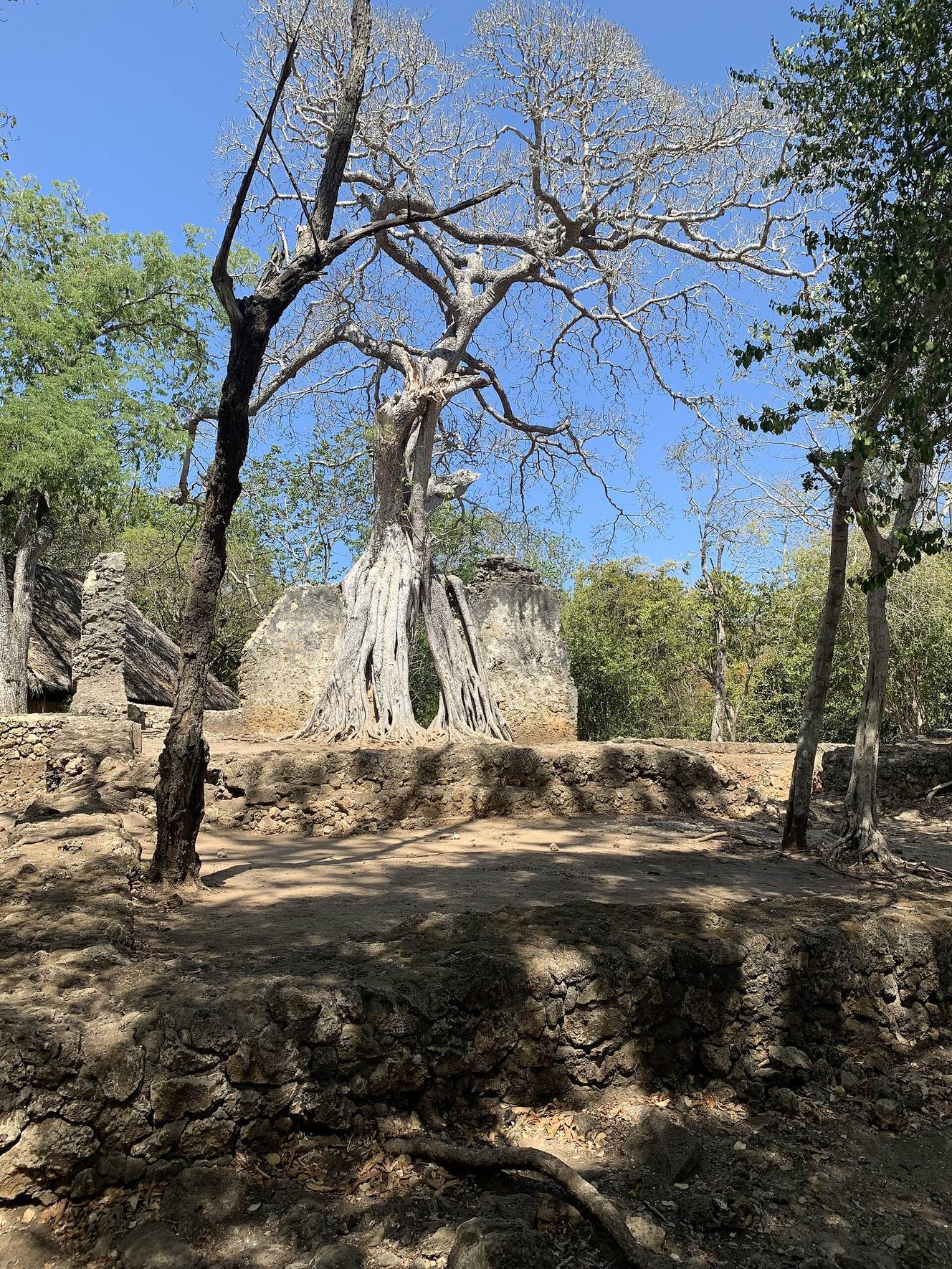
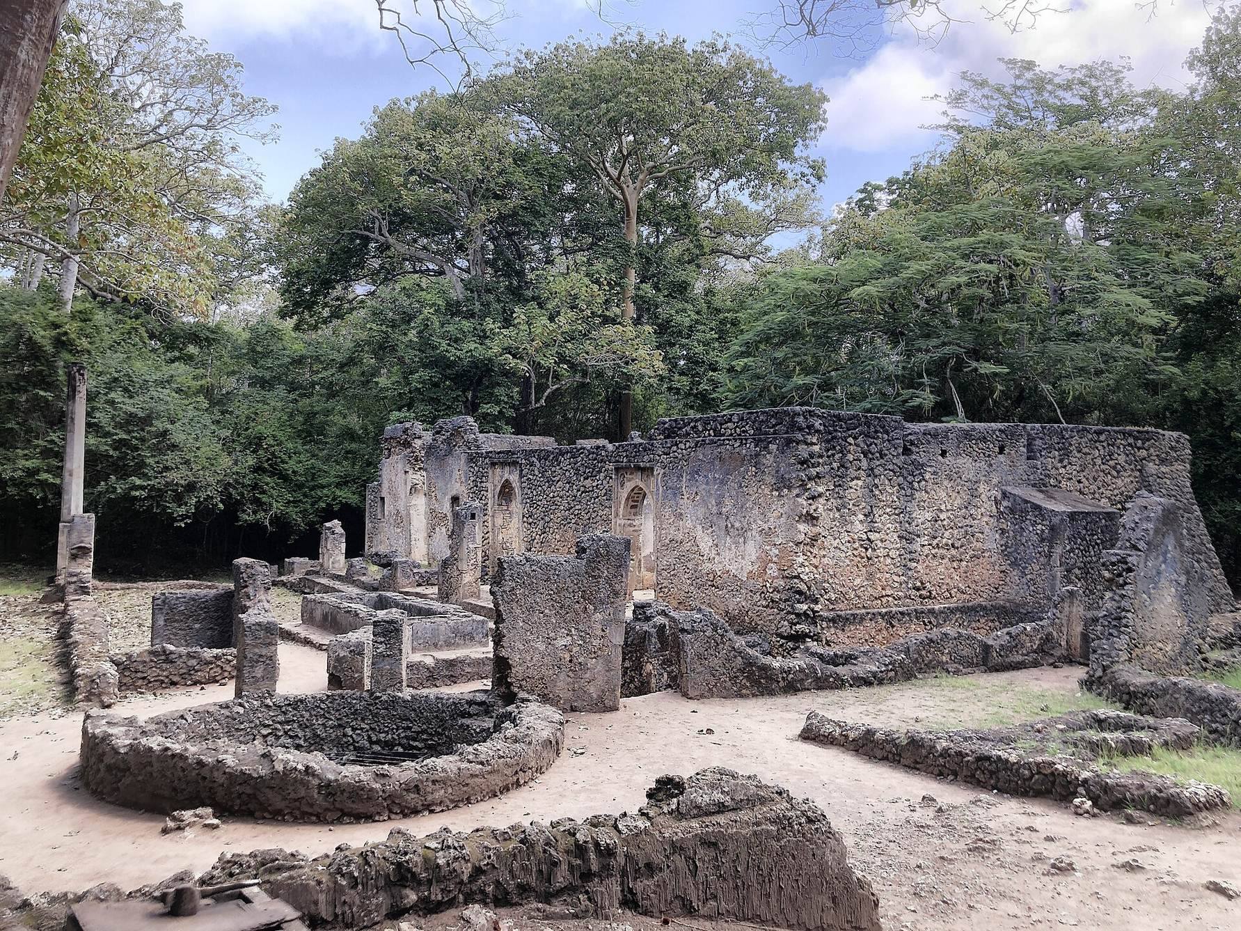
The site covers about 45 acres, or 18 hectares, within Arabuko-Sokoke Forest. An outer wall encloses the wider town, while an inner wall surrounds an area of about 18 acres, or 7.3 hectares. Gedi consisted of a walled urban centre and outlying settlement areas. Streets appear to have followed a grid pattern, and wells, storm-water collection sumps, and lavatories in major buildings indicate established infrastructure.
Walls and urban layout
The outer wall is about 9 feet high and 18 inches thick. It was coated with plaster and is generally attributed to the fifteenth century. The inner wall has been associated with the Portuguese presence on the coast during the sixteenth century, and its gun ports have been used to argue for a later date. The inner wall has a more evident defensive character and has been interpreted as a fortification, although the military effectiveness of both walls remains uncertain. Their gates and construction may also have helped define social boundaries within the settlement.
Most inhabitants lived in mud-and-thatch houses concentrated between and beyond the walls. Floors, postholes, artefact scatters, and dense deposits extend beyond the surviving stone core. Important buildings and elite residences were increasingly built from coral stone from the fourteenth century onward. Coral stone, a limestone formed from ancient coral deposits, was laid with lime mortar. The surviving buildings are single-storey structures, and their foundations were generally shallow and close to the width of the walls above them.
Religious and commemorative buildings
The Great Mosque inside the inner wall
The building traditionally called the Great Mosque is a rectangular fifteenth-century mosque inside the inner wall. Its central room had three entrances and three rows of pillars supporting the roof. One entrance has a spear-point relief with a shield on its spandrel, the triangular space between an arch and its rectangular frame. The eastern entrance has an architrave, or framed architectural element around an opening, decorated with a herringbone pattern. The walls are about 21 inches wide and extend roughly 4 feet into the ground, making them among the deepest foundations at Gedi.
The northern mosque complex
A second Great Mosque stands in the older northern part of the settlement, occupied from the eleventh century. The surviving structure dates from the fourteenth century and was built over two earlier mosques from the twelfth and thirteenth centuries. It measures 26 metres, or 85 feet, along its north–south axis.
Gedi’s mosques had wells and washing facilities for purification before prayer. Their usual plan consisted of a central roofed room flanked by anterooms, with wooden beams resting on square stone pillars. The pillars formed aisles within the prayer space, while the mihrabs, prayer niches indicating the direction of Mecca, were placed in the northern walls. Doorways commonly used square-framed pointed arches, and mosque decoration included carved or porcelain-inlaid spandrels and architraves.
Pillar tombs
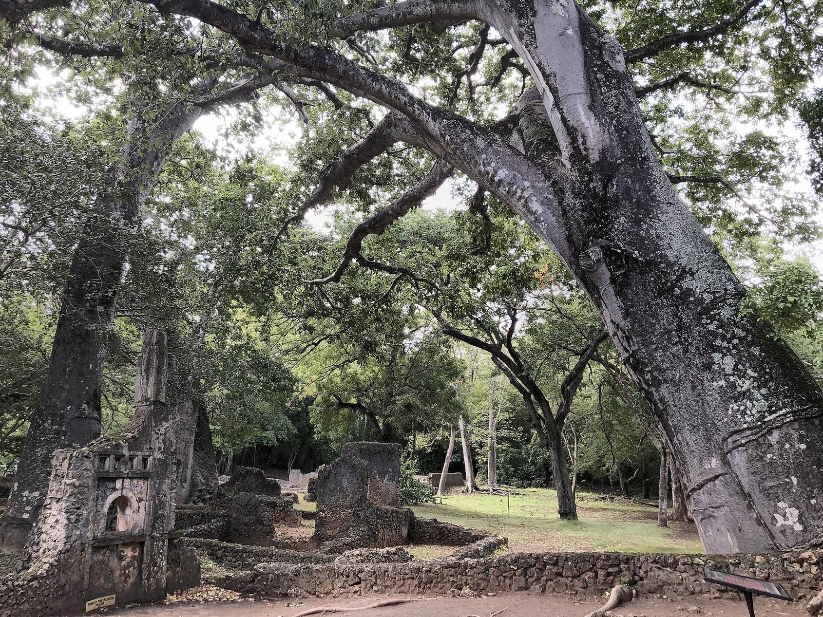
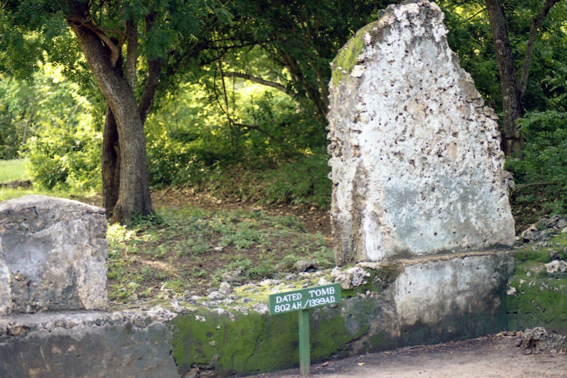
Four large pillar tombs survive at Gedi. A pillar tomb is a masonry burial structure crowned by a pillar or column, a form characteristic of medieval Swahili coastal architecture. The tomb inside the inner wall carries an Arabic inscription dated AH 802, corresponding to AD 1399. Tomb decoration includes recessed panels and other architectural details in the same coral-stone building tradition seen elsewhere in the town.
Palace and residential quarters
The palace or sheikh’s residence
The palace, also described as a sheikh’s residence, was organized around a large central room with two anterooms, each connected to its own courtyard. Residential rooms opened from the main hall. Two further courts, an audience court and a reception court, were entered through separate gates. The building represents the administrative and residential architecture of Gedi’s elite.
Elite houses
The stone residences inside the inner wall include the House on the Wall, House on the West Wall, House of the Dhow, and Large House. A group of smaller houses beside the palace includes the House of the Chinese Cash, House of the Porcelain Bowl, House of the Cistern, House of the Two Rooms, House of the Paneled Walls, House of the Scissors, House of the Venetian Bead, House of the Sunken Court, House of the Cowries, House of the Iron Lamp, House of the Iron Box, and House of the Well.
The basic house was generally arranged as three rooms with a forecourt and a domestic court. A long main room was joined by storage and sleeping rooms at the rear, while some houses had a storage compartment at roof level reached through a trapdoor. Latrines were commonly placed near the rear of the main room, and some courtyards contained wells. One of the oldest stone houses dates to the fourteenth century and has a long, narrow sunken court. Fifteenth-century houses generally had wider and deeper courts, while their varied entrance passages reflect dense construction and the efficient use of available space.
Outlying settlements
Gedi’s hinterland contains isolated mosques and tombs as well as groups of houses. Kilepwa, on an island in Mida Creek, has three stone houses. Other associated remains include an isolated mosque at the western end of the creek, a mosque at Watamu, and a mosque and tombs at Kiburugeni. These sites form part of the wider settlement landscape connected with Gedi.
Archaeological finds and material culture
Excavations recovered abundant beads and ceramics that help establish occupation dates and trade connections. Finds associated with individual houses include two Chinese coins, a porcelain bowl, scissors, a Venetian bead, cowrie shells, an iron lamp, and an iron box. The bead assemblage includes cane-glass cylinders, wound-glass biconical and lenticular beads, and pressed-glass spheres. Kirkman recovered 631 beads from six archaeological layers, most of which were made from opaque glass.
Yellow, green, and black wound and pressed-glass beads were especially common in fourteenth-century layers and continued into later deposits. Small drawn cane-glass beads were frequent in fourteenth- and fifteenth-century levels. Their colours included green, opaque red, yellow, and black, with blue, brown, and red occurring less often.
Ceramics include Chinese porcelain, Islamic glazed wares, and locally made earthenware. Imported pottery came from China, South Asia, and the Islamic world. Finds include celadon, a usually green-glazed ceramic associated especially with East Asian imports, sgraffiato pottery decorated by scratching designs through its surface coating, Yemeni black-on-yellow ware, blue-and-white figured wares, polychrome stoneware possibly made in Persia or India, and partially grey-glazed bowls probably from Indochina.
Chinese imports include celadon and blue-and-white porcelain, and porcelain fragments were also set into mosque decoration. Local pottery was hand-shaped, generally unglazed, and probably fired in open fires. Fifteen potters’ marks occur on pottery from fifteenth- and sixteenth-century deposits, suggesting that Gedi may have had a communal kiln. Local wares continued alongside imported ceramics throughout the later occupation.
Ceramic styles changed through time. Celadon was especially important in the fourteenth century, while blue-and-white porcelain gradually replaced it during the fifteenth century. Monochrome Islamic wares replaced black-on-yellow types, and local pottery shifted from shorter-necked to longer-necked vessels while using fewer incised designs. Deposits reached depths of up to 5 feet. The tomb dated to AD 1399 provides a chronological reference for the layers, with different combinations of celadon, Islamic wares, and Chinese porcelain occurring above and below it.