Fort McIntosh: A Continental Army Frontier Fort in Pennsylvania
Site at a Glance
- Rating
- 4.6
- Popularity
- Very Low
- Country
- United States
- Primary era
- Early Modern
- External website
- Open
- Eras represented
- Early Modern, Modern
- Civilizations
- Unclassified
- Site type
- Military
- Remains
- Fort
On this page8 sections
History
Fort McIntosh is an early American log frontier fort built by the Continental Army in 1778 near Beaver, Pennsylvania, in the United States. Erected during the American Revolutionary War, the conflict in which the thirteen American colonies fought for independence from Britain, it was the first American fort north of the Ohio River when completed.
Construction during the Revolutionary War
Construction followed a conference at Fort Pitt, the major Continental-era fortification at present-day Pittsburgh. The United States agreed to build the fort to help protect Native American communities from British or allied attacks in exchange for Delaware cooperation during the war. Lieutenant Colonel Cambray-Digny, a French engineer, directed the work, which was completed by autumn 1778.
The fort stood near the confluence of the Ohio and Beaver Rivers. General Lachlan McIntosh then moved about 1,500 men from Pittsburgh to Beaver, making the new position part of the campaign to control the Northwest Territory and the Ohio Valley. The Northwest Territory was the large region north and west of the Ohio River organized by the United States after the war. The fort took its name from Lachlan McIntosh, a Scottish-born American military officer and Continental general.
The Treaty of Fort McIntosh
On January 21, 1785, the Delaware, Wyandots, Chippewas, and Ottawas entered the Treaty of Fort McIntosh. The agreement sought to establish clear title to Delaware lands in Pennsylvania so Revolutionary soldiers could purchase them with depreciation certificates, wartime pay certificates whose value had fallen through inflation. Its third article transferred about two-thirds of present-day Ohio and established the first boundary in the Northwest from which later territorial boundaries were measured. The treaty has been characterized as an imposition rather than an equal negotiation.
Postwar use and abandonment
After the Revolutionary War, Fort McIntosh became the home of the First American Regiment, an early regular United States Army regiment formed during the Revolutionary era and described as the oldest active unit in the United States Army. The fort was abandoned by the early 1790s. Rangers, hunters, and spies later used it for shelter, but its military usefulness declined as the frontier moved westward. Supply shortages, vandalism, and deterioration also contributed to its decline. By 1795, the roofs had decayed, leaving only the western wing standing.
Excavation and preservation
Beaver residents began locating and excavating the fort in 1974 with assistance from the University of Pittsburgh and the Carnegie Museum. Four years of digging recovered 80,000 identifiable artifacts. A dedication ceremony took place at the site on October 7, 1978, led by U.S. Army General William Westmoreland.
Pennsylvania placed a state historical marker at the site in 1946, and Fort McIntosh was listed on the National Register of Historic Places in 1975. In 1996, it became part of the Beaver Historic District, where it was identified as one of the district’s most significant contributing properties among approximately 1,250 properties. The Beaver Area Heritage Foundation protects the restored site. A local business owner funded a granite and sandstone memorial in late 2010. Fort McIntosh Day continues to commemorate the fort through demonstrations of eighteenth-century daily life, cannon-fire reenactments, and regimental drills.
Remains
Fort McIntosh occupied ground near the meeting of the Ohio and Beaver Rivers. A 130-foot slope toward the Ohio River formed one side of its natural defense, while a ditch about 15 feet wide protected the other three sides. The fort’s trapezoidal plan measured approximately 150 feet on each side, with raised earthen bastions at the corners and log palisades connecting them. A bastion was a projecting fortified position at a corner, while a palisade was a defensive barrier made from closely set logs.
Interior structures
Inside the enclosure were three barracks, warehouses, officers’ quarters, a forge, a kitchen, and powder magazines. Supplies carried along the Ohio River could enter through an underground passage. The fort may have mounted either two or four iron cannons, although the number remains uncertain.
Excavated foundations and memorials
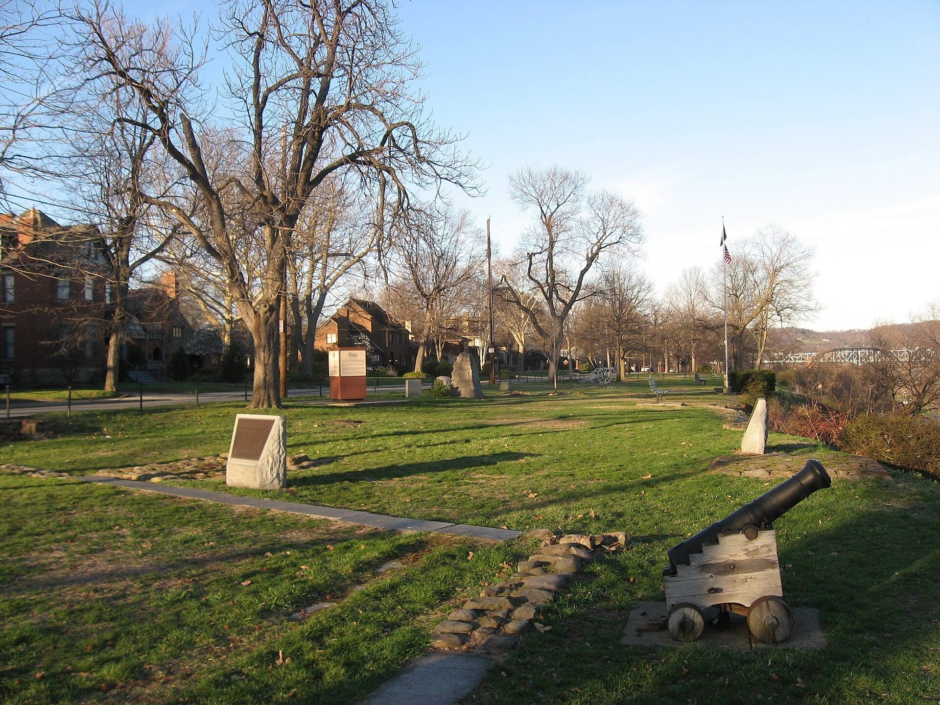
Excavation exposed stone footers marking the positions of the fort’s walls and fireplaces. These masonry foundation bases, which supported or marked the position of walls and other structures, remain part of the restored site. Granite monuments and bronze plaques accompany the original footers, preserving the physical outline and interpretation of the former fort.