Las Labradas: A Pre-Columbian Rock-Art Site in Sinaloa, Mexico
Site at a Glance
- Rating
- 4.8
- Popularity
- Low
- Country
- Mexico
- Primary era
- Iron Age
- Eras represented
- Iron Age, Classical, Medieval
- Civilizations
- Unclassified
- Site type
- Civic
- Remains
- Rock Art
On this page6 sections
History
Chronology and Cultural Setting
Las Labradas is a pre-Columbian rock-art site on a Pacific beach in San Ignacio Municipality, Sinaloa, Mexico. The civilization responsible for its engravings has not been identified. The site is associated with a broad period extending from the end of the Archaic period to the Middle Formative period, approximately 1000–300 BCE. In Mesoamerica, these periods encompass early societies and the development of increasingly settled and socially complex communities.
The chronology is not uniform across the site. Some petroglyphs have been assigned to the ninth or tenth centuries CE, while others may be thousands of years old. Similar carved images occur at several Mesoamerican sites between Mexico and northern Costa Rica, placing Las Labradas within a wider tradition of rock art without establishing a single cultural attribution for its engravings.
Research and Protection
Mexico’s National Institute of Anthropology and History, the federal institution responsible for archaeological research, conservation, and heritage management, has carried out a research project at Las Labradas since 2009. This work supported the protection and conservation of the site.
Las Labradas was the first archaeological zone opened to the public in Sinaloa. It became an Archaeological Monuments Zone on 30 November 2012 and was added to Mexico’s UNESCO World Heritage tentative list on 7 December of the same year. A tentative-list entry identifies a site that a country may propose for future World Heritage nomination, but it is not an inscription on the World Heritage List. The archaeological zone lies within La Meseta de Cacaxtla, a 508-square-kilometre protected natural area containing diverse ecosystems and endemic plant and animal species.
Remains
Coastal Setting and Basalt Blocks
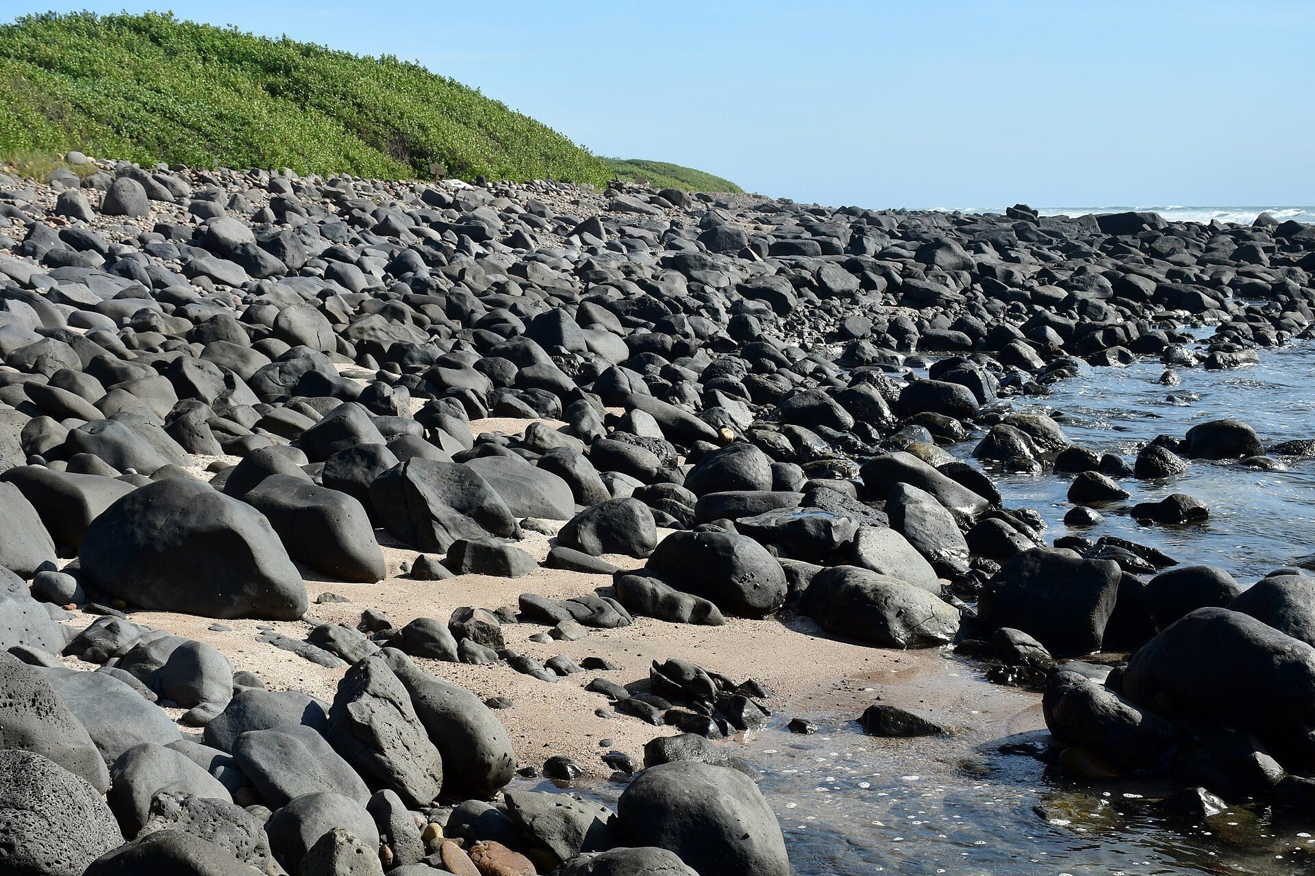
The archaeological zone covers 17.5 hectares along a beach near the fishing village of Barras de Piaxtla, on the southern coast of the Gulf of California. It lies between the El Yugo estuary and the La Chicayota salt marsh, near the mouth of the Piaxtla River and approximately 29 kilometres north of the Tropic of Cancer. The beach extends for about 343 metres and averages 40 metres in width.
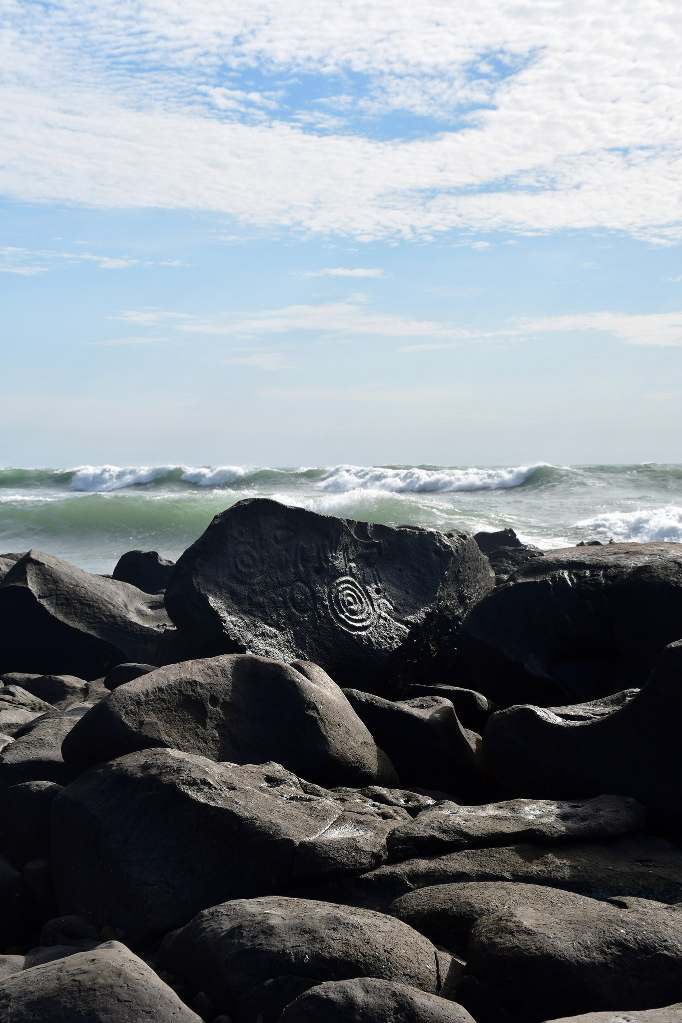
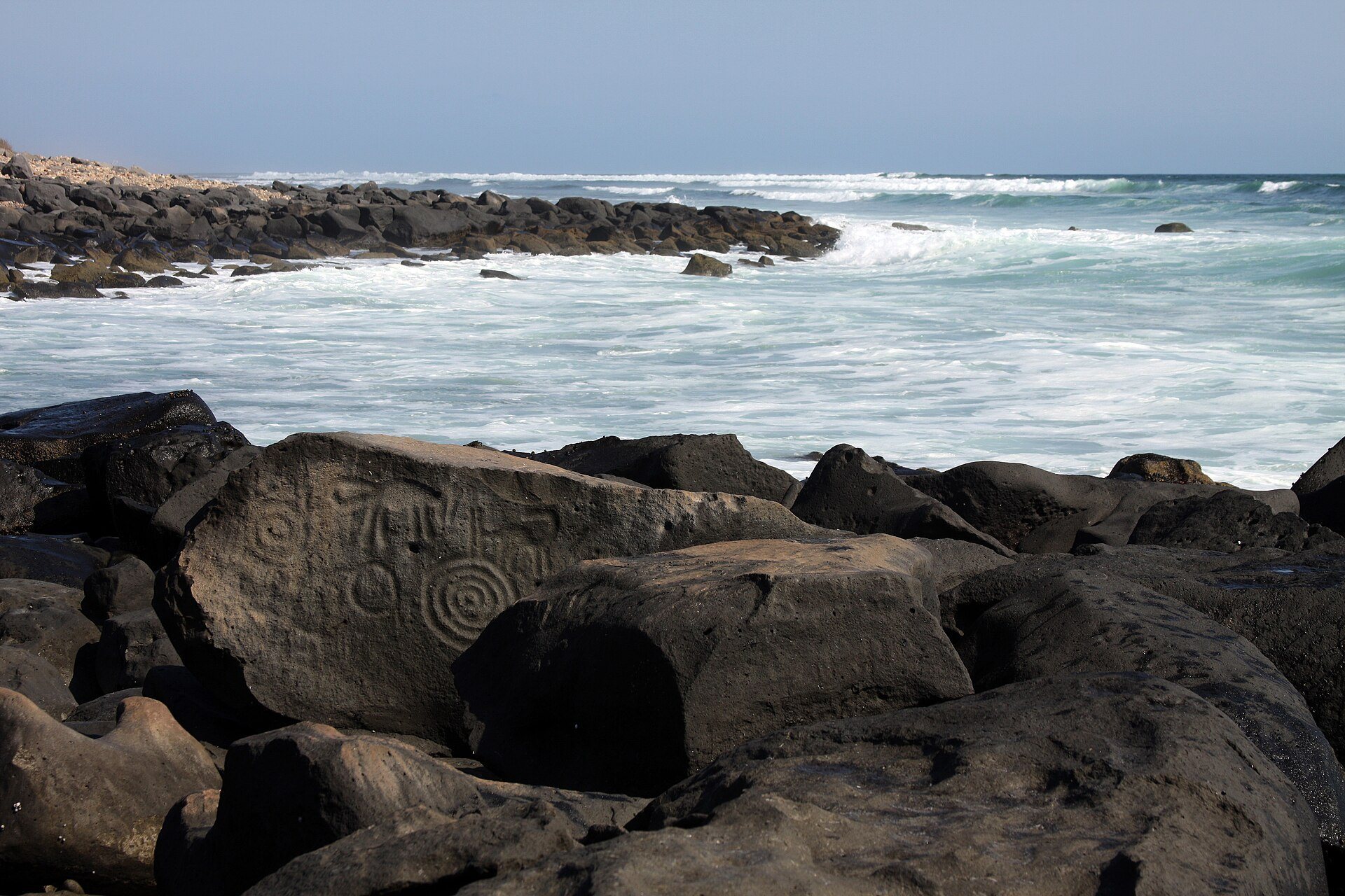
Volcanic basalt blocks are distributed across the beach. Their very dark surfaces vary in size and have been rounded and polished by wave erosion. Some blocks are covered completely by the ocean at high tide, placing the site within an intertidal zone, the area between high and low water. Regional investigations also identify La Ventana, a volcanic-rock cliff, as the location where most of the area’s petroglyphs were made. A museum associated with Las Labradas stands a few dozen metres from the beach.
Petroglyphs and Engraving Techniques
More than 600 petroglyphs have been inventoried at Las Labradas. A petroglyph is an image or symbol worked into a rock surface. The carvings include stylized human figures, animals, plants, flowers, fish, zoomorphic figures, concentric circles, spirals, suns, crosses, and other geometric forms. Their distribution does not appear to follow a fixed pattern, and some basalt blocks carry several separate engravings.
The images were produced through abrasion, which removes or wears away the stone surface, and percussion, which creates marks by striking the rock. Both low and high relief appear among the carvings, whose forms and working methods indicate highly skilled engraving. The site is described as Mexico’s largest concentration of petroglyphs and as the only known site of its type situated in an intertidal zone.
Numerous solar motifs occur among the carvings. Their presence, together with the site’s proximity to the Tropic of Cancer, has led to an interpretation connecting Las Labradas with the summer solstice. This remains an inference based on the imagery and location rather than a confirmed explanation of the site’s purpose.