Sungbo’s Eredo: A Vast Defensive Earthwork in Nigeria
Site at a Glance
- Rating
- 4.2
- Popularity
- Very Low
- Country
- Nigeria
- Primary era
- Medieval
- Eras represented
- Medieval
- Civilizations
- Yoruba
- Site type
- Military
- Remains
- Wall
On this page6 sections
History
Sungbo’s Eredo is an extensive system of defensive banks and ditches in Ibonwon, Nigeria, associated with the historical Ijebu Kingdom in what is now southwestern Nigeria. The earthwork was built by the Ijebu, a Yoruba polity, but its date remains disputed. Local history places its construction between approximately AD 800 and 1000, while Patrick Darling proposed the tenth or eleventh centuries. Later excavations, including work on a section dated to the early fifteenth century, have instead indicated construction in the late fourteenth or early fifteenth century.
Political and defensive development
The Eredo appears to have been created for defence during a period of political confrontation and consolidation in the rainforest of southern Nigeria. Its construction may have helped unite diverse communities within a single kingdom, and its scale indicates the existence of a large organized political community before the expansion of transatlantic trade. The earthwork may also belong to a wider western Nigerian tradition of large banks and ditches, including works around Ife and Ilesa and the Benin Iya earthworks in the neighbouring Edo-speaking region.
The conflicting dates affect how the monument’s development is understood. Earlier interpretations placed it in the tenth or eleventh centuries, whereas archaeological work in 2016 produced evidence for a later construction phase. An excavated section dated to the early fifteenth century supports a late fourteenth- or early fifteenth-century chronology for at least part of the system.
Bilikisu Sungbo and local tradition
Ijebu tradition connects the Eredo with Oloye Bilikisu Sungbo, a wealthy, childless widow and noblewoman. Oloye is a Yoruba chiefly title or honorific. The monument is traditionally regarded as her memorial, and her supposed grave lies at Oke-Eiri, just north of the earthwork.
The association has also led to a connection with the Queen of Sheba, the biblical and Quranic ruler traditionally linked with a wealthy kingdom and an encounter with King Solomon. In the Quran she is identified as Bilqis, while the relationship with Bilikisu Sungbo is a later local interpretation. Archaeology has shown that the monument’s chronology is incompatible with identifying it as the work of the historical Queen of Sheba. Christians, Muslims, and practitioners of African traditional religions nevertheless make annual pilgrimages associated with Bilikisu Sungbo and her supposed grave.
Research and preservation
Peter Lloyd carried out the first excavation of the Eredo. In September 1999, the British archaeologist Patrick Darling surveyed and publicized the monument in an effort to promote its preservation and bring it to wider attention. Before that campaign, knowledge of the Eredo was concentrated mainly among local residents and specialists in Yoruba history.
The Eredo and the walls of Benin City were placed on Nigeria’s tentative list of potential UNESCO World Heritage Sites in 1995. During the 2010s and 2020s, documentation and preservation work included collecting local oral histories, mapping, and non-invasive digital recording. In 2024, Augustine University Ilara partnered with Gérard Chouin and researchers from William and Mary on LiDAR mapping. LiDAR, or light detection and ranging, uses laser pulses to map ground surfaces and can reveal earthworks beneath vegetation. Further archaeological study remains necessary to establish a complete historical interpretation.
Remains
Sungbo’s Eredo survives as an extensive earthwork landscape rather than a continuous masonry wall. Its fortifications form an irregular ring around the territory of the former Ijebu Kingdom, extending for more than 160 kilometres. The enclosed area measures approximately 40 kilometres from north to south and about 35 kilometres from east to west.
Ditches and embankments
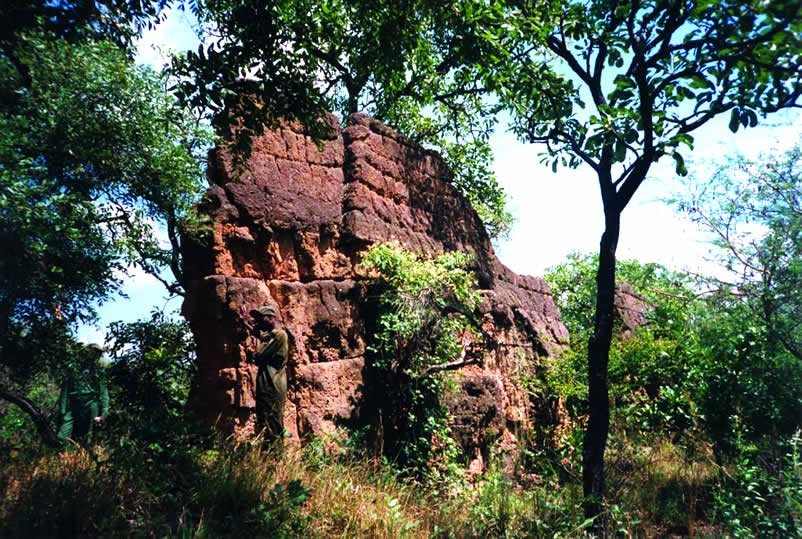
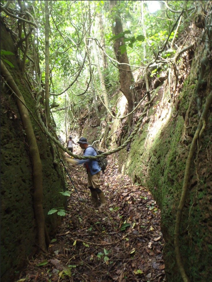
The principal construction consists of a ditch with unusually smooth sides and an embankment on its inner edge. The difference between the ditch bottom and the top of the bank can reach 20 metres. Laterite, a tropical earth rich in iron oxides and clay, formed the main material of the banks and excavated earthwork. Trees and other vegetation now flank sections of the fortifications, turning parts of the ditch into tunnel-like green passages.
The builders appear to have excavated toward groundwater or a clay layer to produce a muddy or swampy bottom. Where clay or groundwater lay close to the surface, digging may have stopped at about one metre. Small conical statues or idol figures may have been placed at the bottom of the ditch or along its upper edge. Together, the banks, ditches, and associated features create an earthwork system whose scale and complex construction underpin its archaeological importance.