Kay-Nah-Chi-Wah-Nung: An Indigenous Cultural and Burial Centre on the Rainy River
Site at a Glance
- Rating
- 4.7
- Popularity
- Very Low
- Country
- Canada
- Primary era
- Medieval
- External website
- Open
- Eras represented
- Classical, Medieval, Early Modern
- Civilizations
- Unclassified
- Site type
- Burial
- Remains
- Necropolis
On this page14 sections
History
Kay-Nah-Chi-Wah-Nung, also known as Manitou Mounds, is an Indigenous habitation, trading, ceremonial, and burial centre on the Rainy River near Chapple, Ontario, Canada. Its earliest known occupation dates to approximately 5,000 BP, meaning 5,000 years before the conventional archaeological reference date of 1950. The site is sacred to the Ojibway and remains connected with their communities, while its position within a major continental waterway network brought people from many regions together.
Early occupation and the Rainy River waterways
The earliest known residents were mobile Archaic hunters, fishers, and gatherers. The Archaic Period was a broad North American era associated with mobile hunter-gatherer societies before later village traditions developed. These communities participated in long-distance trade, and the Rainy River gave the site access to an extensive network of waterways.
Kay-Nah-Chi-Wah-Nung stands at the Long Sault Rapids, a stretch of rapids whose importance came from transportation, fishing, and its position between larger water systems. The Ojibway and their ancestors used the rapids for fishing. Because the water did not freeze, fish could be obtained in every season, supporting relatively large populations. The south-facing hills above the river also supplied areas for growing, gathering, and exchanging medicinal plants, including plants brought by visiting First Nations communities.
Over many centuries, the site became a place where people traded, shared food and knowledge, celebrated, mourned, and met communities from elsewhere on the continent. The site is described as having been inhabited continuously for more than 5,000 years, while its interpretive centre presents approximately 10,000 years of Indigenous history in the wider region.
Laurel and Blackduck traditions
Between approximately 2,300 BP and 900 BP, communities associated with the Laurel culture established villages at Kay-Nah-Chi-Wah-Nung. Laurel is an archaeological designation for an Indigenous cultural tradition identified through settlements, artefacts, burial practices, and other regional remains. Laurel communities built large, round burial mounds along the river. These earthworks were raised over or around human burials and also served as lasting commemorative monuments.
The later Blackduck culture, dating approximately from 1,200 BP to 400 BP, also built mounds along the Rainy River. Its mounds were generally low and linear, differing in form from the large, round Laurel examples. Together, these traditions left a landscape in which burial monuments, village sites, river terraces, and natural resources remained linked to community life.
European contact and the homesteading period
Kay-Nah-Chi-Wah-Nung came into direct contact with European fur traders and explorers during the seventeenth century. Indigenous people continued to live in the area through the fur-trade and settlement periods, maintaining the site’s connection with the Ojibway despite changing political and economic conditions.
Treaty 3, a nineteenth-century agreement between the Canadian Crown and Indigenous nations that defined relationships and land arrangements in the Rainy Lake and Lake of the Woods region, was followed by homesteading in the site area by the Rainy Lake First Nations between 1873 and 1916. Cabins and farm buildings from this period have been identified among the archaeological remains.
Recognition and continuing guardianship
Kay-Nah-Chi-Wah-Nung was designated a National Historic Site of Canada in 1969, at first under the name Manitou Mounds National Historic Site. Its heritage value includes the area’s ancient burial mounds and habitation sites, its natural setting, its connections with past and present cultures, and its continuing relationship with the Ojibway.
An interpretive centre opened in 1987 to present the prehistory and history of the Ojibway people of the Rainy River. Improvements supported by Parks Canada funding in 1995 included the Kay-Nah-Chi-Wah-Nung Historical Centre and a traditional roundhouse. The centre continues the site’s longstanding gathering function as an educational resource for Ojibway culture and a meeting place for Elders. Members of the Rainy River First Nations interpret the site, and the Rainy River First Nation remains its present-day guardian.
Remains
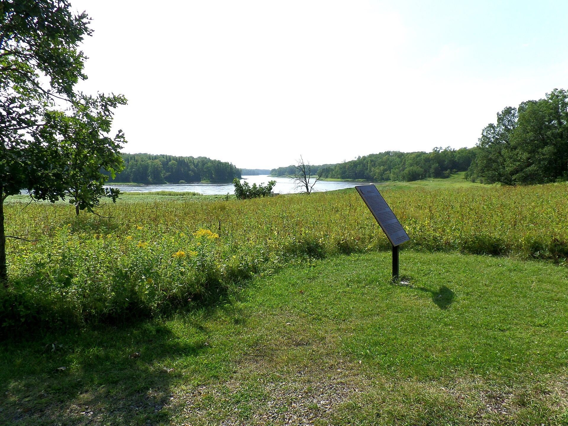
Kay-Nah-Chi-Wah-Nung occupies a strip of lowland about 500 metres wide and 3 kilometres long along the north bank of the Rainy River. The site lies in the Long Sault Rapids area between Rainy Lake and Lake of the Woods, approximately 54 kilometres east of Fort Frances. Its physical setting includes river terraces bearing burial mounds, prominent rapids, and south-facing hills overlooking the water. Across the wider region, a related mound network extends eastward from Quetico through the Rainy River and Lake of the Woods area into southeastern Manitoba.
Villages, river terraces, and natural resources
The site comprises approximately 30 village sites and 15 ancient burial mounds developed between approximately 5,000 BP and 360 BP. Around 20 archaeological sites are also identified within the historical-centre area. The villages occupied a landscape shaped by the river, while the rapids provided year-round fishing and the south-facing hills supported the cultivation, harvesting, and exchange of medicinal plants.
Burial mounds
Laurel mounds
Laurel burial mounds were built on river terraces along the north side of the Long Sault Rapids. They are large and round earthworks, with some rising to approximately 12 metres. Their construction created enduring monuments over or around burials and placed commemorative features within the same river landscape used for settlement, fishing, and gathering.
Blackduck mounds
Blackduck communities also constructed burial mounds along the Rainy River, but their examples were low and linear. These earthworks form a later layer within the mound landscape and preserve a distinct burial tradition associated with the Blackduck culture.
Historical Centre and reconstructed spaces
Kay-Nah-Chi-Wah-Nung Historical Centre
The Kay-Nah-Chi-Wah-Nung Historical Centre stands within a 90-hectare site surrounded by wilderness. Its futuristic building contains five galleries, a conservation laboratory, and collection storage for more than 10,000 artefacts. It serves as the gateway to the Manitou Mounds and presents Ojibway culture and the history of the Rainy River communities.
Village, camp, and roundhouse
The site also includes a reconstructed village, a tepee camp, and a traditional roundhouse. These spaces support interpretation of Ojibway culture and the site’s history while continuing the location’s longstanding role as a place for gathering. A trail approximately 3 kilometres long leads through the site and provides access to the burial mounds and other remains.
Homesteading remains
Archaeological remains from the period between 1873 and 1916 include cabins and farm buildings associated with homesteading by the Rainy Lake First Nations. These structures add evidence of the site’s continued Indigenous occupation after the treaty and through the settlement period.