Siege and Battle of Corinth Sites: Civil War Battlefield and Defensive District
Site at a Glance
- Rating
- 3.3
- Popularity
- Very Low
- Country
- United States
- Primary era
- Modern
- External website
- Open
- Eras represented
- Modern
- Civilizations
- Unclassified
- Site type
- Military
On this page21 sections
History
The Siege and Battle of Corinth Sites is a National Historic Landmark District in Corinth, Mississippi, United States, preserving places associated with three American Civil War engagements of 1862. The district encompasses the Siege of Corinth from April 29 to June 10, the Second Battle of Corinth on October 3–4, and the Battle of Hatchie Bridge near Pocahontas, Tennessee, on October 5.
Railroad junction and military importance
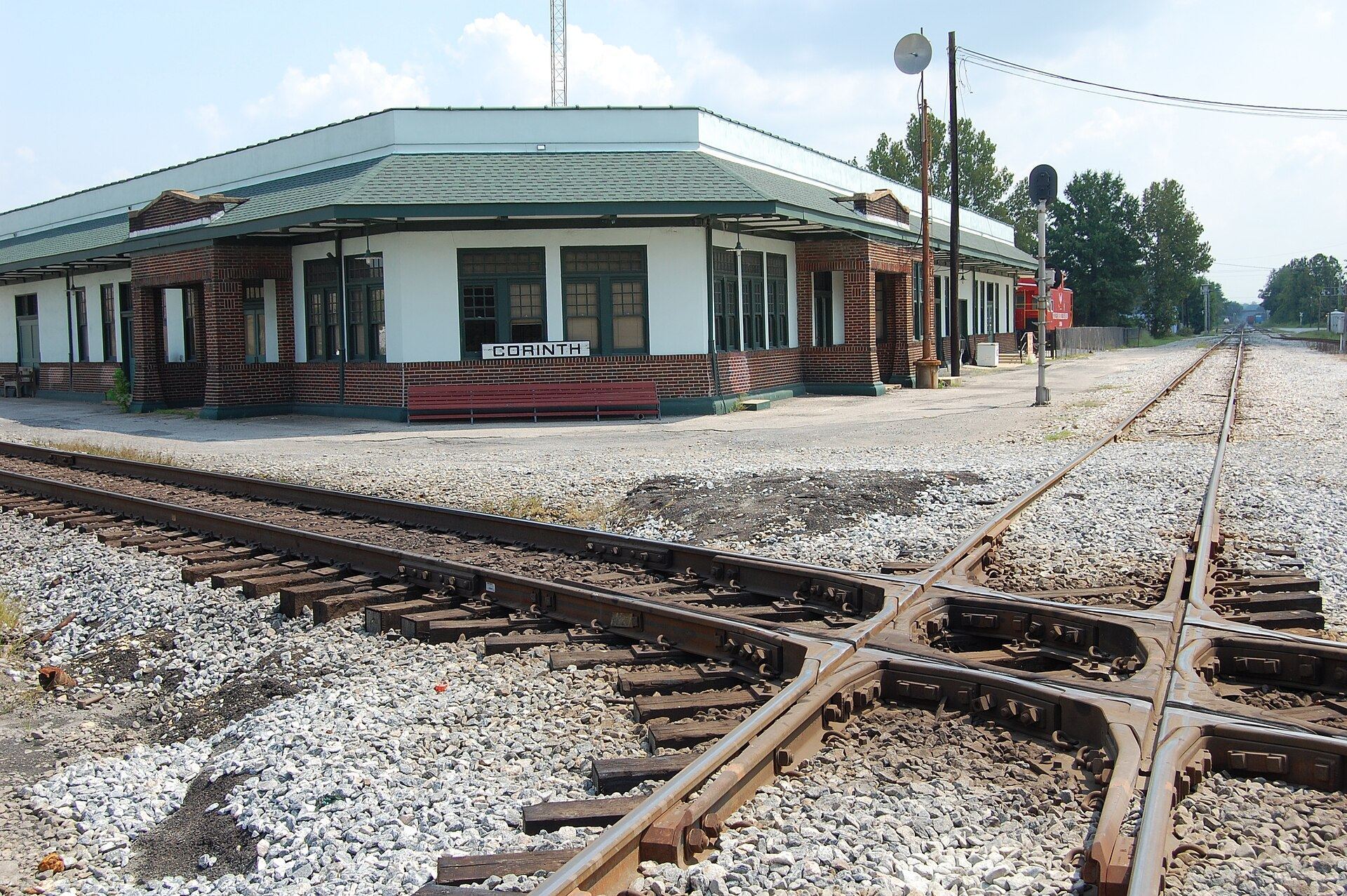
Corinth developed during the 1850s as a railroad town. Planning for the junction began in the middle of that decade, the Memphis and Charleston Railroad opened through the town in 1857, and the Mobile and Ohio Railroad followed in 1861. Their crossing made Corinth an important economic junction and, after the Civil War began, a strategically critical military center.
The American Civil War was the United States conflict of 1861–1865 between the Union, which supported the federal government, and the Confederacy, formed by seceded Southern states. Corinth’s railroad connections made control of the town important to military operations in the western theater.
The Siege of Corinth
After the Union victory at Shiloh in early April 1862, Confederate forces withdrew to Corinth. They strengthened the town with earthworks and other defenses to protect the railroad lines. During the siege that followed, Union forces advanced against the fortified position and compelled the Confederates to retreat.
The October battles
Confederate reinforcements arriving from the west later attempted to recapture Corinth during the Second Battle of Corinth. Union forces repulsed the attack with significant Confederate casualties. As the Confederates withdrew, Union troops moving to support operations around Corinth engaged them at the Battle of Hatchie Bridge near Davis Bridge in Hardeman County, Tennessee.
Preservation of the district
The district’s resources are discontiguous and extend across Alcorn County, Mississippi, and Hardeman County, Tennessee. Some Mississippi resources are preserved within Shiloh National Military Park, a federally administered park preserving Civil War battlefields and related military resources.
The district was designated a National Historic Landmark District and added to the National Register of Historic Places on May 6, 1991. Its resources include Confederate defenses erected before the siege, Union works constructed after Corinth was captured, buildings occupied by military commanders, and the railroad junction that formed the central strategic objective. The related Battle of Corinth Confederate Assault Position on Shiloh Road and Battery Williams lie outside the landmark district because they no longer retain sufficient integrity.
Remains
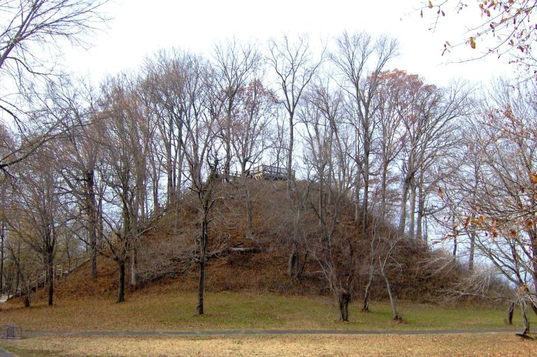
The district preserves a discontiguous collection of battlefield landscapes, earthworks, rifle pits, siege lines, buildings, a cemetery, and railroad features. Its military remains extend across Corinth and the surrounding area, while the Davis Bridge area lies within the larger Hatchie Bridge battlefield in Tennessee. The defensive works consist primarily of excavated and piled soil, with smaller rifle pits and artillery positions forming parts of the wider military landscape.
Battlefields and defensive works
First Phase Battle of Corinth
The First Phase Battle of Corinth area covers 157 acres. It forms one of the principal battlefield landscapes in the district and is associated with the fighting around Corinth during the first phase of the 1862 operations.
Battery F and Battery Robinette
Battery F occupies 1 acre, while Battery Robinette covers 20 acres. A battery was an artillery position, and these areas preserve defensive features associated with the military operations around Corinth.
Confederate earthworks and rifle pit
Confederate Earthworks between the Mobile and Ohio Railroad and Purdy Road cover 133 acres. The district also includes a Confederate Rifle Pit covering less than 1 acre. Earthworks were defensive constructions made primarily from excavated and piled soil, while a rifle pit was a smaller excavated position protecting infantry from enemy fire.
Harper Road Union Earthworks
The Harper Road Union Earthworks cover 3 acres. They represent part of the Union defensive system established after the capture of Corinth.
Union siege lines
Union Siege Line A covers 105 acres and is associated with the divisions commanded by Maj. Gen. William T. Sherman and Brig. Gen. Thomas A. Davies. Union Siege Line B covers 36.5 acres and is associated with divisions of the Army of the Tennessee and the Army of the Ohio. Union Siege Line C covers 6 acres and is associated with Paine’s Division of the Army of the Mississippi. A siege line was a connected defensive position established by an army conducting or resisting a siege.
Davis Bridge
The Davis Bridge area occupies 5 acres in Hardeman County, Tennessee. It represents the portion of the larger Battle of Hatchie Bridge battlefield included in the district.
Buildings and civic remains
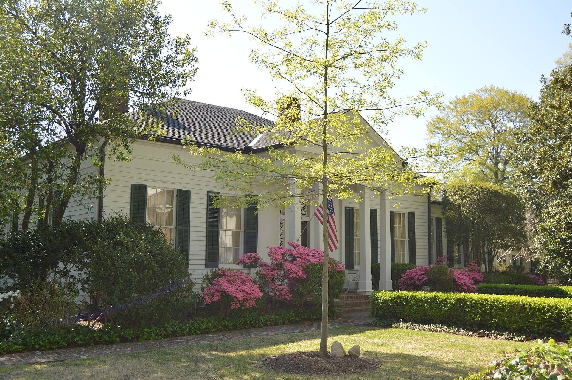
Fish Pond House
Fish Pond House stands at 708 Kilpatrick Street. It is one of four buildings associated with the district that lie within the Midtown Corinth Historic District.
Curlee House
Curlee House, also called Veranda House, stands at 705 Jackson Street. It forms part of the group of buildings connected with the district’s military history.
Oak Home
Oak Home stands at 808 Fillmore Street and is included among the associated historic buildings in Corinth.
Duncan House
Duncan House stands at 810 Polk Street. Together with Fish Pond House, Curlee House, and Oak Home, it represents the district’s surviving building resources.
Railroad and cemetery features
Railroad Crossover
The Railroad Crossover occupies 1 acre. It represents the junction where the Memphis and Charleston Railroad crossed the Mobile and Ohio Railroad, the physical feature that made Corinth strategically important.
Corinth National Cemetery
Corinth National Cemetery covers 16 acres and forms part of the district’s preserved landscape of military-related resources.