Guayabo National Monument: A Pre-Columbian Settlement in Costa Rica
Site at a Glance
- Rating
- 4.7
- Popularity
- Medium
- Country
- Costa Rica
- Primary era
- Medieval
- External website
- Open
- Eras represented
- Bronze Age, Iron Age, Classical, Medieval
- Civilizations
- Unclassified
- Site type
- City
On this page15 sections
History
Guayabo National Monument is the archaeological remains of a pre-Columbian settlement on the southern slope of Turrialba Volcano in Costa Rica. Occupied from approximately 1000 BCE to 1400 CE, it reached its cultural and political peak between about 800 and 1300 CE during the Integration Period, an era associated with larger and more closely organized communities in Central American history.
Early occupation and regional power
Guayabo stood in the mountains between the Atlantic coast and Costa Rica’s Central Valley. Its position helped connect different parts of the region, while the quality of its ceramics, stonework, and goldwork points to a powerful center. Archaeologists place the settlement within the Intermediate Area, a pre-Columbian cultural region extending from Costa Rica toward the Caribbean coast of Colombia and shaped by interaction between societies of Mesoamerica and South America.
The settlement appears to have been a major political and social center. Guayabo itself has been estimated to have housed about 10,000 people, while surrounding communities may have included between approximately 2,000 and 10,000 residents. A cacique, an indigenous chief with political and religious authority, probably governed Guayabo and a wider territory.
Tools found at the site indicate that agriculture was important, especially the cultivation of root crops such as cassava. The inhabitants included people with specialized occupations, and much of the labor appears to have been carried out by the community. Some evidence has also been interpreted as possibly indicating slavery.
Abandonment and rediscovery
Guayabo was abandoned about a century before the arrival of the Spanish. Proposed explanations include disease, warfare, and internal conflict. The settlement later came to attention during nineteenth-century land clearing for agriculture, particularly coffee cultivation.
Initial archaeological exploration began in 1882 under Anastasio Alfaro, a Costa Rican naturalist and archaeologist who directed the National Museum of Costa Rica. A cemetery was excavated in 1891, producing more than 100 artifacts. These objects were exhibited at the 1892 Historical American Exposition in Madrid, and many were later shown at the 1893 World’s Columbian Exposition in Chicago. The most valuable gold and ceramic pieces are now held by the National Museum of Costa Rica.
Research and protection
Years of limited official attention and illicit looting preceded the establishment of a permanent study and research program by Carlos Aguilar through the University of Costa Rica in 1968. Later archaeological work involved Oscar Fonseca, Sergio Chávez, and others. Remote-sensing research has helped detect and map the settlement’s road network.
Costa Rica declared Guayabo a national monument on 13 August 1973, initially protecting 65 hectares. Protection expanded by approximately 158 hectares in 1980, bringing the area to about 218 hectares, and later reached approximately 233 hectares. The protected landscape preserves archaeological remains together with forest and water resources, while supporting educational and scientific work. The monument is administered by Costa Rica’s National System of Conservation Areas through the Central Volcanic Conservation Area.
In 2009, the American Society of Civil Engineers designated Guayabo an International Historic Civil Engineering Landmark. The recognition concerned the settlement’s roads, stone structures, and water-management systems. Continuing protection has preserved much of the known settlement in generally good and relatively authentic condition.
Remains
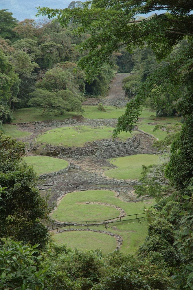
The protected monument covers approximately 233 hectares, or 2.3 square kilometres, in premontane rainforest on the southern slope of Turrialba Volcano. The known archaeological zone occupies approximately 15 to 20 hectares. Its central area contains 43 stone foundations, three aqueducts, two principal roads, dozens of smaller paths, stone tombs, and other settlement infrastructure. Dense rainforest vegetation surrounds the remains, including epiphytes such as bromeliads and orchids.
Settlement platforms and access structures
Stone foundations
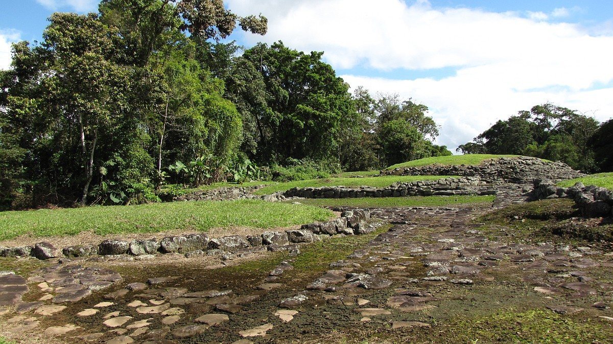
Most principal foundations are circular stone mounds or platforms measuring about 10 to 30 metres in diameter and between 0.5 and 4.5 metres in height. Their form suggests that conical wooden buildings with thatched roofs once stood on them. These structures were probably large communal houses organized around family groups. Mound 1, the largest identified mound, occupies the center of the settlement and is regarded as a representative structure of the Guayabo culture.
Roads and stairways
A paved road begins in front of Mound 1 and extended toward surrounding settlements for approximately 9 kilometres. Carefully laid stone formed the road surface, while the roads also contributed to drainage. Other routes cross the excavated area in several directions, and stone stairs overcome changes in elevation.
Rectangular access structures
Beside the central mound, a stairway leads toward two matching rectangular structures set symmetrically on either side of the road. Their position suggests that they may have served as guardhouses controlling access to the settlement, although their function remains uncertain.
Water management and burials
Aqueducts and storage tanks
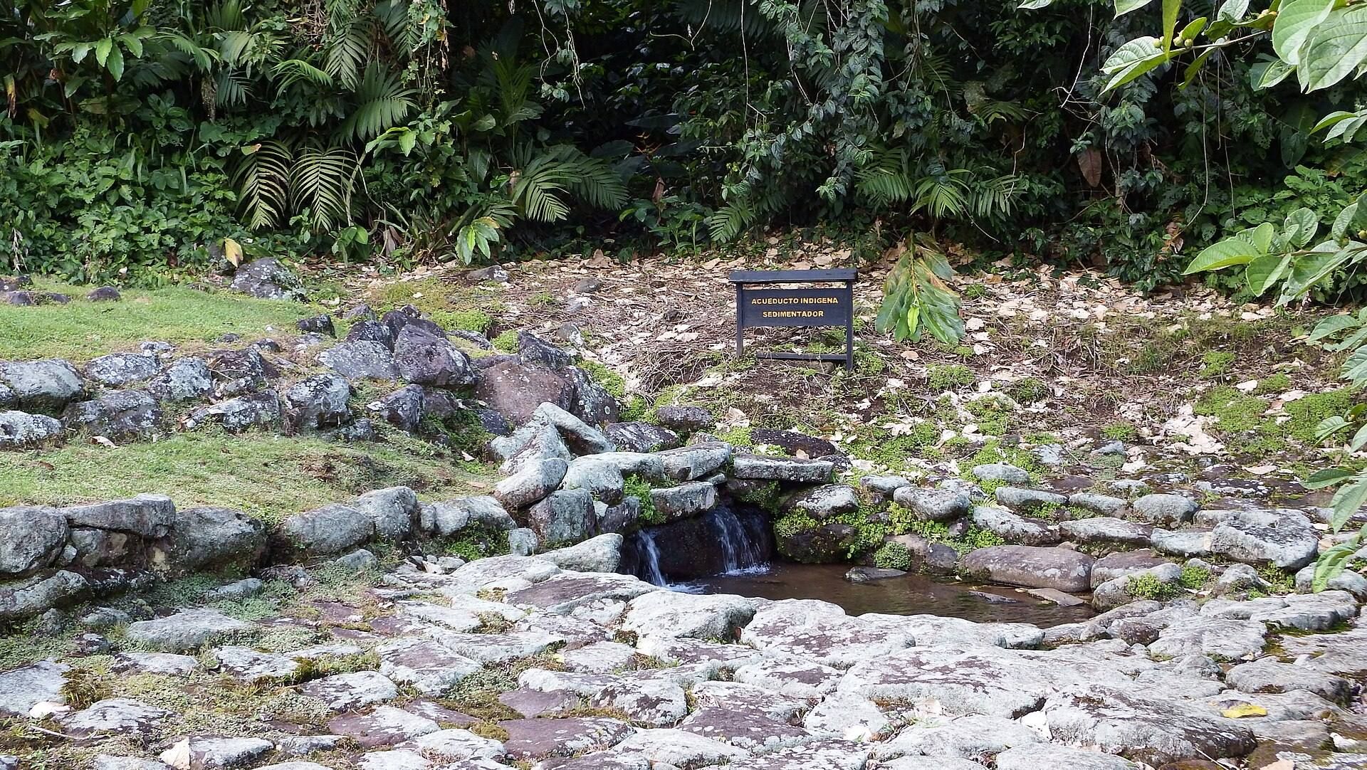
Guayabo contains a complex network of open and closed aqueducts, channels designed to transport water. They carried water to selected locations and to rectangular stone storage tanks in the settlement’s principal sector. Some of these aqueducts are still functioning, and the network forms part of the site’s broader infrastructure of roads, channels, and built stone features.
Stone tombs
Burial areas occur in several parts of the settlement. The tombs include cist graves, burial compartments formed from rounded stones and stone slabs. Their construction adds funerary spaces to the settlement’s residential, ceremonial, transport, and water-management features.
Carved stones and archaeological materials
Petroglyphs and monoliths
Numerous petroglyphs, images or designs carved, pecked, or engraved into stone, are distributed throughout the archaeological area. Animal representations include jaguars and lizard-like or other reptilian figures. The jaguar-and-reptile monolith carries a jaguar on one side and a reptile on the other. Its meaning has not been deciphered, and the general function of the petroglyphs is uncertain, although a decorative purpose has been proposed.
Excavated objects
Excavated materials include ceramics, stone sculptures, gold objects, agricultural tools, and jade. Together with the foundations, roads, water channels, tombs, monoliths, and sculptures, these objects provide evidence for the settlement’s varied craft production, farming economy, burial practices, and regional connections.