Takalik Abaj: A Pre-Columbian Maya-Olmec Archaeological Site in Guatemala
Site at a Glance
- Rating
- 4.7
- Popularity
- Low
- Country
- Guatemala
- Primary era
- Classical
- Eras represented
- Iron Age, Classical, Medieval
- Civilizations
- Maya, Olmec
- Site type
- City
On this page18 sections
History
Takalik Abaj is a pre-Columbian archaeological site in El Asintal, Guatemala, developed through Olmec, Early Maya, and later K’iche’ cultural phases from about 1000 BC into the Postclassic period. The settlement flourished from the ninth century BC until at least the tenth century AD and remained occupied for almost two thousand years. The name Tak’alik Ab’aj means “standing stone” in K’iche’; the site was formerly called Abaj Takalik, a grammatically incorrect word order introduced by the archaeologist Suzanna Miles.
Early settlement and the Olmec phase
The earliest inhabitants settled a densely forested area, cleared land for maize and other crops, and established homes west of the Central Group beside the El Chorro stream. Their houses had floors made from river cobbles and roofs of reeds supported by wooden poles. During the Middle Preclassic, public construction probably began with clay, which was sometimes partly burned to make it harder. Local Ocosito ceramics appeared during this period and continued in use into the Late Classic.
Middle Preclassic evidence connects Takalik Abaj with Mixe-Zoquean-speaking populations and the Olmec cultural sphere. The Olmec cultural sphere flourished in the Gulf Coast lowlands of Mexico and was known for monumental art, including colossal heads and combined human-animal imagery. During the first part of the Middle Preclassic, Takalik Abaj produced Olmec-style sculpture while La Venta was flourishing on the Gulf Coast.
Later in the Middle Preclassic, Olmec ceremonial structures ceased to be used and some Olmec sculptures were destroyed. This transition was gradual and preceded the Early Maya phase rather than forming a sudden break. The change from Olmec to Maya traditions may reflect the movement of Maya people, an ideological transformation within a continuing local population, or both. Local ceramic traditions continued, even as the artistic and political character of the city changed.
The Late Preclassic city
During the Late Preclassic, approximately 300 BC to AD 200, Takalik Abaj became a major city covering more than 4 square kilometres. Its first major flowering of Maya culture is conventionally placed around 400 BC. The Maya were a Mesoamerican civilization whose communities developed writing, calendrical traditions, complex political systems, monumental architecture, and long-distance exchange networks.
The city developed local forms of art and architecture, erected stelae and altars, and created monuments with political and religious meaning. Several Early Maya monuments carry hieroglyphic texts and Long Count dates. The Long Count was a Maya calendar that measured elapsed days from a fixed starting point, allowing dates to be expressed across long periods. These inscriptions and images place Takalik Abaj among the early centres of Maya writing and royal representation.
An Early Maya royal tomb indicates that Maya elites held a dominant position at the site, whether they arrived as traders or conquerors. Takalik Abaj became a commercial, ceremonial, and political centre. Its position near a crossing of the Ixchayá River probably channelled major trade routes through the city and helped it control access to them. Exchange linked the site with Kaminaljuyu and Chocolá and connected the Guatemalan highlands and Pacific coast from Mexico to El Salvador.
Cacao production contributed to the city’s prosperity. The region remained important for cacao during the Spanish conquest in the sixteenth century. Obsidian, a natural volcanic glass used for sharp tools and ritual implements, came mainly from El Chayal and San Martín Jilotepeque, with smaller quantities from Tajumulco, Ixtepeque, and Pachuca.
Early Classic conquest and recovery
From approximately the second century AD, the stela style associated with historical figures at Takalik Abaj spread through the Maya lowlands, especially the Petén Basin. Some earlier monuments were deliberately destroyed. The destruction and the interruption of new construction coincided with the arrival of Naranjo-style ceramics associated with Teotihuacan or its sphere of influence. Teotihuacan was a major metropolis in the Valley of Mexico whose political and cultural influence extended into parts of Mesoamerica during the Early Classic.
The conquerors appear to have imposed long-distance control, replacing local rulers with their own governors while leaving much of the local population in place. The conquest disrupted the older Pacific coastal trade route between Mexico and El Salvador. A new route ran along the Sierra Madre and into the northwestern Guatemalan highlands.
Takalik Abaj recovered during the Late Classic. Naranjo-style ceramics declined, large-scale construction resumed, and many monuments broken during the conquest were re-erected. This recovery formed another phase in the site’s long development, combining renewed building with the continued use of earlier monuments and terraces.
K’iche’ occupation and modern investigation
During the Terminal Classic and Postclassic, K’iche’ ceramics entered the site, particularly in the North Group, and eventually replaced the Ocosito tradition. The K’iche’ are a Maya-speaking highland population of Guatemala. Their conquest probably occurred around AD 1000, several centuries earlier than estimates based on indigenous historical calculations. Activity continued after the conquest without an evident break, although the original inhabitants appear eventually to have abandoned the city.
A published description of Takalik Abaj appeared in 1888. Karl Sapper described Stela 1 in 1894 after seeing it beside a road, while the artist Max Vollmberg drew the stela and recorded other monuments. Walter Lehmann began studying the sculptures in the 1920s. The 1902 eruption of the nearby Santiaguito volcano covered the site with approximately 40 to 50 centimetres of volcanic ash.
J. Eric S. Thompson visited the site in January 1942 with Ralph L. Roys and William Webb on behalf of the Carnegie Institution, and their observations were published in 1943. Further investigations involved Suzanna Miles, Lee Parsons, and Edwin M. Shook. University of California, Berkeley excavations began in 1976 under John A. Graham, Robert F. Heizer, and Edwin M. Shook and continued until 1981. The first season uncovered 40 previously unknown monuments, including Stela 5. Excavations resumed in 1987 under Guatemala’s Institute of Anthropology and History, directed by Miguel Orrego and Christa Schieber, and have continued to reveal additional monuments.
The site was declared a national archaeological park. It entered the UNESCO World Heritage Tentative List in 2002 under “The Mayan-Olmecan Encounter” and was inscribed in 2023 as the National Archaeological Park Tak’alik Ab’aj, a cultural World Heritage property under criteria ii and iii. The designated property covers 14.88 hectares. Some objects recovered at Takalik Abaj are displayed in Guatemala’s National Museum of Archaeology and Ethnology and National Museum of Guatemalan Art.
Remains
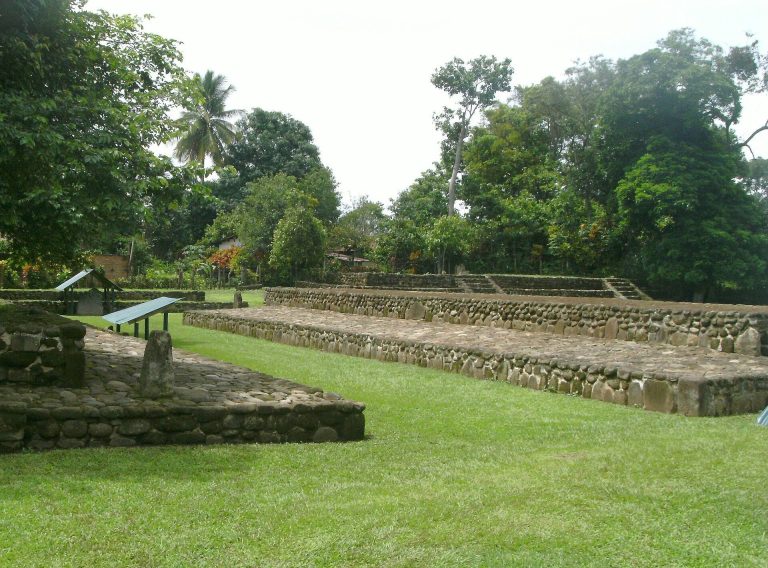
Takalik Abaj occupies a north-south ridge that descends southward between the Nimá River to the west and the Ixchayá River to the east. Steep ravines formed natural boundaries, while a usable crossing near the site lay within the Ixchayá ravine. The site core covers approximately 6.5 square kilometres and contains about 70 monumental structures arranged around roughly a dozen plazas. At its greatest extent, the principal architecture covered about 2 by 4 kilometres, while the full residential area remains undetermined.
Groups, terraces, and plazas
The monumental centre is divided into the Central, West, North, and South Groups across nine terraces. The Central, West, and North Groups cluster together, while the South Group lies about 0.5 kilometres south of the Central Group and about 2 kilometres west of El Asintal. The terraces range from approximately 140 to 220 metres in width, with retaining faces between 4.6 and 9.4 metres high. Their orientations follow the local terrain rather than a single uniform plan. Three principal city-supporting terraces were artificially built, in places with more than 10 metres of fill.
The Central Group occupies Terraces 1 to 5 and contains 39 structures around plazas open to the north and south, together with more than 100 stone monuments. The West Group occupies Terrace 6 and contains 21 structures and seven known monuments. The North Group occupies natural Terraces 7 to 9 and was used from the Terminal Classic through the Postclassic. Its compacted-clay structures and ceramic assemblages reflect a later highland K’iche’ settlement community. The South Group is a dispersed collection of approximately 13 structure mounds outside the core.
Terrace 2 and the early ballcourt
Terrace 2 contains Middle Preclassic structures and an early ballcourt in its southwest section. The playing area is slightly more than 22 metres long and 4.6 metres wide, covering 105 square metres. Structures Sub-2 and Sub-4 form its sides, while Sub-1 creates a southern end zone measuring 23 by 11 metres.
Terrace 3 and the sacred plaza
Terrace 3 contains a major Late Preclassic construction facade. Its southeastern section is associated with a concentration of sculpture and with Structure 7, leading to its identification as the city’s most sacred plaza. It has also been called Tanmi T’nam, meaning “Heart of the People” in Mam Maya.
Structures 5, 6, and 7
Structure 5 is a large Middle Preclassic pyramid on the west side of Terrace 3. It forms the western end of an alignment with Structures 6 and 7. Structure 6 is a stepped rectangular platform first built during the Middle Preclassic and enlarged during the Late Preclassic and the beginning of the Early Classic.
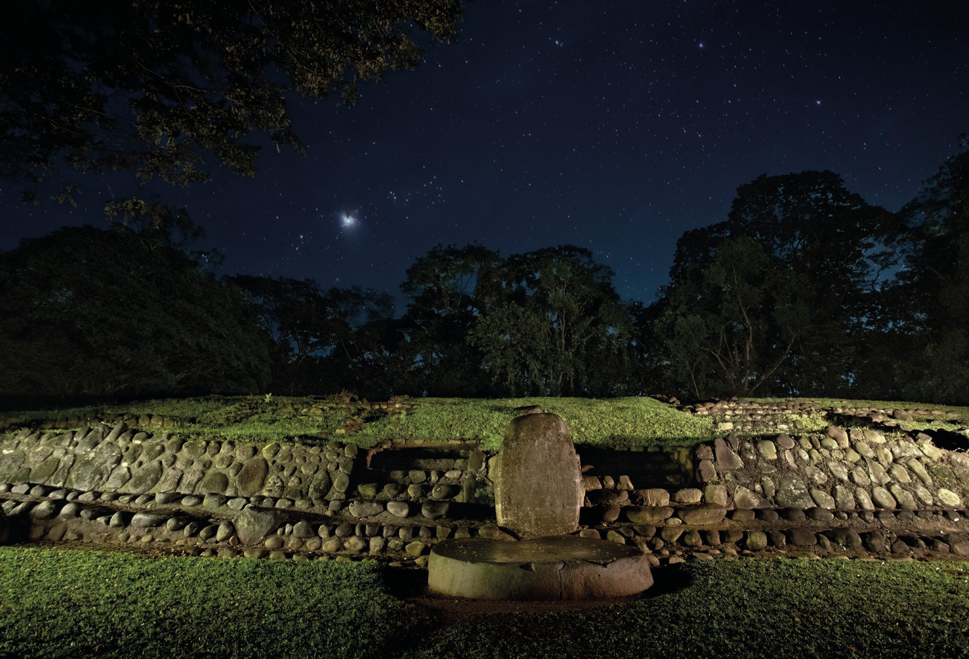
Structure 7 is a large platform on the eastern side of the Terrace 3 plaza. It measures approximately 79 by 112 metres, began in the Middle Preclassic, and reached its final form during the latter part of the Late Preclassic. Structures 7A and 7B occupy its northern and eastern areas. All three were refaced with stone during the Late Classic. Three north-south rows of monuments associated with Structure 7 may have served as an astronomical observatory.
The Pink Structure was a small Middle Preclassic ceremonial platform on the central axis of Structure 7. It was later buried beneath the first version of that structure. Structure 7A measures 13 by 23 metres and is almost 1 metre high. Standing stones faced all four sides, which were surrounded by pavement. Structure 7B, on the eastern side of Structure 7, has similar stone facing and pavement.
Terraces 5 and 6
Terrace 5 measures approximately 200 metres from east to west and 300 metres from north to south. Its Late Preclassic retaining face was built from compacted clay, and the terrace remained in use through the Postclassic. Terrace 6 measures approximately 150 by 140 metres. It contains a Late Preclassic substructure made from basalt blocks, later construction, and traces of Postclassic K’iche’ occupation.
Terraces 7 to 9 and the northern area
Terraces 7 and 8 are natural east-west terraces associated with K’iche’ occupation. Terrace 9 measures approximately 400 by 300 metres and supports Structures 66 and 67. It also contains possible remains of a second ballcourt. Structure 42, the highest structure in the North Group, rises about 11.5 metres. Structure 57 may have served as a lookout, while Structure 61 and its associated mounds may have controlled access to the city.
Structure 86 began as an Early Classic sunken patio dating between AD 150 and 300. It contained offerings, mostly Solano ceramics. A possible North Ballcourt was built from compacted clay and aligned east-west. In the South Group, Structure 17 contained a Late Preclassic cache of 13 prismatic obsidian blades, long regular blades removed from an obsidian core.
Water management and construction
Takalik Abaj’s hydraulic system included 25 channels that diverted runoff, protected principal architecture, and carried water toward residential areas. The channels may also have had a ritual association with a rain deity. The largest measured approximately 0.25 metres wide by 0.30 metres high, while secondary channels were about half that size.
Middle Preclassic channels were made from clay. Those dating from the Late Preclassic through the Classic period were lined with stone, and the largest belonged to the Late Classic. Broken stone monuments were reused in some Late Classic channels. The site also included a temazcal, a Mesoamerican steam bath or sweat lodge, with drainage beneath the structure.
Sculpture and carved monuments
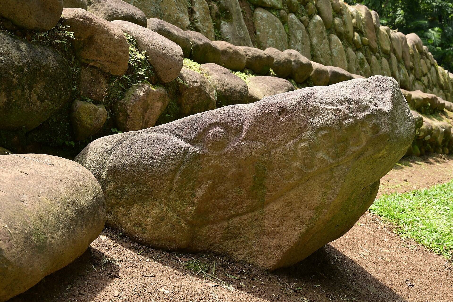
Most monumental sculptures were carved from local andesite and basalt, dense volcanic rocks suited to large carved objects. By 2006, 304 stone monuments had been recorded, including 124 carved examples. Most stood in the Central and West Groups. The collection included Olmec-style sculpture, Maya-style sculpture, potbelly monuments, and local zoomorphic sculptures representing animals.
Most monuments had been moved and reset from their original locations, so their dates often depend on comparison with related artistic styles. Early Maya stelae bear hieroglyphic texts and Long Count dates from the Late Preclassic. Their forms belong to a tradition ancestral to Classic Maya sculpture. Potbelly monuments depict large, usually seated human figures with enlarged abdomens and simplified features. Their precise function remains unknown, while the examples at Takalik Abaj date to the Late Preclassic. Local sculptures are generally zoomorphic boulders representing frogs, toads, crocodilians, owls, and other animals.
Monument 23
Monument 23 is an andesite carving measuring 1.84 metres high, 1.2 metres wide, and 1.56 metres deep. It may be an Olmec colossal head recarved into a niche figure, potentially making it an example outside the Olmec heartland. That identification is disputed. A local mason damaged its upper section during the mid-twentieth century, and archaeologists recovered and replaced the broken pieces.
The Ancestor Carrier
The Cargador del Ancestro, or “Ancestor Carrier,” consists of four fragments reused in building facades during the Late Preclassic. Monuments 215 and 217 were found in Structure 7A in 2008, while Stela Fragments 53 and 61 had earlier been found in Structures 12 and 74. The pieces form a damaged column about 2.3 metres high.
Its imagery includes an Early Maya figure, a vampire-bat head, and an upper figure carrying a smaller figure. The monument predates 300 BC according to the style of its hieroglyphic text. It has been interpreted as a hybrid Maya-Olmec monument showing an Early Maya ruler carrying underworld and ancestral figures.
Altars and stelae
The principal altars include Altar 1 at the base of Stela 1; Altar 2, a broken animal monument identified either as a toad or a jaguar; Altar 3, a roughly worked circular altar of unknown original location; Altar 9, a low four-legged throne; and Altar 10, a throne reused as an altar. Altars 12 and 13 were probably first erected vertically as stelae and later reused horizontally.
Altar 48 is an Early Maya-style andesite monument dating from approximately 400 to 200 BC. Its carved surfaces show a crocodile or cave symbol containing a seated Maya figure and early hieroglyphs. It was deliberately covered by Stela 14. Stelae 1, 4, and 5 are Early Maya-style Late Preclassic monuments. Stela 2 carries a damaged Long Count date with several possible readings, the latest placing it in the first century BC. Stela 5 bears two Long Count dates, the later equivalent to AD 126.
Stela 13 was associated with more than 600 ceramic vessels, 33 prismatic obsidian blades, and other objects connected with Burial 1. Stela 14 is an andesite monument with 26 cup-like depressions. Stela 74 is an Olmec-style fragment incorporated into the Middle Preclassic fill of Structure 7. Discovered in 2018, Stela 87 dates to about 100 BC and depicts a side-view ruler holding a ceremonial bar from which a Maya maize deity emerges.
Burials and offerings
Burial 1 is a Late Preclassic tomb inserted into the centre of Middle Preclassic Structure 7A. No human remains were recovered, but its associated objects indicate a probable royal burial. The offerings included more than 600 ceramic vessels, an 18-piece jade necklace, cinnabar-coated earspools, iron-pyrite mosaic mirrors, a jade mosaic mask, prismatic obsidian blades, a greenstone fish, beads, and ceramics dated to approximately AD 100 to 200.
A separate tomb reported in 2012 was carbon-dated to approximately 700 to 400 BC and associated with a ruler nicknamed K’utz Chman, meaning “Grandfather Vulture.” He has been described as a sacred king or “big chief.” The burial has been presented as a possible link between Olmec and Maya cultural traditions and, as of 2023, as the oldest reported Maya royal burial.