Ingapirca: A Cañari-Inca Archaeological Complex in Ecuador
Site at a Glance
- Rating
- 4.6
- Popularity
- Very Low
- Country
- Ecuador
- Primary era
- Medieval
- Eras represented
- Medieval, Early Modern
- Civilizations
- Inca
- Site type
- Religious
- Remains
- Sanctuary
On this page17 sections
History
Ingapirca is a Cañari-Inca archaeological complex in Cañar Province, Ecuador. Established by the Cañari during the medieval period and greatly expanded in the late fifteenth and early sixteenth centuries, it preserves the remains of a settlement shaped by both Cañari traditions and the northward expansion of the Inca state.
Cañari Settlement and Inca Expansion
The Cañari originally called the surrounding settlement Hatun Cañar, meaning “the great place of the Cañari.” By the fifteenth century, it had developed into a town. The original name of the complex is unknown, while the name Ingapirca, derived from Kichwa and meaning “Inca wall,” has been used for the monument since at least the eighteenth century.
In the late fifteenth century, the expanding Inca state conquered the region. The Inca rebuilt and enlarged the settlement but retained distinct Cañari and Inca customs and residential areas. The Cañari appear to have preserved a degree of autonomy within the transformed community. The surviving complex therefore combines Inca construction with earlier and continuing Cañari elements.
Most of the major building works took place during the expansion of the Inca state into southern Ecuador. Campaigns into the region had been initiated by Túpac Yupanqui, the Inca ruler who preceded and fathered Huayna Cápac. The most substantial construction at Ingapirca was organized during Huayna Cápac’s rule.
Functions and Religious Associations
The complex had several probable functions. It appears to have served religious, administrative, ceremonial, and military purposes, including the role of an Inca forward post and provisioning center for troops moving toward northern Ecuador. It was probably an important center for solar worship and may have functioned as a coricancha, an Inca temple or ritual complex associated especially with the sun. The site has also been interpreted as an astronomical observatory.
Ingapirca was probably built around or over a pacarina, a sacred place regarded in Andean belief as an ancestral or mythological place of emergence. This association may help explain the complex’s religious importance. Its elevated mountain setting and monuments were connected with worship of the sun and moon, while festivals included the preparation and consumption of a locally fermented drink.
Abandonment and Archaeological Investigation
The settlement and fortress were abandoned during the first half of the sixteenth century. Possible causes include the Inca civil war, epidemic disease, and the Spanish conquest. After the conquest, treasure seekers looted the settlement, with particularly severe losses in the burial areas. The buildings were not rebuilt and gradually deteriorated.
During the colonial period, the abandoned complex was described and its structures were tentatively identified. The French scientist and traveler Charles Marie de La Condamine visited Ingapirca and scientifically described it in 1739. More intensive investigation began during the second half of the twentieth century. A Spanish Archaeological Mission excavated and restored the ruins in 1974 and 1975, producing archaeological studies by José Alcina, Miguel Rivera, and Antonio Fresco. Research and conservation have continued since then.
Historical interpretations place Ingapirca among the largest and best-preserved known Inca ruins in Ecuador. Its surviving buildings and associated installations preserve evidence of an important meeting between Cañari traditions and Inca political, religious, and architectural practices.
Remains
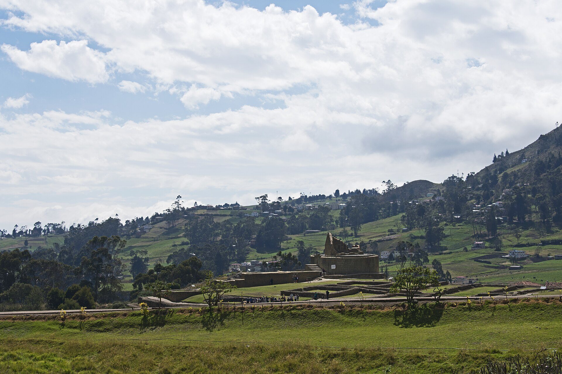
Ingapirca covers approximately 4 hectares at an elevation of about 3,160 meters. Its principal architectural groups are the Castillo or Temple of the Sun, La Condamine, and Pilaloma. Smaller structures, waterworks, roads, ritual rocks, plazas, habitation areas, and storage facilities extend around these major groups. The complex’s construction combines carefully fitted Inca masonry with simpler stonework and features associated with Cañari occupation.
Principal Architectural Groups
Castillo or Temple of the Sun
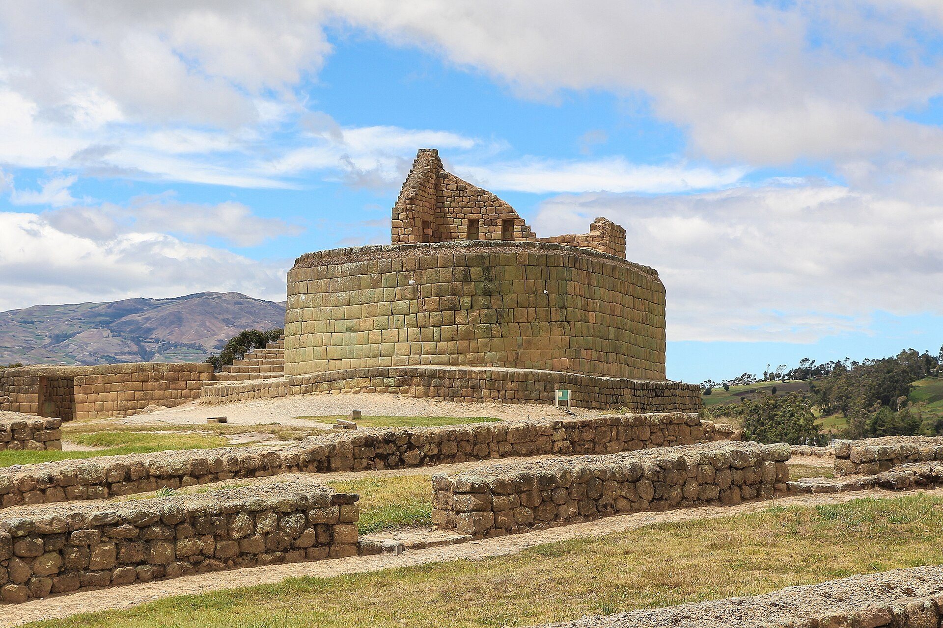
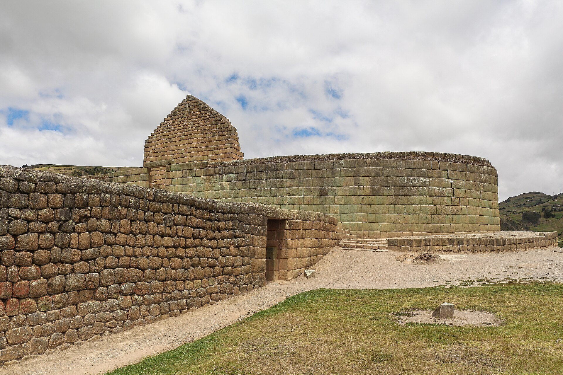
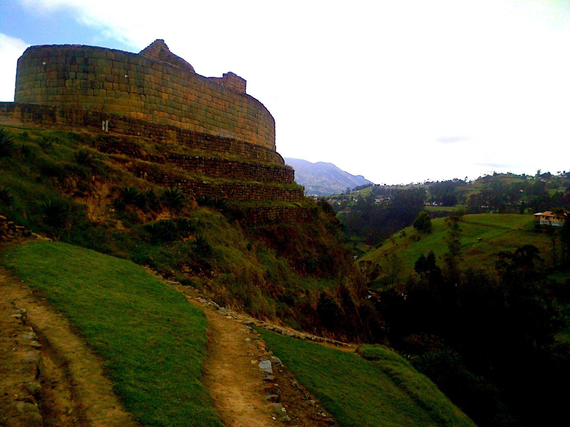
The Castillo, also called the Temple of the Sun, is the central and most prominent structure. It stands on a raised platform approximately 3.5 to 4 meters above the surrounding complex and has an oval or elliptical plan about 37 meters long and 12 to 12.35 meters wide. Masonry walls enclose the platform, which is reached through two stairways and a trapezoidal doorway with a double jamb and a single stone lintel.
The structure was built around or over a large natural rock outcrop. Its upper level contains two separate rooms without a connecting passage. Their eastward and westward orientations permitted observation of sunrise and sunset, while the possibility of solstitial sunlight entering the doorway of the upper chamber has contributed to the building’s interpretation as a solar temple.
The walls are faced with carefully shaped green andesite blocks fitted together without mortar. This cushioned masonry technique gives the stonework its distinctive Inca character. Rainwater infiltration has eroded the facing, and much of the upper chamber has collapsed.
Southern Annex
South of the Temple of the Sun, a long passage separates the main structure from an attached group of six rooms. Three rooms are square and three are rectangular, arranged in alignment and divided by interior courtyards. One associated circular room retains standing walls built with cushioned masonry and contains niches.
La Condamine
La Condamine consists of several rectangular rooms arranged along a central corridor. Its masonry is simpler than the work at the Castillo and belongs to the pirca tradition, a comparatively simple form of stone construction. The group may have been an acllahuasi, a residence for selected women who performed religious, textile, domestic, or other service duties for the state or a temple.
La Condamine was built over what appears to have been a Cañari cemetery of the Cashaloma phase. Twenty-nine burials, most of them belonging to women, were found beneath the structure. Excavations also recovered large quantities of Cañari pottery and several carved stone heads. The original locations of the heads are unknown.
Pilaloma
Pilaloma lies on the upper part of a small hill southeast of the Castillo. Its principal compound is a kancha, an Andean architectural group organized around an enclosed courtyard. Eight rooms surround the central courtyard, and several circular colcas, or storage buildings for grain and other supplies, form part of the group. The rooms have fired-clay floors hardened to a brick-like texture.
Grinding stones, large vessels for storing liquids, and carved stone heads were associated with the rooms. The pottery belongs to the Cañari Cashaloma phase. A stone monolith at the center of the courtyard marks a Cañari tomb. The burial contained a woman known as the “priestess,” numerous vessels offered with the burial, and ten other women who may have been sacrificed attendants.
Waterworks, Roads, and Open Areas
Water Supply and Roads
The complex included aqueducts and an underground water-supply system intended to provide water throughout the compound. Roads connected Ingapirca with neighboring settlements, and a segment of the Inca imperial road system, the Kapak Ñan, is associated with the site. This road network connected settlements, administrative centers, military positions, and supply routes across the Andes.
Plaza and Storage Area
A plaza lies between the Castillo and La Condamine. A lower sector was used for habitation, while clay-built structures between the lower area and La Condamine served for food storage. A broad paved road formerly ran nearby.
Baños
The Baños consists of ceremonial pools. Their association with the wider complex places them among the installations connected with ritual activity at Ingapirca.
Ritual Rocks and Smaller Structures
Ingachungana
Ingachungana is a ritual rock north of the Castillo. Its surface contains hollows shaped like baths or seats and bas-reliefs formed as coiled snakes.
Intiwayka
Intiwayka is a rock associated with a natural formation resembling a human face. It forms part of the smaller ritual and symbolic features distributed through the complex.
Alongside the three principal architectural groups, these rocks and other smaller structures preserve evidence of ceremonies and continuing Cañari elements within an Inca-built setting. The remains present Ingapirca as an interconnected settlement, ritual center, administrative facility, and military supply site rather than as a single isolated monument.