Old Stone Fort: A Middle Woodland Ceremonial Enclosure in Tennessee
Site at a Glance
- Rating
- 4.8
- Popularity
- Medium
- Country
- United States
- Primary era
- Classical
- External website
- Open
- Eras represented
- Classical, Medieval, Modern
- Civilizations
- Unclassified
- Site type
- Religious
- Remains
- Sanctuary
On this page10 sections
History
Old Stone Fort is a prehistoric Native American enclosure in Manchester, Tennessee, in the United States. Most likely constructed between AD 80 and 550 during the Middle Woodland period, it is considered the most complex hilltop enclosure in the South and probably served ceremonial purposes rather than functioning as a military fortress.
Middle Woodland Construction
The enclosure was built gradually over several centuries by Native American communities of the Middle Woodland period, a prehistoric era in eastern North America associated with earthworks, regional exchange, and varied ceremonial practices. Charcoal from the walls has produced radiocarbon dates of approximately AD 30 to 430, while the broader construction period is generally placed between AD 80 and 550.
Archaeological interpretation connects the work with two local Middle Woodland traditions. The McFarland culture is believed to have begun the construction in the first century AD, and the Owl Hollow culture probably completed it. The interpretation rests on the enclosure’s composition, setting, and layout, as well as similarities to earthworks associated with Hopewell societies in Ohio and the builders of Pinson Mounds in western Tennessee. Hopewell refers to related Middle Woodland societies and archaeological traditions known for ceremonial centers, large earthworks, and long-distance exchange.
Research between 1966 and 1971 identified five Middle Woodland settlements within 20 miles of Old Stone Fort. One substantial habitation area lay about three miles downstream. These nearby communities provide a local setting for understanding the enclosure as part of a wider cultural landscape rather than as an isolated construction.
Changing Interpretations and Early Investigations
For many years, observers assumed that the walls formed a defensive fortification. The 1966 excavations by the University of Tennessee supported a different interpretation. The walls are relatively low, the enclosure has an exceptionally large interior, and construction extended over several centuries. Charcoal and other excavated evidence also indicate very limited artifact deposition within the enclosure. Together, these characteristics support a religious or ceremonial function instead of a rapidly built settlement intended for continuous military defense.
Earlier theories gave the structure non-Native origins. In 1823, the Pioneer newspaper proposed that buccaneers from Seville had built it after a shipwreck off Florida. During the twentieth century, interest in alleged Viking discoveries and supposed Viking artifacts led some writers to attribute Old Stone Fort and other stone structures in eastern North America to Vikings. Joseph Jones conducted the first serious investigation in 1876 for the Smithsonian Institution and recovered prehistoric artifacts. In 1928, Tennessee State Archaeologist P. E. Cox excavated trenches and examined the enclosure’s composition. The University of Tennessee investigation in 1966 used trenches, test pits, and wider archaeological research to establish its Middle Woodland attribution.
Cherokee and Early County History
During the latter part of the Cherokee-American wars, a series of conflicts involving Cherokee communities and American colonial or later United States forces, Major James Ore’s Nickajack Expedition is believed to have encamped within Old Stone Fort while traveling toward the Chickamauga towns. These were Cherokee settlements associated with resistance to American expansion in the eighteenth century.
By the mid-eighteenth century, trails crossing the Cumberland Plateau connected Middle Tennessee with Georgia and northern Alabama. One route passed near the enclosure, which served as an important landmark for early travelers. The structure also held symbolic importance for early Coffee County residents. The county’s first court met at the Old Stone Fort Tavern in 1836, and the county seat was laid out on Main Stone Fort Creek.
Industrial Development and Preservation
The peninsula’s rivers and waterfalls encouraged industrial development during the nineteenth century. Samuel Murray built a rope factory on the Little Duck River in 1823. After the factory burned in 1847, W. S. Whitman established a paper mill farther downstream in 1852 and built a powder factory beside it in 1862 to supply the Confederacy during the Civil War. Union troops destroyed the powder factory in 1863.
The Stone Fort Paper Company built a large mill near Big Falls on the Duck River in 1879. The mill supplied newspapers throughout the Southeast, including the Nashville Banner and the Atlanta Constitution, until the early twentieth century. The property later passed to the Chumbley family, whose connections to Stone Fort Paper formed part of the area’s industrial history. The family declined private offers for the land in an effort to protect Old Stone Fort.
Tennessee purchased 400 acres of the Chumbley estate in 1966, creating the core of Old Stone Fort State Archaeological Park. The park now encompasses 876 acres and is managed by the Tennessee Department of Environment and Conservation. Old Stone Fort was added to the National Register of Historic Places in 1973. This is the United States’ federal register for places considered important in American history, architecture, archaeology, engineering, or culture.
Remains
The Enclosure and River Setting
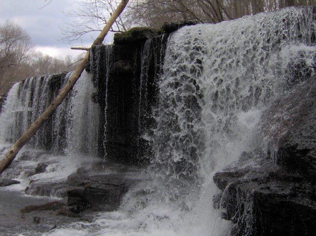
Old Stone Fort occupies a peninsula formed where the Duck River and Little Duck River meet. The Duck borders the peninsula to the northwest, the Little Duck runs along its southeastern side, and a westward bend of the Little Duck forms its southern boundary. The enclosure covers approximately 50 acres on a limestone-rich shelf of the western Cumberland Plateau known as the Highland Rim. Deep river-cut gorges, waterfalls, and whitewater rapids shape the surrounding terrain.
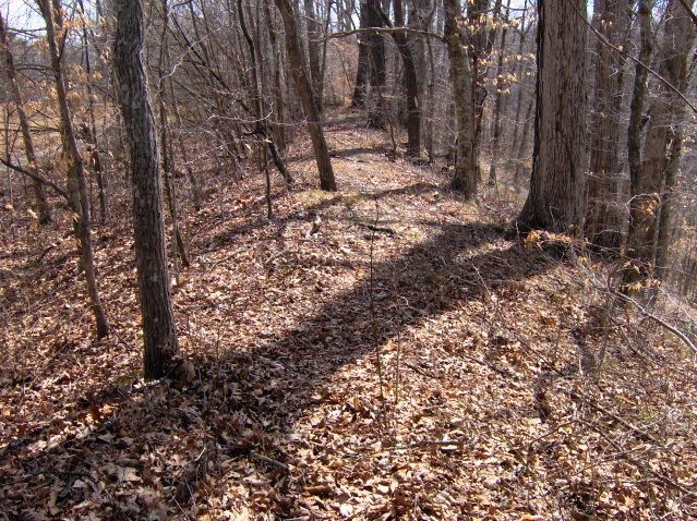
The enclosure consists of stone and earthwork walls averaging about four to six feet in height. Their original construction used inner and outer layers of roughly stacked rocks and slabs, with gravel and earth placed between them. As the fill spread over the stone layers, the walls developed their present mound-like form. Three principal sections follow the natural edge of the peninsula: two run beside the Duck and Little Duck rivers, while a third follows the southern rim.
Walls and Entrance
The northwestern wall along the Duck River extends approximately 1,394 feet. The southeastern wall along the Little Duck measures about 1,094 feet, and the southern wall runs for approximately 2,116 feet. The southern section is generally straight, apart from a bulge in the ridge. The two river-side walls angle inward and approach one another in a pincer-like arrangement on the northeastern half of the peninsula.
The converging walls stop short of one another to form a small entrance. Two ancient pedestal mounds flank this opening, one about 35 feet in diameter and the other about 48 feet across. Beyond the entrance, a 120-foot L-shaped corridor leads into the enclosure. Large open areas lie between the southern, northwestern, and southeastern wall sections. Their position above steep bluffs may have allowed the river-cut edges and their waters to perform a function comparable to that of the pedestal mounds.
Southern Ditch and Industrial Remains
A substantial ditch traditionally called the moat parallels the southern wall at the foot of the ridge. It follows a naturally abandoned river channel rather than a confirmed artificial excavation. It remains uncertain whether prehistoric builders deliberately kept the channel open, but the feature forms part of the physical setting of the southern enclosure.
The later industrial landscape survives near Big Falls on the Duck River. Foundations from the 1879 Stone Fort Paper Company mill remain on the bluffs above the falls, preserving physical evidence of the area’s nineteenth-century manufacturing history.
Modern Interpretation Building
The Old Stone Fort Museum is a separate modern building near the park entrance. Its exhibits present theories about the enclosure’s builders, the archaeological excavations, early Native American history, and the cultures associated with the site. The building includes a small theater, a welcome and gift-shop area, and an observation deck with information about the fort and the surrounding rivers. The deck overlooks the enclosure’s river setting and Blue Hole Falls.