Quiriguá: An Ancient Maya Ceremonial and Political Center in Guatemala
Site at a Glance
- Rating
- 4.7
- Popularity
- Low
- Country
- Guatemala
- Primary era
- Classical
- External website
- Open
- Eras represented
- Classical, Medieval
- Civilizations
- Maya
- Site type
- City
On this page18 sections
History
Quiriguá is an ancient Maya archaeological site in Las Viñas, Guatemala, occupied from at least the Late Preclassic period through the Early Postclassic period. Its ceremonial center developed beside the lower Motagua River, and its history is closely connected with Copán, Tikal, and the control of regional trade. Quiriguá became especially prominent after its ruler K’ak’ Tiliw Chan Yopaat captured and sacrificed Copán’s king in AD 738, an event that established the site’s independence and preceded an extraordinary program of monument building.
Early settlement and dependence on Copán
Quiriguá was occupied during the Late Preclassic period, approximately 400 BC to AD 200, although no surviving structure has been securely assigned to that phase. Excavations have recovered 63 figurines and a chert blade from the early occupation. Ceramics and jade figurines from the Early Classic period connect the site with Copán, Chalchuapa, central Honduras, and the Guatemalan highlands.
Hieroglyphic, architectural, and chemical evidence indicates that Quiriguá and Copán were founded by elite colonists from Tikal during Maya expansion into the southeastern frontier. Recorded dynastic history begins in AD 426, when K’inich Yax K’uk’ Mo’ became king of Copán. Three days later, he installed Tok Casper as the first known king of Quiriguá. The new center was initially subordinate to Copán and appears to have helped place the Motagua trade route under Copán’s control, and indirectly within Tikal’s alliance network.
Tutum Yohl K’inich, identified as Quiriguá’s second king, erected a now-undiscovered stela in AD 455. A monument recording a ritual supervised by Copán’s ruler in AD 480 shows that Quiriguá still occupied a dependent position. A hieroglyphic text dated AD 493 also refers retrospectively to earlier Quiriguá rulers, although parts of the inscription are difficult to read. Fifth-century architecture and monuments at the site closely parallel those of Uaxactun, a center dominated by Tikal, reinforcing Quiriguá’s connection with the Tikal alliance.
Interruption and recovery
Quiriguá entered a hiatus from approximately AD 495 to 653, during which no monuments were erected. This interruption may have been related to Tikal’s Middle Classic hiatus after its defeat by Calakmul, a major Maya political center that competed with Tikal for regional influence. Deliberate damage to Stela U and Monument 26 suggests that Quiriguá may also have suffered attacks by unidentified enemies.
During the sixth or early seventh century, a catastrophic flood covered much of the Motagua Valley with deep silt and altered the local landscape. Buildings standing above the mud, including Group A, remained in use, while parts of the valley platform continued to be occupied. Quiriguá began to recover when King K’awiil Yopaat dedicated a monument in AD 653. Contact with Copán continued, and possible connections with Caracol indicate that the center also participated in wider political networks. Major construction in the acropolis began around this time, including Quiriguá’s first ballcourt.
Independence under K’ak’ Tiliw Chan Yopaat
In AD 724, Copán’s king Uaxaclajuun Ub’aah K’awiil installed K’ak’ Tiliw Chan Yopaat as Quiriguá’s subordinate ruler. By AD 734, however, K’ak’ Tiliw Chan Yopaat was using the title k’ul ahaw, meaning holy or divine lord, rather than the subordinate title ahaw, or lord. He was also using Quiriguá’s own emblem glyph. These changes expressed a claim to independent authority.
The independence movement probably formed part of the wider rivalry between Tikal and Calakmul. In AD 736, K’ak’ Tiliw Chan Yopaat received a visit from Wamaw K’awiil, the high king of Calakmul. The timing of that visit and Quiriguá’s rapid growth afterward suggest that Calakmul supported the rebellion to weaken Tikal and obtain access to the Motagua trade route.
On 27 April AD 738, K’ak’ Tiliw Chan Yopaat captured Uaxaclajuun Ub’aah K’awiil, Copán’s thirteenth king and his former overlord. An inscription indicates that Quiriguá seized and burned wooden images of Copán’s patron deities. The capture may have resulted from an ambush rather than a conventional battle, although the exact circumstances are uncertain. On 3 May, the captive ruler was taken to Quiriguá and decapitated in a public ritual.
The sacrifice greatly increased Quiriguá’s regional standing. The site gained independence from Copán, strengthened its control of important trade routes, and began a major program of construction and monument production. Its sculptural style closely resembled that of Copán, perhaps because captured Copán sculptors were employed at Quiriguá. The population of the site and the surrounding valley grew rapidly after AD 738, although the urban center itself probably never exceeded about 2,000 inhabitants. Quiriguá remained the focus of a dispersed rural population.
Late Classic prosperity and decline
Quiriguá appears to have maintained its independence from Copán through the early ninth century. In AD 762, K’ak’ Tiliw Chan Yopaat supervised the accession of a ruler known as Sunraiser Jaguar at Xkuy, an apparently subordinate site that Copán had previously attacked.
K’ak’ Tiliw Chan Yopaat died on 27 July AD 785 and was buried ten days later in 13 Kawak House, a building whose location has not been identified. His successor, Chan Tiliw Yopaat, probably his son, became ruler 78 days later. He continued an active program of construction and monument production while other Maya centers were declining. Chan Tiliw Yopaat ruled for approximately 10 to 15 years and died between AD 795 and 800. His reign produced three large zoomorphs and two altars regarded as exceptional examples of Maya stonework.
K’ahk’ Jolow Chan Yopaat, the last known ruler, succeeded Chan Tiliw Yopaat. The two reduced stelae erected during his reign suggest that access to the resources needed for earlier levels of monument production had declined, although he built two of the acropolis’s largest structures. Relations with Copán improved somewhat by AD 810, when Copán’s king Yax Pasaj Chan Yopaat visited Quiriguá to perform a ritual marking the end of a 20-year period. The last known hieroglyphic texts at Quiriguá were also created in AD 810, while reduced construction continued for a short time.
Quiriguá declined as trade along the Motagua diminished during the wider Classic Maya collapse. Within a few years the center was nearly deserted, and settlements throughout the Motagua Valley experienced severe decline or abandonment.
Early Postclassic reoccupation and modern investigation
During the Early Postclassic period, approximately AD 900 to 1200, Quiriguá was briefly reoccupied by people connected with the Caribbean coastal regions of the Yucatán Peninsula and Belize. Their presence may have been associated with Chontal Maya control of a trade network linking the Yucatán coast with the Motagua Valley. They added substantial constructions to the acropolis. Finds associated with this occupation include a reclining chacmool, ceramics from the eastern Yucatán coast, copper ornaments, and copper bells. The ceramics indicate connections with Chichén Itzá, while the metal objects are among the earliest known metal artifacts from the Maya area. They date either to the Terminal Classic or Early Postclassic period.
Frederick Catherwood reached the ruins in 1840 and published drawings of two stelae in 1841. Karl Scherzer produced a longer account in 1854. Alfred Maudslay visited in 1881 and returned three more times, most recently in 1894. He cleared monuments, photographed them, made small excavations, recorded the sculptures, and produced paper and plaster molds of the inscriptions. The molds were sent to the Victoria and Albert Museum, and casts were transferred to the British Museum.
In 1910, the United Fruit Company acquired Quiriguá and surrounding land for banana production but reserved approximately 30 hectares around the ceremonial center as an archaeological park. Excavations by Edgar Lee Hewett and Sylvanus Morley took place from 1910 to 1914, followed by intermittent Carnegie Institution projects from 1915 to 1934. The Guatemalan Institute of Anthropology and History, the University of Pennsylvania, and the National Geographic Society conducted an extensive project from 1974 to 1979. The work excavated the acropolis, cleared monuments, and studied groups beyond the site center.
Quiriguá became a National Monument of Guatemala in 1970 and an Archaeological Park in 1974. The Archaeological Park and Ruins of Quiriguá were inscribed on the UNESCO World Heritage List in 1981 under criteria i, ii, and iv. UNESCO approved emergency assistance for rehabilitation in 1999. The archaeological park covers approximately 34 hectares within the wider site area.
Remains
Quiriguá covers approximately 3 square kilometres on the lower Motagua River’s alluvial plain, at an elevation of about 75 metres. The ceremonial center lies roughly 1 kilometre from the river’s present north bank. During the occupation, the river flowed much closer to the center and along the western side of the Great Plaza; its later course change left the river approximately 1 kilometre south of the ceremonial center. Periodic flooding and earthquakes associated with the Motagua Fault affected the site. Local red sandstone, resistant to shearing and fracturing, was used for both architecture and monuments and allowed the carving of exceptionally large freestanding sculptures.
Plazas and acropolis
Great Plaza and Platform 1A-1
The ceremonial center is arranged around three plazas. The Great Plaza, the northernmost and largest, extends approximately 325 metres from north to south. Platform 1A-1 forms its northern part. Measuring 100 by 85 metres, it rises about 0.5 metres above the southern portion of the plaza. The platform was built in two phases over approximately 20 years from river cobbles and paved with stone slabs. K’ak’ Tiliw Chan Yopaat constructed it while extending the plaza northward. It supported Stelae A, C, D, E, and F and Zoomorph B.
Ballcourt Plaza
The Ballcourt Plaza lies at the southern end of the Great Plaza. West of it was probably a riverside docking area. The later ballcourt, Structure 1B-7, was built by K’ak’ Tiliw Chan Yopaat to replace an earlier court buried beneath later construction. Its east-west orientation is unusual in the Maya region, where ballcourts were generally aligned north-south.
Acropolis Plaza and palace complex
The enclosed Acropolis Plaza lies within the acropolis, Quiriguá’s largest architectural complex. Construction began around AD 550 and continued until about AD 810. The raised complex served mainly as an elite residential and administrative area and includes Structures 1B-1 through 1B-6. Excavation found fallen pieces of Maya corbel arches, a construction method in which successive stone courses project inward, but no arches remain standing.
K’inich Ahau Wall
Structure 1B-sub.1, known as the K’inich Ahau Wall, was a free-standing wall more than 23 metres long and 1.5 metres thick on the western acropolis platform. Its western face carried five alternating mosaic masks of solar deities and serpents with human arms. The wall was completed around AD 750.
Acropolis structures
Structure 1B-sub.4 is a ballcourt buried beneath later construction on the western side of the Acropolis Plaza. Built from rhyolite blocks in the mid-seventh century, it was Quiriguá’s first ballcourt and closely copied the style, dimensions, and orientation of the courts at Copán.
Structure 1B-1 preserves Quiriguá’s last recorded date, from June AD 810. Structure 1B-2 was probably the residence of K’ak’ Tiliw Chan Yopaat. Structures 1B-3 and 1B-4 preserve a mosaic frieze showing damaged, headless figures of Kinich Ahau, a Maya solar deity. Structure 1B-5, the largest building at Quiriguá, was constructed during the reign of K’ahk’ Jolow Chan Yopaat. Structure 1B-6 contained an ancestral shrine and a schist-lined tomb with a probable male elite burial and jade dental inlays.
Outlying groups and earlier platforms
Structures 3C-1, 3C-7, and 3C-8 are groups or platforms dating from the Classic or Early Classic periods. Loci 011 and 057 may have served as watchposts controlling movement into the Motagua Valley. Loci 122 and 123 are architectural groups on the floodplain south of the river. Locus 122 resembles some highland Preclassic complexes and is therefore considered to date to that period.
Groups A, B, and C lie approximately 1.5 to 4.5 kilometres from the site core. Group A is a hilltop complex probably dating to the Early Classic. Group B, also called Group 7A-1, contains Stela S, while Group C contains an undecorated stela. The floodplain groups, hilltop complex, and outlying loci extend Quiriguá’s architectural setting beyond the principal ceremonial center.
Stone monuments and inscriptions
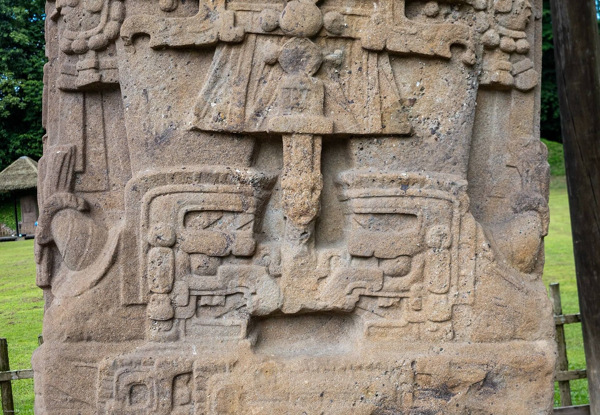
Quiriguá’s monuments were generally carved from single blocks of red sandstone quarried approximately 5 kilometres away. The hard stone supported low-relief sculpture with three-dimensional faces. Long and complex hieroglyphic panels cover many of the monuments. Some use full-figure glyphs, in which numbers normally represented by bars and dots appear as carved deity figures.
Stelae and early monuments
Stela A was erected by K’ak’ Tiliw Chan Yopaat in AD 775 and dedicated with Stela C on 29 December of that year. Stela C, also erected in AD 775, refers to AD 455 and Tutuum Yohl K’inich and records the Maya creation-era date corresponding to 13 August 3114 BC. Stela D dates to AD 766 and contains exceptionally well-preserved anthropomorphic full-figure hieroglyphs.
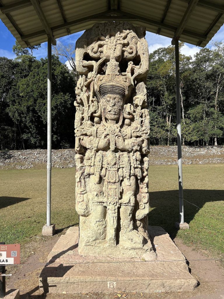
Stela E was dedicated on 24 January AD 771. Including its buried portion, it is 10.6 metres high and weighs approximately 65 tons. It fell in 1917 and broke into two pieces during an unsuccessful raising attempt in 1934; the pieces were later joined with concrete. Stela F is a 7.3-metre-high sandstone monolith dating to AD 761. Stelae H and J date to AD 751 and 756 respectively.
Stela S, dating to AD 746, was moved in antiquity from the Great Plaza to Group B and is heavily eroded. Stela T was dedicated in AD 692 by an unknown ruler. Stela U, from Group A, records a ritual supervised by Copán’s king and was deliberately broken at the knees. Monument 26, a schist stela near Structure 3C-1, is dated by its rear inscription to AD 493 and was deliberately broken in antiquity.
Zoomorphs and altars
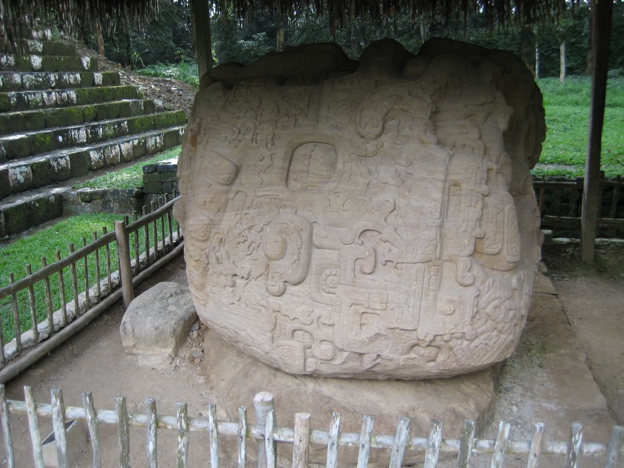
By the late eighth century, Quiriguá had developed a distinctive zoomorph style. These large stone blocks represent composite mythological animals with features of toads, jaguars, crocodiles, and birds of prey. Some retain red pigment, and most may originally have been painted red.
Zoomorph B was dedicated in AD 780. It is a 4-metre-long hybrid crocodile and mountain beast, with a dedication cache beneath it containing seven flint blades measuring between 14 and 46 centimetres. Zoomorph G, the memorial monument of K’ak’ Tiliw Chan Yopaat, was dedicated during Chan Tiliw Yopaat’s reign and shows the dead ruler’s face emerging from the jaws of a large jaguar.
Zoomorph O was dedicated in AD 790 by Chan Tiliw Yopaat. Zoomorph P, dedicated by the same ruler in AD 795, depicts him within the jaws of a crocodile-mountain hybrid monster. An accompanying altar shows an unidentified deity emerging from a fissure in the earth. Altars Q and R probably served as markers for the ballcourt.
Altar L dates to AD 653. It is a roughly worked rhyolite disk associated with K’awiil Yopaat and a twelfth ruler of Copán. Altar M, dedicated on 15 September AD 734, records K’ak’ Tiliw Chan Yopaat’s claim to the title k’ul ahaw and his campaign for independence from Copán. Altar N represents Pawatun, also called God N, a Maya deity associated with the underworld.
Schist monuments and early sculpture
Monument 25 is a cylindrical schist column found at Locus 011. Monuments 29 and 30 are heavily eroded cylindrical schist sculptures that apparently depict anthropomorphic figures or monkeys and probably date to the Late Preclassic period. Their forms provide physical evidence for activity at Quiriguá before the rise of its Classic-period dynasties.