Ruins of Quilmes: A Quilmes Indigenous Settlement in Argentina
Site at a Glance
- Rating
- 4.8
- Popularity
- High
- Country
- Argentina
- Primary era
- Medieval
- External website
- Open
- Eras represented
- Medieval, Early Modern
- Civilizations
- Spanish
- Site type
- City
On this page16 sections
History
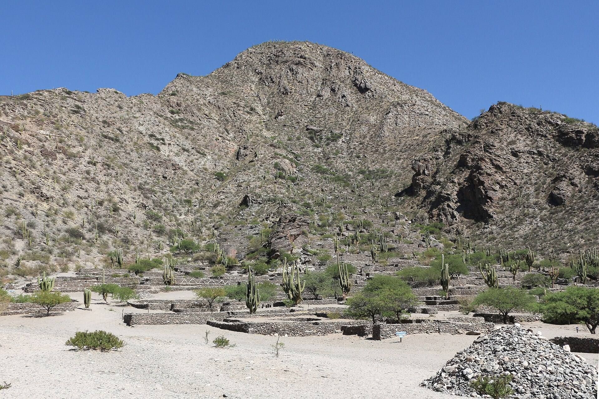
The Ruins of Quilmes are the remains of a major Quilmes Indigenous settlement in Tucumán Province, Argentina, at the foot and on the slopes of Cerro Alto del Rey. Inhabited from approximately the ninth or tenth century, with occupation established by at least the eleventh century, the settlement became one of the earliest and largest pre-Columbian urban communities in Argentina.
Quilmes society and settlement
The Quilmes built a densely populated society based on agriculture, pastoralism, craft production, and irrigation. Maize, quinoa, potatoes, and beans formed part of their food supply, while llamas provided wool, meat, and milk. At its height, the settlement may have held between 3,000 and 5,000 inhabitants. Its position in the Calchaquí Valleys, a group of high and arid valleys in northwestern Argentina, also gave the community a defensible mountain location.
The Quilmes first fought neighboring Calchaquí communities before joining them in opposition to the Spanish. Their settlement resisted Spanish invasion for approximately 130 years, aided by its strategic position and fortified strongholds.
Defeat and forced removal
In 1667, Spanish forces commanded by Alonso Mercado y Villacorta besieged the principal Quilmes strongholds. The siege blocked access to crops on the fertile plain beside the Santa María River and contaminated the mountain water supply. After about a month, the Quilmes surrendered, with their chief Martín Iquín speaking on their behalf.
After the defeat, the Spanish forcibly deported the Quilmes more than 1,000 kilometers on foot toward the Río de la Plata, a distance also described as approximately 1,200 kilometers. Many died during the journey and afterward from hunger, disease, and unfamiliar environmental conditions. Survivors were settled in areas that included the site of the later city of Quilmes in Buenos Aires Province. Other members of the community escaped deportation and remained near their former territory.
The displaced population no longer had access to the algarrobo, a sacred tree that supplied food, fuel, and drink, or to local knowledge of medicinal plants. The settlement was abandoned, and Spanish authorities referred to it as the Fuerte de San Francisco de Los Quilmes.
Land rights and archaeological study
In 1716, the Spanish Crown recognized the territorial rights of the Quilmes and Amaicha communities and ordered their lands returned, but the order was not implemented. From 1770, landowners expanded into Quilmes and Amaicha territory. Indigenous inhabitants were compelled to work without pay and surrender part of their crops or animal production as tribute. The royal charter later became the legal basis for Quilmes claims to their Sacred City and ancestral lands. After the transition to the Argentine Republic, the state no longer recognized the charter, and parts of the territory west of the Santa María River were registered to other owners.
Samuel Alejandro Lafone Quevedo identified the ruins in 1888. Ten Kate visited them in 1893 and found them in very good condition. In 1897, Juan Bautista Ambrosetti made the first detailed study, mapping the settlement, defining its extent, identifying the area used for ecological exploitation, discovering a cemetery, and associating the Quilmes with the Amaicha for the first time. Carlos Bruch later recorded a larger settlement area in 1911. Schreiter investigated children’s burials in funerary urns in 1919 and subsequently studied human and animal drawings in the Quebrada de Quilmes. In 1929, Adán Quiroga reported finely woven textile fragments. Archaeological visits and investigations then largely ceased until 1978.
Restoration and community management
The provincial government expropriated 206 hectares in 1977 and agreed with the University of Buenos Aires to undertake reconstruction. Approved in 1978, the project combined ground clearance, anastylosis, the reassembly of surviving architectural fragments in their original positions where possible, the creation of a site museum, and archaeological research. The Instituto de Tilcara selected the restoration area, and one house was intended to serve as the museum.
Directed by Horacio Difrieri and Norberto Pelissero, the official restoration followed a mainly tourism-oriented approach and affected about 5 percent of the Sacred City. Its result was inaugurated around 1980, but the project was later judged unsuccessful because it did not adequately protect the heritage, integrate it into educational plans, or provide the planned visitor infrastructure. By early 1980, the site was substantially more damaged than it had been during its nineteenth-century rediscovery.
In 1992, the provincial government granted entrepreneur Héctor Cruz a ten-year concession to operate the site. The concession expired in 2002 and was not renewed. The Quilmes Indigenous Community challenged the concession and the construction of a hotel and other facilities without its consent or adequate impact studies. In 2006, Tucumán recognized the ethnic pre-existence of the Indigenous communities and the legitimacy of their land use, and ordered the expired concession rescinded.
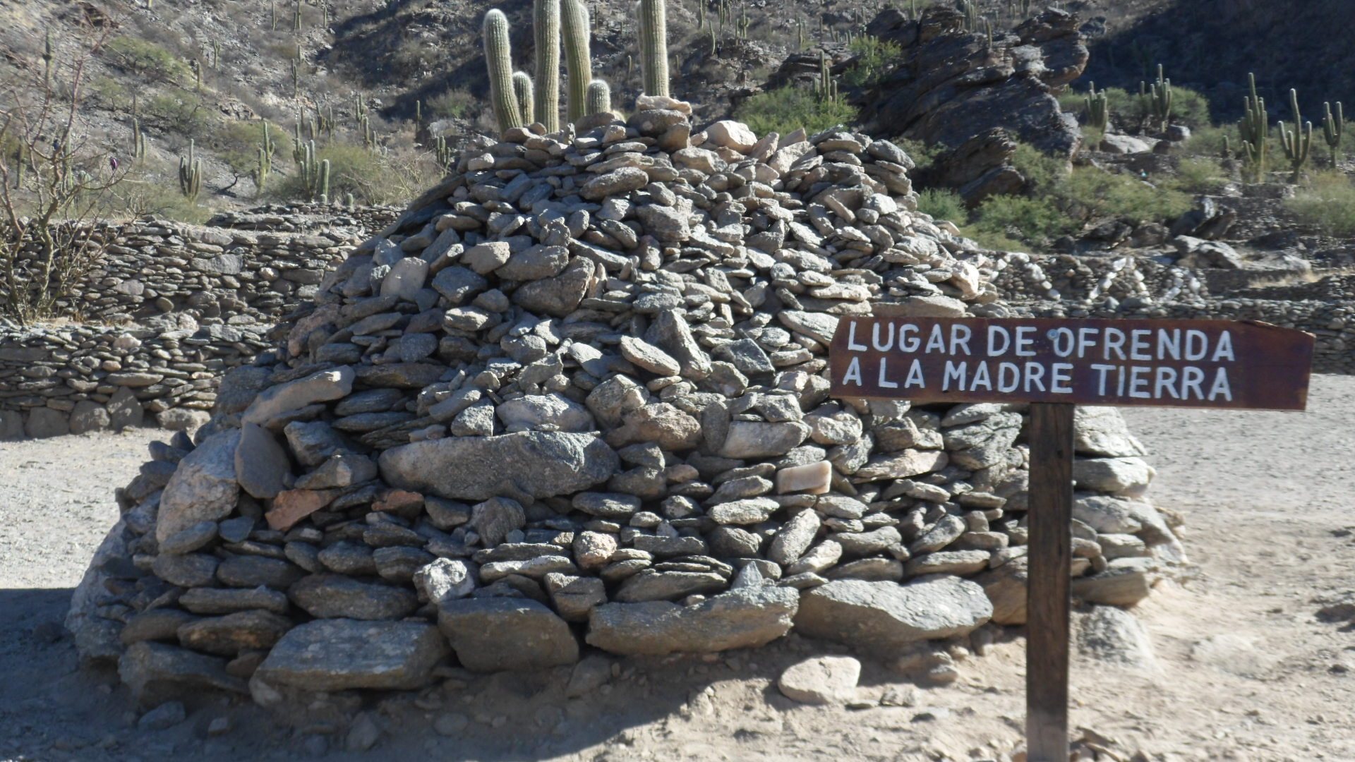
On 28 November 2007, the Quilmes Indigenous Community blocked access to the ruins while demanding restoration of the Sacred City. State forces removed Cruz and his employees on 13 December. On 9 January 2008, descendants of the Quilmes held a spiritual ceremony to Pachamama, an Andean earth and fertility deity associated with agricultural abundance and reciprocal offerings. Access reopened the following day. A later attempted eviction failed after appeals favored the descendants. Since 2008, the Quilmes community has managed the site and offered guided visits.
Remains
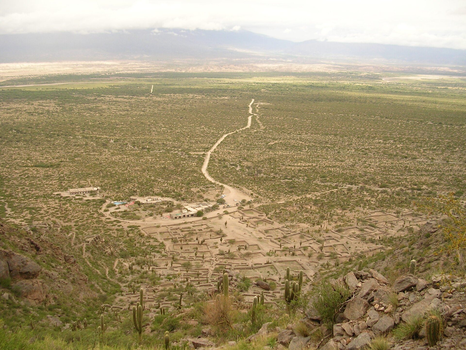
The archaeological settlement extends across approximately 30 hectares on the lower slopes and foothills of Cerro Alto del Rey, overlooking the Yokavil Valley. Earlier investigations described a wider area, measuring about 1 square kilometer in Ambrosetti’s survey and 3 square kilometers in Bruch’s estimate. The surviving remains are organized around stone domestic buildings, defensive positions, paths, water-management works, cultivation areas, storage facilities, and cemeteries. Much of the settlement remains archaeological ground, while two fortresses and one sector of the citadel have been reconstructed.
Buildings and defensive positions
Domestic buildings
Most of the visible remains belong to domestic buildings. Their foundations follow rectangular, square, and circular plans, and the houses were built with stone taken from the surrounding mountain. Old stone walls and paths connect parts of the settlement. A house identified as belonging to the community chief occupies the highest point of the site.
Fortresses and citadel
Two small fortresses overlook the settlement and provided defensive positions with broad views over the surrounding area. Two fortresses and one sector of the citadel have been reconstructed, making the defensive organization of the settlement more visible. The partial restoration represents only a small portion of the original city.
Spanish chapel
The original settlement also contained a chapel built by the Spanish for the evangelization of the Indigenous population. Its remains form part of the later historical layer within the pre-existing settlement.
Water, agriculture, and storage
Water-management works
A dam south of the settlement supplied water through canals. Additional water-management works distributed and controlled the supply within the settlement, supporting habitation and cultivation in the semi-arid mountain environment.
Cultivation and storage
Extensive cultivation areas, especially those used for maize, formed an important part of the community’s food system. The remains also include grain-storage structures, stone animal enclosures, and numerous mortars used with pestles to grind grain.
Cemeteries and archaeological finds
Burial areas
Two cemeteries form part of the settlement’s archaeological remains. Excavation identified children’s burials placed in funerary urns, providing evidence of burial practices within the community.
Objects and images
Investigations recovered finely woven textile fragments and recorded human and animal drawings in the Quebrada de Quilmes. A museum catalogue also listed more than 200 arrowheads, approximately 300 clay figurines, clay tubes, and other objects from the ruins. The removal of these materials from the site was attributed to Manuel B. Zavaleta.
Cacti and other vegetation characteristic of the semi-arid mountain environment remain part of the physical setting. Together with the reconstructed fortresses, domestic foundations, water systems, agricultural works, cemeteries, and paths, these features convey the organization of the Quilmes settlement and the limited extent of its modern restoration.