Tambo Colorado: An Inca Administrative and Military Center in Peru
Site at a Glance
- Rating
- 4.4
- Popularity
- Low
- Country
- Peru
- Primary era
- Medieval
- Eras represented
- Medieval
- Civilizations
- Inca
- Site type
- City
On this page13 sections
History
Tambo Colorado is an Inca administrative, military, and urban center in the Pisco River Valley of Peru, near the route linking the Pacific coast with the Andean highlands. Probably built around 1470 during the reign of Pachacuti Inca Yupanqui, also known as Pachacutec, the settlement served as a tambo, or way station, on the Inca imperial road network, including the Qhapaq Ñan. Its buildings and layout reflect the expansion of the Inca state into the former Chincha sphere.
Chincha and Inca foundations
An earlier settlement from the Chincha period may have occupied the location. The Chincha were a pre-Inca coastal polity whose influence included important commercial networks in the region. After the Inca annexation of the Chincha kingdom, Tambo Colorado was probably established as a military outpost controlling movement between the coast and the highlands.
As the Inca Empire, or Tawantinsuyu, expanded, the settlement’s military function became less dominant. It developed into a local administrative center for officials, messengers, and a military contingent. The road station supported travel along the imperial routes, which connected highland and coastal communities and carried people, supplies, and official information. Chaskis, the relay messengers of the Inca state, and quipuqmayoqs, specialists who managed and interpreted administrative khipu records, were among the groups associated with the settlement.
Tupac Yupanqui and Huayna Capac reportedly visited Tambo Colorado only a few times. During the reign of Huascar, however, the settlement became a base in the confrontation with Atahualpa. Huascar and Atahualpa were rival sons of Huayna Capac whose civil war preceded the Spanish conquest. Atahualpa’s forces later looted and devastated Tambo Colorado during the conflict, and the inhabitants abandoned the settlement. Its use as an official center continued until 1532, although travelers continued using its structures until the 1980s.
Investigation and preservation
Adolph Bandelier carried out the first recorded investigation in 1893. He mapped and photographed the settlement and collected artifacts that are now held by the American Museum of Natural History in New York. Emilio Harth-Terré prepared a more detailed map in 1928, distinguishing pre-Inca and Inca remains and identifying a temple with an altar, a principal building, residences for messengers and record specialists, a residential area, and a watchtower.
Further research followed during the twentieth century. Alberto Giesecke and Horacio Urteaga examined the architectural decoration in 1939 during an expedition organized by the Geographical Society of Lima. In 1957, Frédéric Engel identified three occupation periods at the site, called Paracas Caverns, Monumental Nazca, and Later Pre-Colonial. In 1970, Alejandro Pezzia proposed functions for different sectors on the basis of archaeological evidence. Small archaeological areas near Tambo Colorado include Las Colcas 1, La Llama, Tambo Colorado II, El Pedregal B, Cerro Auquix, La Cima, and Las Terrazas.
Tambo Colorado is designated Cultural Heritage of Peru and covers approximately 1.2 hectares. Its preservation is closely linked to the exceptionally dry coastal environment and to the survival of its adobe architecture and painted surfaces. A museum near the entrance preserves archaeological pieces from the settlement and the surrounding region.
Remains
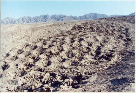
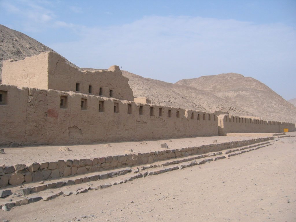
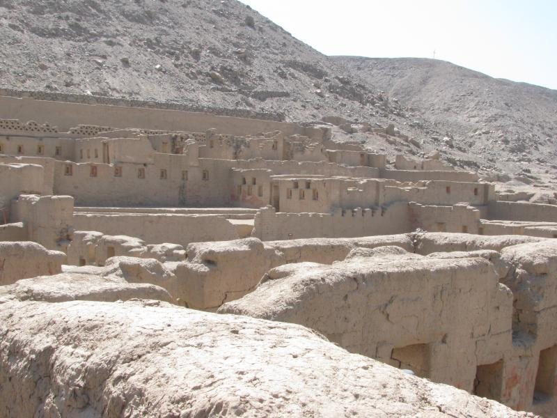
Tambo Colorado occupies a natural platform at approximately 485 to 487 meters above sea level on the northern side of the Pisco Valley. Hills, the valley, and the route toward Ayacucho define the surrounding landscape, while the site lies about 40 kilometers from the Pacific coast. The complex combines Chincha and Inca architectural traditions. Its principal buildings were constructed mainly from adobe and rammed earth, rather than the stonework common in many Inca regions, adapting the settlement to the dry coastal setting.
Enclosure and central spaces
Perimeter wall and plaza
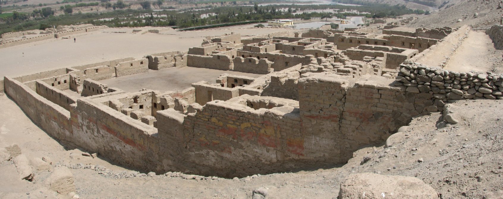
A perimeter wall encloses the settlement and contains decorative niches. Inside it, a large trapezoidal plaza organizes the main sectors. Its longest side measures approximately 150 meters, and the Qhapaq Ñan passes through the open space. Northern, central, and southern groups surround the plaza, creating the principal spatial framework of the complex.
Western ceremonial platform
An ushnu stands on the western side of the plaza. This raised rectangular platform served for public ceremonies, ritual performances, and formal audiences conducted by the Inca ruler or officials. A small wall with niches forms part of the platform, which also provided a view across the Pisco Valley.
Palaces and decorated rooms
Northern Palace I
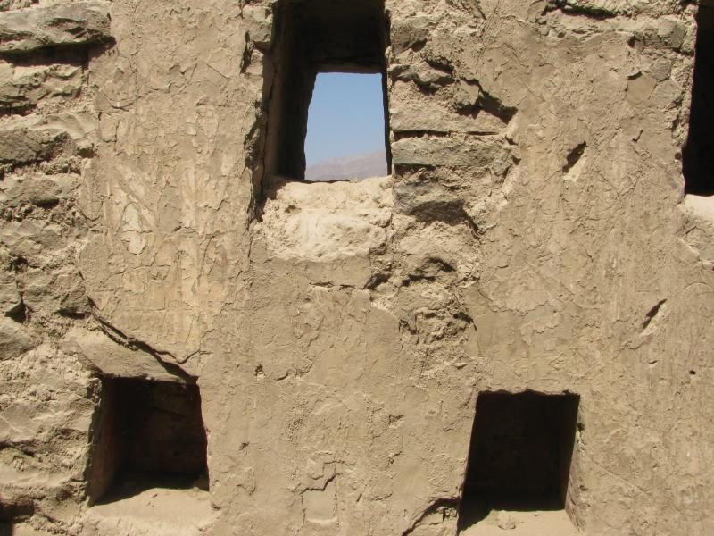
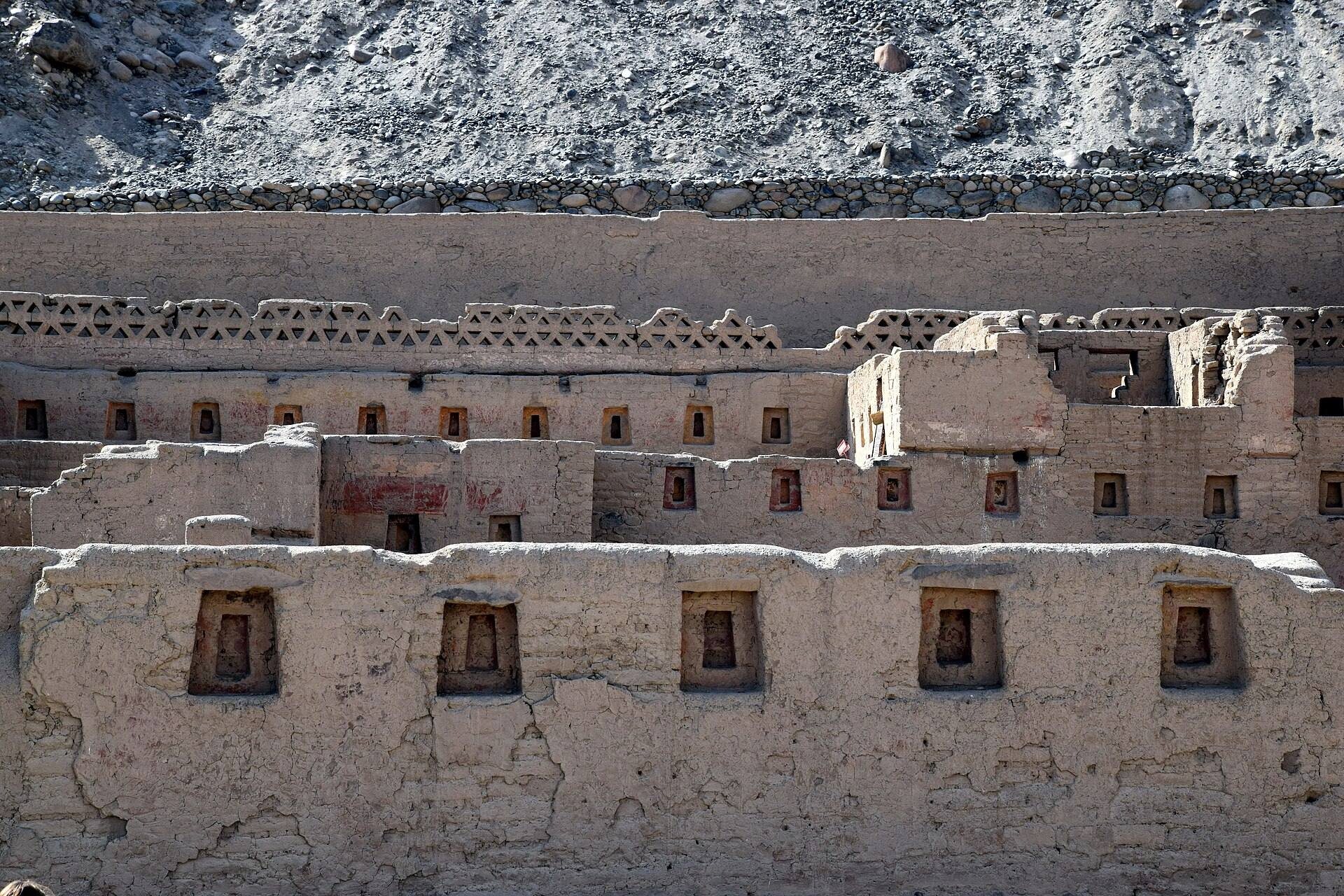
Northern Palace I is the best-preserved and most elaborately built structure at Tambo Colorado. It contains an internal plaza and 66 rooms. The rooms generally have one or two niches, while many also contain trapezoidal windows and entrances. The standardized dimensions of the niches indicate their use for placing important objects.
The palace was built on stone foundations, with quadrangular adobe bricks joined by adobe mortar approximately 2 to 5 centimeters thick. Rammed-earth trellis-like elements decorated the upper parts of some walls. Plaster carried painted decoration arranged in horizontal bands of red, black, white, and yellow ochre. The very dry environment preserved colored paint on many interior and exterior surfaces, including the niches, making it possible to reconstruct aspects of the original decoration. Evidence also indicates that the rooms were originally roofed.
Southern Palaces and principal structures
The southern group includes two Southern Palaces, together with warehouses, houses, and utility buildings. A major structure is also known as La Fortaleza. Other buildings identified within the complex include an imperial palace, barracks, and residences for local administrators. The imperial palace was divided into areas for ordinary people, regional Inca officials, and the Inca ruler.
Religious, logistical, and residential buildings
Temple and water system
A structure identified as a Sun Temple forms part of the settlement’s religious architecture. The palace complex also had a water system supplying cold and hot water. Cold water came from mountain springs, while hot water was conveyed from thermal springs and mountain geysers.
Messengers, warehouses, and watchtower
Warehouses supported the logistical role of the way station, while residences accommodated chaskis and local officials. A watchtower formed part of the wider arrangement of buildings. Together with the barracks and administrative spaces, these structures express the combination of road service, government, military organization, and residence that shaped Tambo Colorado.