Rasuwa Fort: A Historic Nepalese Border Fortification
Site at a Glance
- Rating
- 4.2
- Popularity
- Low
- Country
- Nepal
- Primary era
- Modern
- Eras represented
- Modern
- Civilizations
- Unclassified
- Site type
- Military
- Remains
- Fort
On this page7 sections
History
Rasuwa Fort is a ruined Nepalese fortification in Nepal, built in 1855 during the Nepalese–Tibetan War under the Rana dynasty. It stands near the Nepal–Tibet border in Rasuwa District, where the site controlled an important mountain passage and routes linking the two regions.
Earlier Fortifications and Gorkha Expansion
An earlier fortification may have occupied the site during the Malla period, when Malla rulers governed several kingdoms in the Kathmandu Valley and other parts of Nepal. This installation may date to the seventeenth century or earlier and is associated with protecting the region, overseeing the Nepal–Tibet passage, and regulating trade routes.
The site gained greater strategic importance during the eighteenth-century expansion of the Gorkha kingdom. Under Prithvi Narayan Shah, whose campaigns began the political unification of much of present-day Nepal, the area became involved in conflicts between Gorkha forces and Tibetan incursions. It also served as a centre of power for competing local factions.
War and the Present Fort
The Rasuwa area was the scene of a three-day battle during the second campaign of the Sino-Nepalese War in July 1792. This conflict between Nepal and Tibet, then under Qing imperial influence, ended with a Nepalese victory over Tibetan forces. The site subsequently served as a base for controlling and regulating trade between Nepal and Tibet. These routes also supported cultural and religious exchange in a region influenced by Tibetan Buddhism.
The present fort was constructed in 1855 during the Nepalese–Tibetan War, when the government of Jung Bahadur Rana invaded Qing-ruled Tibet. Jung Bahadur Rana founded and dominated the Rana dynasty, the hereditary ruling family that controlled Nepal’s government from the nineteenth century until 1951. A reconstruction of the fort is dated to 1912.
Decline and Modern Pressure
Under the Shah rulers and later the Rana family, the fort retained strategic value, although it was neglected during periods of relative peace. During the twentieth century, alternative transport routes and the deterioration of its infrastructure reduced its importance. The surrounding region was near areas affected by the Nepalese Civil War of the 1990s, but the fort itself did not play an active role in that conflict.
Nepal and China agreed in 2012 to develop Rasuwagadhi as a formal border crossing. Construction damaged the fort in 2013, and the crossing opened for trade in December 2014 as an alternative to the Zhangmu–Kodari route. A 2020 management plan for Langtang National Park identified stone removal, quarrying, collection of sand and aggregate, encroachment, river-confluence impacts, landslides, and the road beside the fort as conservation concerns. It recommended protecting the confluence, controlling encroachment, and preparing a long-term restoration plan.
Flooding has also reshaped the modern setting around the ruins. On 8 July 2025, a flood destroyed the Miteri Bridge, severely damaged the Syaphrubesi–Rasuwagadhi road and nearby customs facilities, washed away about one kilometre of road, and temporarily severed access between Timure and Rasuwagadhi. Further flooding on 26 August 2026 destroyed the border-crossing complex and damaged the road between Betrawati and Rasuwagadhi at several locations, washing away several bridges and again severing access to the border area.
Remains
Fortification and River Setting
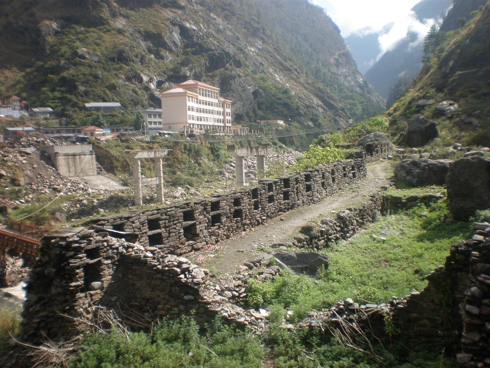
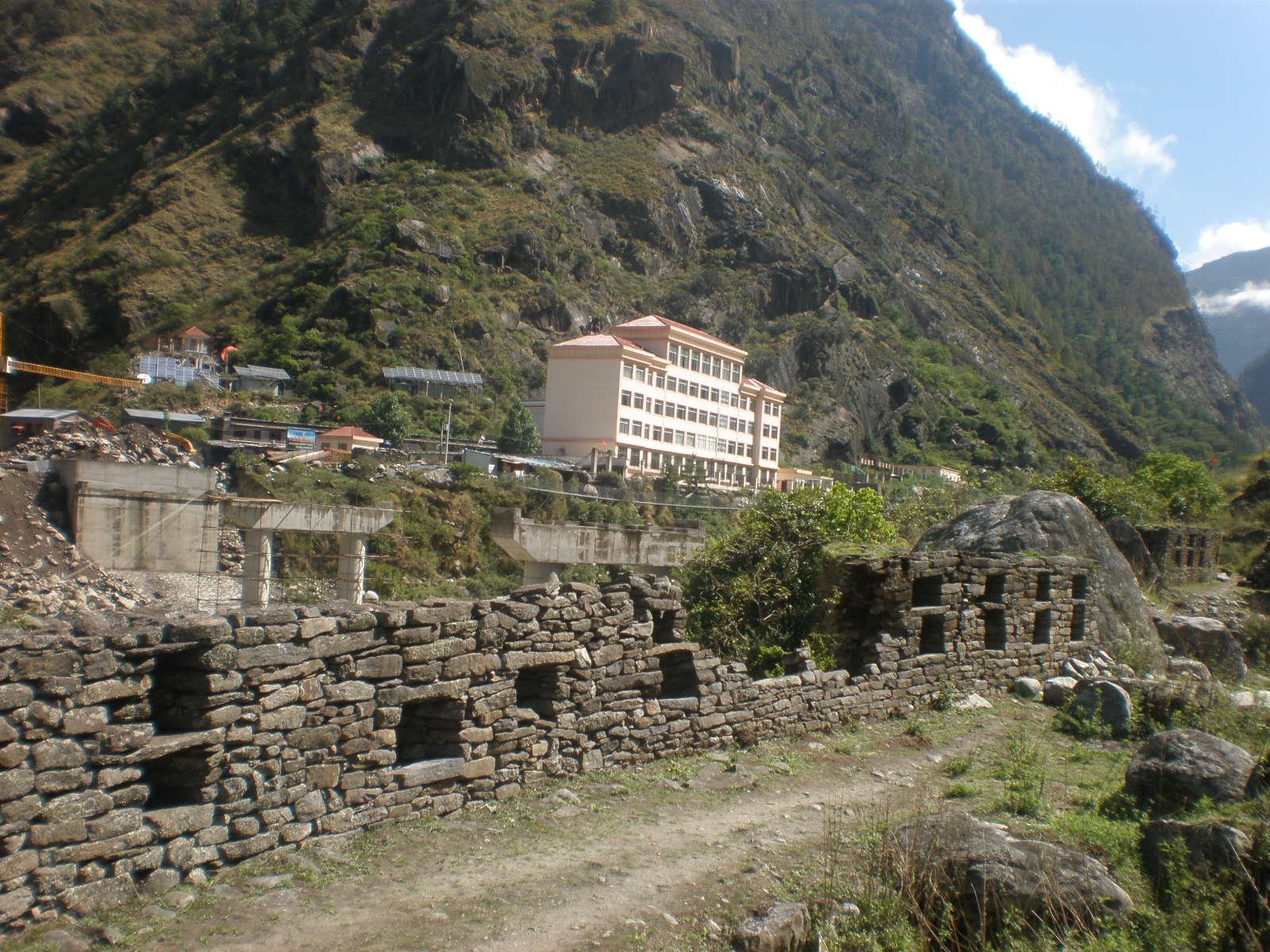
Rasuwa Fort occupies a hilltop beside the Trishuli River system, near the confluence of the Lhende Khola and Kerung Khola. Their combined flow is known on the Nepalese side as the Bhote Koshi. The position provides broad views across the surrounding area and helped control movement through the Nepal–Tibet routes. Within Langtang National Park, a protected mountain area of northern Nepal, the surviving fortification consists of defensive walls, towers, and other defensive structures. Much of the complex has been dismantled or has deteriorated through time and limited maintenance.
Border Infrastructure and Access Corridor
The Gyirong–Rasuwagadhi border crossing and the Miteri Bridge stood immediately beside the fort. The bridge connected the northern end of Nepal’s Trishuli Corridor with Gyirong Port on the Chinese side. National Highway 42 runs alongside the historic site and ends at Rasuwagadhi. Its approximately 18-kilometre Syaphrubesi–Rasuwagadhi section forms the corridor’s northernmost part and links the border area southward with Timure, Syaphrubesi, Mailung, Betrawati, and Galchhi. The 2013 border construction, followed by floods that damaged or destroyed nearby bridges, roads, customs facilities, and the border complex, altered the physical setting around the ruins. Rasuwa Fort lies about 3 kilometres north of Timure and about 25 kilometres south of Gyirong, the nearest Chinese settlement.