Shanhai Pass: A Ming Gateway of the Great Wall in China
Site at a Glance
- Rating
- 4.4
- Popularity
- Very Low
- Country
- China
- Primary era
- Medieval
- Eras represented
- Medieval, Early Modern, Modern
- Civilizations
- Chinese
- Site type
- Military
- Remains
- Fort
On this page12 sections
History
Shanhai Pass is a fortified gateway of the Great Wall in Qinhuangdao, Hebei, China, whose present form was built in 1381 during the Ming dynasty. It commands the narrowest part of the Liaoxi Corridor, the coastal route between the Yan Mountains and the Bohai Sea, and historically guarded the principal easily traversable land passage between North and Northeast China. The Great Wall was a system of walls, fortresses, gates, and military settlements built and rebuilt by successive Chinese states, and Shanhai controlled movement through one of its most important gaps.
Early Fortifications and Frontier Garrisons
Fortifications were established in the area under the Northern Qi, Sui, and Tang dynasties. During the Tang dynasty, the site was known as Yuguan, and a garrison had been established there by 785. Eight further garrisons were created between Yuguan and Jinniukou to defend the corridor against incursions from northeastern groups, including the Dongyi, Donghu, Khitan, and Jurchen.
During the Later Tang and Five Dynasties periods, autonomous governors controlled the area, while by the Five Dynasties period only the Yuguan garrison remained. The Liao dynasty later ruled the region and established Qianmin County east of Yuguan. Further garrisons were constructed under the Jin and Yuan dynasties, continuing the military importance of the passage.
The Ming Pass and Imperial Defense
In 1381, Ming general Xu Da, a leading commander under the Hongwu Emperor, was ordered to repair the old Yongping and Jieling passes. He also established the present Shanhai Pass between the mountains and the sea. After the Yongle Emperor transferred the Ming capital from Nanjing to Beijing following the Jingnan civil war, the pass was extensively reinforced. Its position made it the main defensive barrier protecting the region around the imperial capital.
In the late sixteenth century, the Ming commander Qi Jiguang strengthened Shanhai Pass and built military cities and forts to its east, south, and north. These works made the pass one of China’s most heavily fortified frontier positions. Its importance was reflected in the title “First Pass Under Heaven,” which emphasized its position at the eastern end of the Great Wall.
The Battle of 1644
The decisive Battle of Shanhai Pass took place in 1644, after the rebel leader Li Zicheng captured Beijing and established the short-lived Shun dynasty. Wu Sangui, the Ming commander of the Ningyuan garrison, sought help from the Manchu forces rather than submit to Li. Qing regent Dorgon led the Manchu intervention at Shanhai Pass, where Wu’s troops and the Manchus defeated Li’s army.
Li was forced to abandon Beijing, allowing the Qing, a dynasty founded by the Manchus, to enter the capital and become the dominant power in China. The battle therefore connected the history of the pass directly with the transition from Ming to Qing rule.
Qing Administration and Controlled Movement
During the Qing dynasty, particularly under the Qianlong Emperor, Shanhai Pass became the seat of Linyu County under Yongping Mansion, an imperial territorial administration governing counties. Additional forts were built during the late Qing period to strengthen coastal defenses. Because the pass lay between Beijing and Shenyang, it was also known as the “Key to the Capitals.”
Qing authorities enforced restrictions on movement across the Great Wall. Guards at Shanhai Pass checked the identities of people traveling north, so the fortress operated both as a military barrier and as a controlled boundary between China proper and Manchuria.
War and Political Change in the Twentieth Century
In July 1900, 15,000 Imperial Japanese Army troops landed at Shanhai Pass as part of the Eight-Nation Alliance, an international force formed during the conflict surrounding the siege of the foreign legations in Beijing. They advanced toward the capital to relieve the siege. A later confrontation between Japanese and French troops killed three French and seven Japanese soldiers and wounded five French and twelve Japanese soldiers.
In January 1933, during Japan’s campaign in northeastern China, Japanese forces used a staged explosion as a pretext for demanding the withdrawal of the Chinese garrison. When the demand was rejected, the Japanese Eighth Division attacked with aircraft, tanks, and naval bombardment. It captured the pass two days later, and the Chinese forces withdrew after suffering approximately 2,000 deaths.
In November 1945, the Northeastern People’s Liberation Army attempted to hold Shanhai Pass against Kuomintang forces advancing from the south. Its 10,000 troops were inadequately equipped and too few to defend the position, so the force retreated to Siping. The city later became a destination for refugees fleeing the Liaoshen campaign. During the Chinese Civil War, Communist forces captured the pass on November 27, 1948. After the founding of the People’s Republic of China, it first came under Liaoxi Province and later Hebei Province.
China’s State Council designated Shanhai Pass a Major Historical and Cultural Site Protected at the National Level in 1961. The pass was included in the UNESCO World Heritage listing of the Great Wall in 1987.
Remains
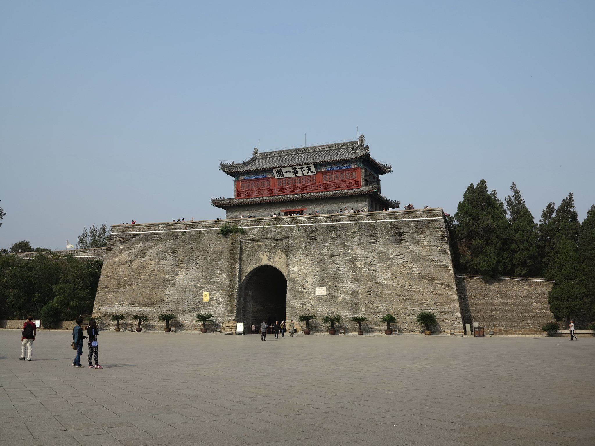
Shanhai Pass occupies a square fortified area of approximately 1.5 square kilometers, with a perimeter of about four kilometers. Its walls stand approximately 14 meters high and reach up to seven meters in thickness. Rammed earth forms their core, while brick facing protects the surfaces. The fortress lies south of the Yan Mountains and north of the Bohai Sea, on the eastern bank of the Shi River, with its defenses extending from the mountains toward the shore of Liaodong Bay.
Fortress Walls and Gates
Deep, wide moats bordered the eastern, southern, and northern sides of the fortress, and drawbridges provided access across them. A drawbridge is a bridge that can be raised to block a route over a moat. The fortified area also contained gates, towers, government offices, and a temple, while a tall bell tower stood near its center.
Zhendong Gate
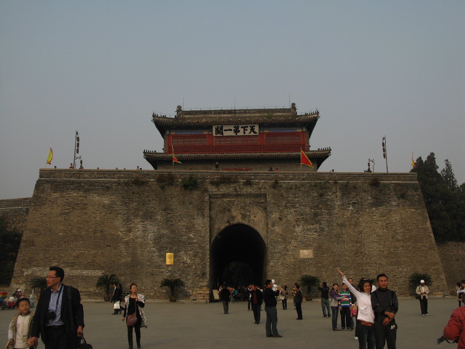
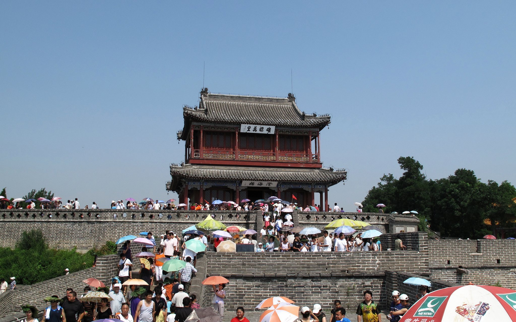
The four sides of the fortress formerly had gates named Zhendong Gate in the east, Ying’en Gate in the west, Wangyang Gate in the south, and Weiyuan Gate in the north. Zhendong Gate was the principal entrance and faced toward Beijing. Its gate tower carries the inscription “First Pass Under Heaven.” The plaque now above the entrance was installed in 1920 as a copy of an earlier calligraphic inscription attributed to the Ming scholar Xiao Xian. The original is preserved on the second floor of the gate tower.
Great Wall and Associated Sites
Old Dragon’s Head
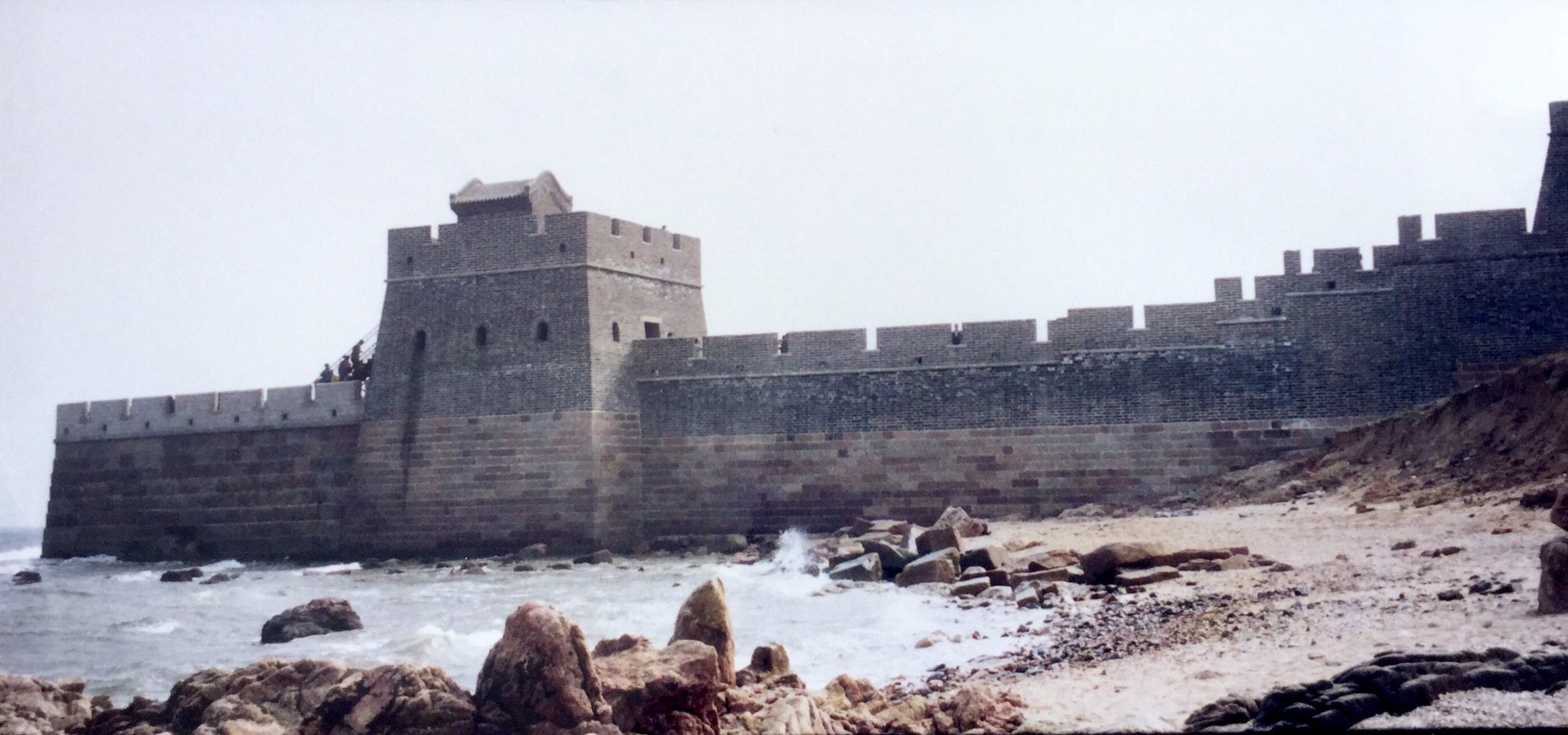
Old Dragon’s Head, the easternmost point of the Great Wall, lies approximately four kilometers south of the fortress. At this point, the wall extends about 20 meters into the Bohai Sea, creating the form of a dragon drinking from the water. The existing section was reconstructed during the 1980s, while its connection with the sea expresses the coastal reach of the Shanhai defenses.
Meng Jiangnu Monastery
A small Meng Jiangnu Monastery stands on Phoenix Mountain approximately seven kilometers east of the pass. Built before the Song dynasty and renovated during the Ming dynasty, it commemorates the legend of Meng Jiangnu, whose husband supposedly died while working on the Great Wall. Four rocks in the sea opposite Shanhai Pass are traditionally identified as her burial place.