Fort Prince of Beira: A Portuguese Frontier Fortification in Brazil
Site at a Glance
- Rating
- 4.7
- Popularity
- Low
- Country
- Brazil
- Primary era
- Early Modern
- Eras represented
- Early Modern
- Civilizations
- Portuguese
- Site type
- Military
- Remains
- Fort
On this page7 sections
History
Portuguese frontier policy
Fort Prince of Beira is a Portuguese star fort in Brazil, built from 1776 to 1783 in the early-modern period according to the Italian trace system. It secured Portugal’s frontier with Spanish territories and helped consolidate Portuguese control of the Guaporé basin. The fort was one of only two built by the Portuguese Empire in the interior of Brazil.
Its creation formed part of the eighteenth-century military and colonization policy associated with Sebastião José de Carvalho e Melo, Marquis of Pombal, the chief minister of King Joseph I of Portugal. Territorial arrangements negotiated between Portugal and Spain from 1750 to 1777 also shaped the struggle for control of the region. Joseph I reigned from 1750 to 1777, while his predecessor, João V, had established the captaincy of Mato Grosso, a Portuguese colonial division governed by a captain-general, to develop and defend Portugal’s Amazonian territories.
Portuguese and Paulista gold prospecting competed with Spanish activities and Jesuit missions along the Guaporé and its tributaries. These rivalries produced repeated conflicts. Portuguese efforts to secure the area included the foundation of Vila Bela da Santíssima Trindade on the Guaporé and the construction of the fortified post of Our Lady of the Conception in 1769. That post was weak enough to encourage a Spanish attempt to seize it, although the attack failed after Spanish forces suffered from fevers and other illnesses.
Construction and military purpose
Luís de Albuquerque de Melo Pereira e Cáceres, governor and captain-general of the captaincy of Mato Grosso, selected the site in late 1773. The new fort replaced the earlier Forte de Bragança, which stood about 2 kilometres away and had already fallen into ruins. The new position was intended to help control both banks of the Guaporé, the Guarujus mines, and the river route linking the Guaporé, Mamoré, and Madeira rivers.
Construction continued from 1776 to 1783. Domingos Sambuceti directed the works until his death from malaria, after which the engineer captain Ricardo Franco de Almeida Serra took charge. At least 200 people, and later more, worked on the project. Workforce records survive for the period from 1766 to 1776. The fort’s name honored Joseph of Braganza, identified as a Prince of Beira and grandson of João V. The title traditionally belonged to the eldest son of the heir to the Portuguese throne.
By 1797, the fort contained a royal warehouse and stores of weapons, ammunition, tools, food, nautical equipment, and other supplies needed by the Crown’s military forces and civil departments. These provisions supported the fort’s role as a military and logistical post on the frontier.
Decline, abandonment, and protection
Once Portuguese control of the region had been consolidated, the fort’s strategic importance declined from the end of the eighteenth century. In 1864, it was nominally assigned a garrison of ten soldiers, although only three were serving there. The others were posted at Pedras Negras and at the mouth of the Itonamas River. A boundary commission examining the Brazil–Bolivia frontier found fourteen soldiers and a sergeant at the fort in 1876.
During the nineteenth century, the fort also served as a political prison. Inscriptions in its prison areas relate to that use. Military occupation ended in 1889, around the proclamation of the Brazilian Republic.
On 6 July 1913, Admiral José Carlos de Carvalho and other officials inspected the abandoned fort. Temporary custody was assigned to the state of Mato Grosso while the federal government considered its administration. One cannon found at the site and a period wooden half-door with its iron fittings were designated for transfer to the National Historical Museum in Rio de Janeiro. The state government subsequently moved the interim Lamego customs post into the ruined fort and maintained a police detachment to guard and conserve it. Brazil’s National Institute of Historical and Artistic Heritage listed the fort as a protected cultural monument on 7 August 1950.
Remains
Fortification and river setting
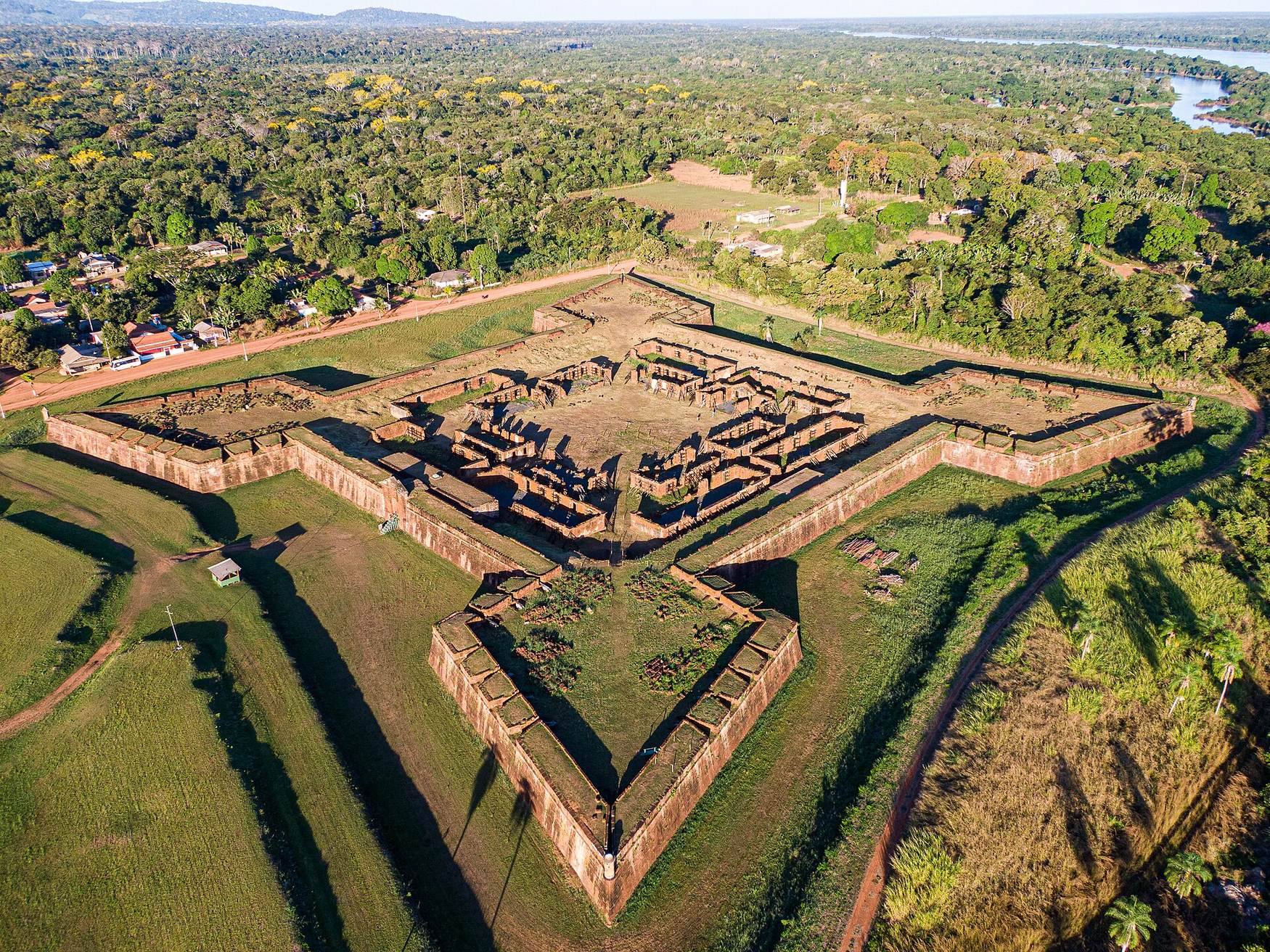
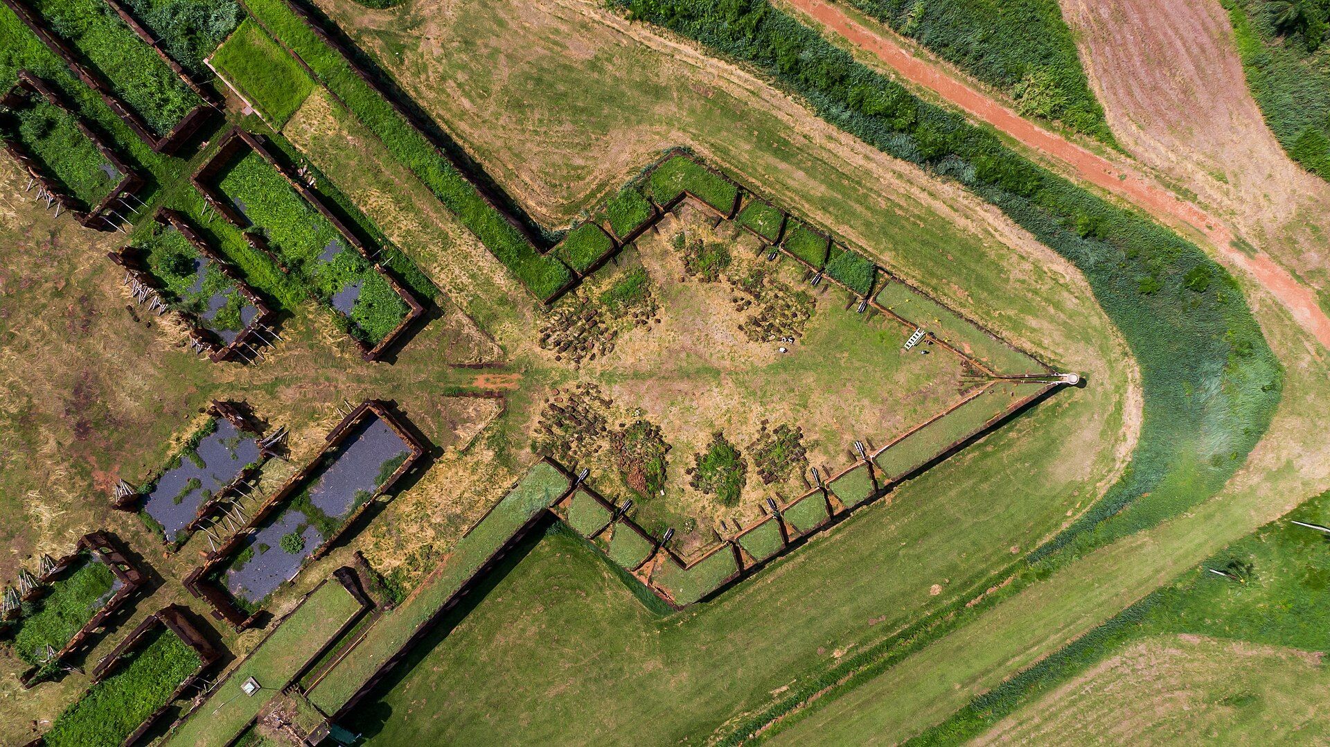
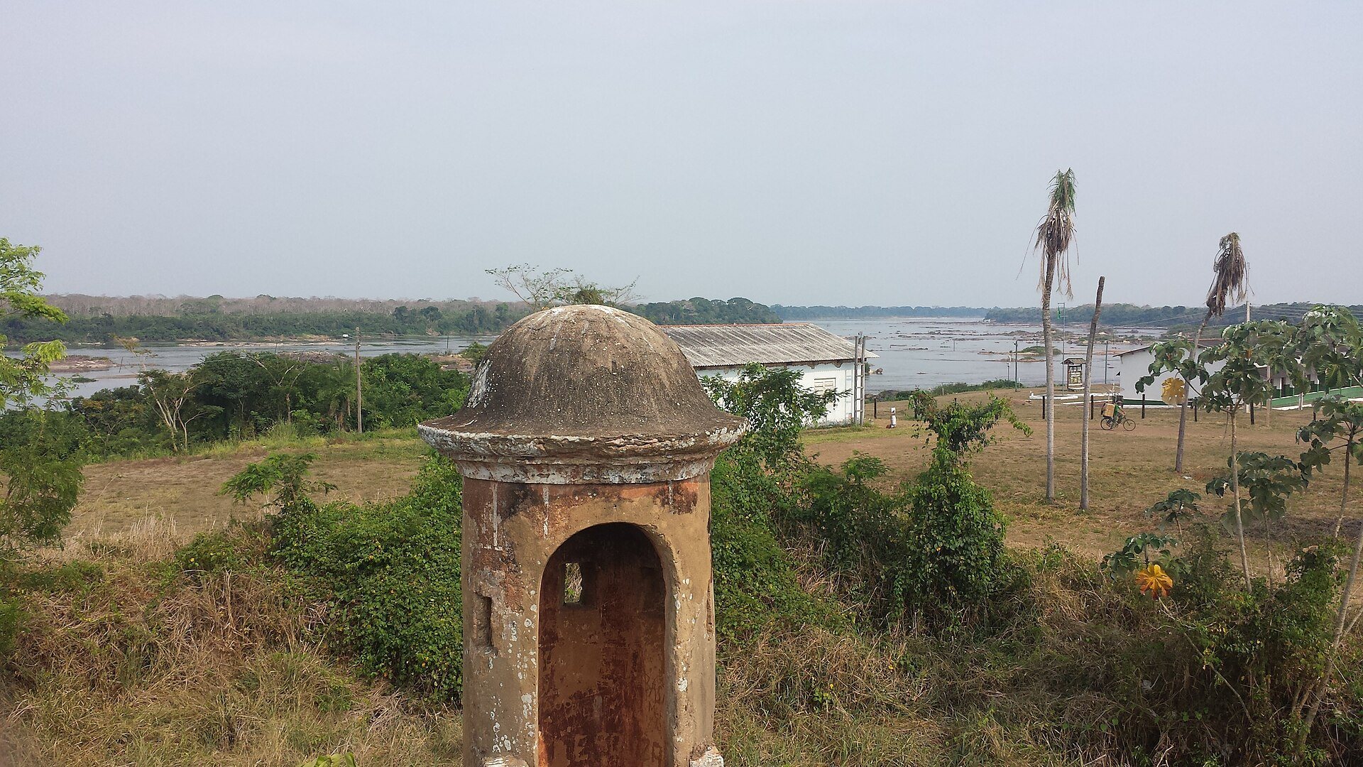
Fort Prince of Beira stands on the right bank of the Guaporé River, near the river’s lower course and its confluence with the Mamoré, in the municipality of Costa Marques, Rondônia. Its position lies on the frontier with Bolivia. The surviving complex is a star-shaped fortification built of stone and lime, using the Italian trace system. This design used angular walls and projecting bastions to reduce vulnerable blind spots and allow defenders to cover adjoining walls with crossfire.
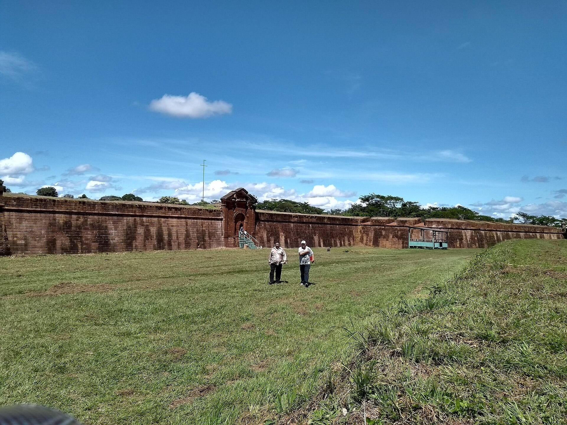
The outer wall rises approximately 10 metres and extends for about 1 kilometre in total. Four bastions project from the fortification, each originally equipped with fourteen cannons. One cannon is reported to remain at the fort. The scale and arrangement of the walls and bastions express the defensive purpose for which the site was built along the Guaporé frontier.
Buildings within the walls
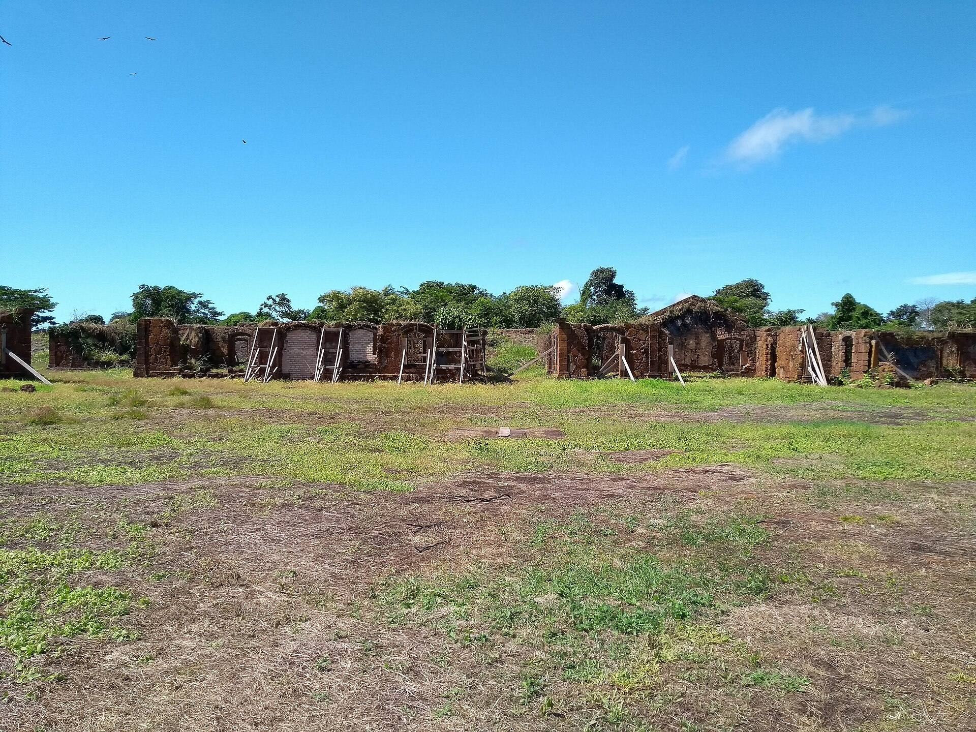
Inside the enclosure are the ruins of a chapel, soldiers’ quarters, service and utility buildings, and a prison. Together, these remains represent the religious, residential, logistical, and disciplinary functions required by a permanent military post. The prison areas contain inscriptions associated with the fort’s nineteenth-century use as a political prison.
The earlier Forte de Bragança, replaced by the stone-and-lime fortification, stood approximately 2 kilometres away. It was already in ruins when the new fort was planned, forming part of the earlier Portuguese effort to secure the same frontier zone.