Tustan: A Medieval Fortress-City and Customs Station in Ukraine
Site at a Glance
- Rating
- 4.8
- Popularity
- Medium
- Country
- Ukraine
- Primary era
- Medieval
- External website
- Open
- Eras represented
- Medieval
- Civilizations
- Unclassified
- Site type
- Military
- Remains
- Castle
On this page15 sections
History
Tustan is a medieval cliff-side fortress-city, administrative center, and customs station in Ukraine, near Urych in the Ukrainian Carpathians. Its earliest phase is uncertain, but the complex remained in use into the sixteenth century, and its first surviving written mention dates to 1340. Built among sandstone outcrops, it controlled a route that carried salt and other goods through the Carpathian passes toward Transcarpathia and Western Europe.
Early regional history
In the ninth century, the surrounding territory was inhabited by White Croat tribes. By the end of the tenth century, regional Croatian principalities had been conquered by Prince Volodymyr Sviatoslavych and incorporated into Kyivan Rus, the medieval East Slavic polity centered on Kyiv. By the mid-twelfth century, Tustan belonged to the Peremyshl Principality, a regional state centered on Peremyshl.
Tustan later became an important frontier center between the Galician-Volhynian Principality, the southwestern successor of Kyivan Rus, and Hungary. Its political setting subsequently placed it between the Kingdom of Poland and Hungary. The fortress therefore combined defensive, administrative, and commercial functions at a point where routes and political boundaries met.
Fortress and customs station
The chronicles associated with Janko of Czarnków and Jan Długosz indicate that Tustan was already an established defensive fortress before King Kazimierz III of Poland, also known as Casimir the Great, took control of it during his 1340 campaign in Rus. Archaeological evidence places the fortress before this takeover as well.
Tustan guarded the salt-trade route from Drohobych through the Stryi and Opir valleys and over the Carpathian passes. Its officials collected customs duties on salt and on livestock being transported through the controlled route. Guards also protected merchants and their goods, making the fortress part of the economic as well as military organization of the frontier.
A papal document dated 15 May 1390 transferred Tustan, its surrounding settlements and property, and a tithe of salt from Drohobych and Zhydachiv to the newly formed Galician Catholic diocese. A royal charter of 4 November 1395 described Tustan as the center of a volost, a territorial administrative district, and granted the village of Krushelnytsia to Ivan, Damian, and their sons.
Later medieval use and decline
In 1539, the king granted Tustan to Mikolaj Blizinski and his heirs at the request of Jan of Tarnow. The grantees were required to defend, restore, reinforce, and maintain the fortress, although it is uncertain whether the required work was completed. In 1541, Blizinski transferred the village of Pidhorodtsi and Tustan to Jan of Tarnow.
The last known written reference to Tustan appears in a 1565 inventory of the Drohobych saltworks. It states that customs duties were still collected there and amounted to 14 zlotys. The fortress then gradually lost its former role. Central European countries developed their own salt sources, reducing the need for Galician salt exports; political relations between Poland and Hungary stabilized and the frontier moved eastward; and changes in military technology and tactics reduced the defensive value of the cliff-side complex.
Research and protection
Scientific interest in the rocks at Urych began in the nineteenth century through local historical and folklore studies. Exploratory work continued during the twentieth century, including investigations by Y. Pasternak, O. Ratych, P. Rapoport, and R. Bahriy.
From 1971 to 1978, Mykhailo Rozhko and his assistants systematically measured surviving construction traces and prepared the first reconstructions. From 1978, a Lviv regional heritage expedition worked at the site. Between 1979 and 1991, it operated as the Carpathian Architectural and Archaeological Expedition of the Academy of Sciences of the Ukrainian SSR under Rozhko’s direction. Rozhko’s research produced spatial and volumetric reconstructions, identified the central fortress core on the Kamin rock group, and distinguished defensive or watch posts on Ostryi Kamin and Mala Skelia. Excavation, architectural measurement, and analysis of wall remains supported a reconstruction of five periods of wooden construction.
The State Historical-Cultural Reserve “Tustan” was established by the Cabinet of Ministers of Ukraine in 1994. The Lviv Historical Museum initially administered it, a separate directorate was created in 2005, and the administration was reorganized under the Lviv Oblast Council in September 2016. Tustan is an archaeological monument of national significance and a natural monument of local significance. The protected complex covers 464 hectares and forms part of the Tustan Site Museum within Skole Beskids National Nature Park.
The name Tustan has several proposed explanations. One derives it from a reconstructed Proto-Slavic personal name meaning “strong,” “firm,” or “brave.” Another is the traditional interpretation “stand here,” recorded by Stanislaw Sarnicki in 1585. A further hypothesis connects the name with Proto-Slavic terms associated with dense growth and a word related to status or state.
Remains
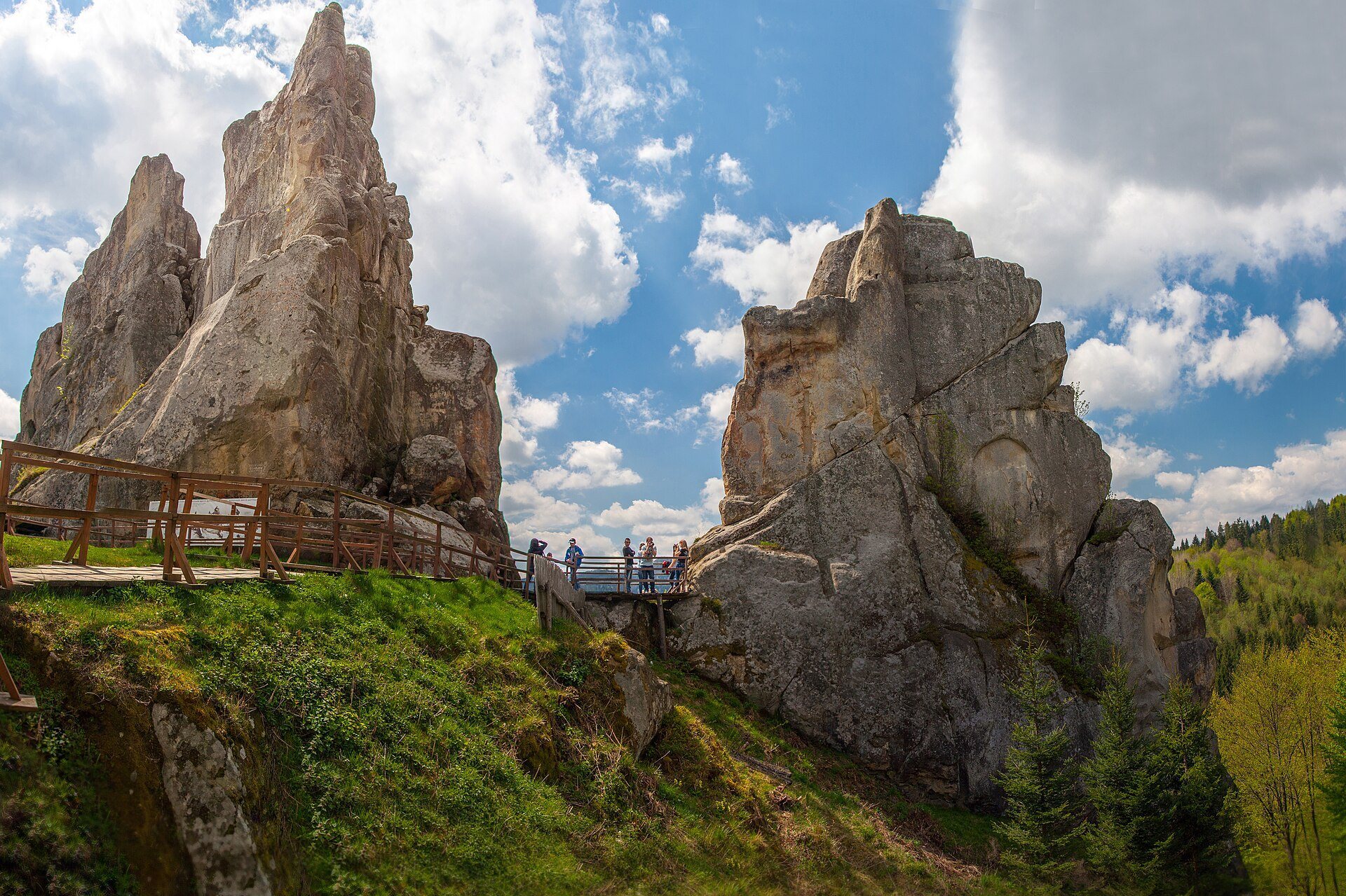
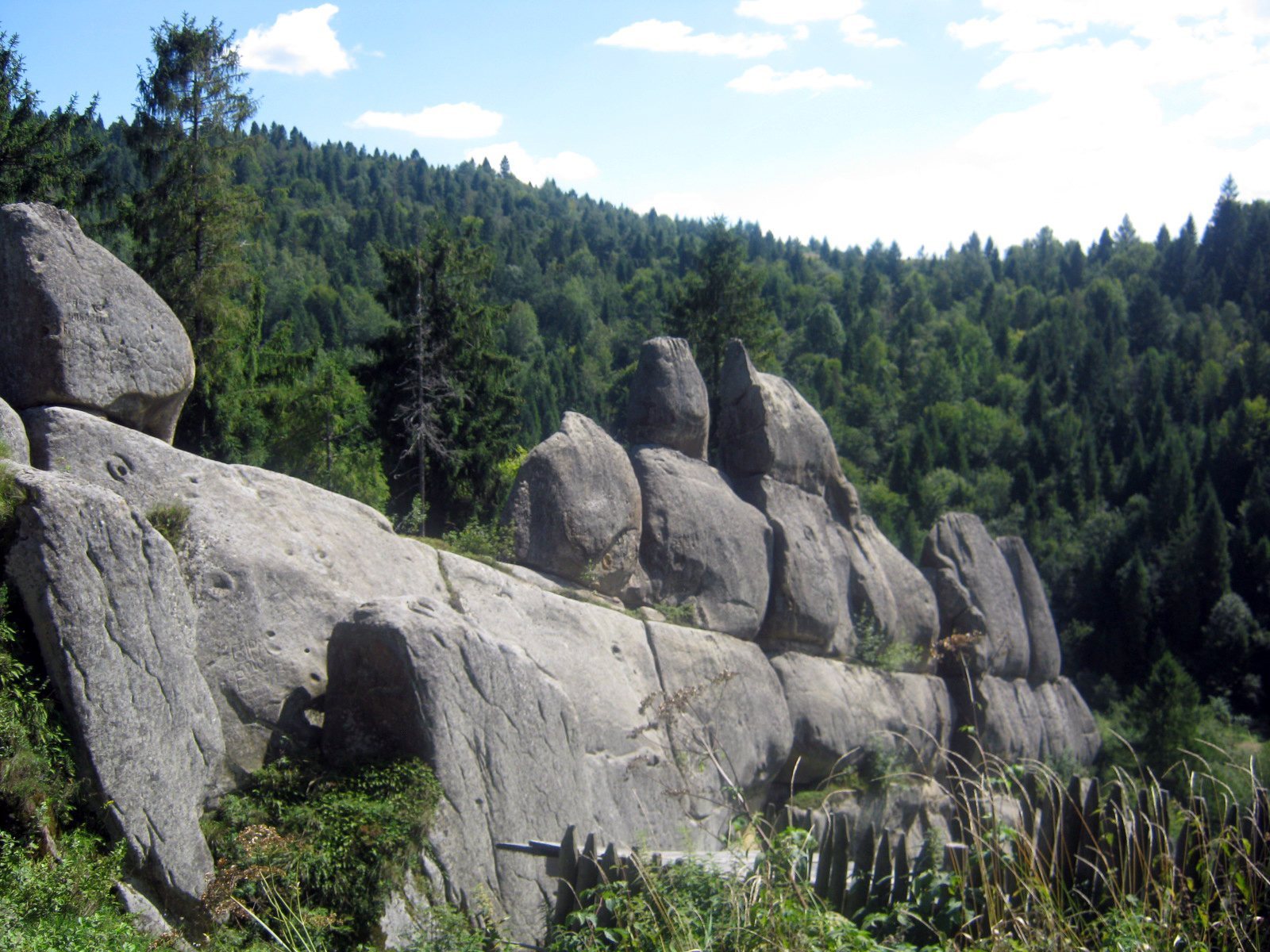
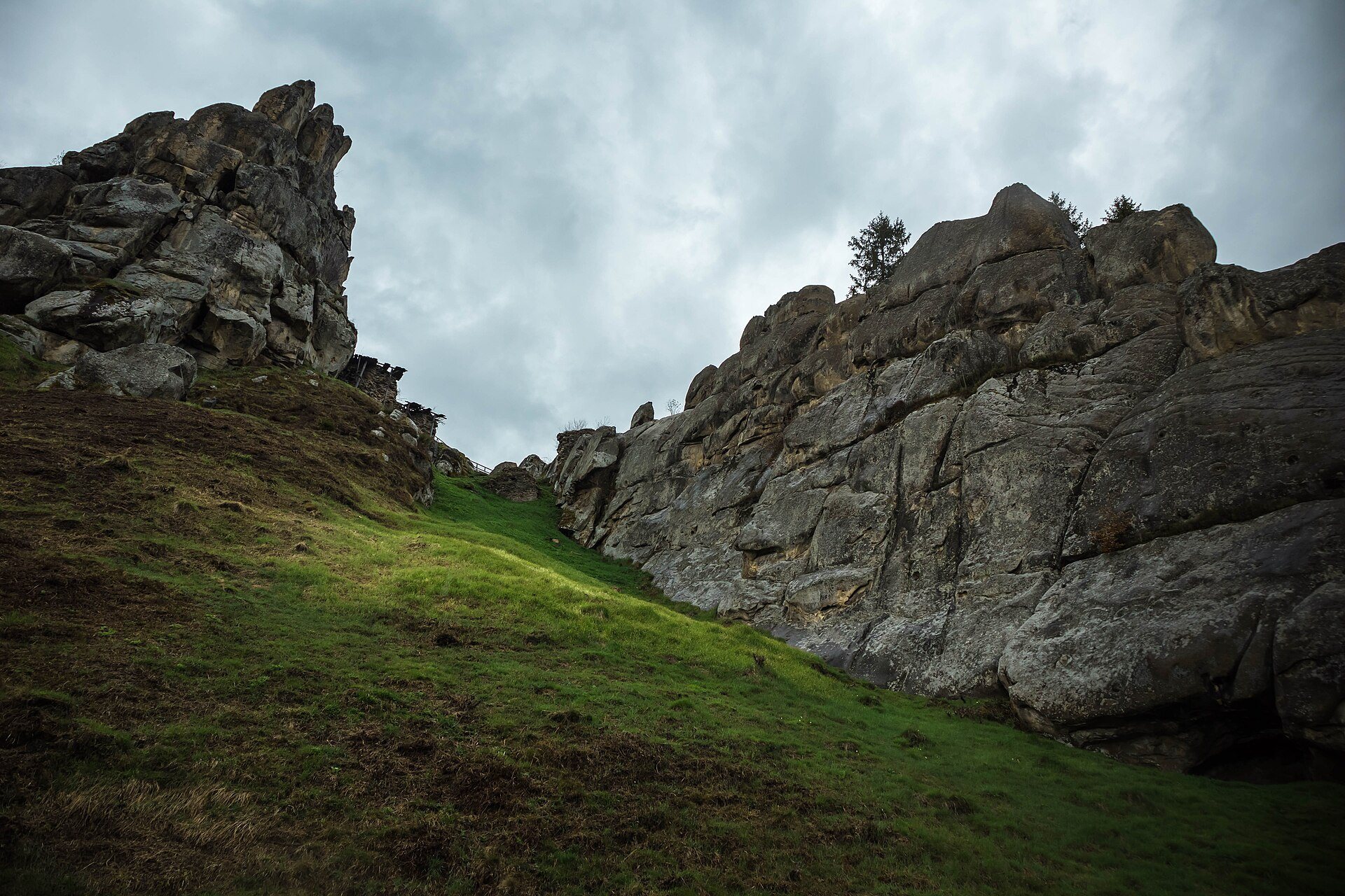
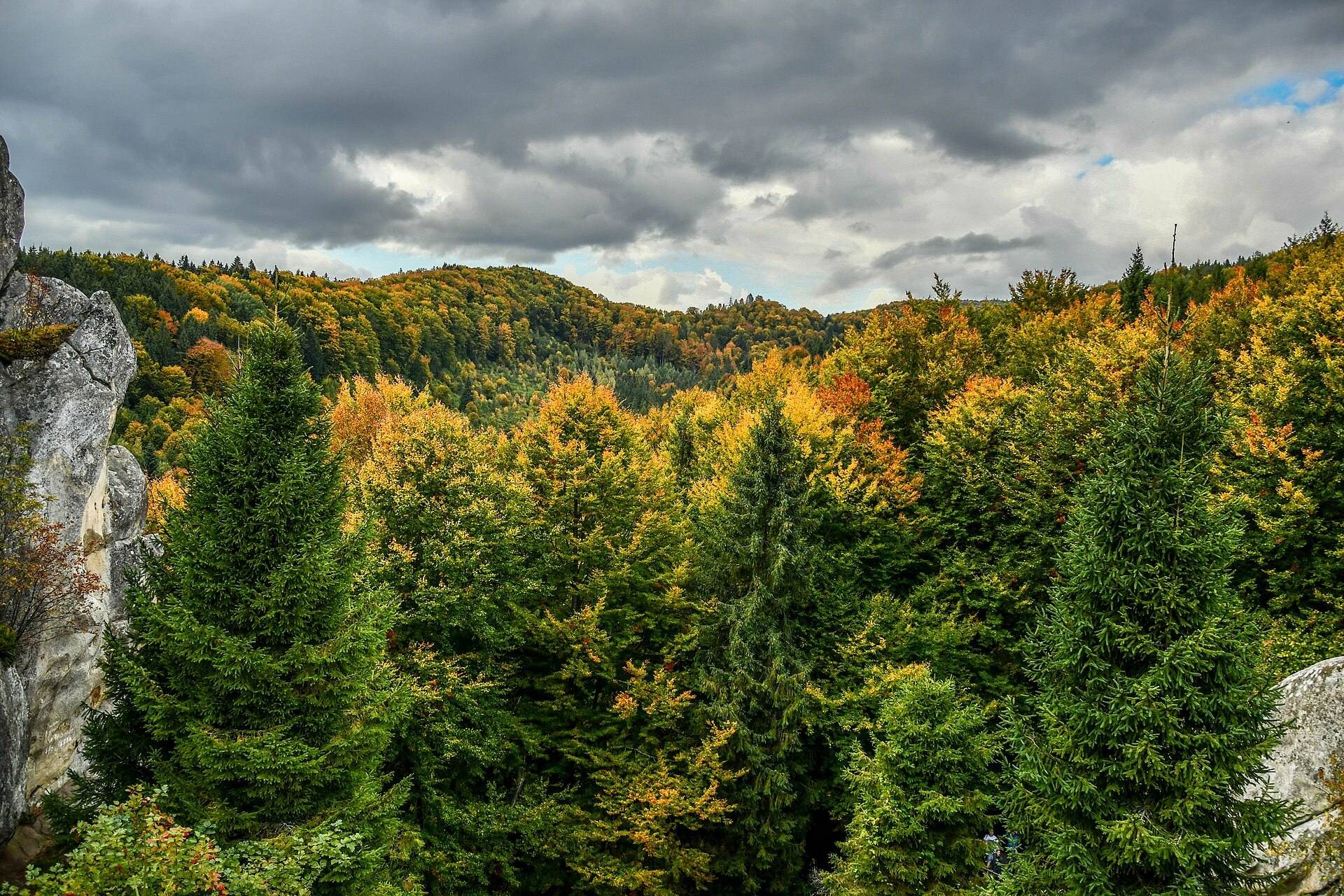
Tustan occupies eroded, near-vertical sandstone outcrops in a forested mountain setting. The principal rock groups are Kamin, Ostryi Kamin, Mala Skelia, and Zholob, also called Orel. The sandstone belongs to the Yamna Formation of the Paleogene and has near-vertical sedimentary bedding with mattress-like and globular textures. Weathering and the composition of the stone produced monoliths, boulder accumulations, cracks, recesses, and small natural and artificial caves.
Rock groups and defensive construction
The rock formations served as natural defensive walls. Builders enclosed gaps between them with wooden walls and cut grooves, notches, and other recesses into the sandstone to anchor logs and related wooden elements. More than 4,000 construction traces have been recorded on Kamin. These marks show how the fortress was built and allow its successive wooden phases to be reconstructed.
The complex expanded repeatedly from the lower parts of the rocks toward progressively higher platforms. At its greatest extent, construction occupied the available galleries and terraces from the foot of the outcrops to their summits. The internal courtyard had continuous construction rising to five storeys, each approximately 3.5 to 4 metres high. Defensive walls may have reached 15 metres, while the principal residential building covered more than 1,000 square metres and included storage and service rooms on the surface and within the rock.
Kamin
Kamin was the central rock group and the core of the reconstructed fortress. Its difficult-to-reach surfaces contain most of the petroglyphs and more than 4,000 traces left by wooden construction. The arrangements of grooves, notches, galleries, and terraces indicate the changing height and extent of the complex through five periods of wooden building.
Ostryi Kamin and Mala Skelia
Ostryi Kamin and Mala Skelia held separate defensive or watch posts within the wider fortress system. Their positions among the sandstone outcrops formed part of the network that extended beyond the central core on Kamin.
Water supply and masonry
A well 35 metres deep and two cisterns cut into the rock supplied water during sieges. These installations formed part of the fortress infrastructure alongside the residential, storage, and service spaces.
A surviving stone wall has been dated by Mykhailo Rozhko to the second half of the thirteenth century. Approximately 2.5 metres thick, it covered earlier grooves cut into the rocks for wooden walls and represents a later masonry phase within the complex’s development.
Archaeological finds
Excavations produced more than 25,000 finds, including wooden construction elements, metal objects, pottery, glass, and leather goods. The wooden material includes fragments of six doorposts, gallery posts, beams, treenails, boards with dovetail joints, laths, shingles, wooden spoons, and a spade. Pottery fragments date from the ninth to the seventeenth centuries.
The metal finds include an engolpion, a small Christian reliquary pendant worn on the chest, as well as a ring bezel engraved with a bird, a bronze mace, a sledgehammer, an axe, crossbow and longbow arrowheads, spearheads, fire strikers, spurs, bell clappers, woodworking cutters and chisels, needles, and book clasps. Ceramic tiles include fragments bearing a relief image of George the Dragonslayer killing a dragon.
Rock images and later marks
Petroglyphs on Kamin
Petroglyphs, images or marks made on rock surfaces, are concentrated mainly in difficult-to-reach locations on Kamin. They include a handmade image of a wolf pursuing an elk, along with a horse and a rider.
Figures on Velyke Krylo
Excavations directed by Rozhko on the slopes of Velyke Krylo uncovered eight rock figures. The group consists of five axes, two crosses, and one four-legged swastika.
Circular marks and later symbols
Circular and disk-shaped marks traditionally described as solar signs have received different interpretations. Mykola Bandrivskyi regarded them as deliberately arranged human-made signs, while geologist Bohdan Ridush identified them as natural reliefs formed by fossilized marine sponges and sandstone weathering. Much of the wider group of petroglyphs may date from the eighteenth to twentieth centuries, when the rocks had become a known destination for travelers. Later marks include heraldic signs, especially tridents, and symbols associated with various organizations.
Comparative examination of cliff-side sites at Bubnyshche, Rozghirche, and Pidkamin helped researchers clarify the construction and architecture of medieval mountain fortifications alongside the evidence from Tustan.