Forte de São Sebastião da Horta: A Maritime Fortification in Portugal
Site at a Glance
- Rating
- 4.4
- Popularity
- Low
- Country
- Portugal
- Primary era
- Early Modern
- Eras represented
- Early Modern
- Civilizations
- Portuguese
- Site type
- Military
- Remains
- Fort
On this page11 sections
History
Forte de São Sebastião da Horta is a maritime fortification in Portugal, built at the beginning of the seventeenth century during the Philippine Dynasty on a rocky promontory at Porto Pim Bay, Faial Island. Also known as Castelo de São Sebastião, it formed part of the defenses of the bay, the site of Horta’s early port, and helped protect the anchorage and monitor movement along the southern coast of Faial.
Origins and early defenses
The defensive system of Porto Pim Bay followed a plan developed from the 1560s by the Italian military architect Tommaso Benedetto. That scheme proved inadequate when English attacks reached the Azores, including incursions in 1589 and 1597. The construction of Forte de São Sebastião probably took place in the early seventeenth century, when Portugal and Spain were ruled by the same Habsburg monarchs during the Philippine Dynasty, which lasted from 1580 to 1640.
Until the nineteenth century, the fort was known as Forte da Cruz dos Mortos. Tradition connects this name with a cross that marked the point beyond which the clergy of the parish church collected the dead. Porto Pim Bay is also associated with the wreck of the Nossa Senhora da Luz, which sank in November 1615 while returning from Goa. Around 150 people are estimated to have died, and the Crown ordered an operation to recover the ship’s cargo.
Eighteenth- and nineteenth-century changes
The fort is probably the structure listed as the Fort of Nossa Senhora das Angústias in an inventory of Azorean fortifications compiled in 1710. The inventory was prepared during the War of the Spanish Succession, the European conflict of 1702 to 1714 over the Spanish throne. Reform works began around 1700 and continued during the following decades, attributed to the Master of the Royal Works of the Azores.
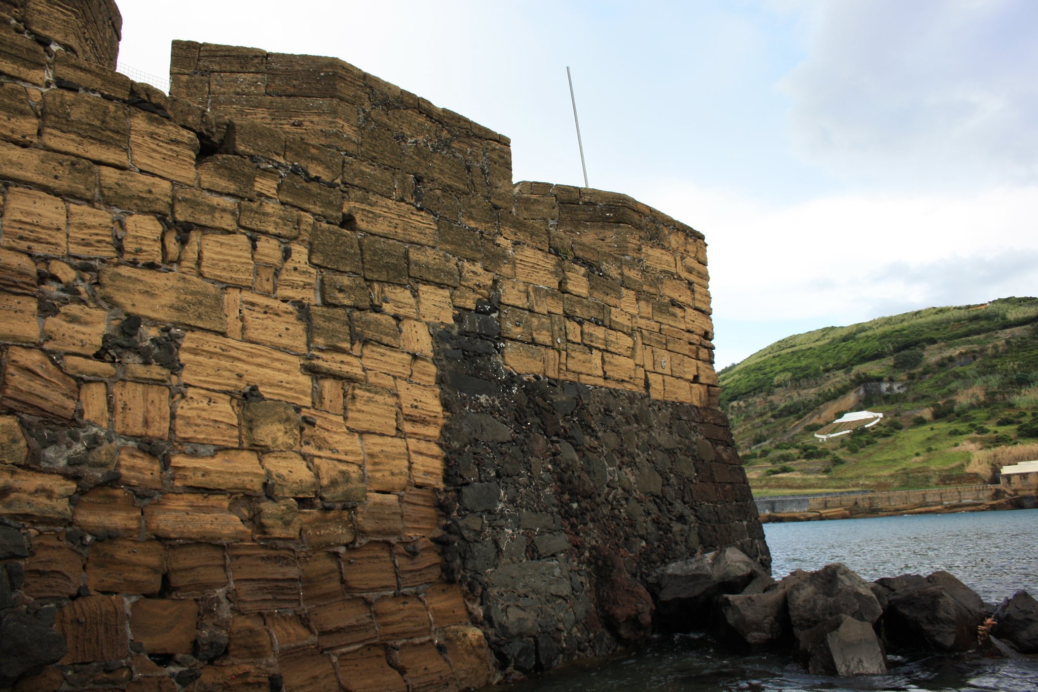
Forte de São Sebastião appears on José Rodrigo de Almeida’s 1804 plan of Faial’s fortifications and bays. Almeida was a sergeant-major of the Royal Corps of Engineers. Around 1817, a reconstruction renewed the fort, making it one of the few military structures on Faial renovated during that period. The work used volcanic tuff from Monte da Guia, a relatively soft rock formed from compacted volcanic ash and easier to shape than basalt.
In 1862 the fort was described as somewhat ruined, and an estimate for repairs had already been prepared. Its later history included military and penal uses. The dependencies housed a detachment of retired island soldiers transferred from Forte do Bom Jesus, whose former premises were converted into Horta’s prison. Forte de São Sebastião itself also served as a prison, reportedly until approximately the end of the Second World War.
Heritage protection and recent deterioration
The fort was classified in 1984 as an Imóvel de Interesse Público, a Portuguese public-interest heritage property, and received further protection under regional legislation in 2004. Since August 2005, its dependencies have housed the Faial Ecoteca, an environmental-awareness center under the responsibility of Horta Municipal Council and the Regional Secretariat for the Environment and the Sea. Since 1 January 2007, management has been carried out by the Observatório do Mar dos Açores, a nonprofit technical, scientific, and cultural association founded in 2002 by people connected with the University of the Azores Department of Oceanography and Fisheries. Ownership belongs to the Autonomous Region of the Azores.
The deterioration of the Porto Pim defensive complex was recognized by the regional administration from 2002 and worsened after Hurricane Lorenzo affected the Azores in October 2019. Projects presented in 2020 for coastal protection and wall recovery were combined in 2021 into a plan for the wider Porto Pim infrastructure complex. In August 2024, the walls were judged to be in an advanced state of deterioration. After stones fell from the walls in January 2025, Horta Municipal Council and the Angústias parish council requested urgent rehabilitation. In May 2025, the regional government announced a public tender for the first phase of coastal-protection works between Forte de São Sebastião and Reduto da Patrulha. The planned work includes reinforcing foundations, reducing waves overtopping the coastal road, repairing architectural elements, and creating a pedestrian path and bathing area. The fort remained degraded while this major intervention was being planned.
Remains
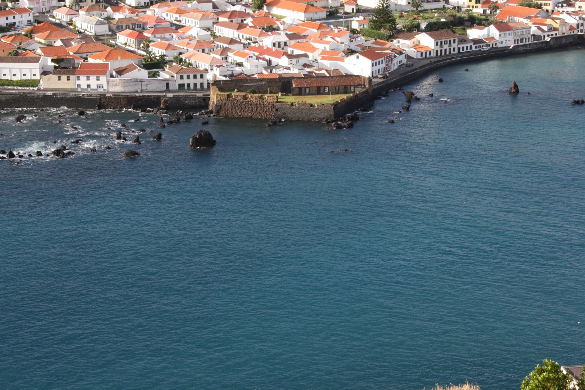
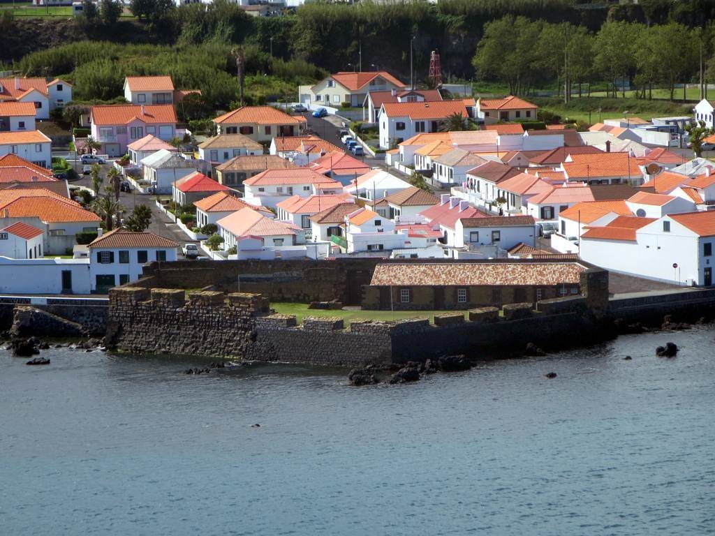
Forte de São Sebastião occupies a rocky promontory projecting into Porto Pim Bay. Water surrounds three sides, while the eastern side faced Forte de Porto Pim across the defensive system. The position allowed cannon fire to cover the anchorage toward the west and southwest, watch the entrance to the bay, and observe maritime movement along Faial’s southern coast. Its role was exclusively maritime because the fort could be attacked from land from Monte da Guia and nearby elevations.
Main fortification
Walls and gun positions
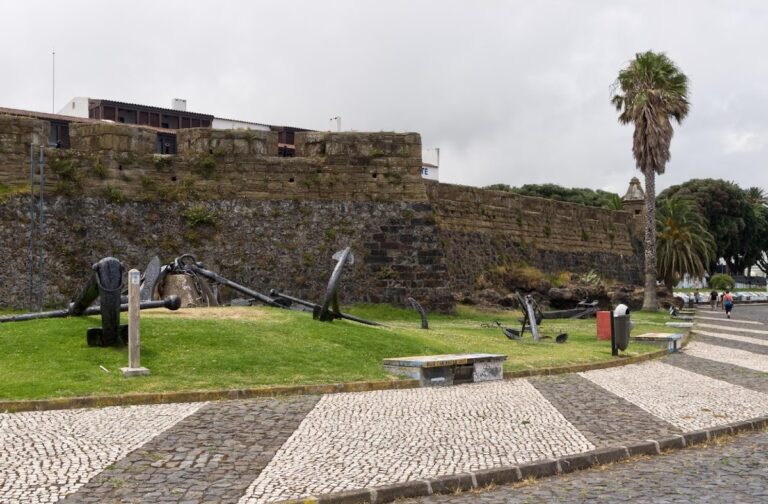
The fort has an irregular, approximately pentagonal plan shaped as a lunette, a projecting fortification with an angular outline designed to support fire along surrounding approaches. It covers about thirteen ares. Eleven gun embrasures, or openings through which cannon could fire, pierce the walls. The north wall rises five metres, while the eastern wall reaches 4.2 metres at high tide.
Two adjoining embrasures on the southwest side occupy the same level and were arranged for grazing fire, meaning low fire directed close to the ground or water surface. The other southwest and west embrasures rise 5.6 metres above the ground and are reached by ramps. Together, these positions allowed the fort to direct fire across the bay and toward the maritime approaches for which it was built.
Service building and entrance
A surviving rectangular, one-story building stands on the terreplein, the level platform behind a fortification’s parapet where troops and artillery could operate. Its three-pitched roof is covered with half-round tiles. The building originally contained the command house and troop quarters, powder magazine, equipment house, kitchen, and latrines, bringing the fort’s operational and domestic spaces together inside the defensive enclosure.
On the side facing Rua do Pasteleiro, the Arms Gate has a segmental arch. This entrance formed part of the fort’s access arrangement and survives with the single-story building and the surrounding defensive works.
Trenches and bay defenses
Rock-cut defensive line
A continuous line of trenches was laid over the rock and extended east and west from the fort. The western line ended at a battery or watch station that disappeared long ago. Part of its position was replaced by guard walls constructed by the Department of Public Works.
Connected installations
Forte de São Sebastião belonged to a wider defensive arrangement around Porto Pim Bay. Other elements included Guarita, Reduto da Patrulha, and Bombardeira. A retaining wall along the bay connected these installations, linking the fort to the broader protection of the anchorage and its coastal approaches.
The walls of the fort and the wider Porto Pim complex are in a degraded condition, including places where stones have fallen from the masonry. The intervention planned in 2025 is intended to reinforce wall foundations, recover architectural elements, and improve coastal protection across the area between Forte de São Sebastião and Reduto da Patrulha.