Firoz Shah Palace Complex: A Tughlaq Royal and Administrative Center in Hisar
Site at a Glance
- Rating
- 4.2
- Popularity
- Medium
- Country
- India
- Primary era
- Medieval
- Eras represented
- Classical, Medieval, Early Modern, Modern
- Civilizations
- British, Delhi Sultanate, Mauryan, Mughal
- Site type
- Military
- Remains
- Fortified Town
On this page25 sections
History
Firoz Shah Palace Complex is a fourteenth-century royal and administrative center in Hisar, India, founded by Firoz Shah Tughlaq of the Delhi Sultanate in 1354. Built in the Tughlaq architectural tradition, the fortified city was completed in 1356 after approximately two and a half years of construction and was settled by 1357. It occupied a strategic position on the Delhi to Multan route, near a branch leading toward Khorasan, and became a regional center containing palaces, religious buildings, administrative facilities, a garrison, and defensive works.
Earlier settlement and the foundation of Hisar-i-Firoza
The fort city, known as Hisar-i-Firoza, was established over an older settlement traditionally identified as Isukara or Aisukari. Deeper layers beneath the medieval remains have been associated with the Sindhu-Saraswati Valley Civilization and the Vedic period. The identification of the site with the prosperous Kuru-Janapada city of Isukara remains an archaeological and historical interpretation rather than a settled fact. The nearby inhabited villages of Laras Buzurg and Laras Khurd are regarded as medieval remnants of the earlier settlement.
Firoz Shah ordered his courtiers to construct palaces inside the new fort. The resulting complex combined a royal citadel with administrative and religious buildings, military quarters, outer defenses, Gujari Mahal, and the Charbagh garden. The fort also reused material from the deserted Agroha Mound. Architectural elements from earlier Hindu and Jain buildings, including reused stonework, are especially visible in the palace and mosque complexes. These reused elements are examples of spolia, architectural pieces taken from earlier structures and incorporated into later construction.
Waterworks, royal residence, and later use
Water management was central to the fortified settlement. The Rajabwah and Ulughkhani canals and their associated hydraulic works supplied the moat, tanks, palace facilities, gardens, and places of worship. The older watercourse beneath these channels has been interpreted as part of an earlier Drishadvati River system. The fort therefore combined military defenses with an engineered water network that supported domestic, administrative, religious, and agricultural activity.
Local tradition connects Gujari Mahal and Firoz Shah’s special association with Hisar to Gurjari, a local Gurjar milkmaid whom the Sultan is said to have met while hunting. According to the tradition, she accepted his marriage proposal but refused to leave her home for Delhi. Firoz Shah consequently established a royal residence at Hisar for her. Gujari Mahal and the Charbagh stood outside the principal rampart, but both were directly associated with the royal complex.
The fort’s military and administrative importance later declined, and some areas were reused or altered. A Mughal-period artillery platform was added to the northern defenses. Gujari Mahal subsequently acquired nine burials dating from the seventeenth or eighteenth century. The complex is listed as having been demolished in 1398, although substantial ruins and restored structures survive within the historic fort area.
Damage, excavation, and conservation
Much of the outer rampart and its bastions was dismantled after the 1857 Indian War of Independence, the conflict that challenged British rule in India. The British administration auctioned the rubble to local builders. Later urban expansion removed or covered further parts of the fortifications, while the former moat is now mainly represented by the alignment and lower level of surrounding roads and markets.
Restoration of the palace began in 1924 and has continued intermittently. The Archaeological Survey of India, India’s national institution for archaeological research, monument protection, and conservation, manages the complex, its mound, and associated monuments as a centrally protected site. Archaeological probes in the northwestern area have revealed layers beneath the Tughlaq structures. The mound remains protected, while conservation has concentrated mainly on the upper medieval remains and their interpretation. The palace forms part of the wider archaeological landscape of Hisar district, which includes the Harappan sites of Rakhigarhi, Banawali, Kunal, and Agroha.
Remains
Fortifications and entrances
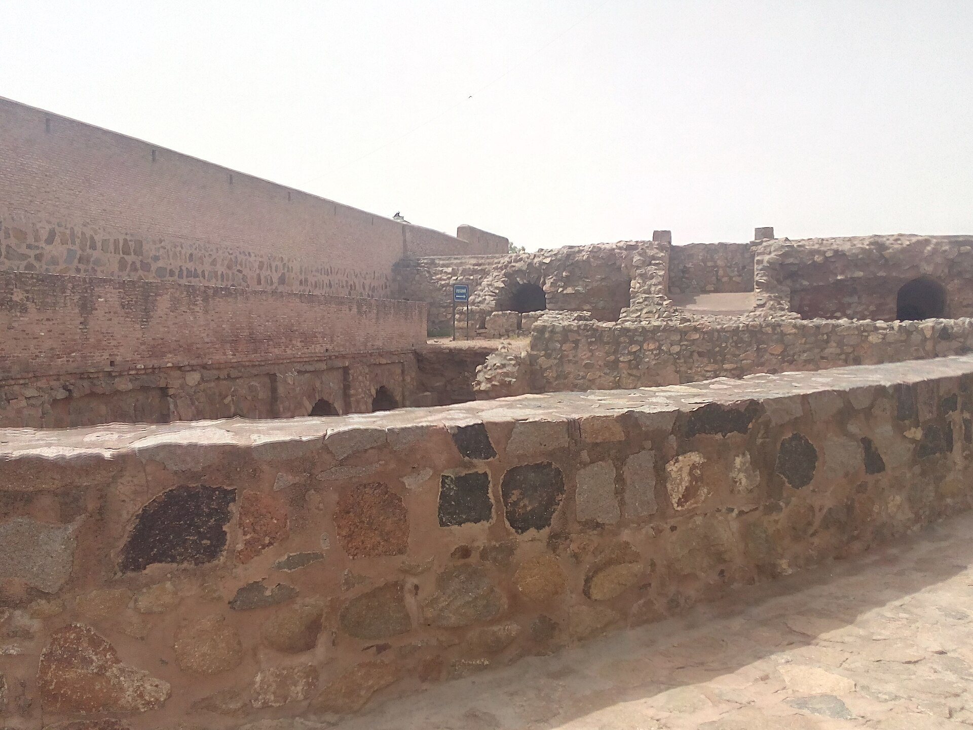
The fort city occupied a polygonal enclosure rather than a perfect square. Its northwestern side was defined by the projecting royal citadel, while Gujari Mahal and the Charbagh stood north of the main rampart in lighter, separate enclosures. The outer defenses were built from heavy rubble masonry and local sandstone, with walls sloping inward to improve stability. Battlements, crenellations, and regularly spaced projecting bastions carried narrow, slanted openings for archers and later firearms.
Rampart and moat
A deep moat surrounded the fort. Internal tanks helped regulate its water level, while canals supplied the moat and other installations. The moat was later silted and filled, and modern roads and markets occupy much of its former course. The surviving defensive fabric consists mainly of sections of rampart, bastion bases, and individual structures integrated into the later urban landscape.
Tughlaq bastions
Four principal Tughlaq-era bastions are identified as the northwestern and northeastern bastions, the North Nagori Bastion, and the South Nagori Bastion. The northwestern bastion survives with three stories above ground and one underground level. It contains internal stairs and arrow openings. The northeastern bastion retains its ground-floor walls. The North Nagori Bastion stands about 100 metres north of the former Nagori Gate, while the South Nagori Bastion stands about 20 metres south of it. Their surviving remains include rubble-stone bases and arrow slits.
Mughal artillery platform
A later Mughal defensive platform projects from the northern rampart near the Summer Pavilion and Gujari Mahal. It is a solid earthen structure enclosed in masonry, with rounded corner bastions, and was designed as a gun platform. A modified doorway in the northwestern bastion connected it with the older fortification.
Gates
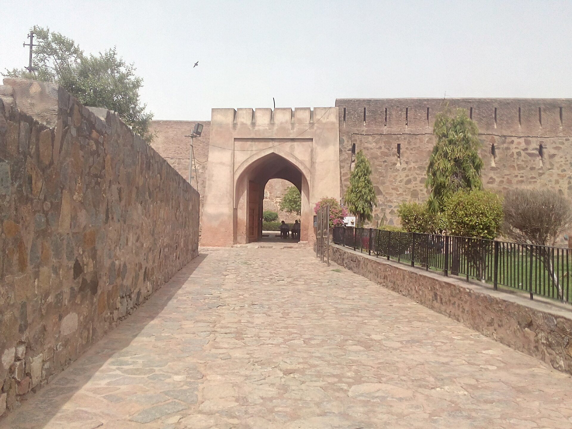
The outer rampart originally had four public gates, named Talaqi, Delhi, Mori, and Nagori. The surviving Shahi Darwaza served as a separate royal entrance, bringing the number of major entrances associated with the complex to five. Talaqi Gate, formerly near the present bus stand, was demolished, although its associated bastion survives. Nagori Gate was replaced by a clock tower, and both the tower and remaining gate fabric were later removed. Mori and Delhi gates disappeared beneath subsequent urban development.
Royal citadel and palace spaces
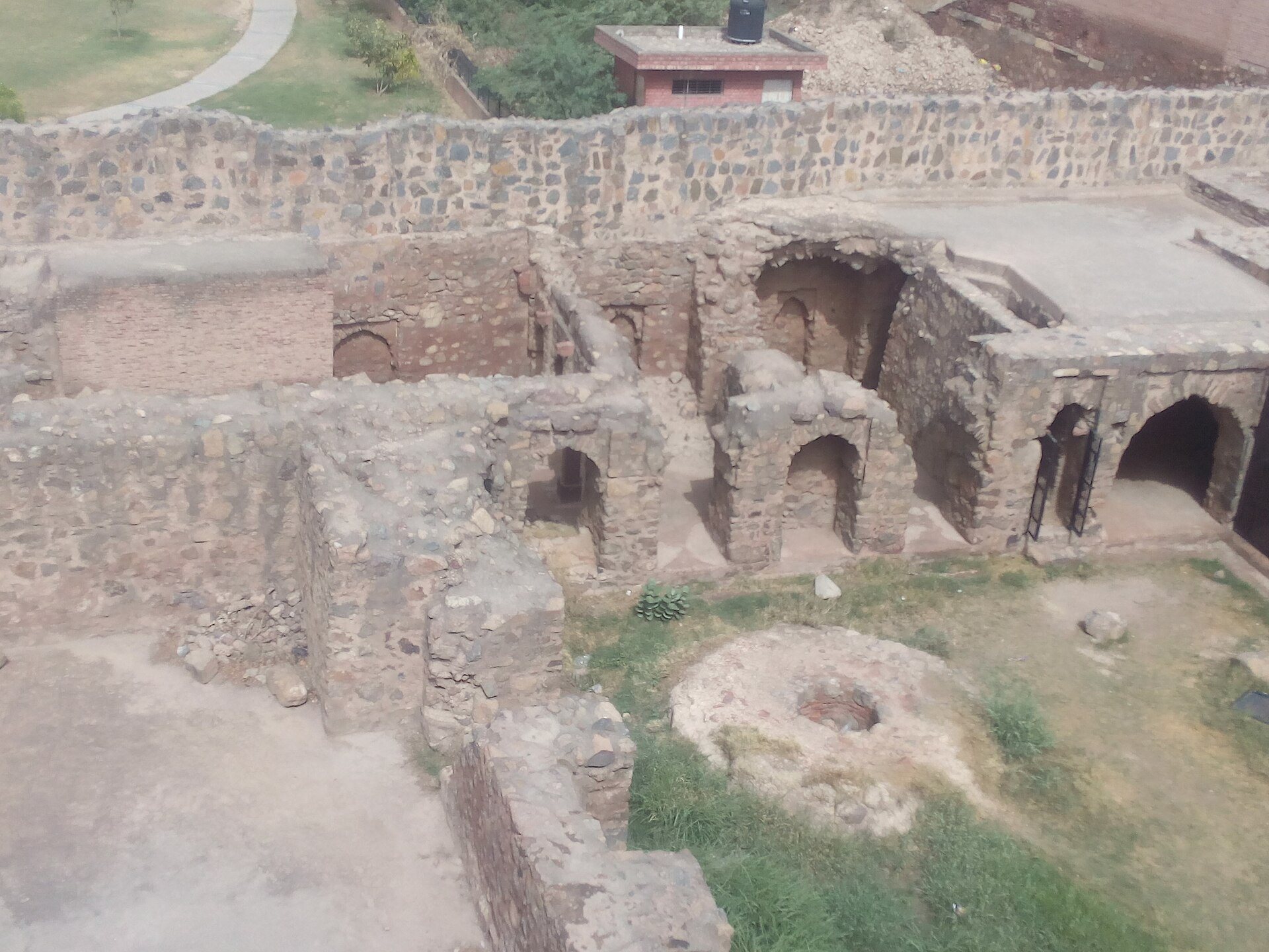
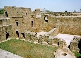
The main citadel is built of rubble masonry and lime mortar. It has two stories above ground and an interconnected underground level of tehkhanas, or chambers below the surface. The underground rooms contain vaulted spaces, narrow ventilation shafts, and a hammam, or bathing chamber. They served for cooling, private retreat, storage, and administration. Arched passages built into the northern and western bastions have no windows, while the western and southern sides retain renovated arched gateways and passages. The western side remains integrated with the rampart.
Citadel towers and northern range
The northwestern corner contains the tallest structure in the complex, a tower with three stories above ground and one underground level. Internal stairs connect its guard or storage rooms, and its position provided sightlines toward the fort gates and the Delhi to Multan route. At the northeastern corner, only the ground-floor base of another watchtower survives. Its upper stories have disappeared.
Sahan-i-Khana
The Sahan-i-Khana was a semi-private courtyard in the northern half of the citadel. It controlled movement between the public mosque and audience areas and the Sultan’s private residential quarters. A stone platform in its northeastern part has circular openings associated with shafts for raising and lowering grain into underground granaries.
Southern range and Diwan-i-Khas
The southern range forms the longest side of the rectangular palace. It had seven ground-floor doorways and nine upper-story openings and contained principal administrative, military, and service spaces. West of the Sahan-i-Khana stood the Diwan-i-Khas, a private audience hall with two ground-floor doorways and three upper-floor doorways. Underground rooms and a hammam provided a cool and secure setting for confidential meetings.
Administrative and service areas
Other rooms have been identified with the treasury, grain administration, finance and revenue offices, bodyguards’ quarters, kitchens, and related services. The royal kitchens lay southeast of the central courtyard and were connected to water channels and a service route leading toward the private quarters. Their remains include collapsed masonry, water channels, and soot-blackened foundation arches.
Garrison kitchens occupied simple hearths and communal cooking spaces in vaulted barracks along the western rampart. Royal stables stood near Talaqi Gate and the citadel. Their partly underground vaulted bays and heavy masonry provided insulation and structural support beneath the ramparts, while some bays remain partly buried under accumulated silt and debris.
Summer Pavilion and religious complex
Royal Summer Pavilion
The Royal Summer Pavilion was incorporated into the northern rampart and faced the Charbagh and Gujari Mahal. It was an elevated, open-fronted structure with arched openings and stone lattice screens. The building now survives as a roofless, ruined single-story structure. The Khwabgah occupied its upper level, where its elevation provided cross-ventilation and a view toward the northern gardens and Gujari Mahal.
Shahi Darwaza
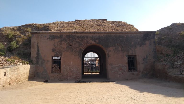
The Shahi Darwaza is the surviving royal entrance. Its single-arched vault is flanked by guard rooms and includes carved stone lintels. It gave direct access to the palace, mosque complex, Gujari Mahal, and royal gardens.
Diwan-i-Aam and Lat ki Masjid
Southeast of Talaqi Gate, a court, mosque, and pillar complex is separate from the residential citadel. It includes the L-shaped Diwan-i-Aam, or vaulted public audience hall, the Lat ki Masjid, an Ashokan pillar, and an L-shaped ablution tank. The Diwan-i-Aam is approximately 5 to 6 metres high, built of rubble masonry, and historically finished with white lime mortar.
Lat ki Masjid is a compact, square, single-story mosque built mainly of red sandstone. Its tapered walls, stone lintels, brackets, and lattice screens combine early Tughlaq forms with construction techniques associated with Hindu and Jain buildings. An exterior staircase at the southwestern corner led to the roof for the muezzin, the person who gives the Islamic call to prayer. A narrow underground staircase at the northwestern corner runs beneath the mosque toward the ablution tank.
Ablution tank and Ashokan pillar
The L-shaped Wudu Hammam south of the pillar is a masonry tank for ritual purification. Steps descend into the water, and an underground conduit connected the tank to the canal system. In the mosque courtyard, the Ashokan pillar consists of four rejoined upper sections with tapering registers and a finial topped by an iron rod. It was probably transported from the Agroha area, while its lower sections are preserved at the Fatehabad mosque.
The pillar retains fragmentary Brahmi characters, an ancient Indian writing system used for early inscriptions associated with Ashoka, a Mauryan ruler of the third century BCE. It also carries later Arabic writing recording the genealogy of Firoz Shah Tughlaq. Earlier inscriptions were partly smoothed, damaged, or replaced when the pillar was reused.
Gujari Mahal and Charbagh
Gujari Mahal
Gujari Mahal was built outside the principal rampart as a separate royal residence and pleasure palace. Constructed of rubble and mortar on a rectangular platform, it had a ramp leading to the upper level, although only part of the main palace survives. Its most prominent surviving feature is an upper-level baradari, a pavilion traditionally defined by twelve openings. The square pavilion has three openings on each side and four massive stone pillars supporting its flat roof. It served for social gatherings.
Three underground apartments lie beneath the baradari platform. One contains a deep, stone-lined tank identified as a hammam. The connected chambers provided privacy and cooling and formed part of the palace water system. A smaller enclosed room on the upper platform may have served as a private retiring room or guard post. Its inward-sloping walls follow Tughlaq construction practice.
Later burials
Nine later graves occupy the upper platform of Gujari Mahal. Five sarcophagi stand on a raised open-air platform, two occupy a lower platform, and two lie in brick shrines within a roofless brick structure. These Mughal-period and later burials postdate the palace’s use as a royal residence.
Charbagh
The Charbagh stood between the main citadel and Gujari Mahal. It followed a Persian-style four-part garden arrangement, with intersecting water channels, trees, pavilions, and shaded paths. Water from the Rajabwah canal was raised into masonry channels and distributed through the garden by gravity. The garden served as a royal retreat and as an irrigated agricultural and horticultural space.
Later architectural layer
A British-era bungalow northeast of the citadel was built on raised ground as the residence of the superintendent of the Government Livestock Farm at Hisar. It remains a later architectural layer within the historic fort area, alongside the medieval fortifications, palace buildings, religious structures, and waterworks.