Fortress of Niha: A Medieval Cave Stronghold in Lebanon
Site at a Glance
- Rating
- 4.6
- Popularity
- Very Low
- Country
- Lebanon
- Primary era
- Medieval
- External website
- Open
- Eras represented
- Medieval, Early Modern
- Civilizations
- Crusader, Kingdom of Jerusalem, Mamluk, Ottoman
- Site type
- Military
- Remains
- Castle
On this page8 sections
History
Fortress of Niha is a medieval cave fortress in Lebanon, standing above Niha on a mountain route between Sidon, the Beqaa, and the Chouf. Its earliest known mention dates to 975, and it appears again in records from 1133. The stronghold occupied an earlier cave fortification that was expanded by the Crusaders after the site entered the Kingdom of Jerusalem around 1110 during King Baldwin I’s campaign against Sidon.
Fatimid and Crusader control
The fortress originally lay within the sphere of the Fatimids, a Shi’i Muslim caliphate that ruled parts of the eastern Mediterranean before the Crusader conquest. It became an important stronghold of the Shuf, a historical lordship in Mount Lebanon and a fief of the County of Sidon. A Druze garrison allied with the Crusaders, led by the local leader Ibn Dahhak Janda’i, held the fortress until 1133. Muslim forces captured it that year, while Crusader control was restored around 1140, when the garrison consisted of Crusaders.
Muslim forces captured the stronghold again in 1165. Around 1170, the Shuf was separated from Sidon as a subordinate lordship, and Fortress of Niha served as its administrative center during parts of 1182 to 1187 and 1240 to 1257. Crusader control returned between 1182 and 1187 and again in 1240, reflecting the repeated shifts between Muslim and Crusader power in the region.
Late medieval rebuilding
In 1257, Julian Grenier, Count of Sidon, transferred the fortress and its lordship to a military order. After the destruction of Sidon and the Mongol invasion, the Crusaders abandoned the caves in 1260. The fortress is also recorded as destroyed in 1261. Rebuilding and restoration attributed to Baybars, a prominent Mamluk military ruler, date to 1270. The Mamluks were the military ruling elite who governed Egypt and Syria during the medieval period.
Mount Lebanon under Ottoman rule
In the late sixteenth century, the Druze emir Fakhr al-Din II reportedly revived the fortifications by rebuilding older Crusader defenses. He sought to strengthen Lebanon’s autonomy from the Ottoman Empire, which ruled much of the region. The fortress remained within the Ottoman sphere and under the authority of the emirs of Mount Lebanon from 1516 until the early twentieth century.
Tradition holds that Qarqumaz Ma’n, the father of Fakhr al-Din II, briefly sought refuge at the fortress in 1584 and 1585. Fakhr al-Din II is also said to have sheltered there before his execution in 1635. Archaeological investigation took place in 1936. The surviving remains are now regarded as part of Lebanon’s cultural heritage and as a landmark within the Chouf Cedar Nature Reserve.
Remains
Rock-cut fortress
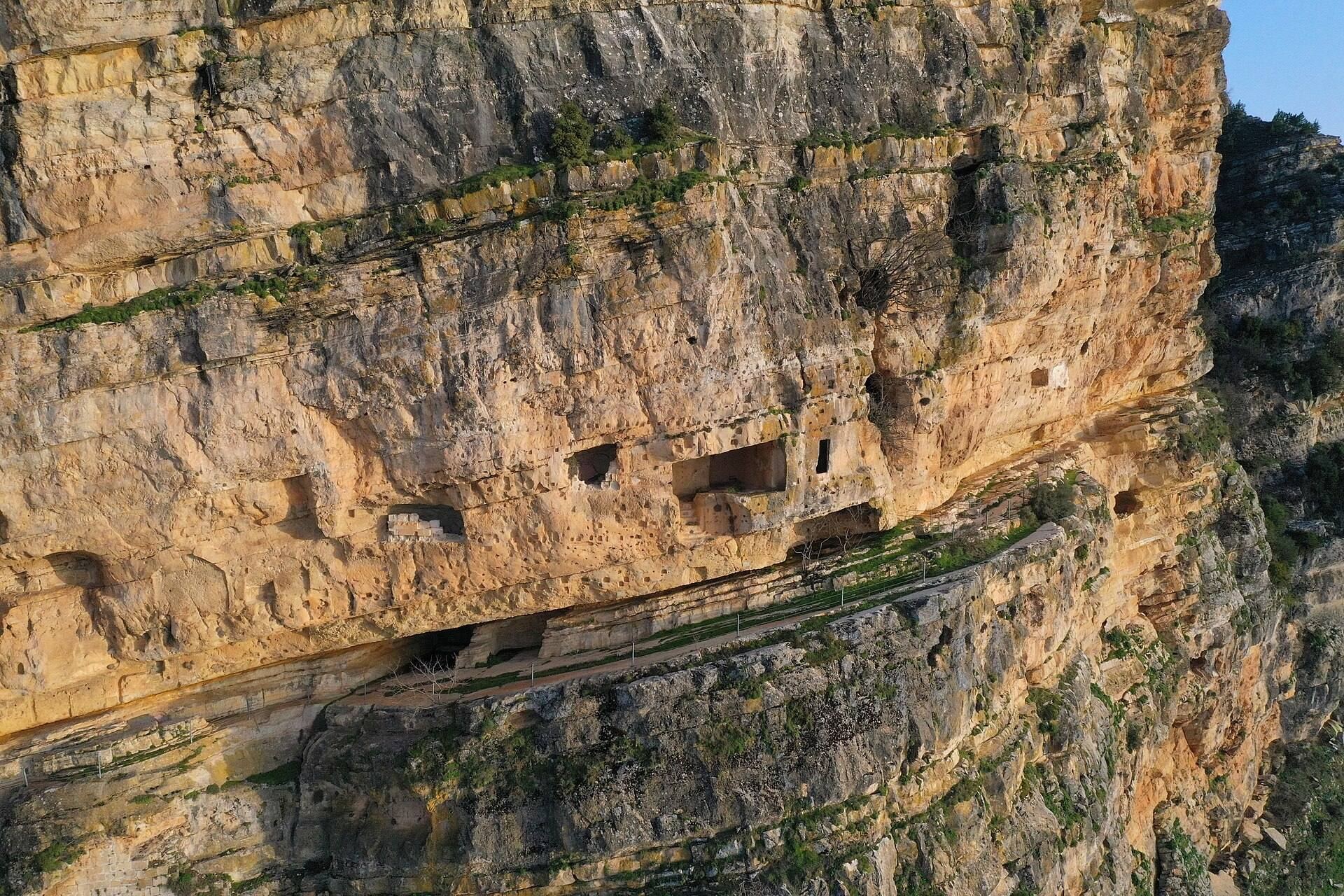
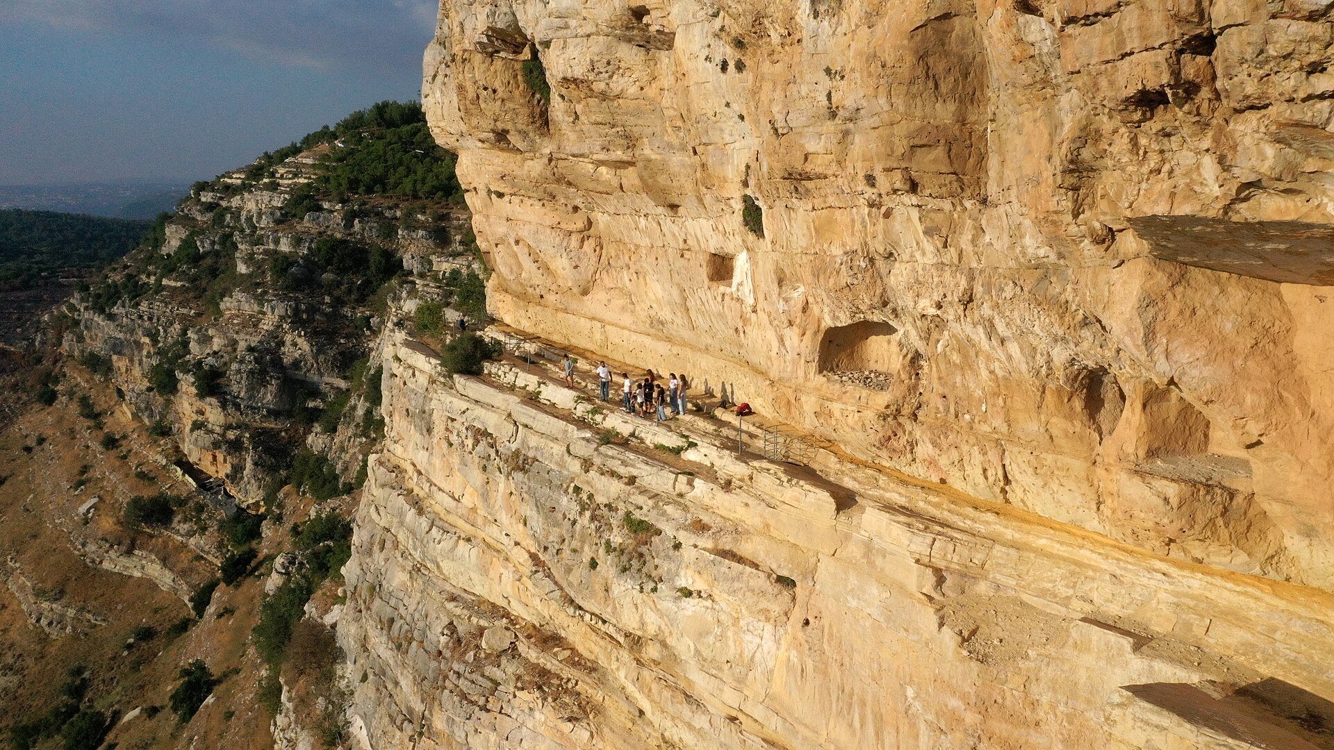
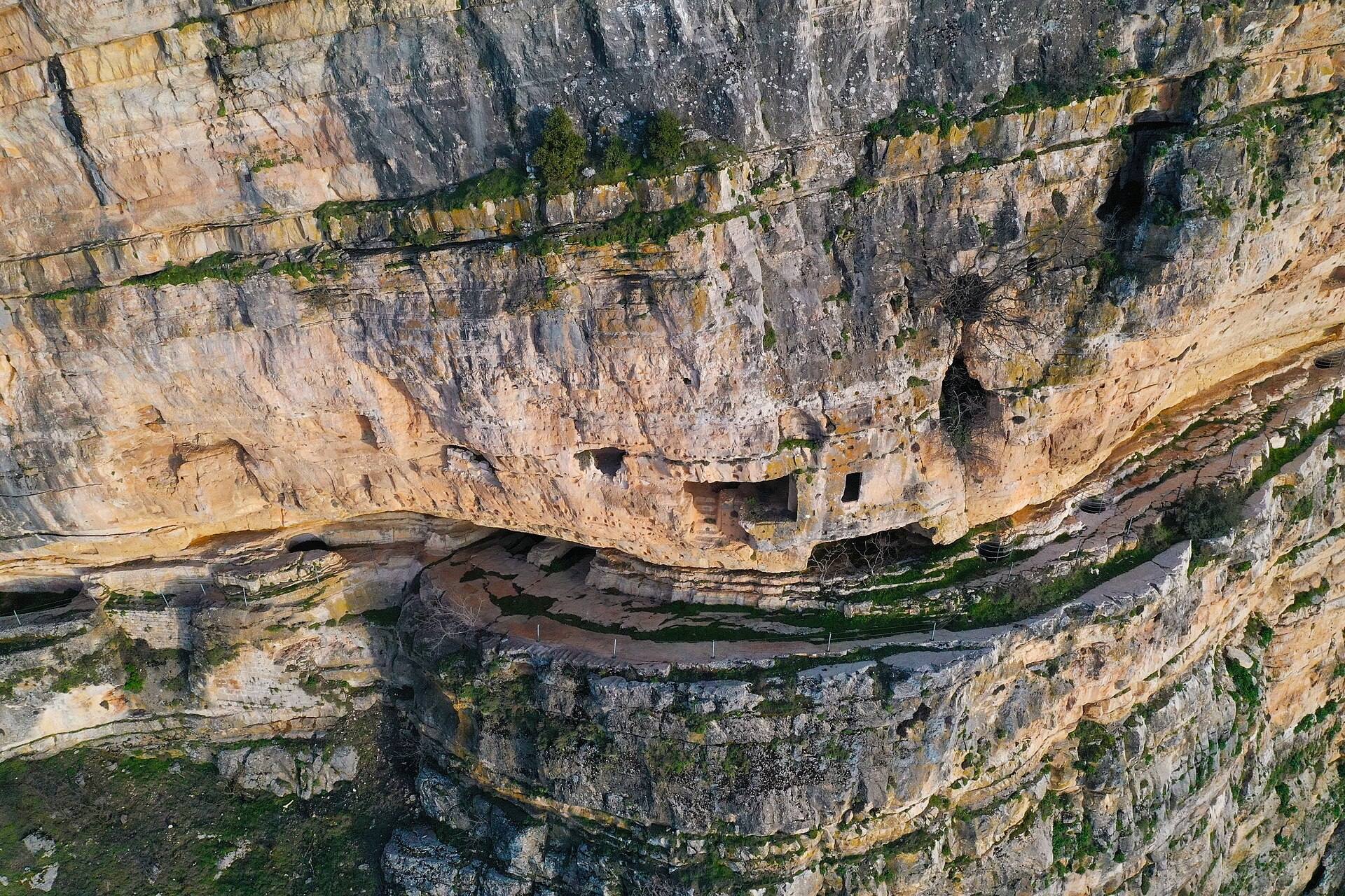
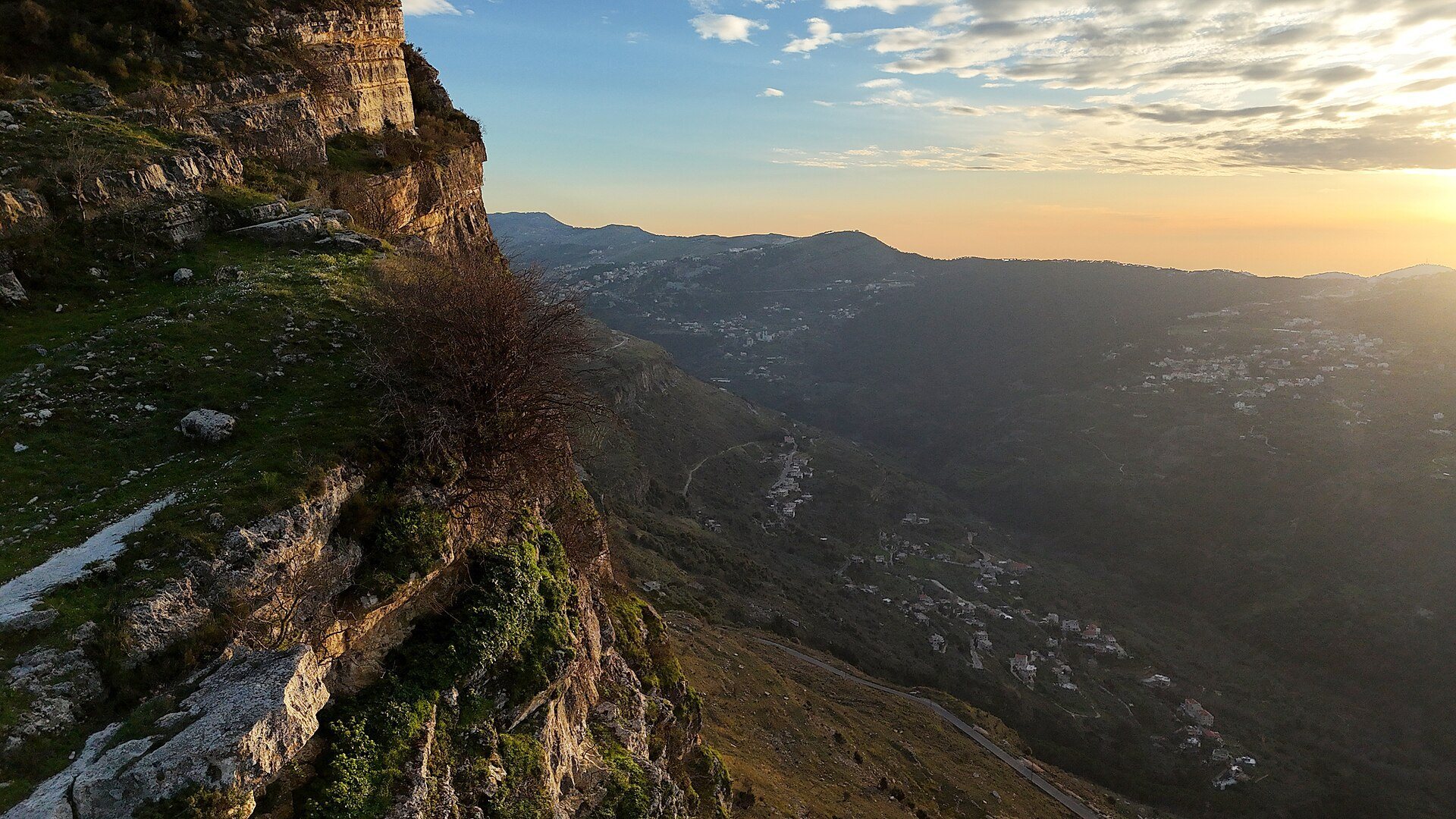
The fortress occupies a natural rock formation shaped by geological folding on a summit above Niha, about 1,200 metres above sea level. It stands on a mountainside west of the Litani and overlooks the Bisri Valley, approximately 16 kilometres east of Sidon and about 33 kilometres from Beirut. Natural openings in the rock resemble cave entrances, while human excavation created an internal complex of rooms, terraces, and chambers extending more than 100 metres into the rock.
Rock-cut rooms provided accommodation for soldiers and storage for provisions. Numerous silos formed part of the complex, including large spaces for storing grain, as well as a chamber intended for growing plants. A chapel stood within the fortified area. The surrounding wall was pierced by numerous openings, and the defensive installations were designed to make the fortress difficult to capture and capable of resisting prolonged sieges.
Water and mountain approach
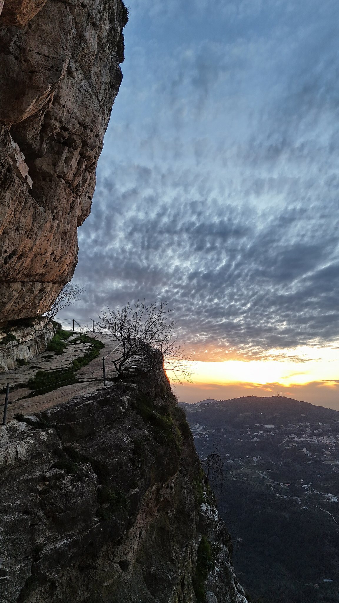
Seven wells were cut into the rock, each reaching approximately 10 metres in depth. Rainwater was collected at the fortress, while a pipe system brought additional water from the Ain al-Halqoum spring, about one kilometre away. The approach followed a narrow mountain path less than one metre wide. From its elevated position, the fortress commands views toward Sidon and, in clear weather, across the area between Tyre and Beirut. Wooden supports were installed along the approach to facilitate access.
Cliff dwellings
Several dwellings survive around the fortress on the rocky cliff. Their construction used beams resting against the rock and the cliff wall, extending the occupied area beyond the principal cave complex.