St. Angelo Fort: A Portuguese Fortress at Kannur
Site at a Glance
- Rating
- 4.4
- Popularity
- High
- Country
- India
- Primary era
- Early Modern
- External website
- Open
- Eras represented
- Early Modern
- Civilizations
- Dutch, Portuguese
- Site type
- Military
- Remains
- Fort
On this page15 sections
History
St. Angelo Fort, also known as Kannur Fort, is a Portuguese fortress at Kannur in Kerala, India, established in 1505 during the early Portuguese expansion across the Indian Ocean. Kannur was the principal port of the Kolathunad kingdom after Kozhikode and stood in a region known for producing and exporting spices, especially pepper.
The Portuguese trading post
Vasco da Gama’s fleet sighted Kannur in 1498, and Portuguese visitors reached the port in 1501. The local ruler then allowed them to establish a settlement. A Portuguese trading post opened that year and was reorganized in 1502 under Vasco da Gama, with Gonçalo Gil Barbosa acting as its factor, the official responsible for commercial administration. The post imported ginger, cardamom, and horses, chiefly for the armies of the Vijayanagara Empire.
In October 1505, Francisco de Almeida negotiated permission from the local ruler to build a fortress protecting the trading post from rival Muslim merchants. Gonçalo Gil Barbosa laid the foundation on 24 October, and a wooden fort was completed on 30 October. The precise beginning of the fortification remains uncertain, since work may have continued soon after October 1505 or begun in May 1506. A stone fort was started on the site in 1507.
Lourenço de Brito became the first captain and commanded 150 Portuguese soldiers supported by two patrol ships. Once the fortress was completed, Almeida used the title of viceroy. The fort served both as a defensive stronghold and as a base supporting Portuguese operations connected with the conquest of Goa and Malacca, as well as campaigns against the Mamluks. Goa financed its expenses because the Portuguese settlement at Kannur did not produce enough local revenue.
Sieges and Portuguese power
A naval battle took place in Kannur harbor in 1506 between a Portuguese fleet commanded by Lourenço de Almeida, Francisco de Almeida’s son, and the fleet of the Zamorin of Kozhikode. The Zamorin was the ruler of Kozhikode, the leading political and commercial power in the Malabar region.
From approximately April or May until August 1507, the fort resisted a major siege linked to a succession dispute within the Kolathiri dynasty, the ruling house of Kolathunad. A new ruler aligned himself with the Zamorin and Kannur’s Muslim merchant community. The siege ended on 27 August, when a relief fleet under Tristão da Cunha arrived and restored the local ruler’s pro-Portuguese position.
In August 1509, Francisco de Almeida detained Afonso de Albuquerque in the fortress after refusing to recognize him as his successor as governor. Albuquerque remained confined for several months and was released after a larger Portuguese fleet arrived in October 1509. He subsequently became governor and was responsible for rebuilding or renovating the fort.
Lopo Vaz de Sampaio strengthened the fort in 1526. During another siege in 1565, António de Noronha directed its defense because the serving captain, Paio de Noronha, wished to abandon the position. These episodes show the fortress retaining a military role through successive phases of Portuguese rule.
The Portuguese settlement
The Portuguese settlement expanded east of the main fortress. By the seventeenth century it contained about forty married Portuguese families and thirty married families of indigenous Christians. The western end of the promontory held the pier, hospital buildings, supply and ammunition stores, and a hermitage.
Outside the Portuguese walls lived a mixed Portuguese-Indian or Christianized community and a small Hindu fishing village. The older town of Kannur stood farther around the bay and was called the “Moorish bazaar” in Portuguese records. The wider settlement therefore combined the fortified trading post with several communities and commercial areas around the harbor.
Dutch and British occupation
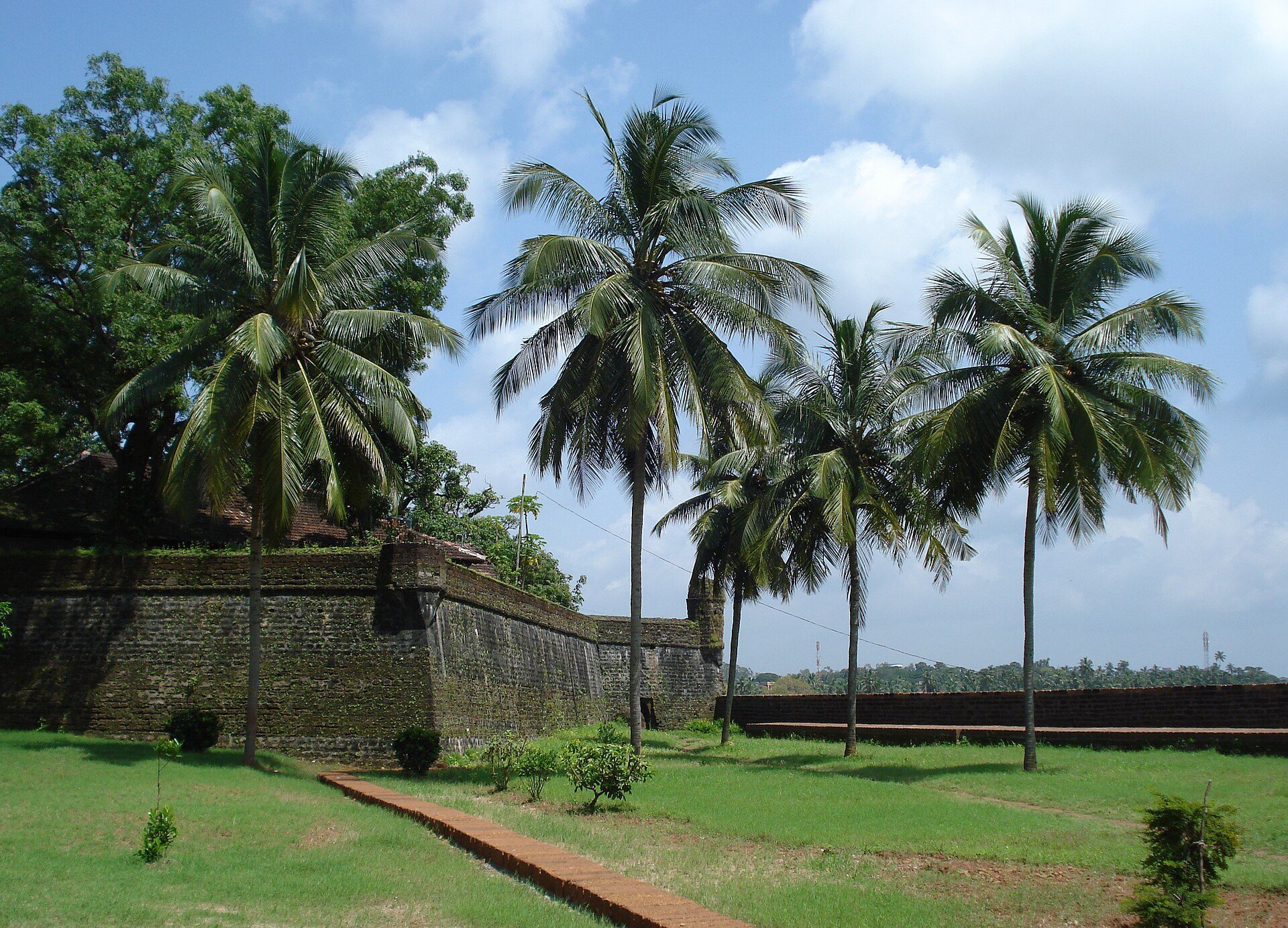
Dutch forces captured Kannur and the fort from Portugal on 15 February 1663. They modernized the defenses and built the bastions named Hollandia, Zeelandia, and Frieslandia. A bastion is a projecting section of a fortified wall that allows defenders to observe and fire along the adjoining walls. These Dutch works form the principal surviving elements of the present structure.
In 1772, the Dutch sold the fort to Ali Raja of Arakkal. British forces seized it in 1790 and used it as their principal military station on the Malabar coast until Indian independence in 1947. The monument is now protected and maintained under the supervision of the Archaeological Survey of India, the national institution responsible for archaeological research, monument protection, excavation, and conservation in India.
Archaeology and historical memory
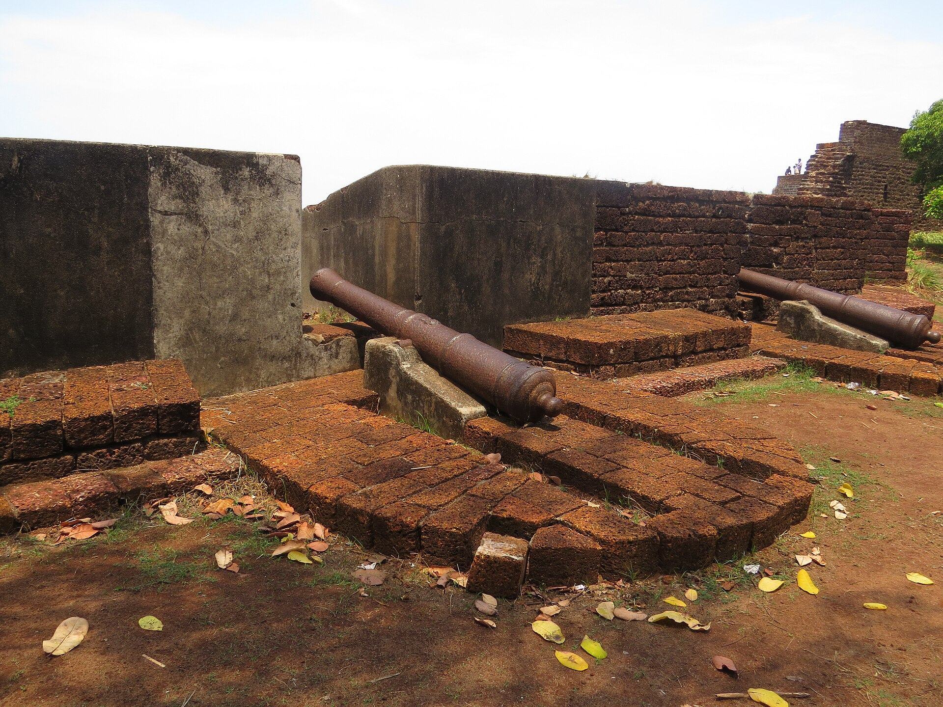
An excavation by the Archaeological Survey of India in 2015 recovered thousands of cannonballs from the fort premises. Each weighed several kilograms, and their burial was understood as part of military preparedness. A painting showing the fort with a fishing boat or ferry in Mappila Bay is preserved at the Rijksmuseum in Amsterdam.
The fortress also figured in the history of the Zamorin’s naval commanders. After the assassination of Kunjali Marakkar, a title used by those commanders, his severed head was displayed on the fort’s walls. This episode connects the surviving structure with the conflict between Portuguese power and the maritime forces associated with Kozhikode.
Remains
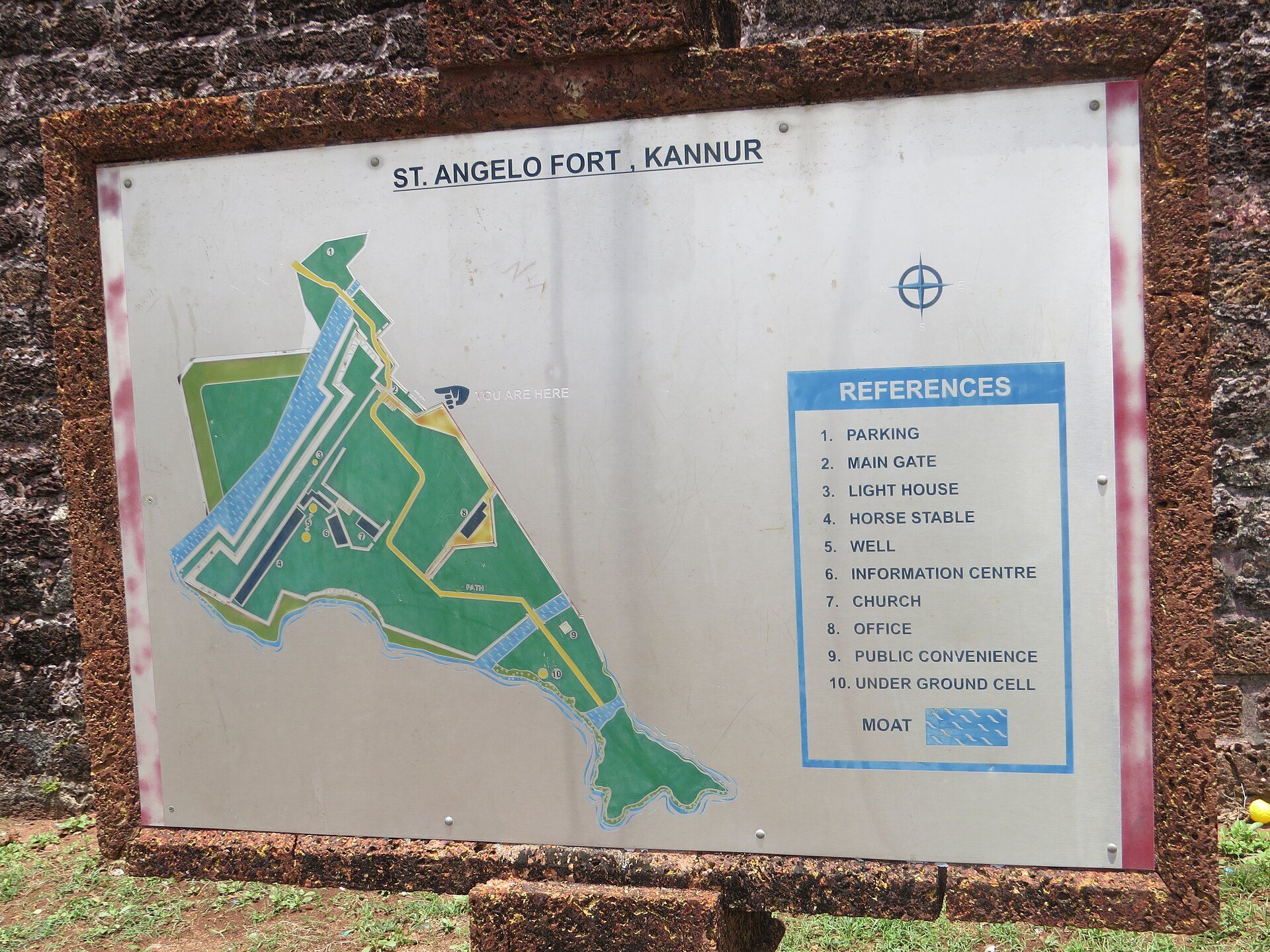
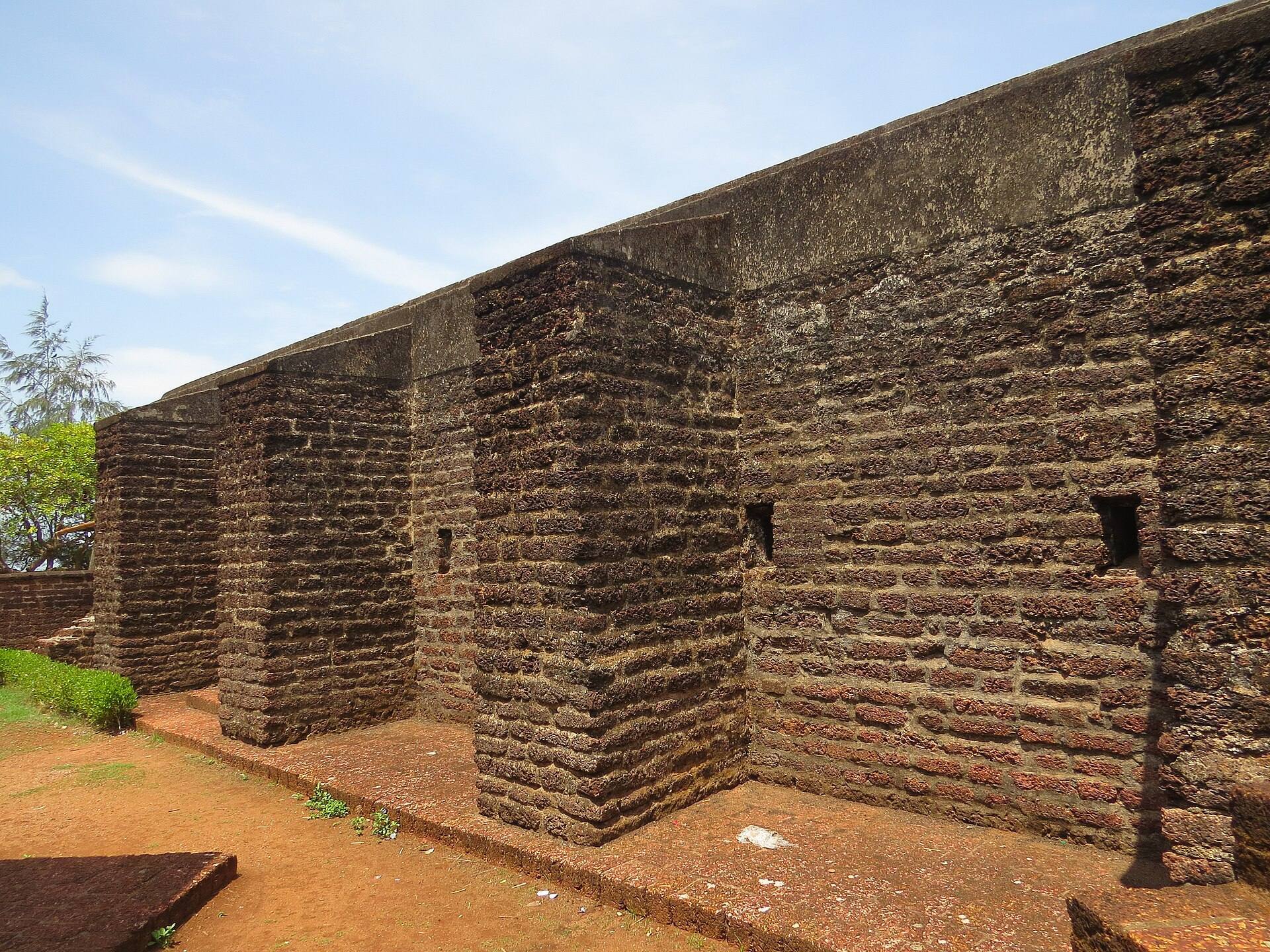
St. Angelo Fort occupies the end of a rocky promontory projecting into the sea and overlooking the bay. The fort and its settlement were organized behind a landward wall and moat, while a keep dominated the trading post and fortress. The surviving structure is built of laterite, a reddish, iron-rich stone widely used in the architecture of coastal India.
Fortifications and settlement layout
Portuguese fort and town walls
The original Portuguese fort had a three-storey tower surrounded by the captain’s house and the feitoria, or trading post. The Portuguese town was enclosed by a bastioned wall approximately 550 metres long and protected by a moat. The settlement extended east of the principal fortress, while the western end of the promontory contained the pier, hospital buildings, storage areas for supplies and ammunition, and a hermitage.
Dutch bastions
The bastions Hollandia, Zeelandia, and Frieslandia are the principal features of the present fort. Their projecting forms were designed to give defenders observation and firing positions along the faces of the surrounding walls. The fort’s location on the rocky promontory places these surviving defenses above the bay and the Arabian Sea.
Original tower and beach wall
The original Portuguese fort was later demolished. Vestiges of its tower and a wall above the beach rocks survive within the later defensive complex, preserving physical evidence of the earliest Portuguese phase.
Interior buildings and surviving features
Entrance and defensive structures
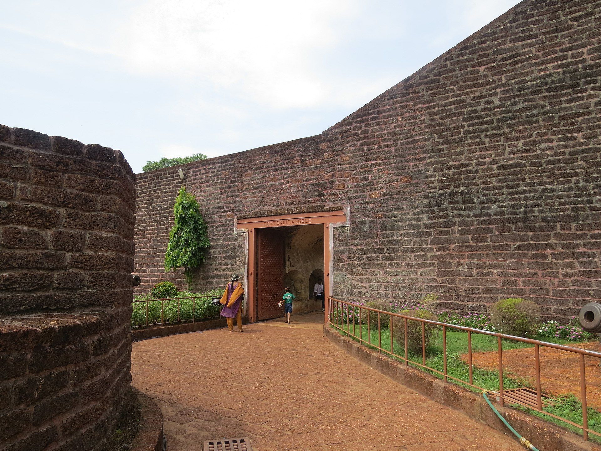
The surviving complex includes the fort entrance and gate, interior spaces, substantial walls, and a watchtower. Stairs lead to the top of the walls, linking the interior of the fort with its defensive perimeter. These elements form part of the protected monument maintained by the Archaeological Survey of India.
Barracks, stables, chapel, and lighthouse
Barracks, stables, and a chapel are among the documented buildings within the fort. A lighthouse also stands inside the enclosure. Together with the walls, gate, watchtower, and internal stairs, these features represent the military, religious, and operational functions retained in the surviving structure.
Inscriptions and artillery remains
A tomb for the wife of one of the Dutch commanders and two children bears Dutch inscriptions. A cannon is associated with the fort, while the recovery of large quantities of cannonballs from the premises provides material evidence of its defensive use.
The fort overlooks the Arabian Sea and lies near Moppila Bay Harbor and the Arakkal Mosque. Its laterite walls, Dutch bastions, surviving Portuguese vestiges, internal buildings, inscriptions, and artillery remains preserve the successive Portuguese, Dutch, and British military phases of Kannur’s fortified history.