Fort São Sebastião: A Portuguese Fortress on Mozambique Island
Site at a Glance
- Rating
- 4.3
- Popularity
- Low
- Country
- Mozambique
- Primary era
- Early Modern
- Eras represented
- Early Modern
- Civilizations
- Portuguese
- Site type
- Military
- Remains
- Fort
On this page11 sections
History
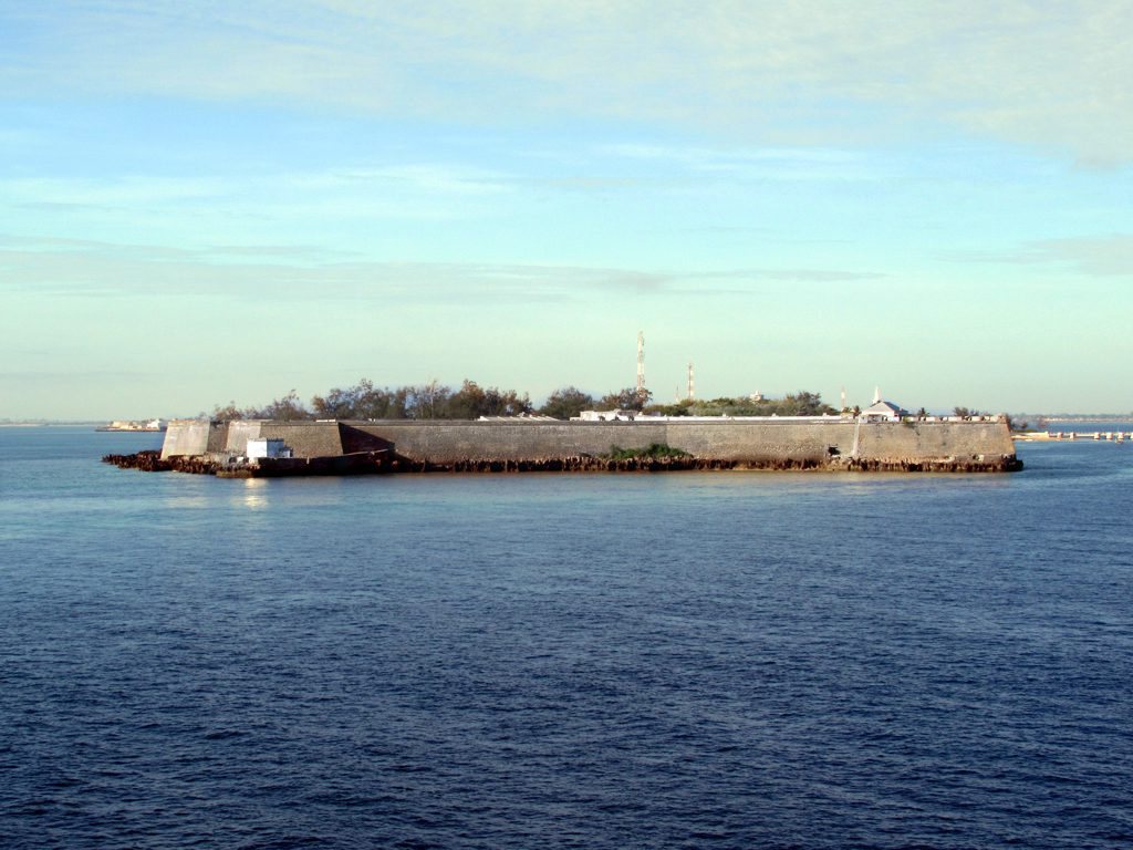
Fort São Sebastião is a Portuguese fortification on the northern end of Mozambique Island in Mozambique. Construction began in 1558 and continued for approximately fifty years. It is the oldest complete fort still standing in sub-Saharan Africa, and its position reflects the importance of the island as a Portuguese base in the western Indian Ocean.
From Swahili port to Portuguese base
When Vasco da Gama reached Mozambique Island in 1498, it was a Swahili settlement governed by a sheikh subordinate to the Sultan of Zanzibar. The island was an important Islamic port, with shipbuilding and commercial connections to the Red Sea, Persia, India, and the islands of the Indian Ocean.
Portugal established a trading post at Sofala in 1505 and another on Mozambique Island in 1507. The island became a center for the gold trade of the Monomotapa kingdom, a southeastern African state associated with gold production and long-distance commerce. It also served as a staging and overwintering point for Portuguese fleets sailing to India. Portuguese traders exchanged Indian textiles and beads for gold, enslaved people, ivory, and blackwood. From 1570 to 1898, the island was the capital of Portuguese East Africa, the Portuguese colonial administration in southeastern Africa that later corresponded chiefly to Mozambique.
Early defenses and the new fortress
In 1508, Vasco Gomes de Abreu ordered the factor Duarte de Melo to build the Tower of São Gabriel to defend the Portuguese settlement. The tower gradually lost military importance as plans for a larger fortress took shape. Growing threats to Portuguese positions in the western Indian Ocean made the original defense increasingly vulnerable. An agreement in 1538 between the Sultan of Gujarat and the Ottoman court to reconquer Diu, Turkish naval activity along the East African coast, and unrest among Swahili communities all contributed to the concern.
João de Sepúlveda, captain-general of the Malindi coast, called for a stronger fortification. In August 1545, João de Castro, the fourth viceroy of Portuguese India, sent King John III a further recommendation and a proposed design. Portuguese India was the Crown’s colonial administration and network of territories, trading posts, and fortifications around the Indian Ocean, governed in the region by a viceroy. The king’s reply of 8 March 1546 accepted the proposal in principle but entrusted the architectural work to Miguel de Arruda.
João de Castro’s plan placed the fort at the island’s northern end, overlooking the entrance channel to the inner harbor. Two bastions on the landward side were intended to provide crossfire against attackers. The plan also proposed blocking the Sancul Channel, but that work was never carried out. Francisco Pires took the fortification plans to India in 1546.
The project was delayed until approximately 1554 or 1555 while Portuguese India strengthened the defenses of Hormuz. The layout was attributed to Friar Bartolomeu dos Mártires, although he may have begun the execution of Arruda’s design rather than created it independently. Construction proceeded slowly and was repeatedly interrupted by shortages of skilled labor and the lethal climate. Much of the unskilled labor was performed by enslaved people belonging to the fort’s inhabitants.
Garrison, attacks, and reconstruction
The fort received a garrison while it was still incomplete in 1583. The detachment was commanded by Nuno Velho Pereira, who was responsible for constructing the magazines and arsenals. The commander of the fort was subordinate to the viceroy of Portuguese India and also oversaw trade in the Zambezi region.
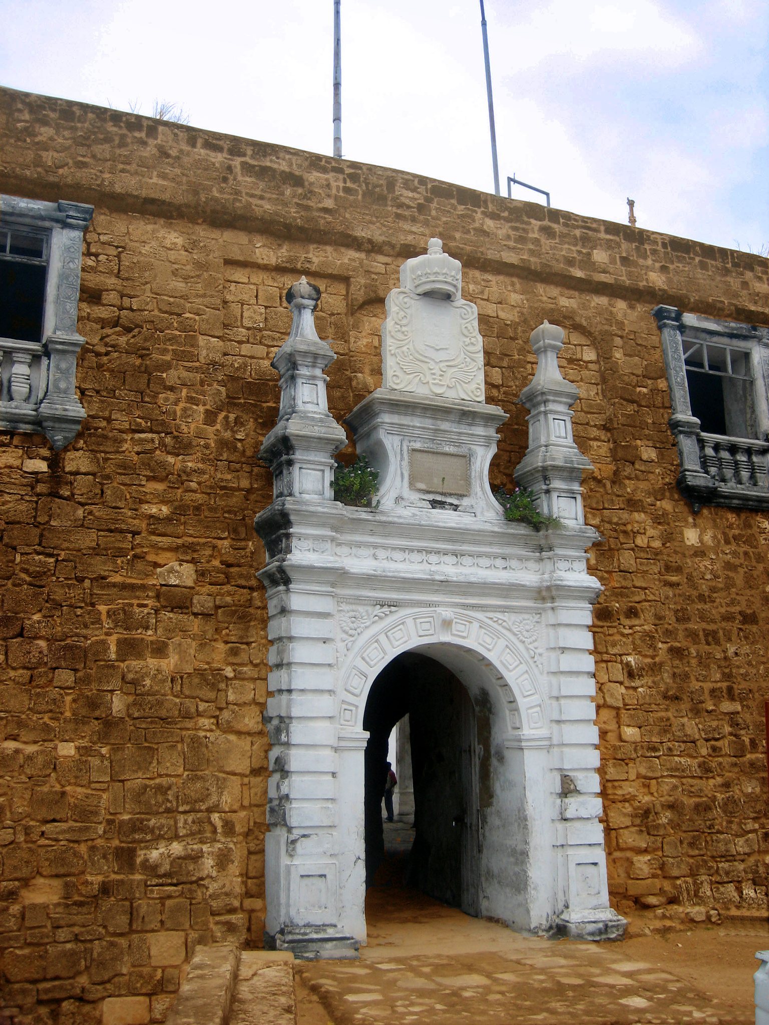
During the Philippine Dynasty, the period from 1580 to 1640 when Portugal and Spain were ruled by the same Habsburg monarchs, the fort resisted Dutch attacks in 1604, 1607, and 1608. Artillery inflicted serious damage on its walls and buildings, and reconstruction was completed in 1620 with minor changes to the original plan. The former main entrance, located between the bastions of São Gabriel and Santa Bárbara on the side facing the island’s interior, was considered too exposed to artillery. It was blocked, and a new entrance was opened between São Gabriel and São João.
Muslim forces from Muscat attacked in 1669 and again in 1704, after the loss of Fort Jesus at Mombasa in 1698. The attacks were repelled. Renovation and enlargement during the eighteenth century gave the fortress much of its present appearance. French troops later carried out the last recorded attack, which was also repelled.
Abandonment and conservation
Portuguese governments maintained Fort São Sebastião until Mozambique became independent. The fortress was then abandoned for a period, allowing vegetation to overgrow its buildings and threatening parts of the walls and other structures with ruin. Its old cannons were also neglected.
Mozambique Island became a UNESCO World Heritage site in 1991, and the fort forms part of the island’s protected monumental complex. A rehabilitation plan signed by UNESCO and the Government of Mozambique on 11 December 2003 provided for restoration work, and the fort is now in good condition. In 2013, the Zamani Project, a nonprofit research group associated with the University of Cape Town, carried out terrestrial three-dimensional laser scanning. The resulting digital record supports research, education, restoration, and conservation.
Remains
Defensive layout
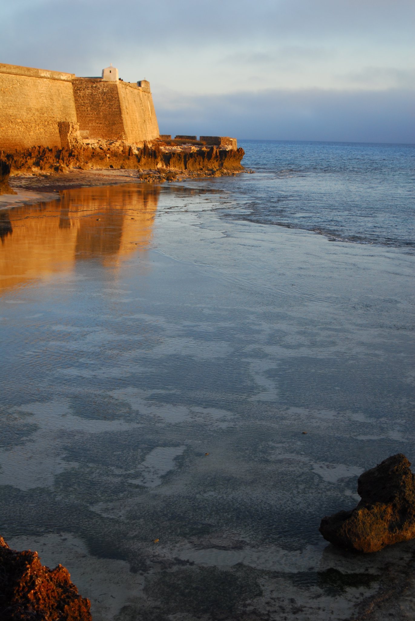
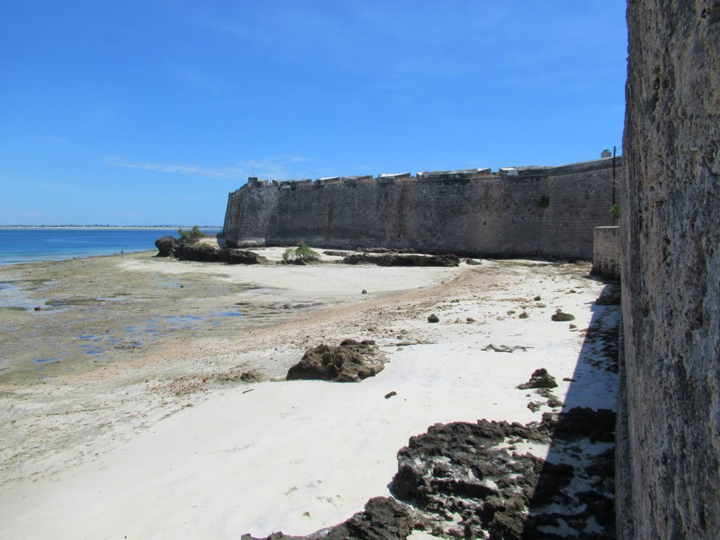
Fort São Sebastião has a rectangular plan, with its longest side measuring more than 110 metres. Its walls are founded directly on the underlying rock. The northern, eastern, and western sides face the sea, while the southern side is landward and is flanked by the bastions of São Gabriel and Santa Bárbara. A bastion is a projecting section of a fortified wall that allowed defenders to fire along the faces of the fortification.
Four bastions protect the corners: São João, Nossa Senhora, São Gabriel, and Santa Bárbara. Three are triangular, while the fourth is shaped as a projecting breakwater or spur. São Gabriel is the largest and principal bastion, with 24 gun openings. Two projecting elements were later demolished, giving the fort the star-shaped polygonal appearance shown in a Dutch engraving of 1635.
Interior buildings and water supply
At the height of its use, the fortress contained troop quarters, a chapel, a hospital, several storehouses, and arsenals. These facilities supported the garrison and the fort’s defensive and administrative functions.
Rainwater cistern
An underground cistern collected rainwater for use inside the fort. Built during the 1580s, it was restored in 1605 by Captain Sebastião de Macedo and continues to serve this function. A cistern is an underground reservoir or tank designed to collect and store water.
Chapel of Nossa Senhora de Baluarte
The Chapel of Nossa Senhora de Baluarte stands at the northern interior of the fortress, at the foot of the Nossa Senhora bastion. Built in 1522 in the Manueline style, a late Portuguese Gothic style associated with elaborate maritime, natural, and religious ornament, it is regarded as the only example of that style in Mozambique and the oldest European building in the Southern Hemisphere.
Earlier Tower of São Gabriel
The earlier Tower of São Gabriel, also called the Tower of Mozambique, had a square plan, three internal stories, and a surrounding wall with corner turrets. Built in 1508, it carried cannon and was defended by fifteen armed men. The Jesuits later received the ground occupied by the tower on the condition that it be demolished and that replacement buildings could not be used against the new fort. Those conditions were disregarded, and the tower’s structure became a supporting wall for the chapel of the College of São Paulo.
Dutch forces used the former tower structure to mount batteries during their attacks on Mozambique Island in 1607 and 1608. The tower was partially dismantled after these attacks and was not rebuilt.