Munger Fort: A Historic Fortification on the Ganges in India
Site at a Glance
- Rating
- 4.3
- Popularity
- Medium
- Country
- India
- Primary era
- Early Modern
- Eras represented
- Medieval, Early Modern
- Civilizations
- British, Mughal
- Site type
- Military
- Remains
- Fort
On this page24 sections
History
Munger Fort stands at Munger in Bihar, India, on the south bank of the Ganges. The fort’s early history is traditionally associated with the Slave dynasty, the first ruling house of the Delhi Sultanate, while its documented history can be traced from around 1330. Munger, also known as Monghyr during British rule, became a strategic stronghold shaped by successive Hindu, Afghan, Mughal, and British regimes.
Early and medieval rule
Munger’s earlier associations reach back to the ancient kingdom of Anga, the Pala rulers of the ninth century, and a fourth-century CE stone inscription connected with Chandragupta. The town was also linked with the name Mudgagiri, which traditions connect with the Mahabharata, the sage Mudgala, the Buddhist disciple Maudgalyayana, the Munda people, and Munigriha, meaning a hermit’s dwelling.
The Karnataka dynasty of Mithila controlled the area until Bhaktiyar Khalji captured it in 1225. Munger then passed under the Khalji ruler Gyasuddin Khalji and the Sultanate of Bengal from 1301 to 1322. Muhammad bin Tughluq annexed it to Delhi in 1342. Repairs followed during the governorship of Prince Danyal of Bengal, son of Sultan Alauddin Husain Shah. Danyal is also associated with the construction of the shrine of the Sufi saint Shah Nufa at the fort’s southern gate in 1497.
Afghan and Mughal control
Sher Shah Suri, the Afghan founder of the Suri Empire, defeated and killed Ibrahim Khan of Munger at Surajgarha in 1534. Munger subsequently came under Sher Shah’s control and became involved in his war with the Mughal emperor Humayun. Afghan rule replaced Mughal rule after Sher Shah’s victory.
In 1590, the fort served as the headquarters of the Bihar army of the rulers of Gaur, a historic political centre in Bengal. Their general, Kutub Khan, received control of the fort from Makhdun Alam, the brother-in-law of Nasrat Shah. During the reign of Akbar later in the sixteenth century, Munger returned to Mughal control. Raja Todar Mal, a senior Mughal administrator, used the fort as a base while suppressing a rebellion in Bengal and substantially renewed its defences.
Shah Shuja, the second son of the Mughal emperor Shah Jahan and brother of Aurangzeb, took refuge at Munger during the Mughal succession struggle. A treaty in 1658 added Munger to his territories, and he built a palace along the fort’s western side beside the river.
Conflict and the rise of Mir Qasim
The fort changed hands during the conflicts of the eighteenth century. In 1745, Mustafa Khan, a rebel leader under Alivardi Khan, seized it after its defences had weakened. He remained briefly before moving toward Patna with guns and ammunition taken from the fort. Maratha forces raided Bihar and Munger during the conflict of 1744. In July 1757, British forces under Eyre Coote pursued Jean Law to Munger but did not attack the strongly defended fort. Its governor instead supplied Coote with boats.
In February 1760, Major Caillaud and forces of the Nawab of Bengal defeated the Mughal emperor Shah Alam II. The emperor and his army then withdrew from Munger and the surrounding district, and Mir Qasim’s rule began. The fort’s officer, Johan Stables, later attacked the Raja of Kharagpur, who had opposed the Nawab.
Mir Qasim Ali controlled Munger from 1760 to 1764 and moved the capital of Bengal from Murshidabad to Munger in 1763. His general, Gurgin Khan of Isfahan, reorganized the Bengal army on British lines. Mir Qasim also strengthened the fortifications, built palaces, and established a firearms arsenal. Gunmaking continued locally, with several hundred families later associated with the craft.
Mir Qasim used Munger as a base during his war with the British East India Company, but he was defeated in 1764. His rule was also associated with atrocities against inhabitants of Munger and Patna and against captured English personnel. The killings at Patna became known as the Massacre of Patna. After Mir Qasim’s defeat, the fort declined in military importance, although it remained an important British position.
British rule and later use
In 1766, Lord Clive suppressed a rebellion by East India Company officers stationed at Munger. Known as the White Mutiny, it arose after the reduction of bh a t t a, an additional monthly payment made to officers. A small garrison remained, but maintenance of the fort was later neglected. Lord Cornwallis built a country house within the fort, and Munger continued to matter to the East India Company and the British Raj until Indian independence in 1947.
The fort came under British control through the political settlement by which Mir Qasim displaced his father-in-law, Mir Jafar, in an arrangement involving the East India Company and its trade duties. An old British cemetery, also called Lal Darwaza cemetery, lay north-west of the northern gate. It served British officers and other personnel stationed at Munger, with monuments dating from the late eighteenth and early nineteenth centuries. Its latest monument dates from 1862.
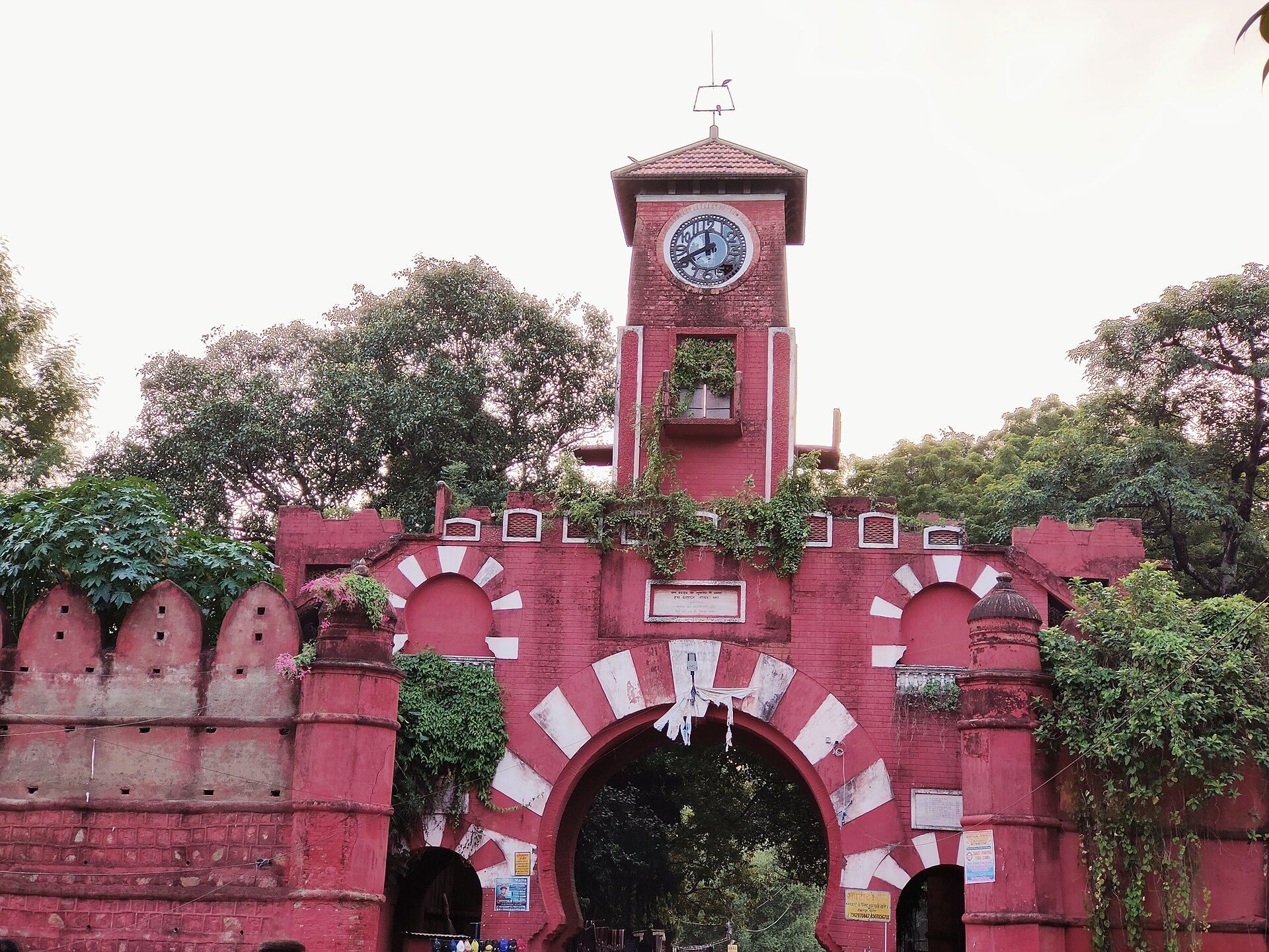
The Bihar School of Yoga was founded inside the fort by Swami Satyananda Saraswati in 1964. Since 1978, it has owned Ganga Darshan, a former hilltop residence, and has maintained its headquarters within the fort. The institution teaches traditional yoga and undertakes yoga projects and medical research. The fort and its constituent monuments are in ruins overall, while the principal gate remains in good condition. The Government of Bihar controls the site.
Remains
Munger Fort occupies about 222 acres, or 90 hectares, across rocky hills. Its perimeter measures approximately 2.5 miles, or 4 kilometres. The enclosure is octagonal, with four gates and ramparts. A deep moat about 175 feet wide protects the landward sides and opens toward the Ganges at both ends. The river borders the fort to the west and partly to the north. At this point the Ganges is about 2 kilometres wide and was historically crossed here only by boat.
Walls, gates, and elevations
Fortifications and Lal Darwaza
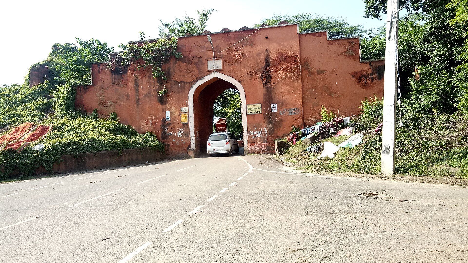
The fort’s defensive works were greatly expanded under Mughal rule. The inner walls are about 4 feet thick, the outer walls about 12 feet thick, and the complete fortification about 30 feet thick. Earth fills the interval of roughly 14 feet between the inner and outer walls. The principal entrance, Lal Darwaza, survives in good condition and contains a carved stone believed to have come from a Hindu or Buddhist structure.
Karnachaura
Karnachaura, also called Karanchaura or Karan Chabutara, is the highest point within the fort. This natural rocky hill is associated with the ancient Raja Karna and commands views over the surrounding area. A residence attributed to Raja Karna was later converted by the British into a saluting battery. The battery helped suppress the 1766 officers’ rebellion.
The former citadel
The second elevation is an artificial rectangular platform thought to mark the former citadel. Its masonry building, Damdama Kothi, may have been constructed by Muslim rulers or by earlier Hindu kings. The British demolished it by blasting to build the Collector’s Bungalow. Underground rooms were discovered beneath the building, and two arched passages in a nearby well led toward the bungalow and Shah Shuja’s palace. Stone carvings and sculptures were visible in the exposed masonry during Buchanan’s archaeological investigations.
Hilltop buildings
The saluting battery and residence
During General Goddard’s tenure, the hilltop site was refurbished and converted into a large residence for the British commanding officer. The building later belonged to the Maharaja of Vizianagram and then the Raja of Murshidabad. It became the property of the Bihar School of Yoga in 1978. An older platform in front of the bungalow is also associated with the period of Raja Karna and his wife.
Southern shrine
Tomb of Pir Shah Nufa
The tomb associated with Pir Shah Nufa stands near a rampart close to the southern gate. The tomb is dated to 1177, while construction of the shrine is associated with 1497. The complex occupies a square area about 100 feet on each side, with retaining walls supporting an earthen mound about 25 feet high.
The domed tomb chamber measures about 16 feet square and has circular turrets. It includes a prayer room and a restroom. Carved stones from earlier ruins contain holes and depressions that were believed to cure certain diseases in children when touched or used in prescribed ways.
Palace complex
Palace of Shuja
The monument locally called the Palace of Shuja is associated by tradition with the Mughal prince Shah Shuja, although its physical form is attributed to Mir Qasim. High walls bound it on three sides, while the Ganges forms its western boundary. The complex included a Khas Mahal, or private women’s palace, a Diwan-i-Am, or public audience hall, and a Tope-Khana, an armoury or artillery store.
Armoury and audience buildings
The armoury has walls between 10 and 15 feet thick and is now used as a dormitory. The Khas Mahal and public audience hall are largely ruined and have been used as a jail and a school for prisoners. A mosque on the western side of the palace is now ruined and has been used as a storehouse. A hammam, or bathhouse, and a dressing room stood west of the present jailer’s office.
Underground passages
A dry well or pit beneath the mosque floor is about 10 to 12 feet deep. Several tunnels run from it in different directions. One former opening connected the underground space with the river, although that opening has since been shored up.
Riverfront and religious remains
Kashtaharini Ghat
Kashtaharini Ghat occupies a bend where the Ganges flows northward. Its stepped stone approach descends from the high bank to the river. Religious tradition associates the ghat with Govind Chandra of Kannauj, who is said to have granted land for its construction after bathing there during the festival of Akshaya Tritiya.
Archaeological remains connected with the ghat include an inscription from about the tenth century referring to King Bhagiratha and the construction of a Shiva temple. Carvings and sculptures were recorded by the archaeologist Bloch in 1903. An inscribed image of the meditating Buddha is preserved in the Indian Museum in Kolkata.
Chandisthana
Chandisthana is a shrine identified as a village-deity sanctuary of the goddess Chandi. It appears as a hole in a rock associated with the rule of King Karna Vikrama. Local religious tradition regards it as one of the 64 Shakta pithas, sacred places associated with Shaktism, the Hindu tradition centred on the divine feminine.
Tomb of Mulla Muhammad Said
The south-western bastion contained the tomb of Mulla Muhammad Said, a Persian poet from Mazandaran who died at Munger in 1704. The tomb was located inside the fort and has since been removed.
British cemetery
Lal Darwaza cemetery
The eighteenth-century British cemetery near the fort contains obelisk tombs and other monuments. Its earliest monument is a massive black stone pillar, probably reused from a temple, erected in memory of Stewart, who died at Munger in 1769. The cemetery’s latest monument dates from 1862.