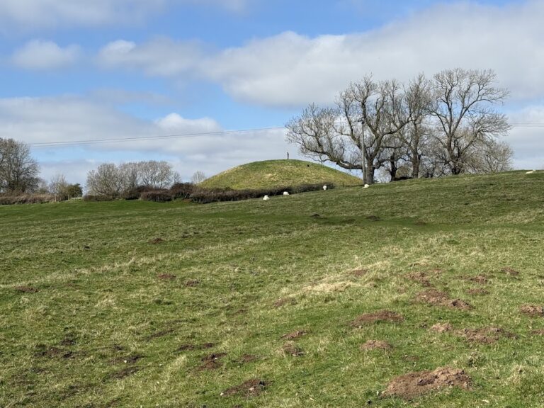
Lunt Roman Fort: A Roman Military Fort in Britain

Site at a Glance
- Rating
- 4.1
- Popularity
- Low
- Country
- United Kingdom
- Primary era
- Classical
- External website
- Open
- Eras represented
- Classical, Medieval
- Civilizations
- Anglo-Saxon, Roman
- Site type
- Military
- Remains
- Fort
On this page12 sections
History
Lunt Roman Fort is a Roman military fort in the United Kingdom, built around AD 60 during the final campaign against Boudica, the leader of the major revolt against Roman rule in Britain in AD 60–61. Its earliest occupation belongs to approximately AD 60–61, and the fort formed part of the military response to the rebellion. It stood near the junction of the Fosse Way and Watling Street in a heavily militarized area that also included forts at Wall, Mancetter, Alcester, and Metchley.
First occupation and military headquarters
During its first phase, Lunt served as a supply depot and headquarters for an unidentified Roman legion. Its position on an elevated site near important roads gave it value within the military network established during the campaign. The fort was not rebuilt in stone during its short period of use, and its early structures were constructed mainly from timber and earth.
The reduced fort and the gyrus
A second occupation began in AD 64, when the installation was reduced in size and assigned to a cohort. A cohort was a Roman military unit smaller than a legion. This phase brought a major change to the fort’s plan because the construction of the gyrus, a circular enclosure for exercising or training horses, required the demolition of some earlier buildings. The altered fort remained in use until approximately AD 77–78.
In the late AD 70s, the number of barrack blocks was reduced. This may have been connected with an uprising by the Silurians, a people of south Wales, and the need to station soldiers nearer to possible unrest. A third phase, dated approximately AD 77–79, included a double-ditch system, a twin-portalled southern gateway, and occupation beyond the defences.
Abandonment and later activity
The fort was finally abandoned around AD 80. Agricola, whose governorship of Britain began in AD 79, shifted Roman military strategy toward the conquest of territories farther north. A single coin of the emperor Gallienus, who ruled from AD 260 to 268 during a period when parts of the western empire formed the breakaway Gallic Empire, was found in a gateway post hole. It may indicate a temporary military reoccupation after AD 260, although it may instead represent a casual loss long after the fort had ceased to function.
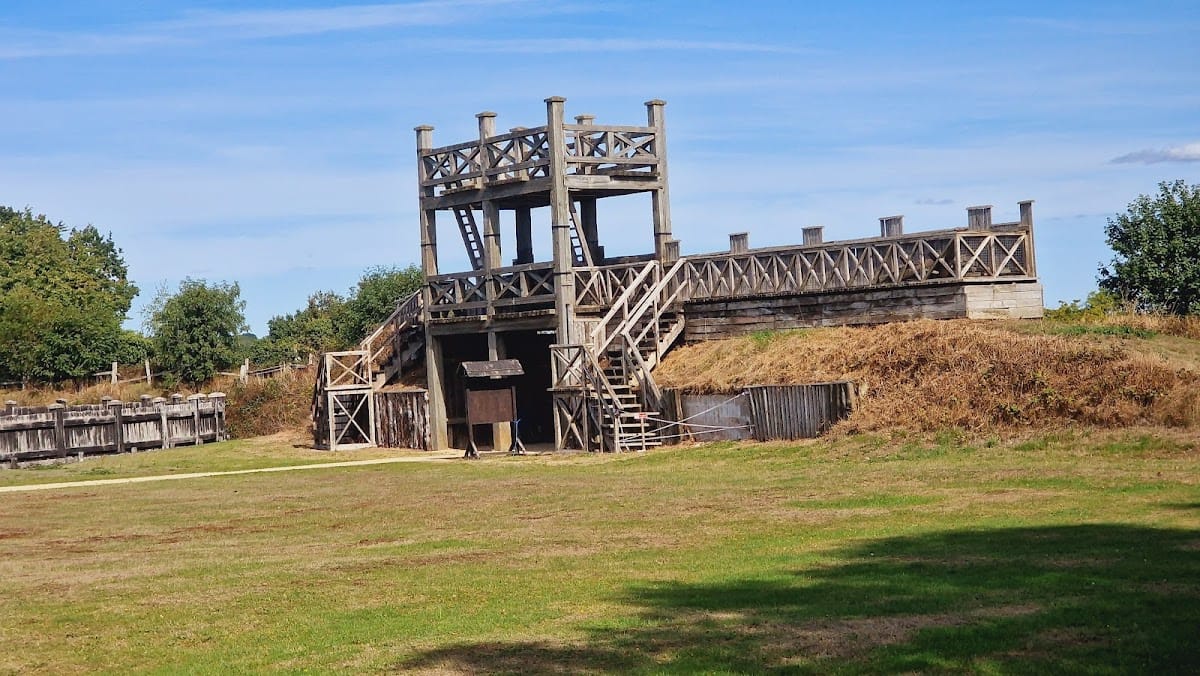
The site was identified in the 1930s after substantial quantities of Roman pottery were found. From the 1960s, Brian Hobley, keeper of field archaeology at Coventry Museum, directed a long-term project that combined excavation with research into Roman military construction methods. The fort was fully excavated and partially reconstructed during the 1970s. Some reconstructed features used their original foundations, while archaeologist Margaret Rylatt led the rebuilding of the wooden gateway with tools and techniques intended to replicate those used by Roman military engineers.
Archaeological work in 2001 identified evidence of Anglo-Saxon settlement dating to Sub-Roman Britain, the period after Roman imperial administration ended in Britain and before early medieval Anglo-Saxon kingdoms emerged. Later medieval occupation is represented by large post holes and a post-Roman ditch containing pottery fragments. Lunt Roman Fort is preserved as a scheduled monument, a legally protected archaeological or historic site designated by the state, under the official designation “Roman fort at The Lunt,” made on 14 June 1962. It functions as a museum governed by the Herbert Art Gallery and Museum.
Remains
Lunt Roman Fort occupies a high plateau above a steep wooded slope descending toward the River Sowe. The elevated position provided views northward, while the slope, a nearby river crossing, fresh water, and timber from the Forest of Arden contributed to the site’s defensive and logistical value. The surviving plan combines earthwork defences, timber structures, and the circular gyrus, producing an unusual arrangement rather than the regular straight-sided plan commonly associated with Roman forts.
Defences and layout
The fort was surrounded by a V-shaped ditch and a turf rampart formed from two sloping turf walls filled with earth dug from the ditch. A chest-high wooden fence stood above the rampart, with narrow openings wide enough for a Roman sword to pass through. A slot at the bottom of the ditch may have functioned as an ankle breaker. The northern, southern, and western sides followed relatively straight lines, while the eastern defences curved outward around the gyrus. On the west, the defensive line followed the top of the plateau.
The circular training enclosure
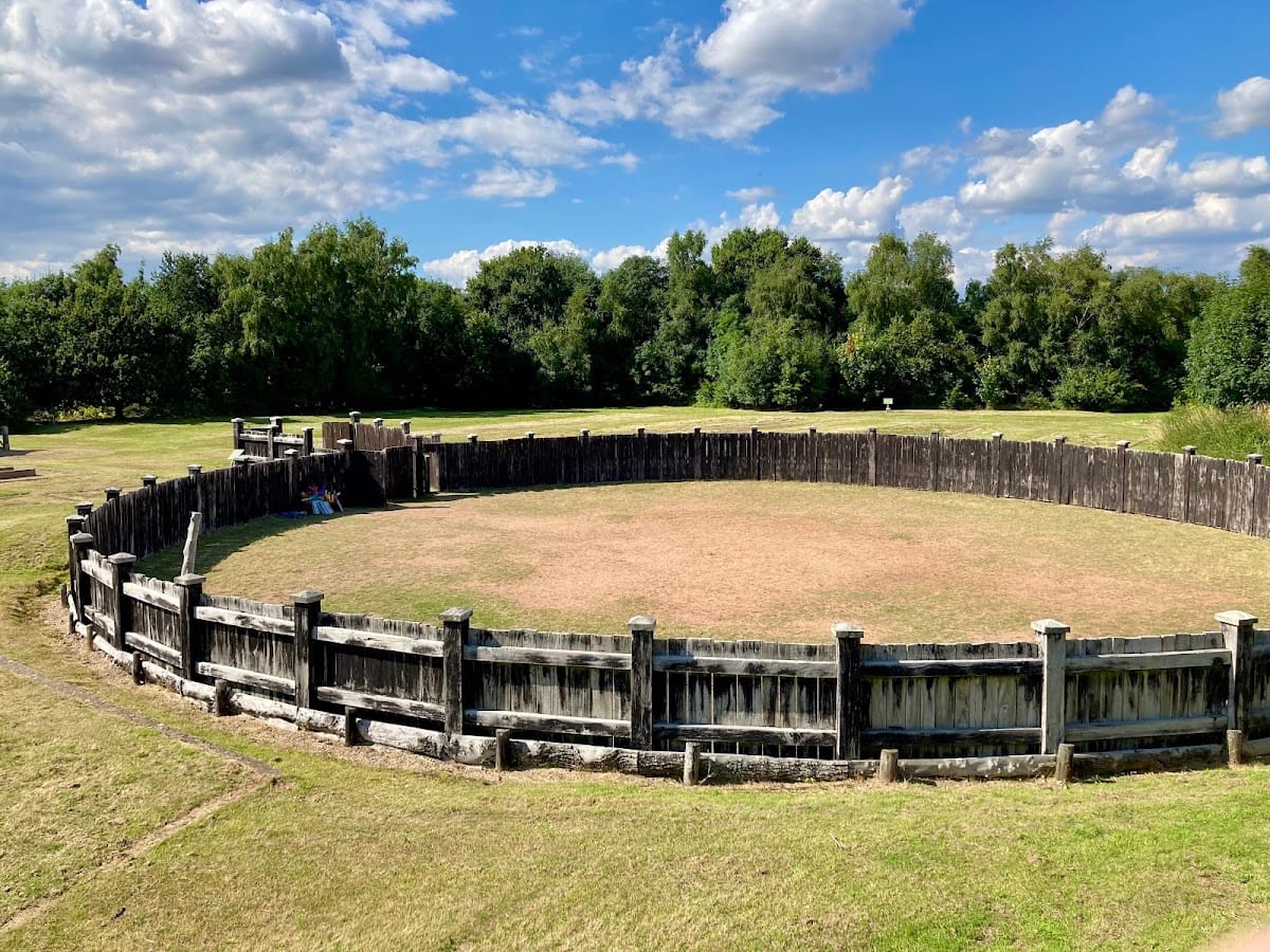
The gyrus is a circular timber-stockaded enclosure incorporated into the eastern side of the fort. It measures approximately 32 metres across and is stated to enclose 1,024 square metres. Before the stockade was built, the sand and gravel subsoil was excavated to a depth of approximately 600–900 millimetres. The enclosure was probably used to train horses, possibly by making them move around its perimeter on a long rein. It is described as the only known gyrus in the Roman Empire and as a feature otherwise not found inside a Roman fort.
By inserting the gyrus into the eastern side, the builders disrupted the fort’s standard “playing-card” arrangement and changed both the eastern wall and the internal layout. The resulting plan is described as unique in Roman Britain and across the Roman Empire. The reconstructed gyrus stands on its original foundations and helps convey the physical effect of this unusual feature on the fort’s design.
Buildings, storage, and military activity
Command buildings and barracks
Excavation identified the principia, the main administrative and command building of a Roman fort, together with the praetorium, the commander’s residence or headquarters building. The second-phase fort also contained six barrack blocks. Their arrangement has been used to estimate a garrison of approximately 480 infantry and 120 cavalry.
Granaries and working areas
Two granaries and storage facilities formed part of the second-phase fort. Horse fittings, small quantities of Roman armour, possible stabling, and an extensive metalworking area provide physical evidence for cavalry activity. One granary was reconstructed on its original foundations and houses the site’s museum exhibition.
Southern gateway and reconstructed timberwork
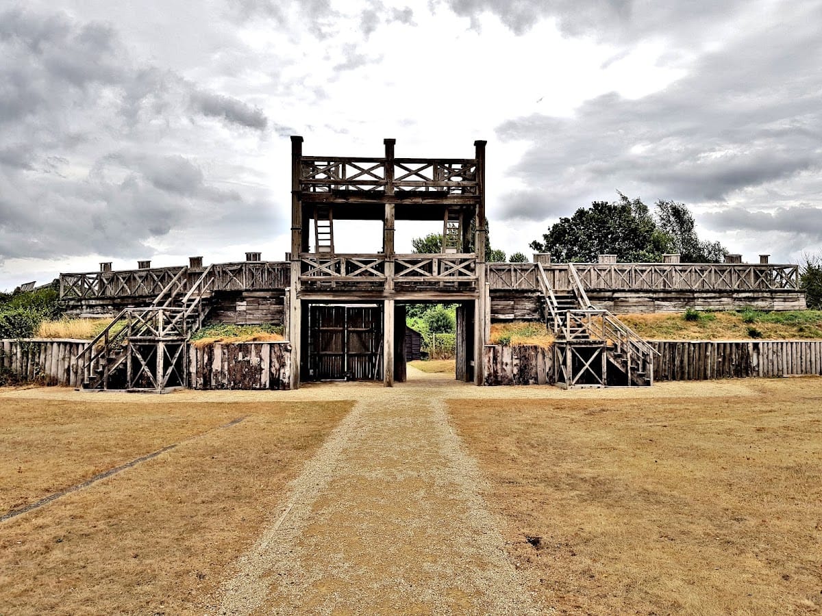
The reconstructed gateway is a twin-portalled structure on the southern side of the fort. Its form was modelled on representations associated with Trajan’s Column. A section of the defensive wall, the gateway, one granary, and the gyrus were rebuilt during the 1970s. The reconstructed elements are timber-based, reflecting the fort’s original construction and its continued use without a stone rebuilding phase.
Finds and later remains
Finds include a fragment of Roman Samian pottery, a fine usually red-slipped Roman tableware, and a coin bearing Nero’s head that dates to AD 65 and was discovered in 2001. A ring etched with a palm-leaf design was also recovered. The motif symbolized victory and was associated with successful gladiators.
The 2001 archaeological work also recovered artefacts associated with Anglo-Saxon settlement. Large post holes and a ditch containing pottery fragments provide physical evidence for medieval and post-Roman activity at the site.