Chitradurga Fort: A Multi-Period Hill Fort in India
Site at a Glance
- Rating
- 4.6
- Popularity
- Very High
- Country
- India
- Primary era
- Medieval
- Eras represented
- Medieval, Early Modern
- Civilizations
- Chalukya, Hoysala
- Site type
- Military
- Remains
- Castle
On this page9 sections
History
Chitradurga Fort is a medieval and early modern hill fort in Chitradurga, India, constructed in stages by regional South Indian dynasties between the eleventh and thirteenth centuries and expanded substantially by the Nayakas of Chitradurga from the fifteenth to the eighteenth centuries. Its principal purpose was military defense, and its stores, reservoirs, and water-harvesting systems supported the garrison during prolonged sieges.
Early dynasties and medieval development
The earliest phases of the fort are associated with the Chalukyas and Hoysalas, major medieval ruling dynasties of southern India. Inscriptions connected with the Chalukyas, Hoysalas, and Vijayanagara rulers have been found in and around the fort. Nearby rock edicts from the Ashokan period at Brahmagiri have also linked the wider area with the Mauryan Empire. The region later came under the Rashtrakutas, Chalukyas, and Hoysalas before becoming part of the sphere of the Vijayanagara Empire.
The name Chitradurga derives from Chitrakaldurga, a Kannada expression meaning “picturesque fort.” British records used the form Chitaldoorg, and the name was also applied to the town and district. The fort’s location among granite hills and boulders helped shape its defensive development, while later rulers extended the earlier fortifications across the surrounding heights.
The Nayaka stronghold
The Nayakas of Chitradurga, also called the Palegar Nayakas, were regional military chiefs and governors who first served the Vijayanagara Empire. After Vijayanagara rule ended in 1565, they became independent, controlled the region for more than two centuries, and made the fort the political center and stronghold of their province.
Timmanna Nayaka, also known as Thimmappa Nayaka, was the first ruler in the Nayaka hierarchy. He had been a chieftain from Matti under the Vijayanagara ruler Saluva Narasimha Deva Raya and was appointed governor of Chitradurga after military service. His rule ended when he was imprisoned and died in Vijayanagara custody. His son Obana Nayaka, or Madakari Nayaka I, succeeded him in 1588.
Bharamappa Nayaka, who ruled from 1689 to 1722, is regarded as the greatest of the Nayaka rulers. During his reign, forts, palaces, tanks, temples, gateways, and bastions were constructed, and he fought several battles against the Mughals. The Nayakas’ family deity was Ekanatheswari, regarded as an incarnation of Adi Parashakti. The fort also became associated with the Lingayat religious institution Murugarajendra Matha, which was later moved to a site about 2 kilometres northwest of Chitradurga.
Hyder Ali and the end of Nayaka rule
Madakari Nayaka V, the last ruler of the Chitradurga Nayakas, ruled from 1758 to 1779. Hyder Ali, the eighteenth-century ruler and military leader of Mysore, attacked the fort in 1760, 1770, and 1779. Madakari Nayaka successfully used the fort in the first two conflicts, at different times allying with Hyder Ali and with the Marathas. In 1779, Hyder Ali captured the fort, defeated and imprisoned Madakari Nayaka, and the former ruler was later killed. The defeat followed betrayal by the Marathas and by some local Muhammadan officers serving the Nayaka.
Hyder Ali briefly controlled the fort, including during the period when a mosque was added to the complex. British forces captured it in 1799 after defeating his son, Tipu Sultan, in the Fourth Mysore War, the conflict that reorganized the Kingdom of Mysore under the Wodeyar dynasty. Chitradurga then became part of Mysore Province. British troops occupied the fort from 1799 to 1809 as a base for defending Mysore’s northern frontier, after which control returned to the Government of Mysore.
Tradition and historical memory
Local tradition connects the surrounding hills and boulders with the Mahabharata, the ancient Sanskrit epic whose central narrative includes the Pandavas, Bhima, and Kunti. According to the legend, Bhima killed the man-eating giant Hidimbasura in a duel at Chitradurga while the Pandavas and their mother were in exile, and the boulders formed part of the weapons used in the struggle.
Another local legend concerns Onake Obavva, the wife of a soldier guarding the fort, whose defense during one of its wars became part of Chitradurga’s historical memory. After Madakari Nayaka’s death, the fort’s treasury was said to contain considerable wealth.
Remains
Hills, walls, and gateways
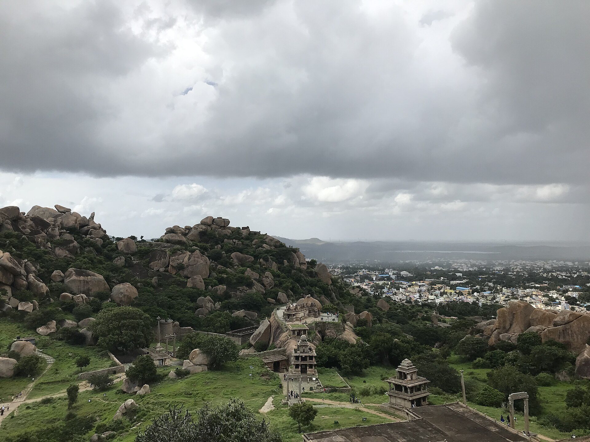
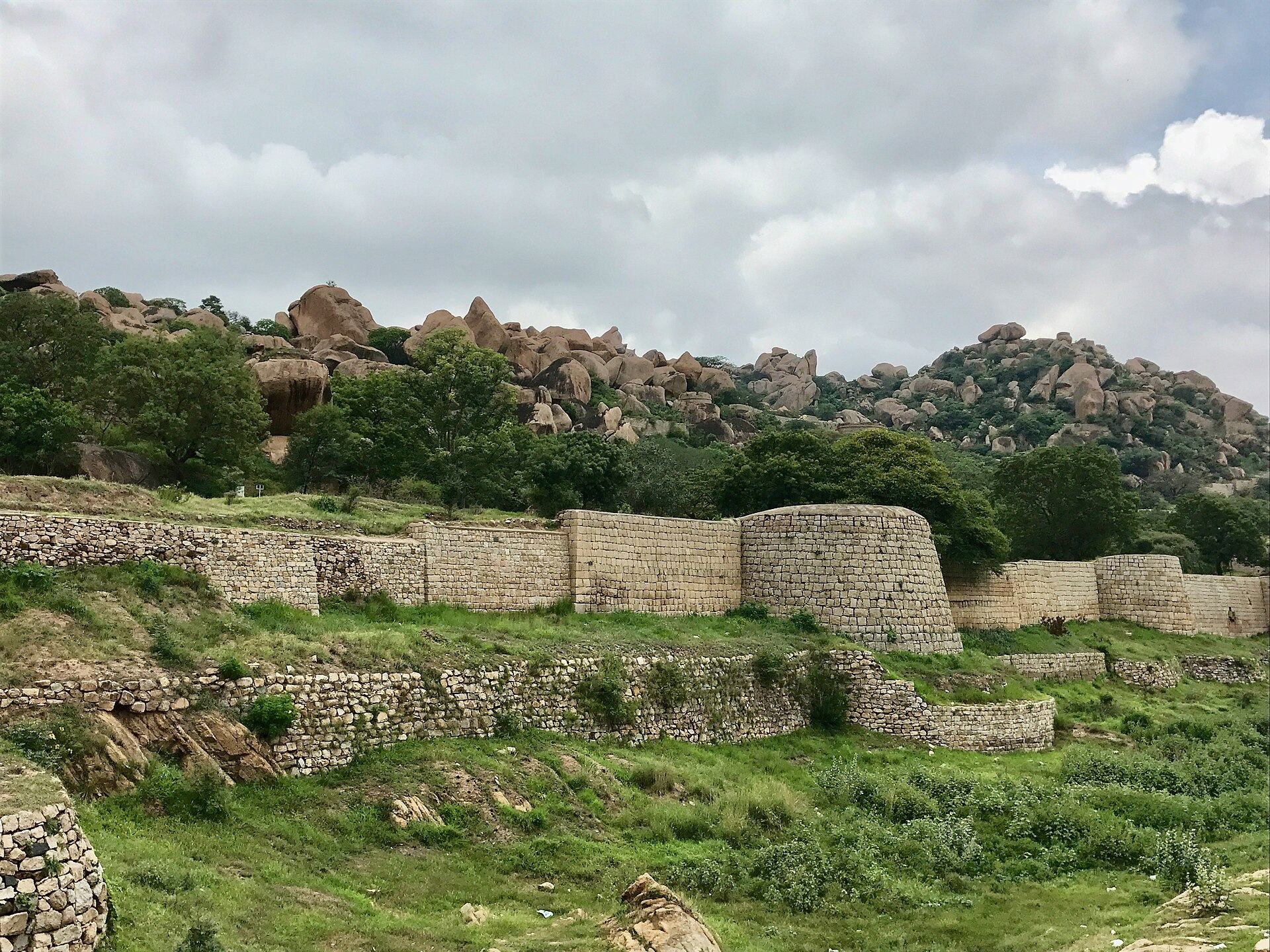
Chitradurga Fort occupies several granite hills of the Chinmuladri range and a summit above the flat valley of Chitradurga district. The hills consist of massive rock formations, towering boulders, and valleys, forming part of the fort’s defensive setting. Seven concentric fortification walls enclose the seven hills across approximately 1,500 acres. The walls extend for about 8 kilometres and range from approximately 5 to 13 metres in height according to the terrain and geological strata.
The earliest fortification was built in mud. Sections were later strengthened with granite slabs, particularly during the eighteenth century. Large granite blocks were carefully sized, cut, trimmed, and laid without cementing material. Later additions used burnt brick set in mortar, with thin cement or lime plaster and painted surfaces. The outermost line had four principal gates, Rangayyana Bagilu, Siddayyana Bagilu, Ucchangi Bagilu, and Lalkote Bagilu. Each entrance was approached through an ascending, winding, narrow passage that hindered elephant attacks and the use of battering rams. The eastern gateway has features associated with the Bahmani Sultanate.
Defensive works and water storage
The defensive system included 19 gateways, 38 rear entrances, 35 secret entrances, four concealed passages, and approximately 2,000 watchtowers. Small embrasures, openings through which defenders could fire weapons, were set into the walls. The fort also contains a citadel, storehouses for grain and oil, and defensive facilities that are described as well conserved. Monsoon rain has eroded parts of the mud-brick walls of the storehouses and granaries.
Rainwater was collected through a cascading system that directed water into interconnected reservoirs. The arrangement was designed for large-scale storage and supported the fort during sieges. Water tanks and reservoirs are distributed through the fortified hills, where the system was traditionally said never to have suffered a water shortage.
Temples and other buildings
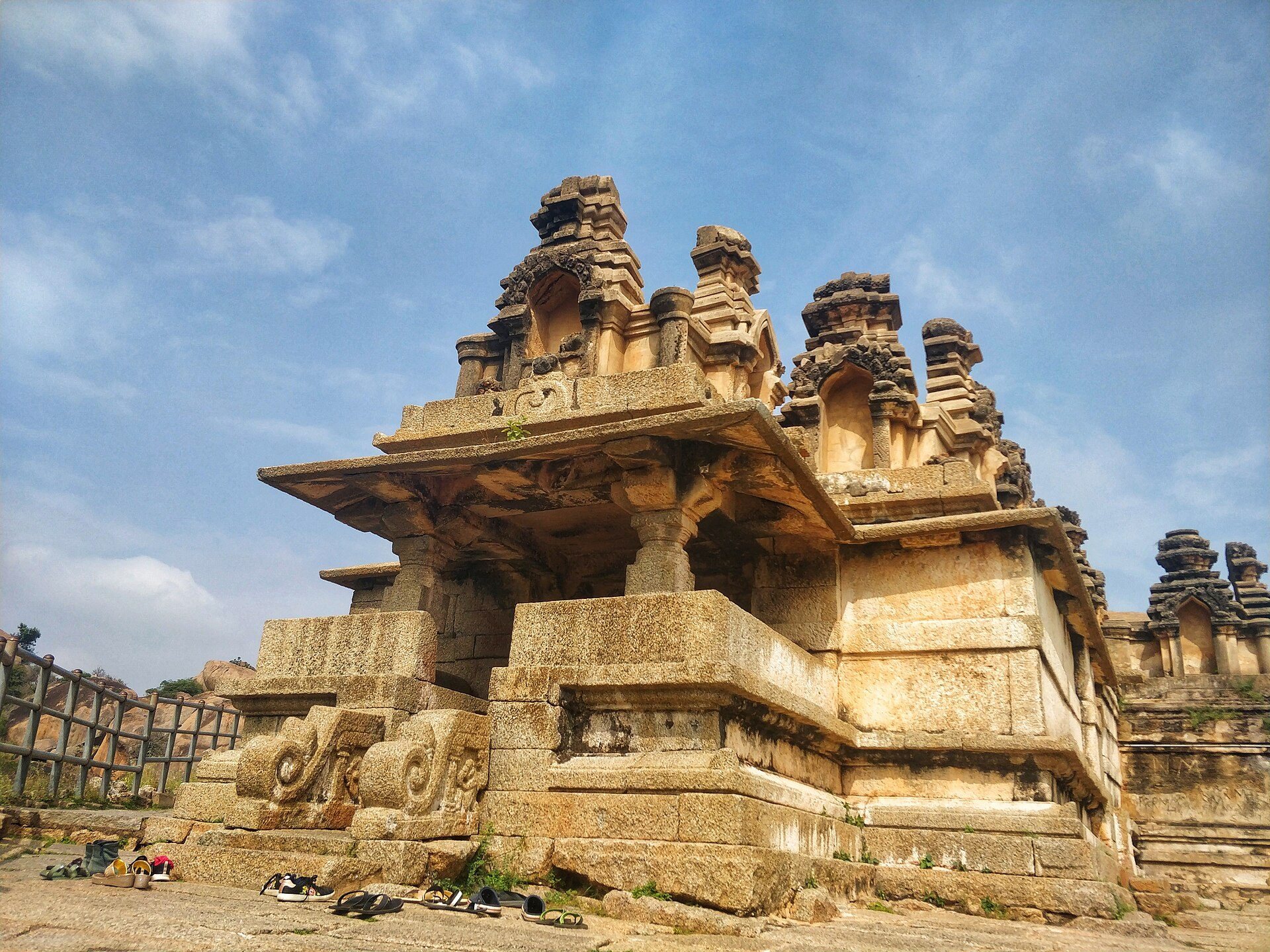
The rocky hills contain a citadel, warehouses, reservoirs, temples, a mosque, and buildings collectively described as the “Palace of Stones.” The upper fort contains eighteen temples, including the Hidimbeshwara, Sampige Siddeshwara, Ekanathamma, Phalguneshwara, Gopala Krishna, Hanuman, Subbaraya, and Nandi temples. Ekanatheswari’s footprints are carved into a stone block at the entrance to the fort.
The Hidimbeshwara Temple displays the tooth of Hidimba. At its entrance stand a monolithic pillar and two swing frames, together with the Bheri, or Drum of Bheema, a large iron structure made from plates that measures approximately 3 metres in circumference and 2 metres in height. Sampige Siddeshwara Temple stands at the foot of the hill. Inscriptions in the Gopalakrishna Temple date its idol to the early fourteenth century.
The fort lies within a valley formed by the Vedavati River, while the Tungabhadra River flows to its northwest. Its highest elevation is approximately 976 metres. Jogi Matti, about 5 kilometres south of Chitradurga, contains the highest hill peak in the area, distinct from the highest elevation within the fort itself.