Sakitama Kofun Cluster: An Ancient Burial-Mound Complex in Japan


Site at a Glance
- Rating
- 4.3
- Popularity
- Low
- Country
- Japan
- Primary era
- Medieval
- External website
- Open
- Eras represented
- Classical, Medieval
- Civilizations
- Yamato
- Site type
- Burial
- Remains
- Necropolis
On this page20 sections
History
The Sakitama Kofun Cluster is an ancient burial-mound complex in Japan, located at Sakitama in Gyoda, Saitama Prefecture. Japanese elite and ruling groups built its mounds from the latter half of the fifth century through the seventh century, during the late Kofun period and the succeeding Asuka period. Construction began with Inariyama Kofun and continued for roughly a century and a half. The place-name Sakitama is regarded as the origin of the name of modern Saitama Prefecture.
Regional rulers and the Kasahara interpretation
The cluster is traditionally regarded as the cemetery of the Kasahara family, connected with the Kuni no miyatsuko of Musashi. A Kuni no miyatsuko was a hereditary provincial official or local ruler recognized within the early Japanese state. Another interpretation associates some burials with the Chichibu Kuni no miyatsuko. These identifications remain historical interpretations rather than established facts.
The Nihon Shoki records that in 534, Kasahara no Atai Omi won a succession conflict concerning the office of Musashi Kuni no miyatsuko and was appointed by Emperor Ankan, a sixth-century ruler associated in historical tradition with the organization of provincial authority. This episode has helped support the theory that the burial cluster was linked with the Kasahara ruling lineage. The inscribed iron sword from Inariyama Kofun also contributes to that interpretation, since the name of the sword owner’s father may be read as “Kasahara.”
The location of the cluster’s earlier political or ceremonial base remains open to interpretation. Proposed locations include sites in the Hiki area, Nomoto Shogunzuka Kofun, and several places along the left bank of the Ara River. These proposals reflect attempts to understand the political setting of the people buried at Sakitama.
Development, damage, and survival
Earlier descriptions stated that the cluster contained about 100 mounds. A 1935 survey identified 11 keyhole-shaped mounds and 11 circular mounds. The area before the middle of the 1930s was also described as containing nine large mounds, 35 small circular satellite mounds, and one square mound.
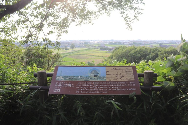
The concentration was reduced by wetland development and land reclamation. During Ishida Mitsunari’s 1590 water attack on Oshi Castle, numerous mounds were damaged. Ishida’s forces used water in an attempt to besiege the castle. From the late Meiji period through the early Showa period, further small mounds were removed as farmland expanded and earth was taken for reclamation. The mounds of Wakaoji Kofun and Atagozuka Kofun were also cut away.
Edo-period records preserve knowledge of the site. The Shinpen Musashi Fudoki and the Oshi Meisho Zue described the mounds, while a detailed 1806 map of the Five Highways depicted Maruhakayama, Futagoyama, and either Teppozan or Kawarazuka Kofun. The place-name “Hundred Mounds” likewise preserves evidence of the former concentration of burial mounds.
Shogunyama Kofun was excavated in 1893. In 1934, soil extraction damaged the front part of Inariyama Kofun. Temporary protection was requested in 1935 for Maruhakayama, Futagoyama, and Teppozan Kofun. Broader investigation followed, and the cluster was designated a National Historic Site in 1938. Sakitama Village became its administrator that year and established a preservation society in 1939.
Modern investigation and protection
After Sakitama Village was incorporated into Gyoda in 1954, the former Sakitama Village Kofun Cluster was renamed the Sakitama Kofun Cluster in 1957. Conservation and archaeological investigation began in 1966 in connection with the development of Sakitama Fudoki no Oka. Aerial photography in 1968 revealed crop marks corresponding to buried mound and moat features, and Inariyama Kofun was excavated that August.
During conservation treatment in September 1978, an inscription in gold inlay was identified on the excavated iron sword. The objects from Inariyama were designated an Important Cultural Property in 1981 and elevated to National Treasure status in 1983. The Sakitama Ancient Burial Mounds Museum opened in 1969, an association for excavated cultural materials was established in 1980, and the Shogunyama Kofun Exhibition Hall opened in 1997.
The cluster became a Special National Historic Site on March 10, 2020. It was the first such site in Saitama Prefecture, the first kofun cluster in eastern Japan to receive that status, and the first elevation of a kofun cluster to the category in 67 years. The cluster also forms part of the Japan Heritage story “Gyoda, the Town of Tabi Storehouses Supporting the Footwear of Japanese Dress.” Saitama Prefecture and Gyoda are promoting it for potential UNESCO World Heritage inscription under the theme “Sakitama Kofun Cluster: The Terminal Point of the Ancient East Asian Kofun Culture.”
Remains
The surviving cluster consists of eight large keyhole-shaped mounds and one large circular mound. A keyhole-shaped mound combines a rectangular front section with a circular rear section. The protected area extends about 600 meters from east to west and 900 meters from north to south, on a buried loam terrace approximately 17 to 18 meters above sea level in the northern part of the Omiya Upland. Its setting includes low rises, wetlands, natural levees, riverside dunes, and back-marshes. The cluster lies about 2.5 kilometers southeast of central Gyoda, north of the Ara River and south of the Tone River.
The large keyhole mounds generally share a similar orientation and stand close together. They normally have two square moats separated by an intermediate bank. Some also have projecting platforms, architectural extensions attached to the mound or its intermediate bank, on the west side of these features. Most of the keyhole mounds lack stone facings, although Maruhakayama may have had a small amount of stone facing. The protected area was expanded to include moat sections and other surrounding remains, growing from 45,838.65 square meters to 222,745.20 square meters in 1989 and to 265,339.61 square meters through further expansions in 2013 and 2018.
Principal burial mounds
Inariyama Kofun
Inariyama Kofun is the oldest mound in the cluster, dating to the latter half of the fifth century. It is a keyhole mound about 120 meters long. Its circular rear section measures 62.6 meters across and rises 10.4 meters high, while the front section is 82.4 meters wide. The mound contained both a gravel burial cist and a clay burial cist. Two square moats surrounded it, with projecting platforms on the mound and the intermediate bank.
The name comes from a small Inari shrine formerly located on the mound. Excavation produced an iron sword with a gold-inlaid inscription, a mirror with pictorial designs, ring-shaped knobs, divine beasts, curved beads, armor, weapons, horse fittings, knives, Sue ware, Haji ware, figurative haniwa, and cylindrical haniwa. Haniwa were clay funerary figures and cylinders placed around or on burial mounds. Sue ware was high-fired, wheel-made pottery, while Haji ware was a lower-fired traditional Japanese ceramic. The finds are collectively designated “Excavated Objects from Inariyama Kofun, Sakitama, Musashi.”
Futagoyama Kofun
Futagoyama Kofun dates to the first half of the sixth century and is the largest kofun in the Musashi region. It measures 132.2 meters in length. The rear section is 67 meters in diameter and 11.7 meters high; the front section is 83.2 meters wide and 13.7 meters high. Two square moats surround the mound, and projecting platforms extend from both the mound and the intermediate bank.
The name refers to the apparent two-mountain form created by the mound’s front and rear sections. It is also known as Kannonjiyama.
Shogunyama Kofun
Shogunyama Kofun dates to the latter half of the sixth century and is 90 meters long. Its circular rear section is 38.8 meters in diameter and 3 meters high, while the front section is 63.6 meters wide and 7 meters high. It probably had two square moats and projecting platforms on the mound and intermediate bank.
Its burial facility is a horizontal stone chamber, a chamber reached through a passage running laterally into the burial space. The chamber was built with hornblende andesite, green schist, and Boso stone, a sandy tuff. The use of these materials indicates that the buried person probably possessed considerable power. The chamber contained a breast-design mirror, iron arrowheads, weapons, horse fittings, and other grave goods, many with close connections to the Korean Peninsula. A dedicated exhibition hall presents the interior of the stone chamber.
Maruhakayama Kofun
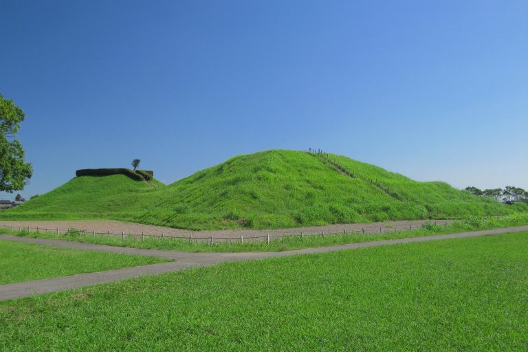
Maruhakayama Kofun dates to the first half of the sixth century and is the largest circular kofun in Japan. It is 105 meters in diameter and 17.2 meters high, with a circular moat approximately 40 meters wide. It was formerly interpreted as a scallop-shaped mound. Fragments of Sue ware, Haji ware, figurative haniwa, and cylindrical haniwa have been found.
The mound contains the greatest volume of earth among the cluster’s mounds and reaches its greatest height. A Jizo Bodhisattva, a Buddhist figure commonly represented in stone, is enshrined on the summit. Military chronicles state that Ishida Mitsunari placed his headquarters there during the 1590 siege of Oshi Castle. The name Maruhakayama refers to the mound’s circular form, although another explanation connects it with a corrupted form of “Maro burial mound.”
Atagoyama Kofun
Atagoyama Kofun is the smallest keyhole mound in the cluster and dates from the middle to the latter half of the sixth century. It is 54.7 meters long. The rear section is 26.4 meters in diameter and 3.6 meters high, while the front section is 31.4 meters wide and 3.7 meters high. Two square moats surrounded it.
A stone Buddhist image is enshrined on the front section. Excavated material includes fragments of Sue ware, figurative haniwa, and cylindrical haniwa. The mound’s name derives from a former Atago shrine that stood there.
Kawarazuka Kofun
Kawarazuka Kofun dates to the middle of the sixth century and is the only mound in the cluster for which the arrangement of haniwa is known. It measures 73.4 meters in length. The rear section is 36.2 meters in diameter and 4.8 meters high, and the front section is 45 meters wide and 4.6 meters high. Two square moats surrounded it, with a projecting platform on the mound.
The finds include Sue ware, Haji ware, figurative haniwa, and cylindrical haniwa. The figurative haniwa are numerous and generally well preserved. The name derives from tile makers who lived nearby in the early Meiji period.
Teppozan Kofun
Teppozan Kofun dates to the latter half of the sixth century and measures 107.6 meters long. Its rear section is 49.7 meters in diameter and 8.5 meters high, while the front section is 68.1 meters wide and 9.5 meters high. It has two square moats, with three moats in some areas, and projecting platforms on both the mound and intermediate bank.
The burial facility is a horizontal stone chamber. Sue ware, Haji ware, figurative haniwa, and cylindrical haniwa have been found there. The name reflects the use of the area as a firearms-training ground by the Oshi domain during the Edo period. The mound was also called Ofuroyama.
Okunoyama Kofun
Okunoyama Kofun dates to the middle of the sixth century and is 66.4 meters long. The rear section measures 38.4 meters across and 5.6 meters high, while the front section is 43.2 meters wide and 6 meters high. It had two square moats and a projecting platform on the mound. Sue ware, Haji ware, figurative haniwa, and cylindrical haniwa have been found. Its name reflects its position at the easternmost end when viewed from the east.
Nakanoyama Kofun
Nakanoyama Kofun dates from the end of the sixth century to the beginning of the seventh and is the latest-built of the principal mounds. It is 79 meters long. Its rear section is 38 meters in diameter and 4.9 meters high, and its front section is 44 meters wide and 5.2 meters high. Two square moats surrounded it.
Finds include Sue ware, Haji ware, and a Sue-style haniwa jar. The mound stands between Okunoyama Kofun and the vanished Tobaguchiyama Kofun and is also known as Karabitsu-yama.
Associated mounds and archaeological traces
Sengen-zuka Kofun
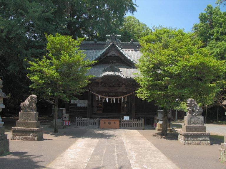
Sengen-zuka Kofun lies outside the protected area and dates to the first half of the seventh century. It is a relatively large late-period circular kofun, approximately 50 meters in diameter and 8.5 meters high, with an outer circular moat about 73 meters in diameter. Fragments of Sue ware and Haji ware have been found. Maetama Shrine occupies the summit, while Sengen Shrine stands on a lower part of the mound.
Tobaguchiyama Kofun
Tobaguchiyama Kofun, also outside the protected area, was the only square mound associated with the cluster. It dated from the first half to the middle of the seventh century and measured 42 meters on each side. Two square moats surrounded it, with an outer moat approximately 80 meters on each side. A Sue ware jar was found there. The mound disappeared in 1918, and the area is now residential, with traces of the moats remaining underground.
Small circular mounds
Twelve small circular mounds were associated with the cluster. Each had a moat and measured between 12.5 and 26 meters in diameter. Their dates range from the latter half of the fifth century to the first half of the sixth century. Sue ware, Haji ware, figurative haniwa, and cylindrical haniwa have been recovered from them. Several, including Sakitama Mounds 8 to 10, Gyoda City Mound 75, and Tenshojiura Kofun, lie outside the protected area.
Other small circular mounds once stood near the eastern side of Inariyama Kofun. Some are known through oral accounts and excavation, while others survive as mound remains or archaeological traces. The Hakusan Kofun Cluster to the north has also sometimes been included within the broader Sakitama grouping.
Construction and present landscape
The main sections of Inariyama, Shogunyama, and Teppozan Kofun have provided the principal evidence for burial facilities. The complete range of chamber forms remains uncertain, but the known sequence generally develops from vertical stone chambers, entered from above, to horizontal chambers introduced during the latter half of the sixth century.
Sakitama Ancient Burial Mound Park now incorporates the cluster. The park also contains relocated traditional farmhouses, including the former Endo and former Yamazaki residences, the Saitama Prefectural Museum of the Sakitama Ancient Burial Mounds, and a facility for making haniwa. Together, the mounds, moats, excavated objects, and associated archaeological traces preserve the changing form of elite burial construction from the late fifth century into the seventh century.