Saray-Jük: A Medieval Golden Horde and Kazakh Khanate City in Kazakhstan
Site at a Glance
- Rating
- 4.5
- Popularity
- Very Low
- Country
- Kazakhstan
- Primary era
- Medieval
- Eras represented
- Medieval
- Civilizations
- Golden Horde
- Site type
- City
On this page14 sections
History
Saray-Jük was a medieval city in Kazakhstan, built during the Mongol period on the right bank of the lower Ural River near present-day Saraishyq village. It existed principally from the thirteenth to the sixteenth century and became one of the major cities of the Ulus of Jochi, the western division of the Mongol Empire later known as the Golden Horde. Its position on the northern branch of the Great Silk Road connected it with Europe, the Volga region, Khwarazm, Central Asia, and China.
Foundation and Mongol-period development
The foundation of Saray-Jük is traditionally attributed to Batu Khan, a grandson of Genghis Khan, in a historical account by Abu al-Ghazi Bahadur Khan, a seventeenth-century ruler and historian who recorded traditions about Turkic and Mongol rulers. Other interpretations place the city’s origin generally in the Mongol period, possibly at the site of a winter nomadic encampment. A proposed Khwarazmian foundation in the tenth or eleventh century remains unconfirmed, since excavations conducted between 1996 and 2000, together with earlier work, found no layers dating before the Mongol period.
The city is identified as the capital of the Ulus of Shiban from 1242 to 1280. It later grew into a political, commercial, economic, and cultural center. During the fourteenth century, its prosperity rested on caravan trade, taxation, military spoils, local production, and its strategic position between the eastern and western regions of the Jochid realm.
Islam was an important force in this development. Berke Khan’s conversion helped spread Islam through the Golden Horde, and under Uzbek Khan it became the state religion. Saray-Jük consequently gained importance as a spiritual and ideological center, with religious institutions forming part of its urban life.
Written descriptions and urban prosperity
The earliest known written description of Saray-Jük comes from Ibn Battuta, a fourteenth-century Moroccan traveler and geographer who visited the city in 1333 or 1334 during the reign of Uzbek Khan. He placed it on the Uly-su River and described a boat bridge resembling the bridge at Baghdad. He was hosted at a religious lodge and met the city’s qadi, the Islamic judge.
Saray-Jük also appears in Francesco Balducci Pegolotti’s Pratica della mercatura, compiled between 1338 and 1342. The work refers to the city in connection with the trade route from Tana to Khwarazm. Within Saray-Jük, inhabitants practiced pottery, metallurgy, gardening, melon cultivation, fishing, and other crafts, while the surrounding area served Golden Horde nobles as a hunting and fishing retreat.
Destruction, rebuilding, and political change
Timur’s forces destroyed Saray-Jük in 1395. Timur, also known as Tamerlane, was a Central Asian conqueror whose campaigns affected many cities across the territories of the Golden Horde. Occupation at Saray-Jük continued after the attack. Part of the settlement was restored, and houses were built over ruined structures in the early fifteenth century. The city also shifted toward the Sorochinka channel as the river environment changed.
Saray-Jük was rebuilt between 1430 and 1440 and remained commercially important during the sixteenth century, although trade in this period was conducted mainly through natural exchange. After the decline of the Golden Horde, the city became the capital and principal reliably attested city of the Nogai Horde, a western-steppe polity dominated by Manghit elites, from the fifteenth century until its destruction.
The city was also associated with the White Horde and later with the Kazakh Khanate, whose rulers included Janibek, Burunduk, Kasym, and Haqnazar khans. During Kasym Khan’s reign, Saray-Jük became one of the principal administrative and diplomatic centers of the Kazakh Khanate and the de facto residence of the khan. In 1568, Haqnazar Khan restored the city to the Kazakh Khanate after a period of separation.
In 1580, uncontrolled Cossack forces led by Nechai and Bogdan Barbosha conquered, looted, and burned Saray-Jük. Many inhabitants subsequently moved to Khiva, although settlement at the site did not end immediately. In 1640, with permission from the city’s rulers, a fortress for Russian settlers was established about two kilometers upstream from the ruins. It developed into later settlements, including the present-day village of Old Saraishyq. From the eighteenth century, fired bricks from the abandoned city were dismantled and reused in the construction of the Guryev fortress.
Research, memory, and protection
The ruins attracted antiquarian and scholarly attention from the eighteenth century. P. I. Rychkov, Johann Gustav Gerber, and Peter Simon Pallas described the remains, while K. F. Gebel and later investigators carried out or recorded archaeological work. A. E. Alekseev excavated at the site in 1861, followed by N. K. Arzyutov in 1937, Alkey Margulan in 1950, and Lev Galkin in the 1980s. Zainolla Samashev directed extensive excavations from 1996 to 2008.
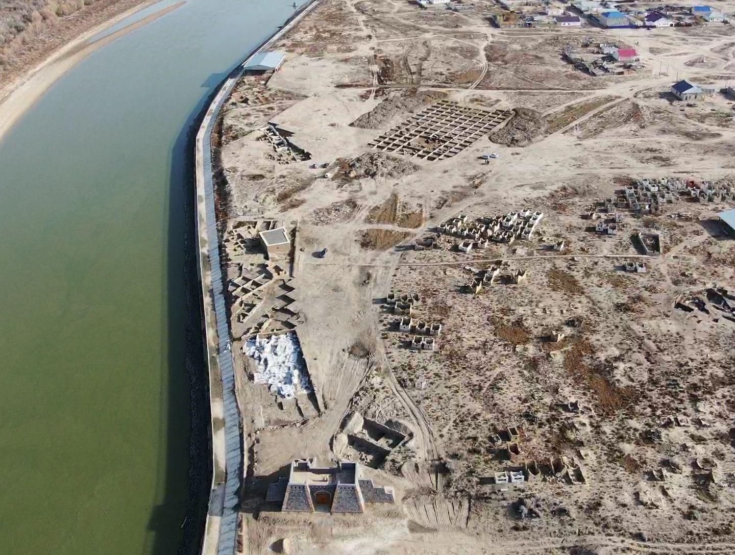
Systematic research by archaeologists of the Saraishyq State Historical and Cultural Museum-Reserve has continued since 2019. The work combines archaeology with anthropology, osteology, numismatics, genetics, archaeozoology, geodesy, and geographic information systems. Excavations between 2020 and 2021 at the Khan Tombs revealed two burial structures, whose human remains were radiocarbon-dated to the second half of the fifteenth century. Textile fragments associated with the burials indicate their elite character.
Work between 2021 and 2023 at Trench 3 uncovered a substantial public building probably intended for receiving guests and possibly serving caravan travelers. Research at Trench 2 from 2023 to 2025 revealed part of a city street, residential remains, multi-room complexes, street infrastructure, and elements of a sewerage system. A 2024 to 2025 program examining the Golden Horde heritage of Saray-Jük and other sites in western Kazakhstan included excavation of a large burial structure at Trench 6, study of twelve individuals, discovery of a thirteenth-century coin of Khwarazmshah Muhammad, and investigation of a large structure with fired-brick column bases.
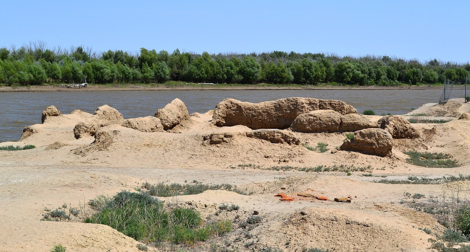
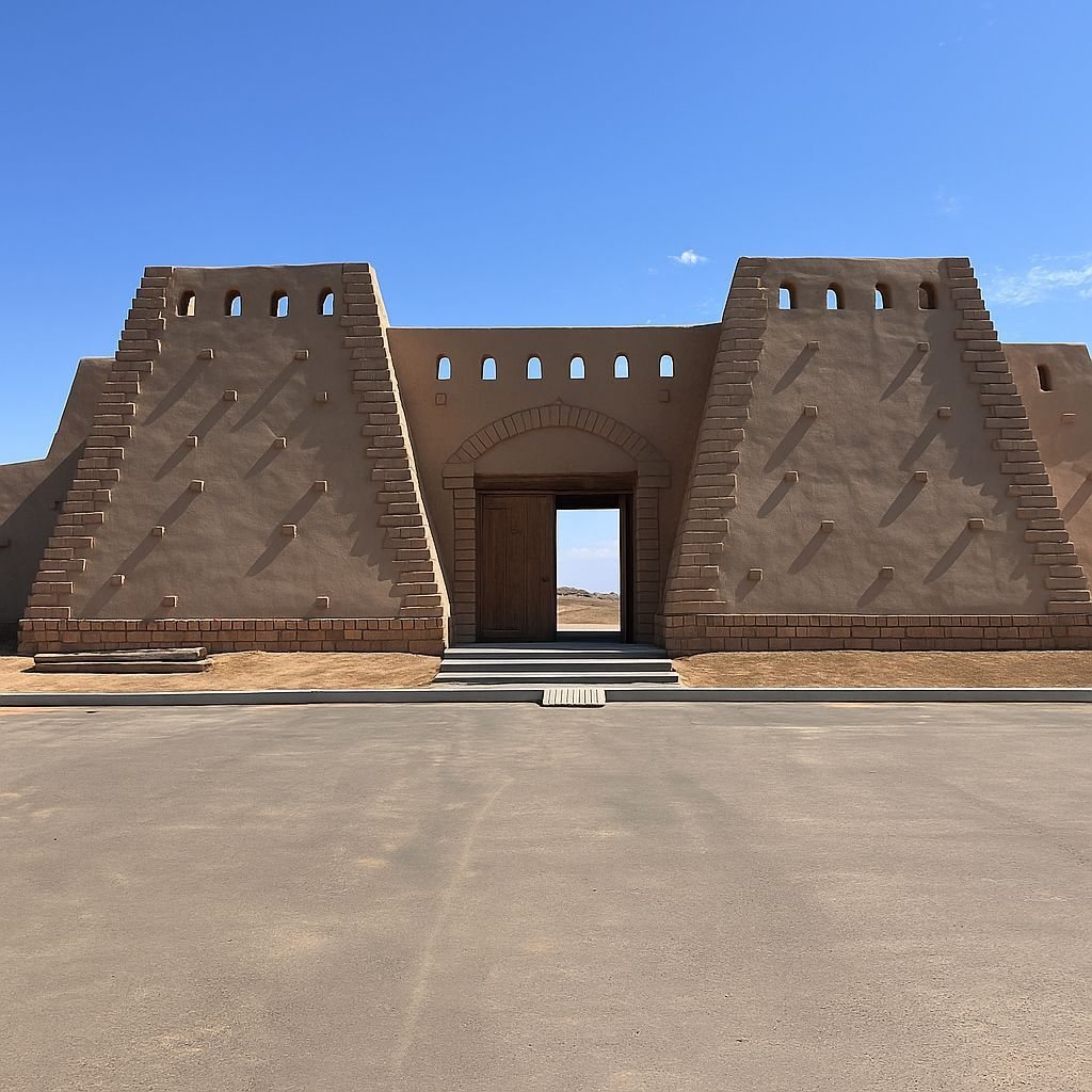
Different traditions and historical accounts associate Saray-Jük with the burials of Golden Horde, Nogai, and Kazakh rulers. The names include Mengü-Timur, Berke, Sartak, Tokhta, Tokhtakiya, Janibek, Berdibek, Tokhtamysh, Barak, and Kasym, as well as the Nogai beks Ismail and Uraz. The identification and number of these burials vary among the accounts. The medieval settlement is protected by the Saraishyq State Historical and Cultural Museum-Reserve. Since 2025, Saray-Jük has held the status of a monument of history and culture of Kazakhstan of republican significance. River erosion continues to threaten its archaeological layers and ruins, while a memorial complex has stood at the site since 1999.
Remains
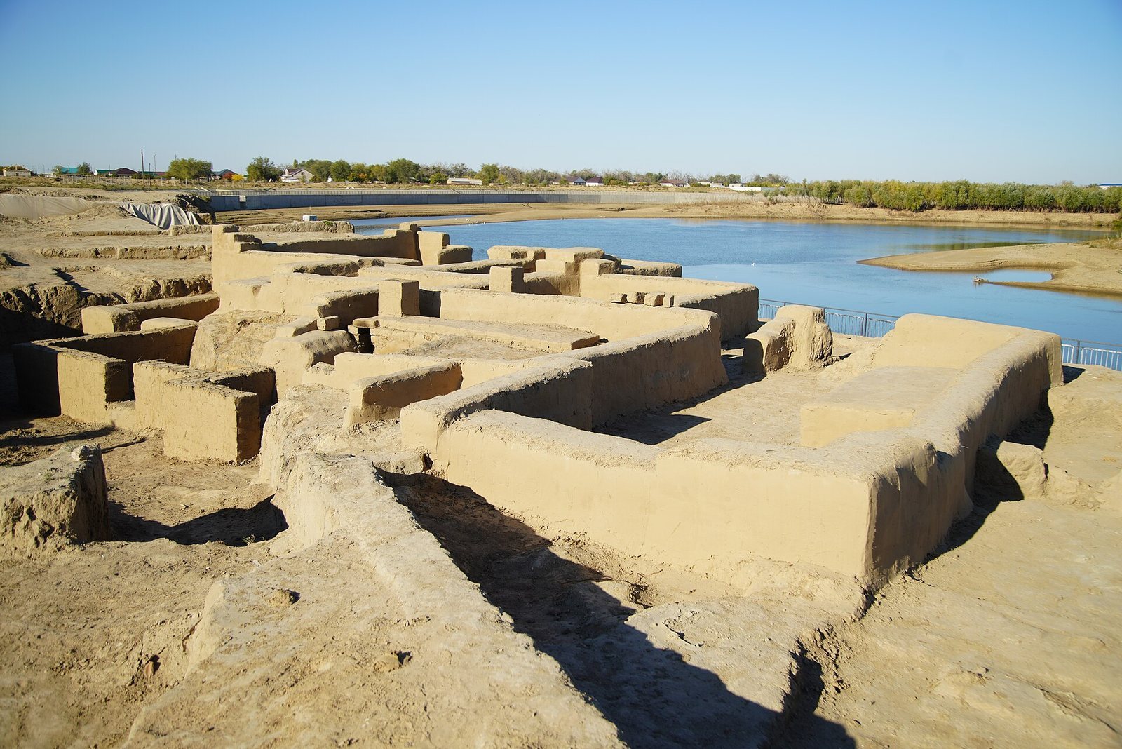
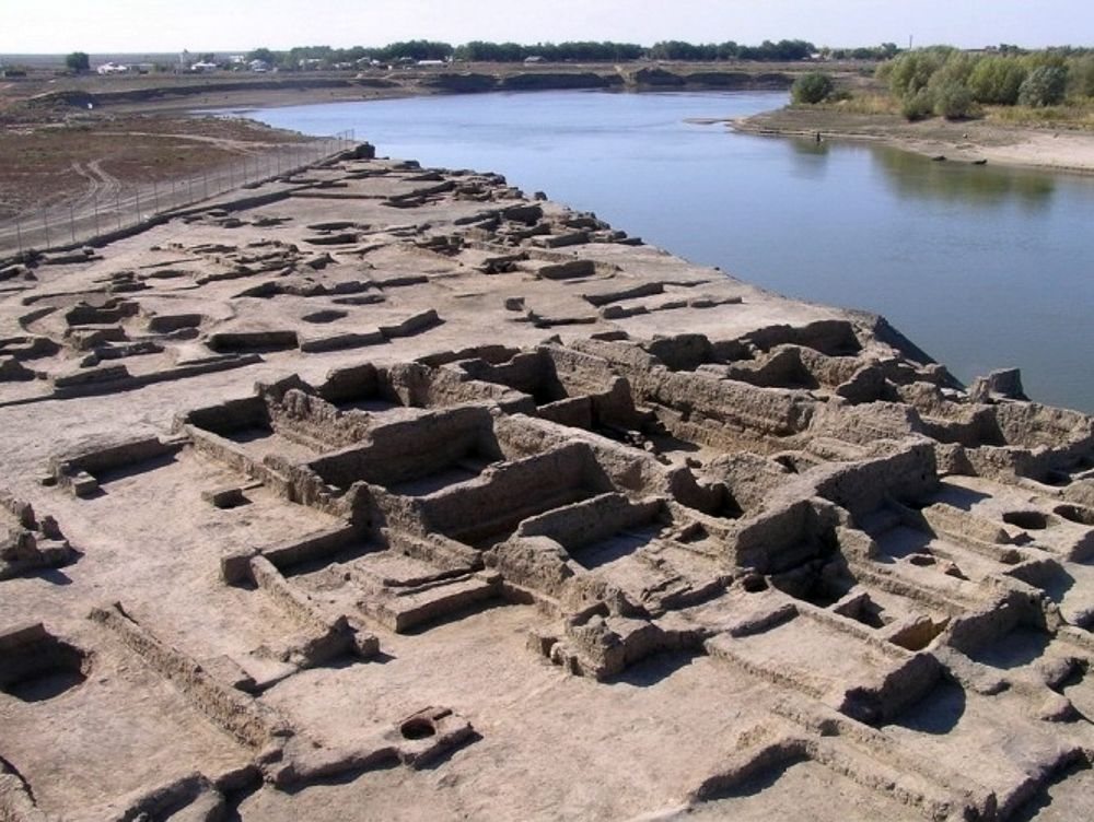
Saray-Jük occupied a broad triangular area formed by the Ural River and the Saray-Jük channel, which flowed around the settlement on its western side. Changes in the river’s course and repeated flooding influenced the city’s location and caused successive shifts in settlement. The excavated remains show an urban center built mainly of mud brick, with fired brick used for particular structures and architectural details. Four principal phases are distinguished, from planned early housing to later settlement concentrated southward along the channel.
Urban quarters and civic buildings
Residential quarters
The earliest excavated houses date mainly from the middle of the thirteenth century to 1312. Most were three- or four-room buildings made of mud brick, with plastered and whitewashed walls and storage rooms. Their raised platforms, known as sufa, provided places for sitting and sleeping. In some houses, flues circulated heat and smoke from a stove beneath the platform, and excavation found pieces of felt resting on some sufa.
A later urban phase introduced broad streets about five meters wide, open spaces, and organized residential quarters. Houses became compact multi-room dwellings, while some elongated buildings combined domestic rooms with enclosed household and storage areas. Later homes continued to use sufa and included tandoor ovens, clay or brick ovens used for cooking and heating, internal heating flues, fired-brick floors, and washing areas called tashnau.
Waterwheels irrigated fields and gardens near springs in the settlements around the city. Pink clay jars and vessels used with these wheels were recovered during excavation. The vessels were fixed around the wheel’s circumference and lifted water into a wooden trough, from which it entered an irrigation channel. Wells, furnaces, workshops, a brick kiln, and additional heating, drainage, and sewerage installations also formed part of the urban infrastructure.
Baths and the public guest building
Bathhouse remains stood near the city and the riverbank escarpment. The baths had changing and washing rooms, mud-brick walls coated with waterproof plaster, and decorative tiles. Fired-brick floors incorporated underfloor heating. Ceramic water pipes, large settling vessels, and iron or bronze cauldrons supported the supply and heating of water.
Trench 3 contained another bath complex with a changing room, washing room, and furnace for heating water. The structure also included numerous rooms and long corridors. Its arrangement supports an interpretation as a public guest-reception building that may have accommodated caravan merchants and other travelers. The building belongs to the excavated urban structures associated with Saray-Jük’s role on regional caravan routes.
The Khans building
Excavated between 1997 and 2000, the building known as the “Khans” was a palace-type complex containing 25 rooms. Its entrance portal was faced with fired brick and decorated with white alabaster ornament, while an open area lay before the entrance. The complex was probably commissioned by Orus Khan, a fourteenth-century ruler of the Jochid ulus associated with the political struggles of the Golden Horde period. He sought to strengthen his domain and develop Saray-Jük as a capital alongside his residence at Syghnaq.
The central part of the city contained palaces, administrative buildings, a mint, caravanserais, baths, mosques, madrasas, and khanqahs, religious lodges associated with Islamic mystical or Sufi practice. A madrasa was an institution for Islamic learning. The architectural remains and excavated objects show connections with traditions of the Lower Volga, Khwarazm, and the Syr Darya region, together with distinctive links to the steppe.
Burial grounds and elite tombs
The Khan Tombs
As residential quarters were abandoned, parts of the former city became sacred burial grounds. Thousands of graves were created in deserted areas, and six forms of constructed family burial structure, or sagana, have been distinguished. Their differing forms reflect variation among local groups, social classes, Islamic practices, and older traditions.
The two sagana excavated at the Khan Tombs had entrances facing southwest and included dromoi, covered or open entrance passages leading to burial chambers. Their inner walls were coated with white alabaster, and alabaster-based mortar joined the masonry. Human remains were accompanied by fragments of high-quality silk velvet decorated with silver-gilt threads, indicating the elite character of the burials. Radiocarbon dating places the remains in the second half of the fifteenth century.
The Trench 6 burial structure
The large sagana investigated at Trench 6 was built from fired brick bonded with alabaster mortar and had a domed architectural form. Anthropological study examined the remains of twelve individuals. The same trench also exposed a large architectural structure with column bases made of fired brick. Its construction methods indicate advanced building skill and a developed decorative practice.
Materials, inscriptions, and trade evidence
The site has produced mud-brick and fired-brick buildings, decorated tiles, ceramic water pipes, furnaces, and parts of heating systems. Decorative materials include glazed and unglazed ceramics, some bearing gold decoration and zoomorphic or vegetal designs. Fragments of glazed vessels carry religious or other inscriptions, while stamps bearing Arabic script provide additional evidence of the city’s written and administrative culture.
Coins from the thirteenth to the sixteenth century have been recovered, with the largest group dating from the fourteenth century. The earliest belong to the reign of Tokhta. The assemblage includes local and Central Asian coins, silver pieces from Crimea, a hoard of silver dirhams, and a thirteenth-century coin of Khwarazmshah Muhammad. Household and craft objects, weapons, metalwork, pottery, a cowrie shell, and other applied-art objects further reflect the city’s connections across the steppe and wider trade networks.
In 1909, local fishermen recovered a large ceramic vessel bearing inscriptions on its shoulder and body. It was transferred to a museum in Oral, where the inscriptions were read as passages corresponding in meaning to Yusuf Balasaguni’s Kutadgu Bilig. Another vessel associated with the site also bears excerpts from that work. Coins, ceramics, and metal artifacts recovered during the excavations from 2023 to 2025 were placed in the museum-reserve exhibition.