Yamchun Fort: A Yuezhi-Era Caravan and Military Fortress in Tajikistan
Site at a Glance
- Rating
- 4.6
- Popularity
- Very Low
- Country
- Tajikistan
- Primary era
- Classical
- Eras represented
- Classical
- Civilizations
- Unclassified
- Site type
- Military
- Remains
- Fort
On this page12 sections
History
Yamchun Fort is an ancient fortified site in Tajikistan’s Wakhan Corridor, built between the 3rd and 1st centuries BC, approximately 300 to 100 BC, and associated with the Yuezhi culture. Its position in the Pamir region placed it along a mountain route where military protection and control of caravan traffic were closely connected. Only the ruins survive, but the scale of the fort reflects the importance of the corridor in the history of long-distance exchange.
Yuezhi foundations and the caravan route
The Yuezhi were a Central Asian people who moved into Bactria and later established the Kushan Empire. Yamchun Fort formed part of a wider network of forts, fortresses, caravanserais, markets, and settlements that linked China with Afghanistan through the Wakhan Corridor. A caravanserai was a fortified roadside establishment where merchants and their caravans could lodge, obtain supplies, and receive protection. Yamchun’s original purposes included supporting caravan passage and providing a military position along the route.
The Pamir and Hindu Kush section of this network carried goods between Han-controlled China and the Seleucid realm. Under the Kushan Empire, a major northern route connected the Han settlements of Kashgar and Yarkand with Bactria, north of the Hindu Kush, and continued westward through the Wakhan Corridor. The Kushan Empire was a major Central Asian power whose territory connected routes between China, India, Iran, and lands farther west.
Trade, authority, and religious associations
Caravans using the commercial route paid transit tribute to cities and to the Kushan Empire. These revenues helped supply and protect travelers, while the forts also gave authorities a means of controlling foreign movement. Merchants were sometimes kept inside fortified places to prevent disputes with nearby communities. Yamchun therefore belonged to a system in which trade, security, taxation, and political oversight operated together.
In 139 BC, Emperor Wu of Han sent the envoy Zhang Qian to investigate lands west of Han influence. Emperor Wu was a powerful ruler of China’s Han dynasty, which expanded westward and promoted distant diplomatic and commercial connections. Zhang Qian’s reports about Central Asia encouraged the maintenance of routes joining China, India, and Central Asia, contributing to the development of the Silk Road, a network of overland and regional routes linking East Asia with Central Asia, Iran, the Middle East, and the Mediterranean world.
The fort is also known by the names Zamr-i-Atash-Parast, meaning “fortress of the fire worshippers,” and Kafir-Qala. The first name associates the site with Zoroastrianism, an ancient Iranian religious tradition centered on Ahura Mazda in which fire has an important ritual and symbolic role. Yamchun is the name of a nearby stream and settlement. During an expedition in 1838, explorer Alexander Burnes and East India Company naval officer John Wood recorded other temples in the surrounding area associated with Zoroastrians.
Modern description
Archaeologist Marc Aurel Stein made a detailed description of Yamchun Fort during his 1928 expedition through Central Asia, undertaken for the government of India. Stein was a major archaeologist and explorer of Central and Inner Asia whose expeditions documented many archaeological sites. His description helped preserve a detailed account of the fort’s surviving defensive arrangement.
Remains
Mountain setting and overall layout
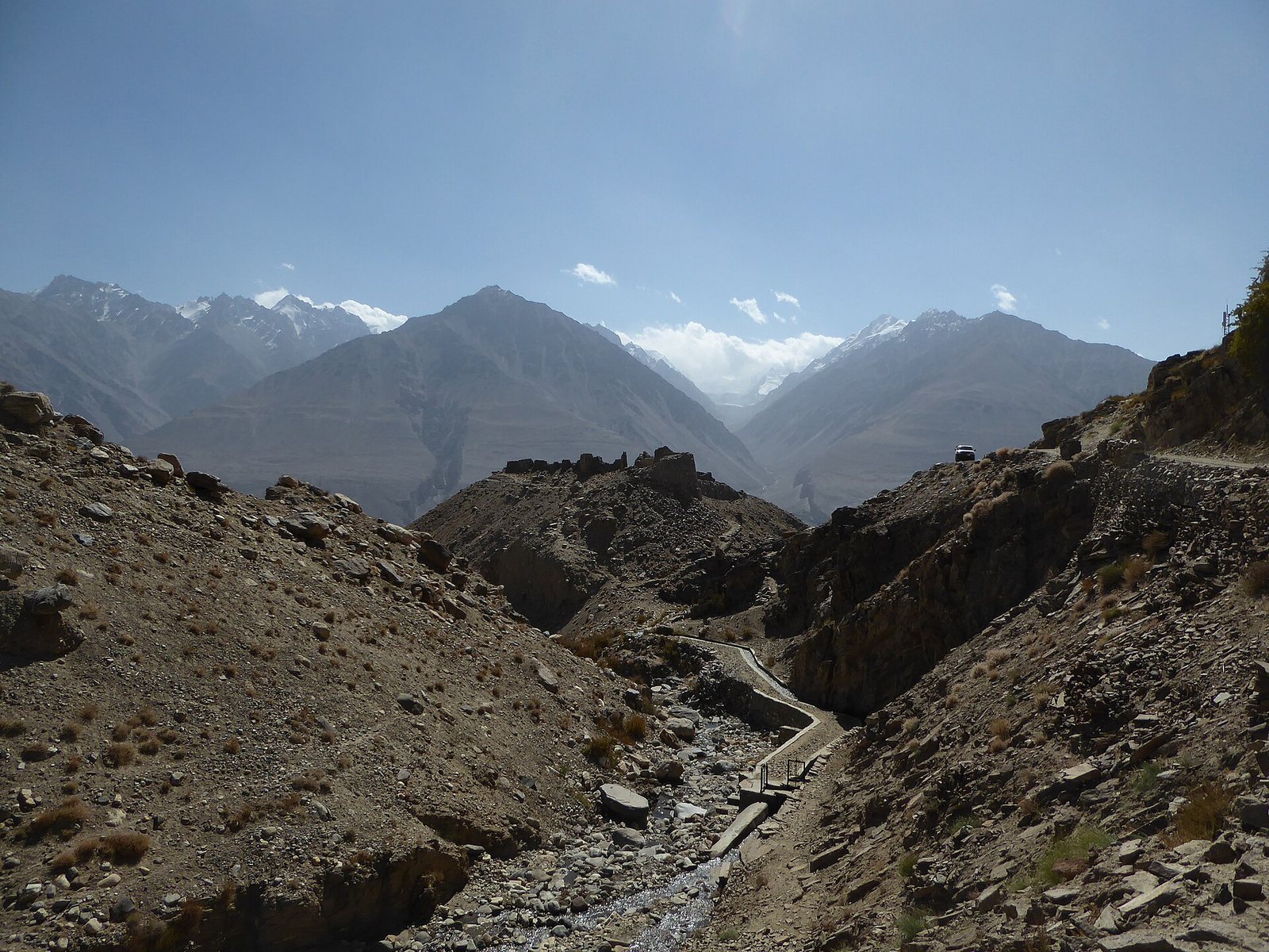
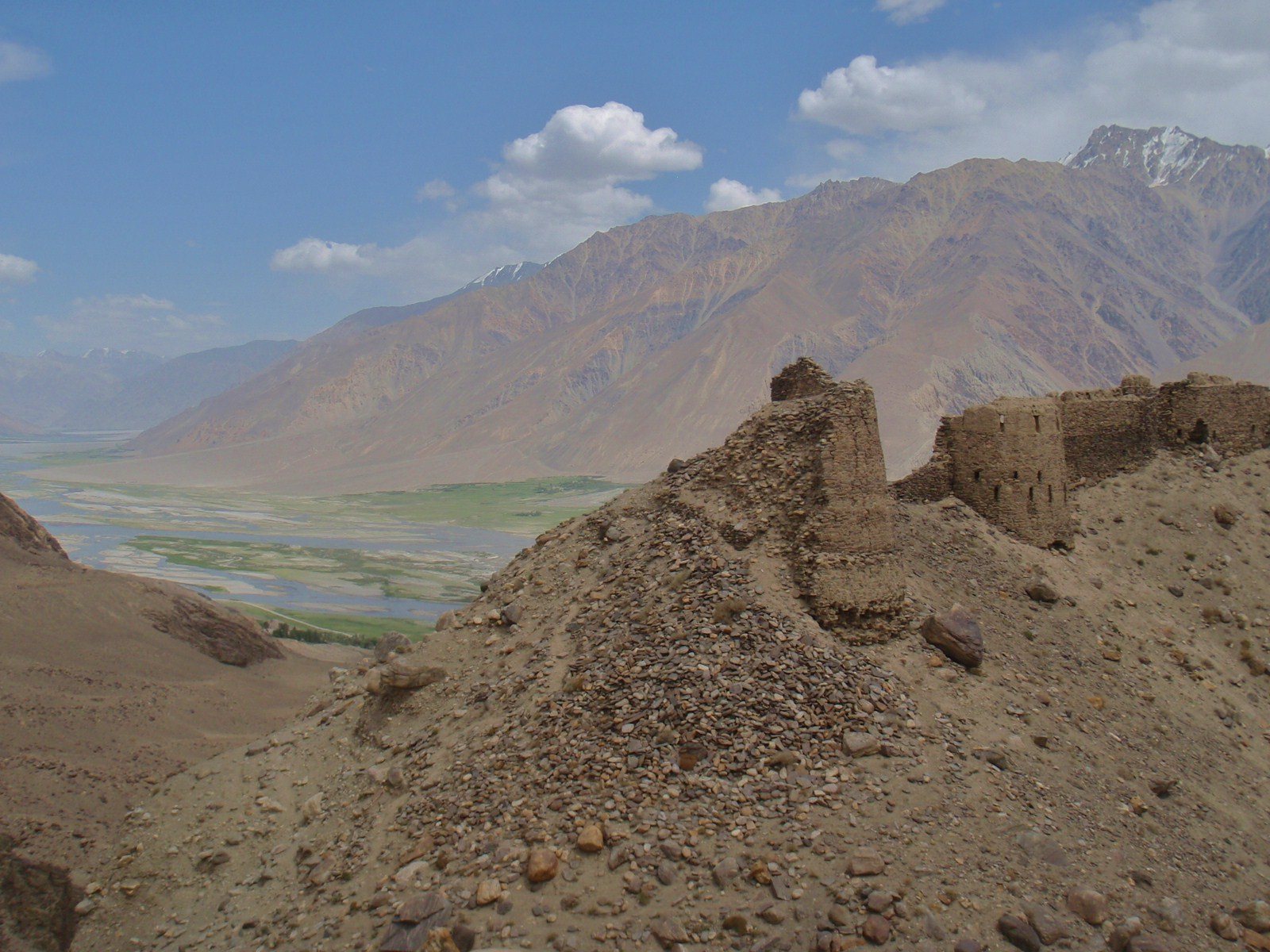
Yamchun Fort occupies a mountainous position approximately 400 metres above the Wakhan Valley, along the Pamir route through the Wakhan Corridor. The fortified area measures about 400 metres in diameter, while its outer circuit extends for up to 950 metres. The site is organized around a citadel and two additional level areas, all incorporated into a defensive arrangement of three concentric circuits formed by double walls.
Citadel and interior areas
Citadel
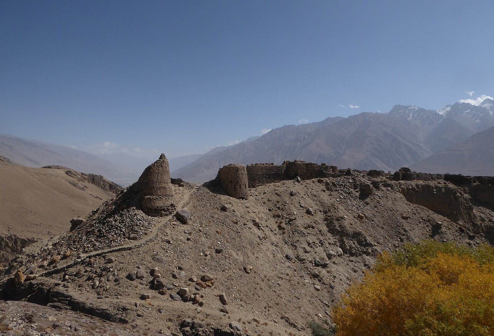
The citadel contains the remains of bastions and barracks. Bastions are projecting fortified structures that strengthen a wall and allow defenders to protect sections of its perimeter. These remains form the central built area within the wider circuits, while the citadel’s military character is reinforced by its position within the mountain fortress.
Additional level areas
Two further level areas accompany the citadel. Their intended purpose was presumably to contain or control a possible breach in the outer walls, linking these spaces to the defensive planning of the whole fort. Their relationship to the concentric wall circuits shows that the site was organized in successive defensive zones rather than around a single enclosure.
Walls and towers
Concentric wall circuits
Three concentric circuits of double walls surround the fort. Together, they created layered defenses across the steep Pamir setting. The outer circuit reaches up to 950 metres in perimeter, giving the surviving ruins an extensive footprint above the valley.
Towers and loopholes
Thirty-six towers strengthened the walls. Each tower was fitted with stepped loopholes, narrow openings through which defenders could fire. The loopholes sloped slightly downward toward the hillside, allowing soldiers to direct fire onto approaches below. Some were also oriented inward toward the fort, providing a further means of controlling movement within the defensive complex.